

cstrunk
-
Posts
608 -
Joined
-
Last visited
Content Type
Profiles
Blogs
Forums
American Weather
Media Demo
Store
Gallery
Everything posted by cstrunk
-
Bob Pack said he may have caught a glimpse of it but it's definitely rain wrapped. Strong couplet with a CC drop beginning to show up. Likely TOG.
-
Today looks to me like a south of DFW I-35 hail special.
-
They ought to just stick to the EF-5 description for ratings and if they want to apply super-strict construction engineering criteria, reserve that for a new EF-6 category. That'll cause a stir.
-

Texas/Oklahoma Discussion & Obs Thread 2022
cstrunk replied to It's Always Sunny's topic in Central/Western States
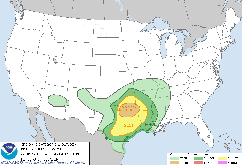
Do we want to rename this thread? Or start a new thread for 2023? SPC highlighted much of eastern OK, NC TX, and eastern KS in their Day 4 (Friday) Outlook for severe weather will all hazards possible. -
The Rocky Mountains? Sorry, couldn't resist.
-
Seems like the cap and the moisture mixing out really prevented yesterday/last night from being a LOT worse than it turned out to be.
-
Central Iowa looks to have a rough go of it late this afternoon/early evening...
-
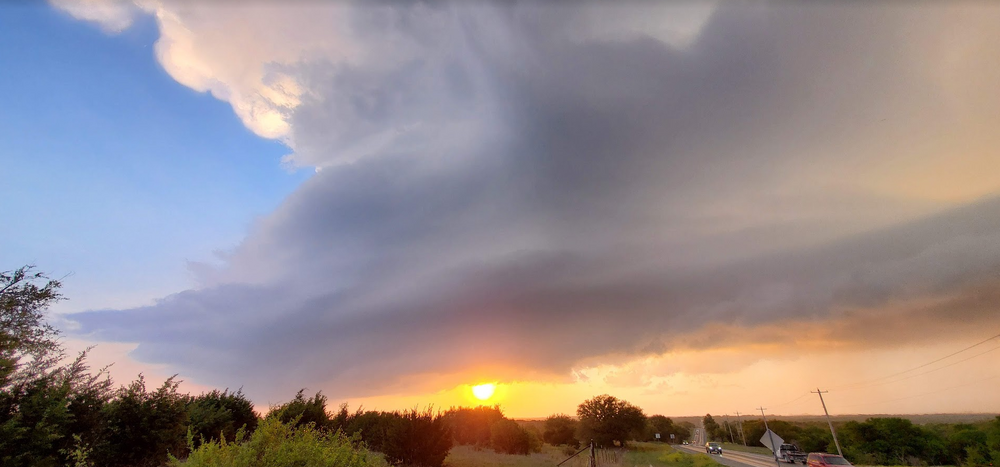
I chased the Stephenville, TX supercell - what a beautiful storm. No tornado. I'll get some pictures posted when I get a chance. *Edit - here's a sneak peak:
-
Made it to Glen Rose. Headed west towards that cell SE of Abilene. Sun is out, it's hazy, and the wind is howling.
-
Pulled the trigger. In Terrell now, still headed in the direction of Glen Rose. Hope to follow any supercells to the south of the Metroplex.
-
I'm thinking about chasing today for the first time in forever. My target would be Glen Rose.
-
If I were chasing today I'd be just south of Lawton, OK and follow storms east on the north side of the Red River. Denton, TX wouldn't be a bad place to start either.
-
SPC adds an enhanced risk area for NC/NE TX and extreme SE OK.
-
March 2nd Moderate Risk ArkLaTex
cstrunk replied to Ed, snow and hurricane fan's topic in Central/Western States
Confirmed tornado warning for Bossier City, LA. -
March 2nd Moderate Risk ArkLaTex
cstrunk replied to Ed, snow and hurricane fan's topic in Central/Western States
Also not warned? *Edit - now it is. -
March 2nd Moderate Risk ArkLaTex
cstrunk replied to Ed, snow and hurricane fan's topic in Central/Western States
Storms in Deep East Texas are starting to get "the look" to me. -
March 2nd Moderate Risk ArkLaTex
cstrunk replied to Ed, snow and hurricane fan's topic in Central/Western States
Cells are forming in East Texas - will need to watch them to see if any of them can strengthen. -
March 2nd Moderate Risk ArkLaTex
cstrunk replied to Ed, snow and hurricane fan's topic in Central/Western States
Looks like a pretty substantial W shift of the Moderate/Enhanced areas with the incoming SPC Outlook. SE edges trimmed back. -
January 2nd and 3rd Severe Weather Threat
cstrunk replied to DanLarsen34's topic in Central/Western States
I was watching when they talked about this. It was just east of Tulsa. -
Texas/Oklahoma Discussion & Obs Thread 2022
cstrunk replied to It's Always Sunny's topic in Central/Western States
Front blew threw here at 12:25 pm when the temp was 47F. Almost 40 minutes later it's 32F. Hoping for some flizzard action in ETX this afternoon! -
Texas/Oklahoma Discussion & Obs Thread 2022
cstrunk replied to It's Always Sunny's topic in Central/Western States
A decent area of Texas and much of Oklahoma getting some beneficial rains today. Could be some severe weather, too. -
Texas/Oklahoma Discussion & Obs Thread 2022
cstrunk replied to It's Always Sunny's topic in Central/Western States
Yawn. Wake me up when September ends. -
Texas/Oklahoma Discussion & Obs Thread 2022
cstrunk replied to It's Always Sunny's topic in Central/Western States
Seems like this round is pretty much over for Longview. I ended up with 7.14". 7.10" within a 24 hour period from 3 pm Sunday to 3 pm Monday. -
Confirmed tornado in Winona, TX within the last hour.


