jm1220
-
Posts
26,187 -
Joined
-
Last visited
Content Type
Profiles
Blogs
Forums
American Weather
Media Demo
Store
Gallery
Everything posted by jm1220
-
And since it'll be coming N at 50 mph, on the east side that means 205 mph winds! Bye Bye Fire Island
-
155 mph hurricane straight into Jones Beach, 20 foot surge. I’d lock yourself up in the bunker now. And prepare your goodbyes, although everyone you say goodbye to is likely screwed too.
-
It ain’t sick of us!
-
Euro however is a huge torch. If we have mostly southerly flow it'll be the 92/75+ type conditions, if westerly downslope with 20+C 850s many of us will make a run at 100 but have dews more in the 65-70 range.
-
Few drops here. Looks like a dry stretch coming up before the next heat wave which will help it get hotter.
-
What he said.
-
I’m keeping the climate change/power sources posts, someone else can do what they want with them, but the posts that turn it into diatribes about politics that always lead to trolling and bickering, are beyond ridiculous. IMO if it’s a constructive discussion that’s fine and it’s a slow weather period; when it devolves into ridiculousness it has no place here.
-
Stop with the politics stuff. Go somewhere else, PM, whatever. If you notice your posts disappearing that’s why.
-
Depends. If the flow is coming from the Midwest where there can be very high dews, that’s what we get.
-
The westerly flow blows the smoke back into Canada but brings back the swampy humidity. So we have a choice between waves of smoke during the drier conditions or 75+ dews.
-
When the W PAC cools down and Pacific Jet slows down, sure.
-
Yep. We reliably get T-storms in the dead of winter, 3” snowstorms though are harder than pulling out a molar with a rusted plier. Have to go down to Norfolk now to get those. Red smoky moon again tonight. Plenty of that these days too.
-
I don’t see why we can’t reach 100 for many of us if we get another stretch of WNW downslope heat. Especially since like you said we’re not getting much rain over the next 5-7 days. Topsoil dries out very quick this time of the year as we can see with the browning lawns.
-
Reddish look to the moon last night too.
-
Sneaky warm day-just hit 90.
-
I guess instead of cold or warm fronts now, we have smoke fronts.
-
Yep that was intense. Had numerous trees down in my neighborhood too. As usual with the east side of any tropical system here-a couple showers but very high wind. Luckily it didn’t hit NC as a borderline cat 2/3, in that case power here could’ve been off for weeks.
-
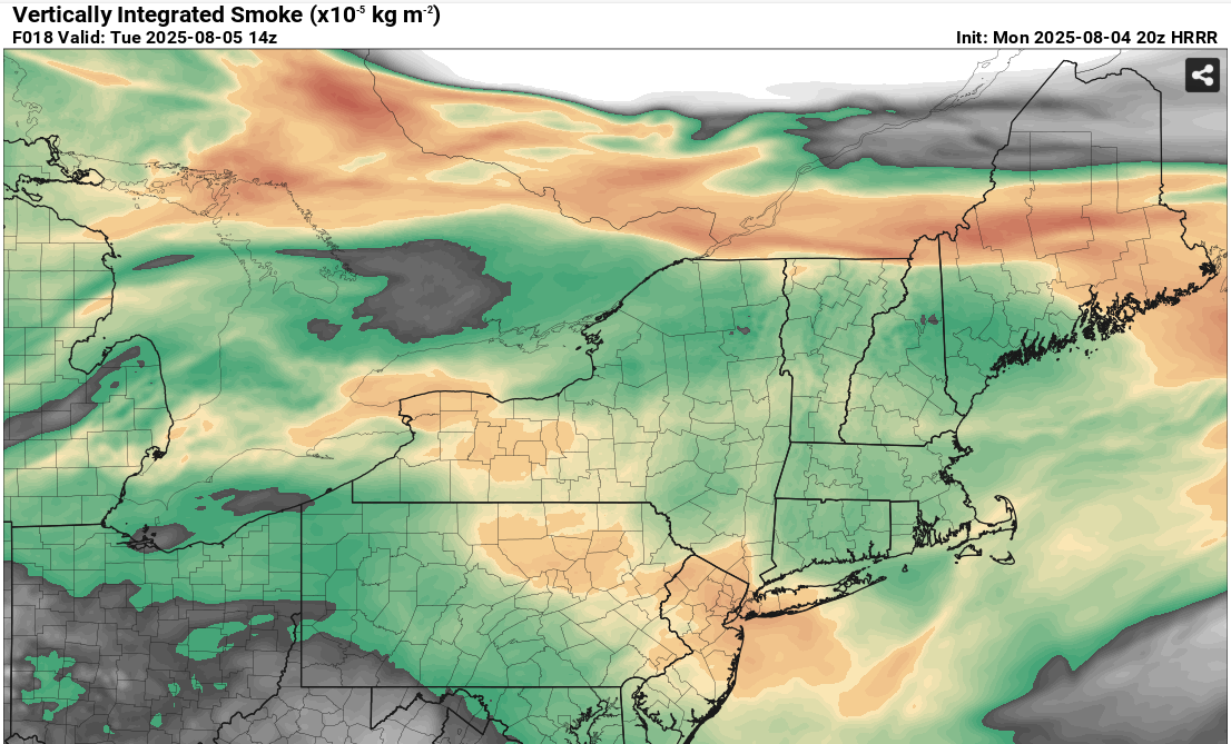
Hazy look to the sky today. Smoke is back!
-
HRRR says smoke should rotate down into our area tomorrow. Shouldn’t be bad near the surface but enough to make it hazy.
-
Others would know a lot more than me but the last few years have set records in Canada for wildfires. Probably a combination of higher temps, less rain and less snow in the winter.
-
Looks like it'll be a bigger problem for NNE especially Maine.
-
https://www.pivotalweather.com/model.php?m=hrrr&p=smoke_viden&rh=2025080212&fh=1&r=us_ne&dpdt=&mc=
-
61 here. Might as well be mid January under the PV compared to early this week.
-
Some more fell overnight, total for me was about 1.1”.