

jm1220
-
Posts
26,187 -
Joined
-
Last visited
Content Type
Profiles
Blogs
Forums
American Weather
Media Demo
Store
Gallery
Everything posted by jm1220
-
And it makes intuitive sense that more Siberian snow creates a contrast with the warm W PAC near Japan and enhances the Pacific jet. The warm mid latitudes may be altering the Hadley Cell which some have pointed out. So to me it makes sense how these factors work together to ruin our pattern where I live for snow. I don’t like it but the planet and its feedbacks don’t care what I want. Guess I can buy a cabin in ME for the winter where there are still plenty of very snowy winters left to look forward to.
-
Yep, outside of a lucky spot or two 0.30” or less east of the city.
-
Front/squall line coming through. We’ll see if any of this rain over NJ comes through. Otherwise it looks like the split screw is happening as expected. Onto the weekend (hopefully) event.
-
The weekend deal if it happens is an occluding low cut off from cold air. It would be a cold windy rain on the coast and maybe snow inland/elevated.
-
Most models to some extent have the split-screw for I-95. I'm not optimistic for most except the NW crew. We'll see in the morning.
-
Hilarious/sad how this time of year is when the hype/weenie winter maps etc start getting trotted out to juice up the subscribers.
-
We’ll see. Ground is bone dry so the rain is badly needed.
-
Yep-the more infamous winter was the year before at Valley Forge, but that winter is said to have been even colder and deadlier.
-
The front is coming through in the morning. Not a good time if we want organized rain. Wouldn’t surprise me at all if this is another bust.
-
I'll jump for joy even if MBY makes it to 30" this winter. The average since 1995 here is in the mid 30" range-similar to CT coast.
-
Models seem to be shifting Wed's rain to.... wait for it... drum roll.... north and west of the city again! Seems like the front comes through in the morning which is the worst time heating-wise to generate showers/storms. So it wouldn't surprise me at all to see it fizzle out.
-
The polar jet/cold air source is way north in Canada and this low would entirely be a product of the subtropical jet. It would be cold rain or a mix like what we had in 97-98 or 23-24. But that’s if it even develops.
-
Last winter was torture here-nothing worse than freezing with some cirrus while watching the Deep South get slammed, then when a storm can finally make it here it turns into a SWFE (we had one decent 4-6” SWFE in Feb but that’s the exception around NYC) or cutter. I’d rather have the 22-23 scenario where like you said it was clear way out in time our window is slammed shut.
-
If we see a crazy Pacific jet slam into the west coast and knock down any sustained +PNA and destroy any phasing opportunities to bring a good storm up here, I know exactly what to expect. Hopefully in that case it’s a mild winter since the wasted useless cold last winter was ridiculous. If whatever storm we get will be rain anyway, might as well be enjoyable outside.
-
Guess he's from Little Rock since that's the bullseye for the other Armageddon zone?
-
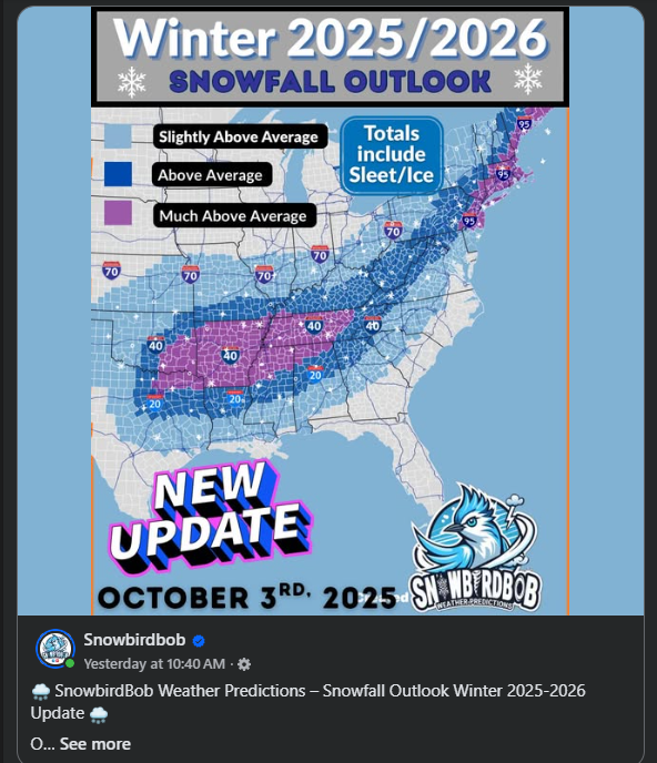
Look what I found! It's build up the subscribers season. Anyone ever heard of this guy?

-
Look what I spied with my little eye. Time to build up the subscribers! Who's SnowbirdBob?
-
Time to build up the subscriber base for the winter. Like the squirrels gathering nuts.
-
Was 43 here when I left my house.
-
Bluewave has posted about how a very cold Siberia creates a contrast with the very warm water off Japan which fuels the raging Pacific jet which we certainly DON’T want. So it’s a more complex relationship than “Siberian snow cover is always good”.
-
A Nino in general is better for this area than Nina not factoring in anything else. We also had the Feb 2003, Feb 1983, missed 2/6/10 by a hair, etc huge Nino fueled storms. Nina by its nature generally favors the upper Midwest and New England, but obviously other factors especially today with the boiling W PAC play a major role. 2023-24 was basically a Nina with a lot more rain and one snowstorm here in Feb even though on paper it was strong El Niño. The overall unfavorable Pacific completely messed it up.
-
2015-16 was an above to much above average temp winter here and snow wise was above normal. You have to remember as you go south you need less snow overall to get to normal and one epic pattern or good luck can get you there. I don’t take much stock in temp maps that show above normal and think that means it’ll automatically mean it’s another bad snow winter. If I see another setup for more stretches of a horrendously bad Pacific that means much more to me.
-
45 here.
-
Humbelda? But Humberto is likely already extratropical-it’s clearly a frontal cyclone now.
-
Not looking like much of anything here rain wise for a week or more.


