

Met1985
-
Posts
16,974 -
Joined
-
Last visited
Content Type
Profiles
Blogs
Forums
American Weather
Media Demo
Store
Gallery
Everything posted by Met1985
-
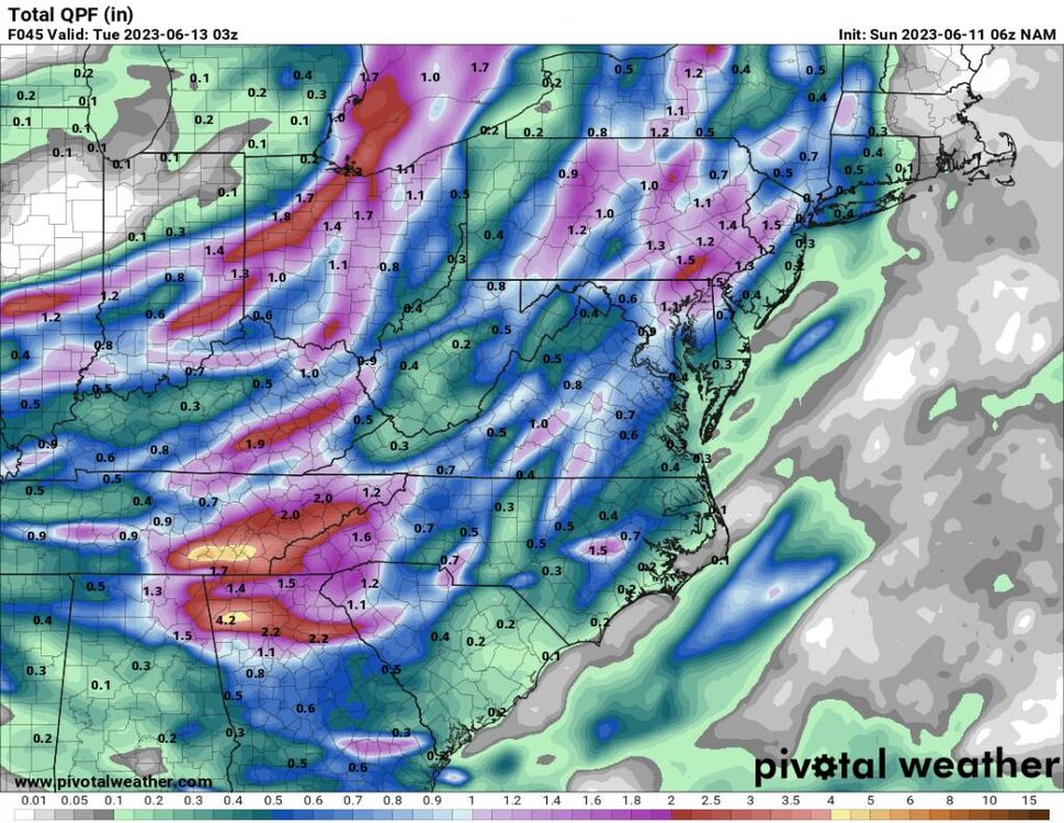
Today's rain came in a lot earlier than what even the models were showing. Already soaked here with more to come.
-
06z NAM Sent from my SM-G998U using Tapatalk
-
Rain already working into the southern mountains this morning.
-
The last two night have been perfect radiation for us. It's been downright cold in the morning. Pretty remarkable at the temp and sometimes snow differences from your place to mine.
-
Another beautiful cold morning with a low of 42.
-
Of course it was lol!
-
That is amazing for this time of the year.
-
Also I read that Mount Washington received over 4 inches of snow and sleet Wednesday.
-
According to the records we shattered the record low this morning. This morning we had a low of 39 degrees! The past 2 day's we've not gotten out of the 60s for highs.
-
We had cloud cover here all night. Didn't make it but to 54 here. Tonight should be much colder.
-
A beautiful evening with a few showers and a temp of 59 degrees.
-
Yeah rain will be heading this way in a few hours then a beautiful week on tap.
-
Looks like daytime highs and lows will be some 10 to 15 plus degrees below normal for the rest of the week before we warm up again. For June this is amazing weather.
-
Tomorrow's highs look delightful and Thursday morning lows look chilly. Sent from my SM-G998U using Tapatalk
-
Had another earthquake in Haywood around midnight. That's the 7th one on 2 weeks.
-
Surprisingly woke up to .32 inches of rainfall overnight and it was still raining a bit when I left the house at 4 am. Everything was soaked and was a perfect time for the flowers to get watered.
-
Looks like we are in for some absolutely beautiful weather come mid to late week.
-
Very cool observation Larry. Things like this are fascinating to witness especially being so rare of sorts.
-
Yeah non here.
-
Yeah I saw that dropping through. Kind of weird seeing weather come in that way.
-
Yep woke me up also. The whole house shook.
-
Getting a nice shower to cool things off this evening.
-
Damn son! That's a beauty.
-
That would be about damn time.
-
Very isolated and scattered showers through the county.


