Met1985
-
Posts
16,913 -
Joined
-
Last visited
Content Type
Profiles
Blogs
Forums
American Weather
Media Demo
Store
Gallery
Everything posted by Met1985
-
Spoke too soon. Things are starting to pop.
-
Some storm clouds. Sent from my SM-G998U using Tapatalk
-
Asheville is fixing to get lit up with the mid to northern mountains. Looks like things are breaking apart for my area mostly.
-
That line coming through Knoxville currently looks pretty impressive.
-
Let me take a look.
-
Looks like tomorrow and tomorrow night we could get a decent amount and maybe some severe storms rolling through.
-
Heavy rainfall this afternoon. Really low ceiling.
-
Had some rain yesterday and getting a light shower already today.
-
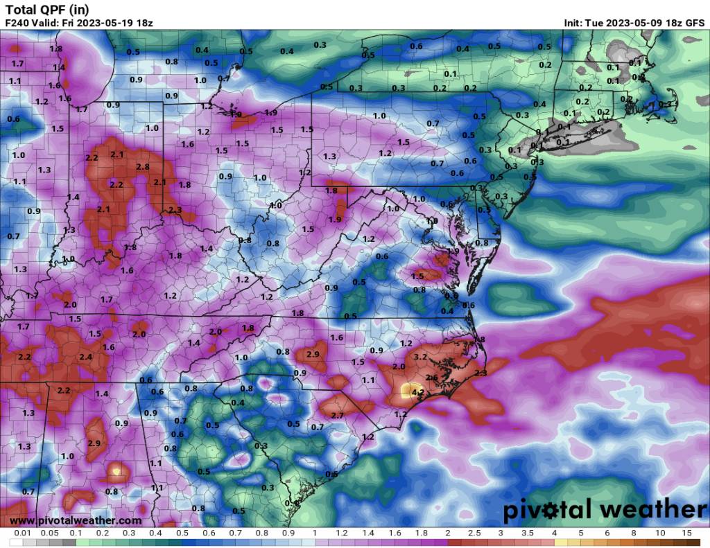
12z gfs is also showing a lot more rainfall. Sent from my SM-G998U using Tapatalk
-
Euro showing even more rainfall for the area today. Sent from my SM-G998U using Tapatalk
.thumb.jpg.8887cc82d97eee0306e59bc6a06723b6.jpg)
-
Heavy rainfall popping up around several locations on Haywood and Buncombe. Ran into a gullywasher on Patton Avenue this afternoon.
-
Storms starting to pop ahead of that big swath in Tennessee. Some nice storms showing up.
-
Looks like things will pop off with that big blob of moisture from Tennessee coming in this afternoon. Going to be stormy.
-
Oh yeah. Just like we are getting rain currently but a mile down the road no rain.
-
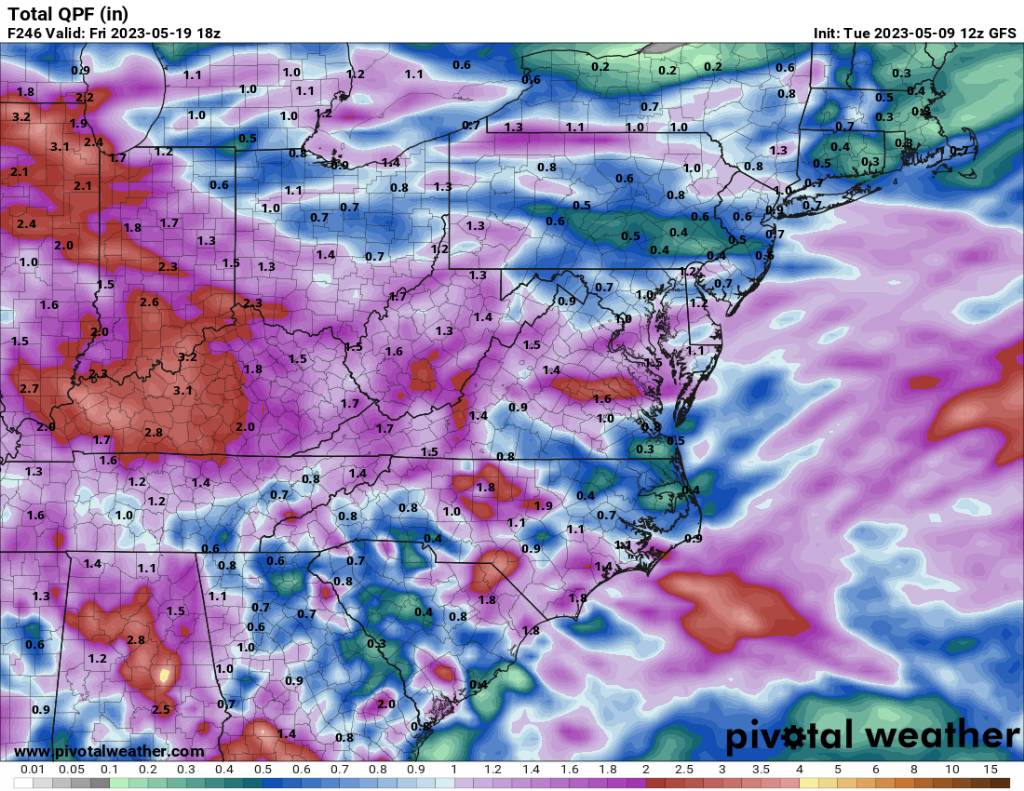
Euro has jumped big time on a pretty wet next 7 to 10 days. Sent from my SM-G998U using Tapatalk
-
Yeah you can see all the moisture coming from Tennessee heading east.
-
The overnight euro is much less impressive so we will see. Sent from my SM-G998U using Tapatalk
.thumb.jpg.f52d7c11b3ad768de990d964447f668f.jpg)
-
And all of a sudden, overnight models more than double our rainfall over the next week. Sent from my SM-G998U using Tapatalk
-
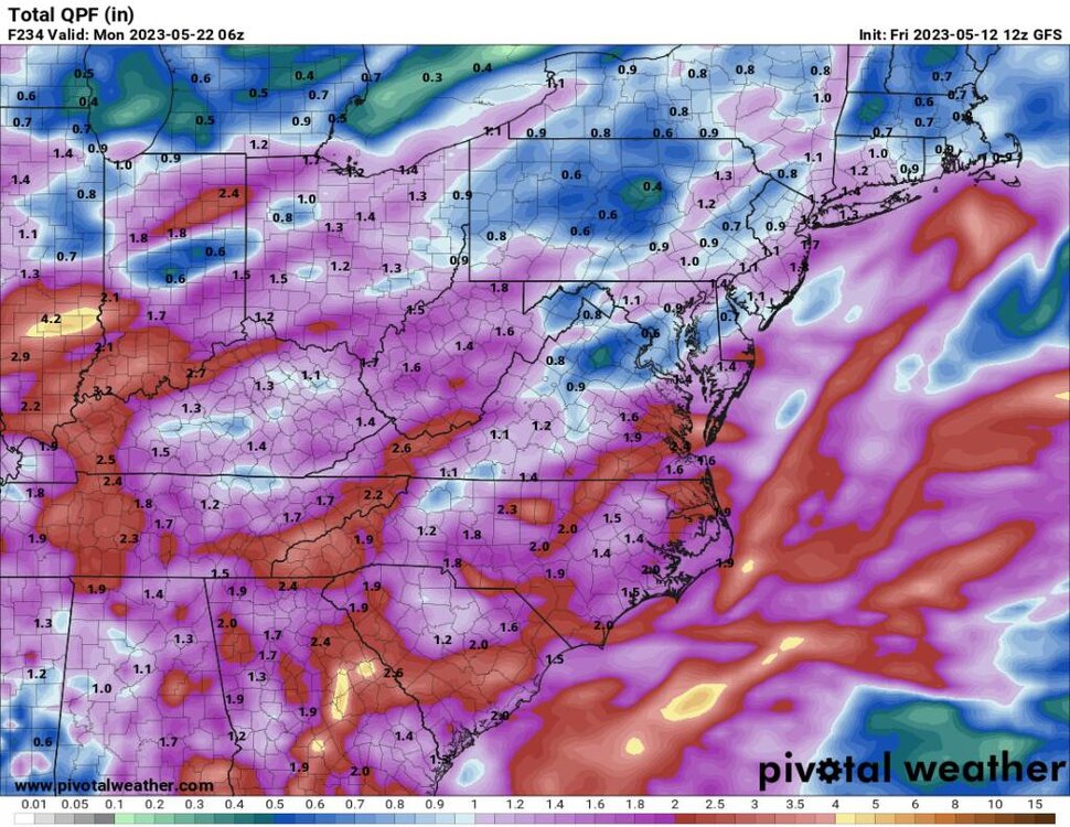
Not a ton of rain over the next 10 days but enough it looks like. Sent from my SM-G998U using Tapatalk

-
Looks like some rainfall over the next 10 days. Will take it. Sent from my SM-G998U using Tapatalk

-
Yeah I bet. I went into work at 4:30 so no such luck here lol.
-
Yeah storms and heavy rain hitting here. Big storms rolling in. Was not expecting this, this morning.
-
Yeah no kidding! We had a few big branches fall out of some trees.
-
Lot's of rainfall yesterday evening and overnight. It's pouring this morning going to work. Well over an inch of rainfall and still coming.
-
Yeah no kidding. They where impressive.


.jpg.dbfa4819d7e137736d325a4d86207495.jpg)
.jpg.fc4b99e0426e4fa38037fbd4f551066d.jpg)