

Met1985
-
Posts
16,913 -
Joined
-
Last visited
Content Type
Profiles
Blogs
Forums
American Weather
Media Demo
Store
Gallery
Everything posted by Met1985
-
A beautiful evening with a few showers and a temp of 59 degrees.
-
Yeah rain will be heading this way in a few hours then a beautiful week on tap.
-
Looks like daytime highs and lows will be some 10 to 15 plus degrees below normal for the rest of the week before we warm up again. For June this is amazing weather.
-
Tomorrow's highs look delightful and Thursday morning lows look chilly. Sent from my SM-G998U using Tapatalk
-
Had another earthquake in Haywood around midnight. That's the 7th one on 2 weeks.
-
Surprisingly woke up to .32 inches of rainfall overnight and it was still raining a bit when I left the house at 4 am. Everything was soaked and was a perfect time for the flowers to get watered.
-
Looks like we are in for some absolutely beautiful weather come mid to late week.
-
Very cool observation Larry. Things like this are fascinating to witness especially being so rare of sorts.
-
Yeah non here.
-
Yeah I saw that dropping through. Kind of weird seeing weather come in that way.
-
Yep woke me up also. The whole house shook.
-
Getting a nice shower to cool things off this evening.
-
Damn son! That's a beauty.
-
That would be about damn time.
-
Very isolated and scattered showers through the county.
-
Numerous showers are coming through but absolutely nothing on radar is showing up.
-
A surprise rain shower came through. Enough to really soak everything.
-
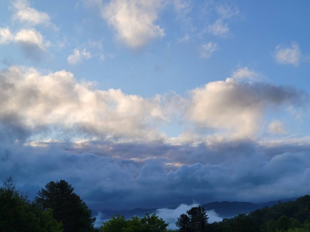
A beautiful scene this morning. Sent from my SM-G998U using Tapatalk
-
The models drying the moisture up busted badly. Very badly.
-
Yeah they where. Some 20 to 30 degrees below normal.. Both Saturday and yesterday we never reached 60 and for the end of May that's impressive.
-
All in all I think this exceeded what some of the model's where showing. The drying up effect did not happen obviously.
-
Yeah that is impressive. That line is stout.
-
Man the middle mountains are absolutely getting smoked currently.
-
We are just getting into June this week. The longer we can hold off the heat the better. Also delays any kind of drought if we have one this year.
-
It's beautiful.

