Met1985
-
Posts
16,913 -
Joined
-
Last visited
Content Type
Profiles
Blogs
Forums
American Weather
Media Demo
Store
Gallery
Everything posted by Met1985
-
Yeah you can see it back filling also.
-
You can see the training going on from your area up to Haywood through Candler area up into Madison. If that hold then we will see close to 4 inches for sure.
-
Moderate to heavy rainfall this morning with a temp of 45 degrees with over 1.5 inches storm total so far. NAM FTW.
-
Moderate to heavy rainfall the past few hours with the temp down to 46 degrees. Talk about raw on May 27th....
-
You can tell the heaviest rainfall is setting up in the south mountains. The gfs is out to lunch.
-
Lol funny how it is Memorial day weekend and we are colder now than in January....
-
18z is just the opposite of the NAM. Sent from my SM-G998U using Tapatalk
.thumb.jpg.dc13c4ac7ba6c5bf67fec7c6dca6f809.jpg)
-
Temp down to 48 with steady rainfall.
-
Yep especially for the southern escarpment.
-
Rain is starting here so we will see who has the best grasp on this all.
-
Afternoon high today was 56 degrees. Some 20 degrees below average.
-
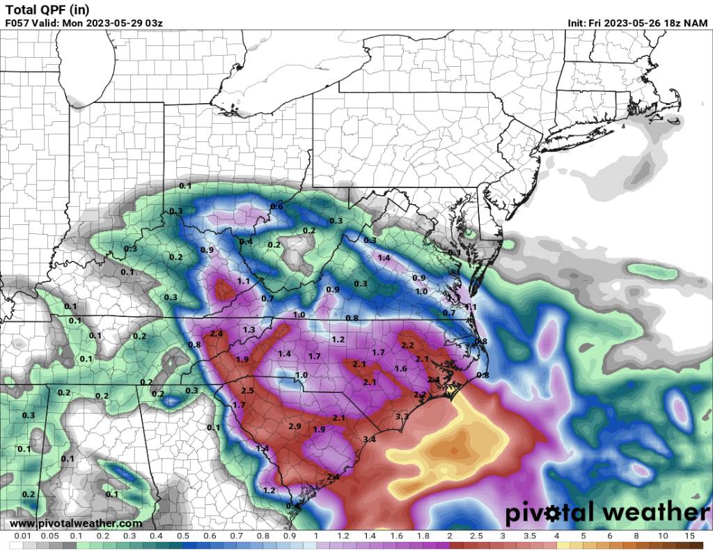
18z NAM holding strong on a very moist south mountains event. Sent from my SM-G998U using Tapatalk
-
12z Canadian Sent from my SM-G998U using Tapatalk
.thumb.jpg.a3b18419bd4a53075179fc7ee8a936bd.jpg)
-
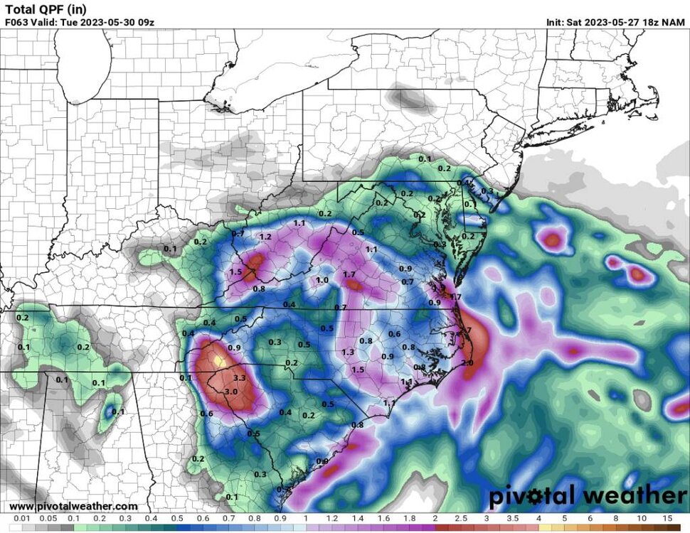
12z 3K NAM Sent from my SM-G998U using Tapatalk
.thumb.jpg.afba8e4f441bb0bc2e2ba9bc50eff34b.jpg)
-
12z HRRR is completely opposite of the NAM. Sent from my SM-G998U using Tapatalk
.thumb.jpg.6454641ee6bf6c47151cae949bae9b0e.jpg)
-
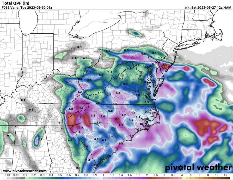
12 NAM honing in on the middle to southern mountains. Sent from my SM-G998U using Tapatalk
-
Yeah was a cold start this morning at the house with a low of 48.
-
HRRR is pretty widespread Sent from my SM-G998U using Tapatalk
.thumb.jpg.024b02a35e3eed3835c11f3042b5bd0c.jpg)
-
NAM is super concentrated. Sent from my SM-G998U using Tapatalk
-
Euro still going widespread. Sent from my SM-G998U using Tapatalk
-
A sharp cutoff on the south side of precipitation on the gfs. Sent from my SM-G998U using Tapatalk
.thumb.jpg.8c9bb485658fee6060f17d42cae2b871.jpg)
-
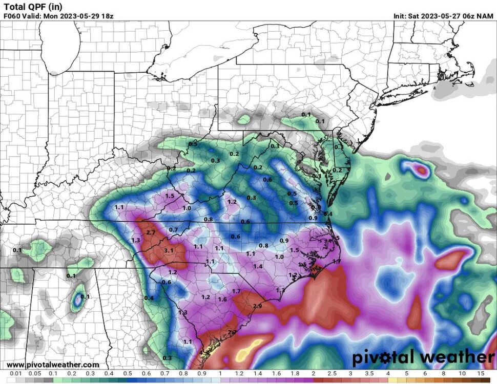
18z NAM Sent from my SM-G998U using Tapatalk

-
The models are still jumpy with this event so who knows. I do think from I40 north is a soaker.
-
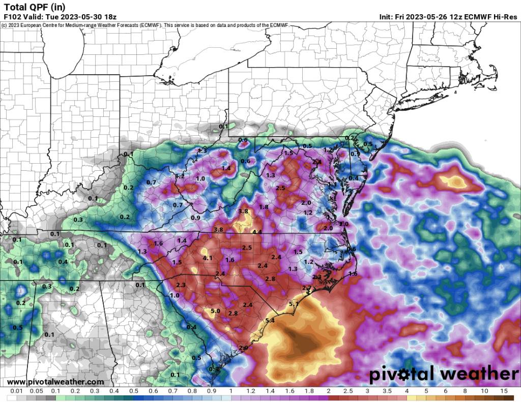
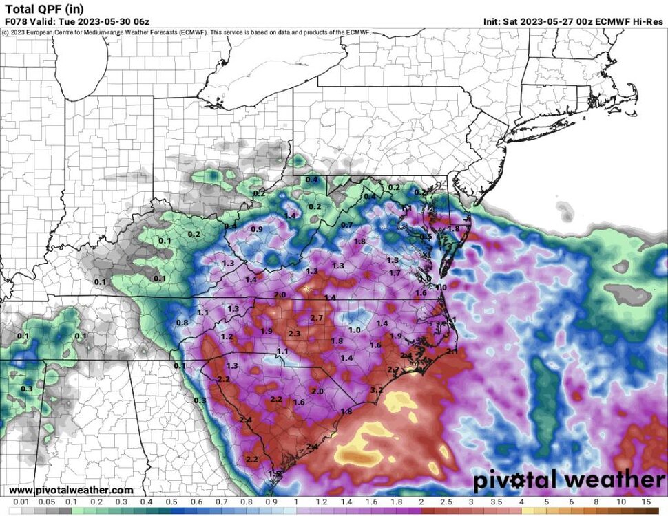
12z euro Sent from my SM-G998U using Tapatalk

-
Yeah definitely flooding down that way for sure. Even after being a bit dry. That much rain would cause flooding down along the river.


.jpg.7eaf0bc369c71651757ec5c09f26038d.jpg)

.jpg.e08316ef00bb6b83e668f7477b9c63b8.jpg)
.jpg.f248f3453a6b7e59357dd5a589e00f60.jpg)
.jpg.a0a1980faa5ac00aaf40ba1365581797.jpg)

.jpg.9f2d16cac0ee3cac47f9a7101522ad73.jpg)


.jpg.e54fc0f175badfd2f1f2fc961c9ac07d.jpg)