Met1985
-
Posts
16,909 -
Joined
-
Last visited
Content Type
Profiles
Blogs
Forums
American Weather
Media Demo
Store
Gallery
Everything posted by Met1985
-
Because we are supposed to be going into spring and it wouldn't surprise me if we finally got blocking and we had a crap spring.
-

2023-2024 Fall/Winter Mountain Thread
Met1985 replied to The Alchemist's topic in Southeastern States
Yeah things look bleek for sure. -
Book it because freaking spring is right around the corner....
-
2023-2024 Fall/Winter Mountain Thread
Met1985 replied to The Alchemist's topic in Southeastern States
Euro still has the disturbance. Sent from my SM-G998U using Tapatalk
.thumb.jpg.70dc2e7d6bd9270b72cdf914de3794dc.jpg)
.thumb.jpg.3fce836b7dbb288dab6771f63b9d13de.jpg)
-
That's really cold for yall down there. We've been in the same boat. Comfortable highs but cold at night. Since Saturday We've had lows anywhere from 16 to 20 consistently. Had a low this morning of 18.
-
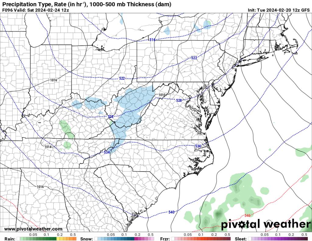
2023-2024 Fall/Winter Mountain Thread
Met1985 replied to The Alchemist's topic in Southeastern States
Gfs is catching on it seems. Sent from my SM-G998U using Tapatalk
.thumb.jpg.39671d4756b6a229a0864e0b6b6a6664.jpg)
.thumb.jpg.5c486c3fc130ae47ffbd5cc46edea502.jpg)
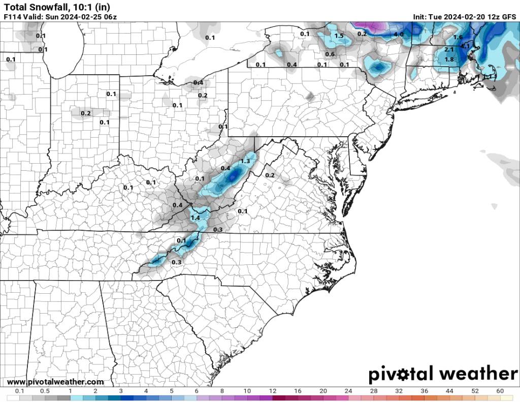
-
A little something could be brewing. Sent from my SM-G998U using Tapatalk
.thumb.jpg.f7d25f10321bc9d410f69702aaf67533.jpg)
-
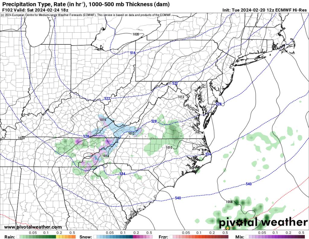
2023-2024 Fall/Winter Mountain Thread
Met1985 replied to The Alchemist's topic in Southeastern States
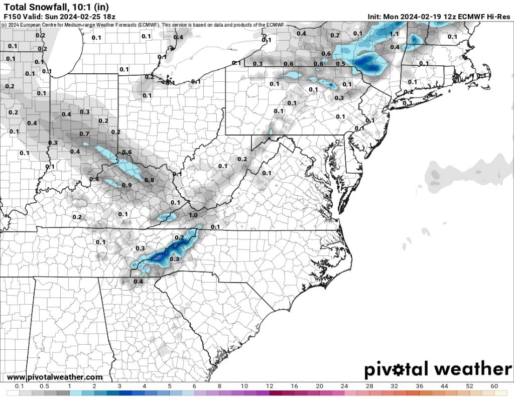
Euro showing a little something with a low dropping down. Sent from my SM-G998U using Tapatalk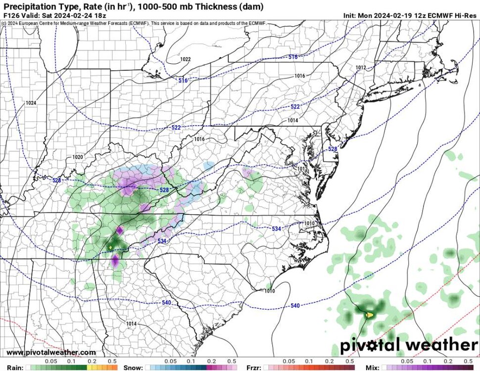
.thumb.jpg.946769d98125deab9c30fa2553633346.jpg)
-
This was a very memorable storm here in Haywood. As reading the write up it's mentions Haywood and all the snow we got even in the Valley. I was only 7 but my mom told me we where out of school for a week. People were stranded everywhere. It's Snowed more than a foot up in the mountains in the area.
- 750 replies
-
- 2
-

-
- snow elk
- wooly worm
- (and 1 more)
-
2023-2024 Fall/Winter Mountain Thread
Met1985 replied to The Alchemist's topic in Southeastern States
16 for a low. -
2023-2024 Fall/Winter Mountain Thread
Met1985 replied to The Alchemist's topic in Southeastern States
Yeah tonight is a proper winter night. Temp down to 22 degrees going for the teens. Heck I Still grilled out tonight on the deck. -
Refresher snow & obs between ~midnight and Noon Sat Feb 17 2024
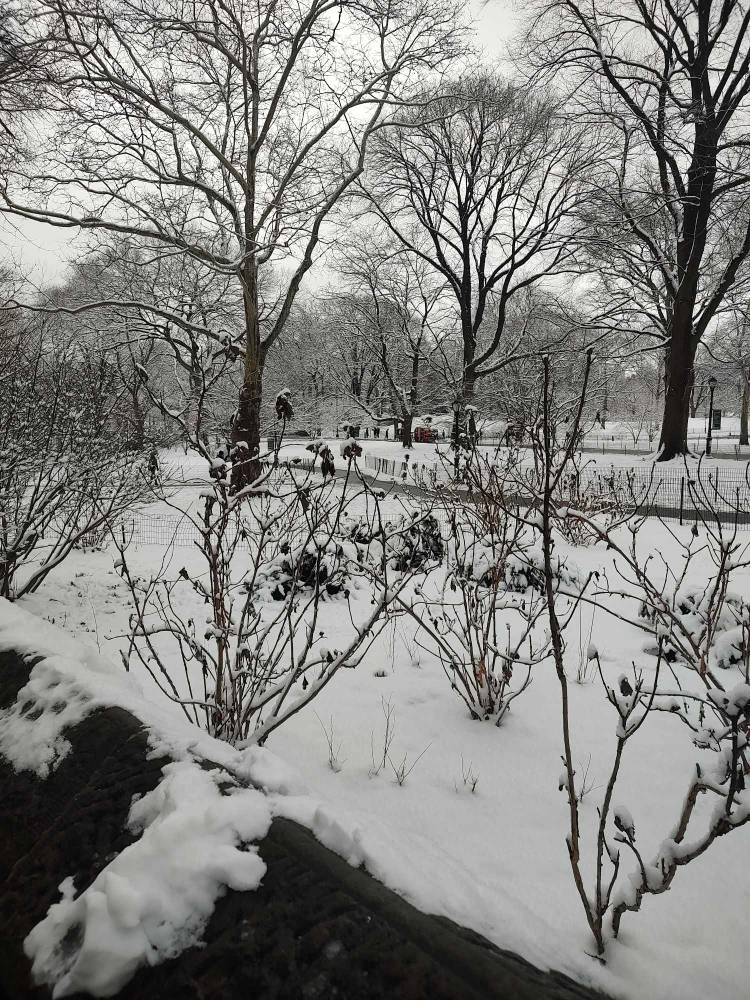
Met1985 replied to wdrag's topic in New York City Metro
Beautiful scenery. Sent from my SM-G998U using Tapatalk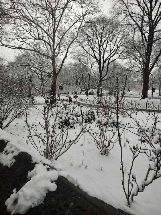
-
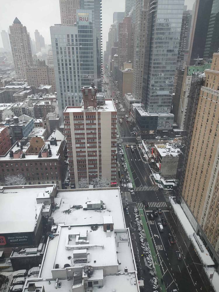
Refresher snow & obs between ~midnight and Noon Sat Feb 17 2024
Met1985 replied to wdrag's topic in New York City Metro
Downtown. Sent from my SM-G998U using Tapatalk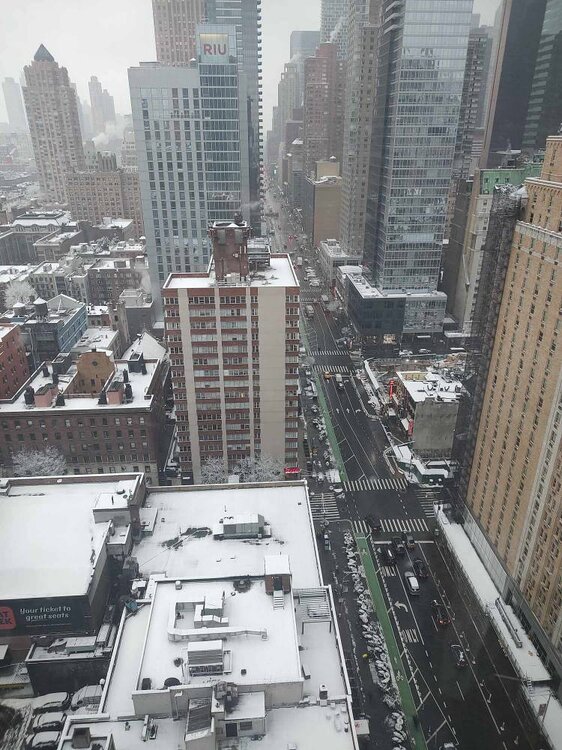
-
2023-2024 Fall/Winter Mountain Thread
Met1985 replied to The Alchemist's topic in Southeastern States
Flurries flying here..that's what we have so enjoy it lol. -
Refresher snow & obs between ~midnight and Noon Sat Feb 17 2024
Met1985 replied to wdrag's topic in New York City Metro
Inner city. Snowing nicely. Sent from my SM-G998U using Tapatalk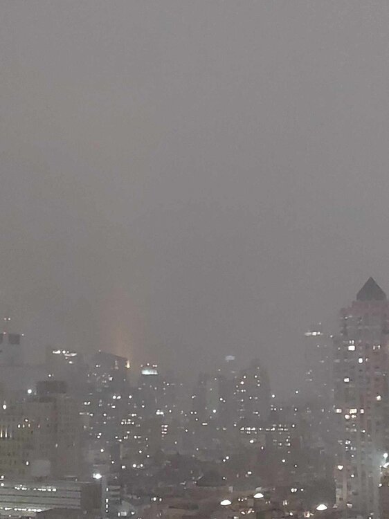
-
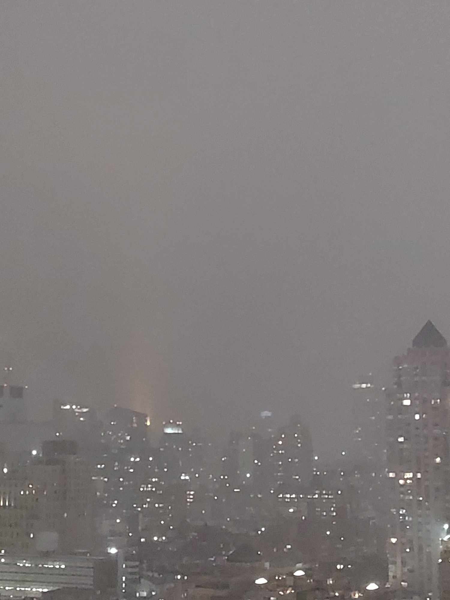
Refresher snow & obs between ~midnight and Noon Sat Feb 17 2024
Met1985 replied to wdrag's topic in New York City Metro
That band is ever so slowly moving north a bit. Sent from my SM-G998U using Tapatalk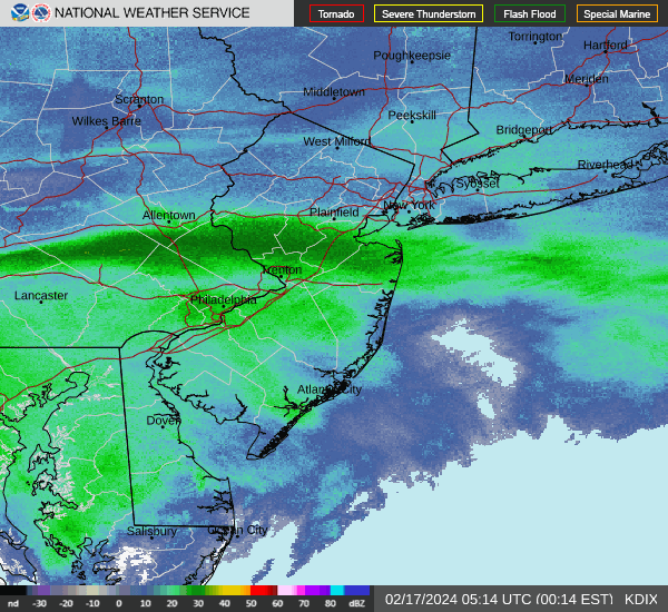
-
You've done a wonderful job Larry. Very much appreciated.
-
That's impressive for this season.
-
That's pretty cool for this season. We are in the 20s here in WNC.
-
Oh yeah I understand and I know exactly what you are saying. The paper mill I worked at was kind of like that. Right on the river, waste water plant, lots of boilers and furnaces, we practically made our own weather in the winter.
-
That would explain a lot lol!
-
This is definitely fascinating especially in our area. I've seen us here in the mountains have moderate snow with absolutely nothing showing on radar because the moisture is so close to the ground. Kind of like a fog precipitation cloud. Very interesting for sure.
-
2023-2024 Fall/Winter Mountain Thread
Met1985 replied to The Alchemist's topic in Southeastern States
I'd say. Looks like a flash freeze up there. -
2023-2024 Fall/Winter Mountain Thread
Met1985 replied to The Alchemist's topic in Southeastern States
Main slug. Sent from my SM-G998U using Tapatalk
-
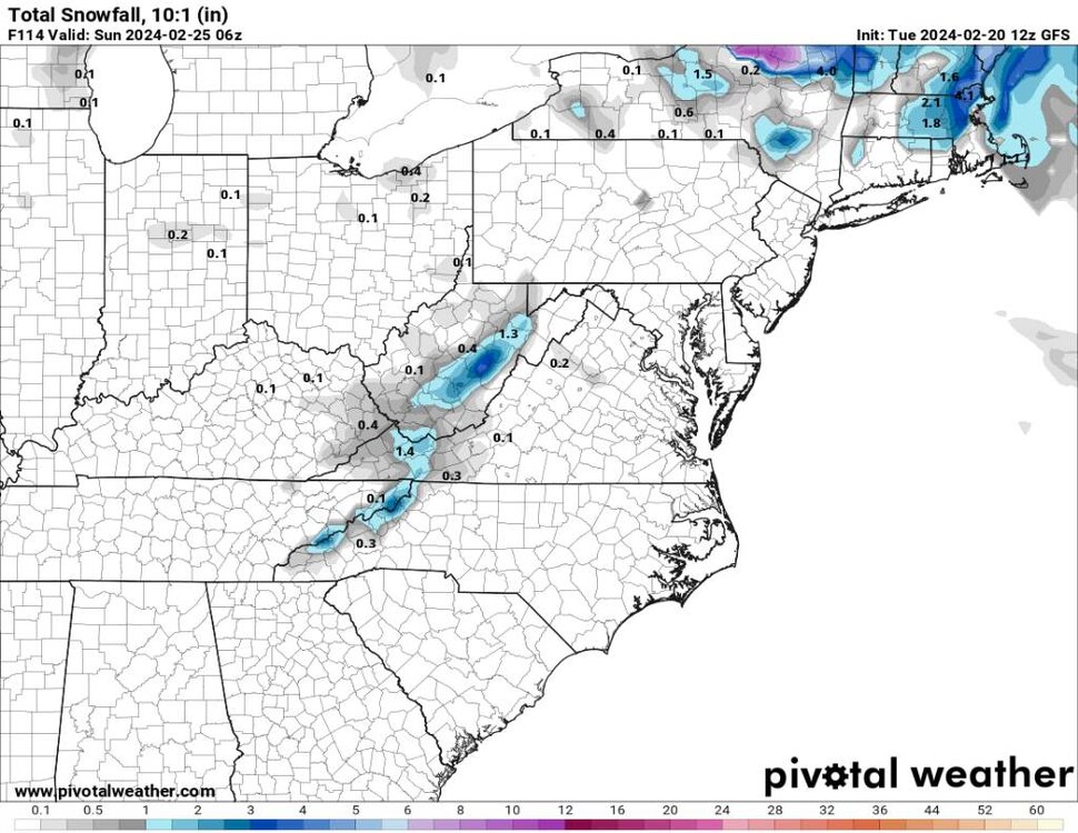
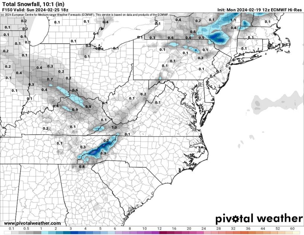
2023-2024 Fall/Winter Mountain Thread
Met1985 replied to The Alchemist's topic in Southeastern States
Moisture out ahead of the main slug. Sent from my SM-G998U using Tapatalk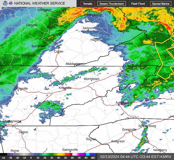


.jpg.167b9e2c4b9d5bb047ebe200410ca0b6.jpg)
.jpg.617a084eac35c9e2c3d4096a6decbecf.jpg)
.jpg.b64f8df0ba137af9b33d3805c72510e9.jpg)
.jpg.b8b76d0d881b538babfdbaaab26114d4.jpg)
.jpg.24106ed5e0bdeac388c22515b05a340d.jpg)

.jpg.a8c1e80a4174c42af26e5bdc062bfaea.jpg)