

Met1985
-
Posts
16,909 -
Joined
-
Last visited
Content Type
Profiles
Blogs
Forums
American Weather
Media Demo
Store
Gallery
Everything posted by Met1985
-
18z gfs ens looks good. Remember the longer in time the smoother the composites are. Sent from my SM-G998U using Tapatalk

.thumb.jpg.a6baf9c32c3283fcbc75495058005890.jpg)
-
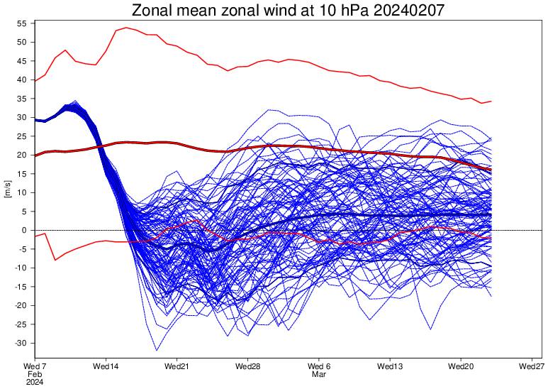
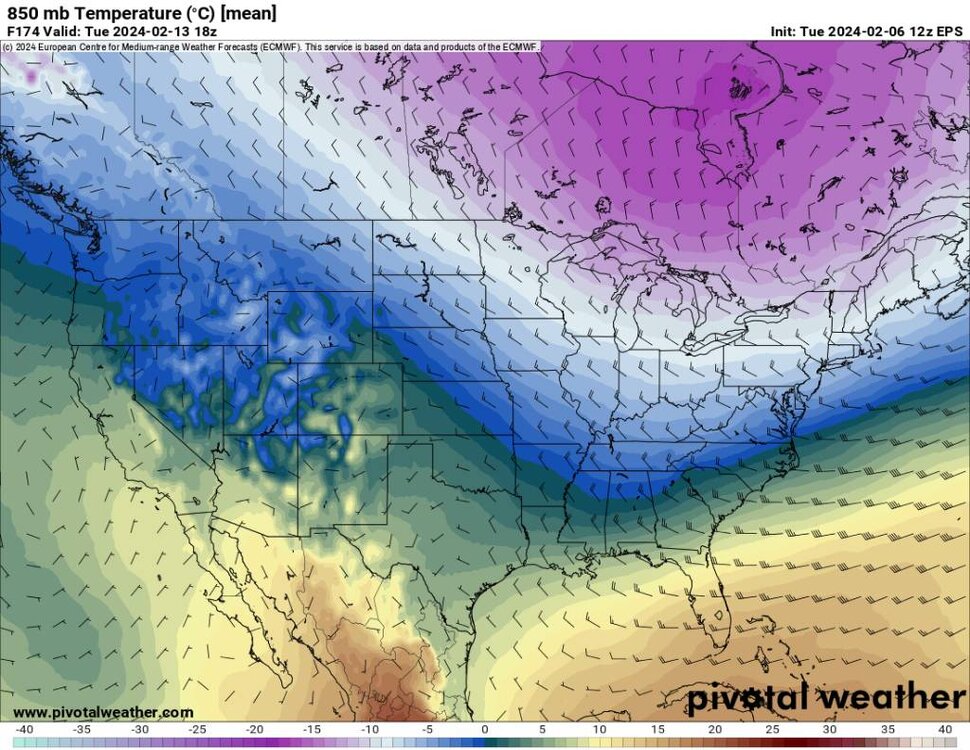
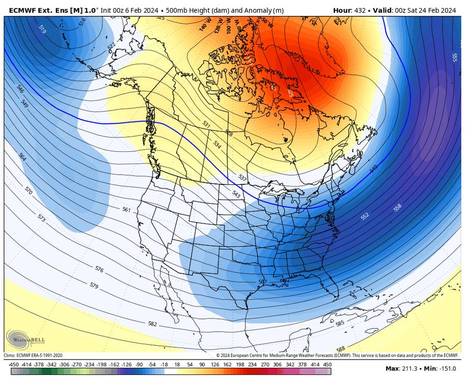
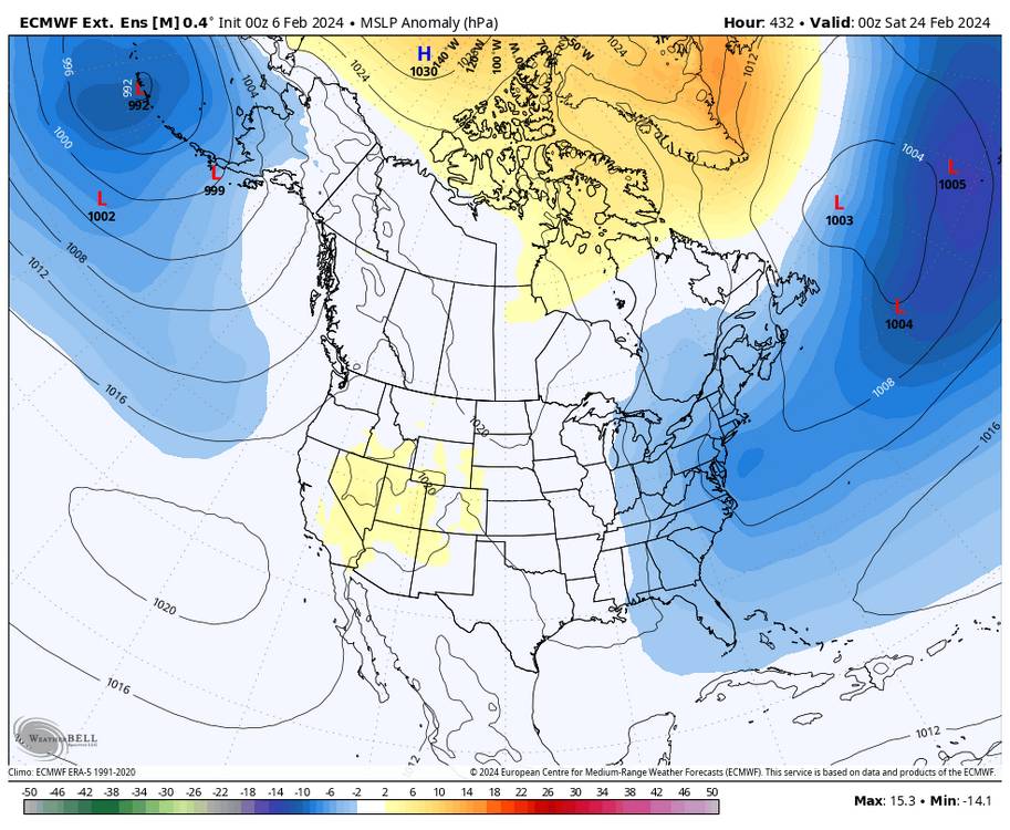
Been seeing more and more talk about a major SSW on the way. This by no means is a unicorn but would greatly enhance blocking towards the first of March. Sent from my SM-G998U using Tapatalk
-
I would suggest people look at the models verification scores recently also. The OP GFS has been horrible. Just putting that data out there.
-
There's just been a ton of shit posting.
-
Things look fine. Get the cold in here and something will hit. Too much energy flying around. The cold air is coming.
-
You just did on the 06z! WTF are you smoking?
-
GAWX has been posting some exceptional stuff this winter. I'd follow him and the analogs especially this year considering we are in a NINO and it's facts that NIÑOS are back loaded.
-
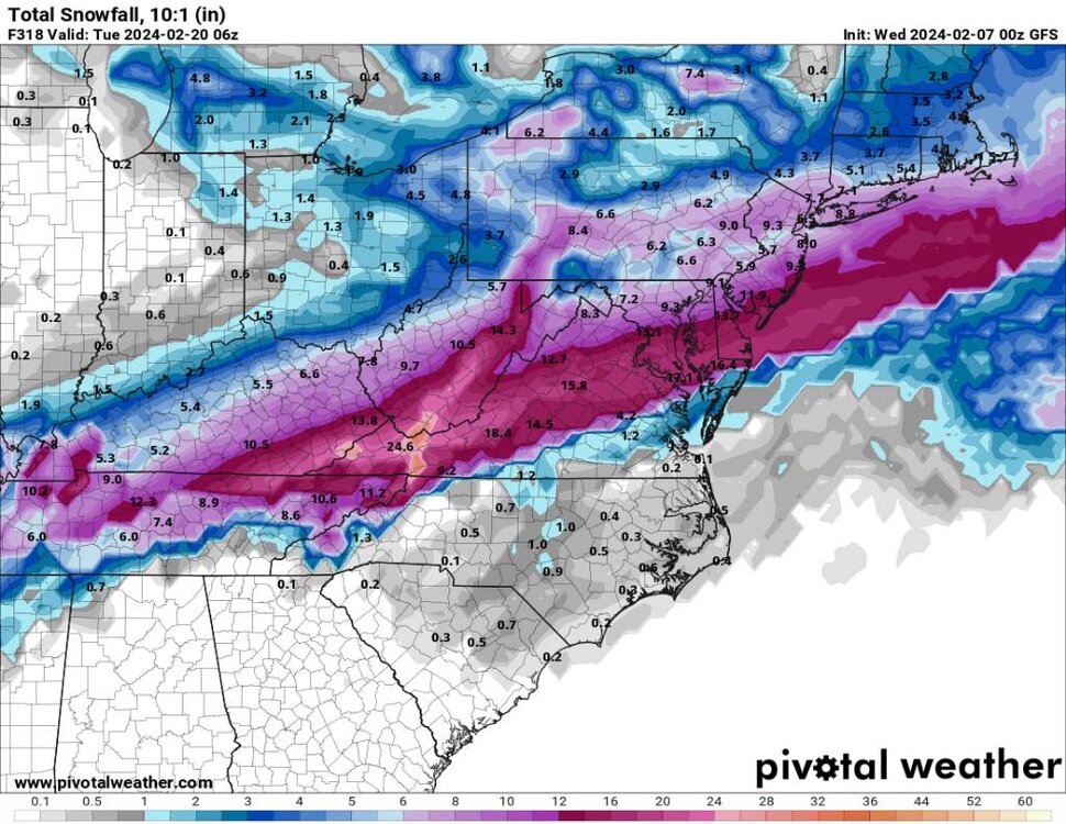
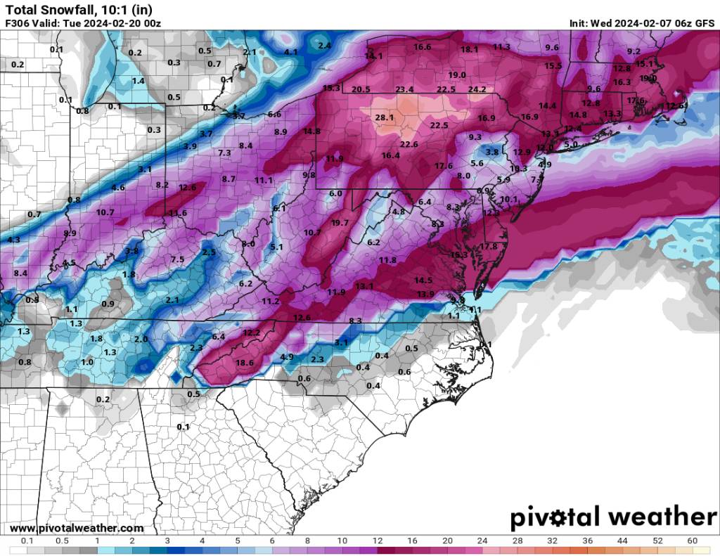
Yeah I just posted it. 18 inches for Asheville and several inches for the piedmont.
-
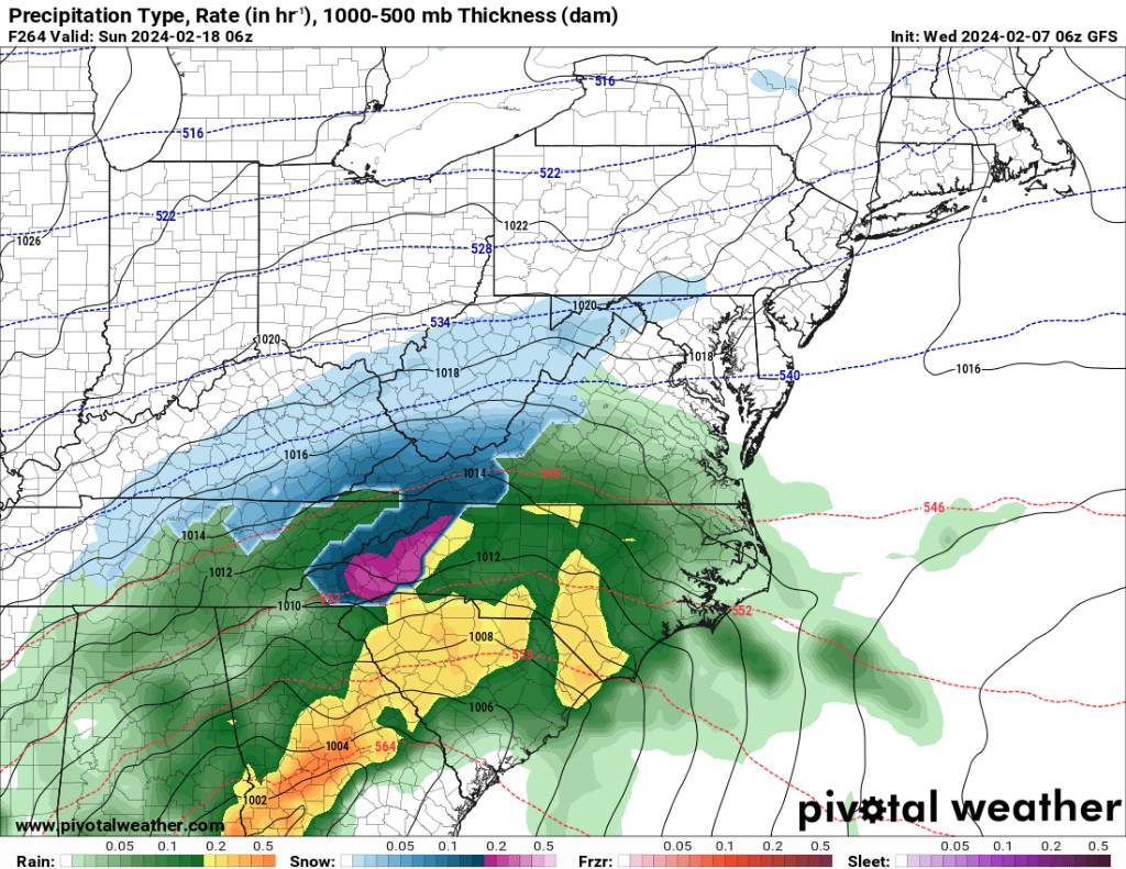
00z EPS looks fine. Sent from my SM-G998U using Tapatalk

.thumb.jpg.c511e3ed3e8f93fcf9a3378390d4aa89.jpg)
-
06z GEFS looks workable. Sent from my SM-G998U using Tapatalk

.thumb.jpg.8bd9b851ae804dcccba4af95a6ec27de.jpg)
-
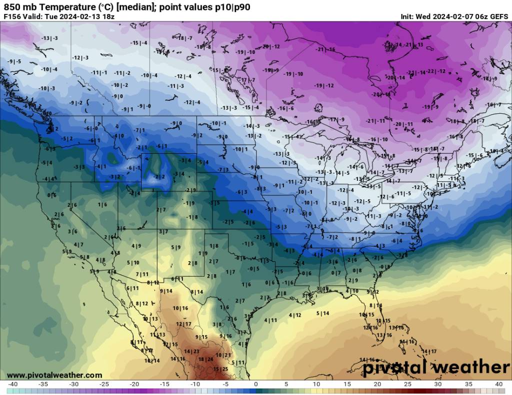
There looks to be potential in the prime of this pattern change. Sent from my SM-G998U using Tapatalk

.thumb.jpg.13fc98de1ff5850b0a536ab56ce65797.jpg)

-

2023-2024 Fall/Winter Mountain Thread
Met1985 replied to The Alchemist's topic in Southeastern States
A bit down the road. Sent from my SM-G998U using Tapatalk.thumb.jpg.3b3c41cf82c22198bccd9b98b7ada6b9.jpg)
.thumb.jpg.86dd54160a6003d39073ed04c582f59b.jpg)
.thumb.jpg.53e9fef6105dc70847e5b8a1455af19b.jpg)
.thumb.jpg.89916708f0e13b48691bdd012e6f4d0d.jpg)
-
2023-2024 Fall/Winter Mountain Thread
Met1985 replied to The Alchemist's topic in Southeastern States
There is a lot of potential showing up. Sent from my SM-G998U using Tapatalk
.thumb.jpg.abc298fd9f3997a7d18c7e85f48e9c6d.jpg)
-
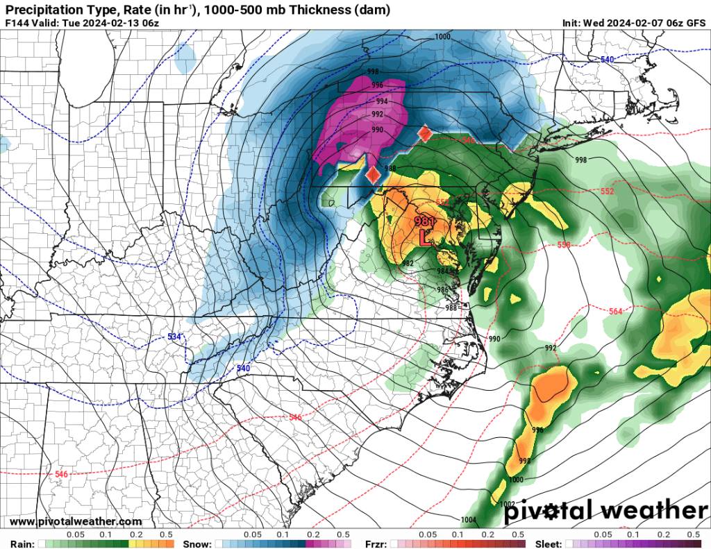
Yeah big snow for VA. There are signs folks could see some snow outside the mountains. Sent from my SM-G998U using Tapatalk
-
I thought this was the mid range thread instead a thread to shit all over it? Some of yall in here are unbelievable and mods feel free to move if needed.
-
Then go to the sanitarium thread.
-
They have been decent this season as well. Sure they didn't get the cold right for this time period but they have been pretty good this season. As you should know cold doesn't always equat to snow.
-
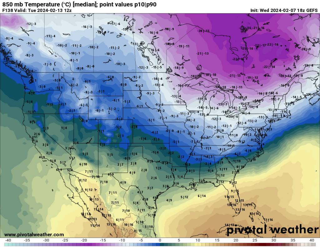
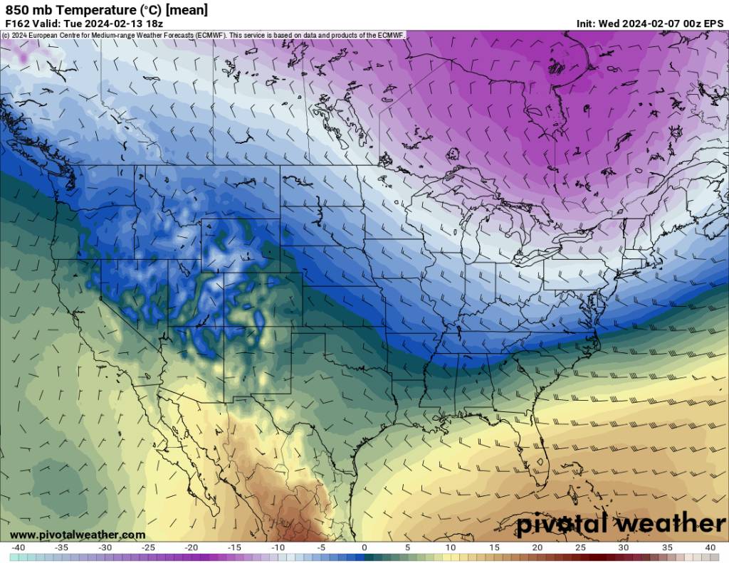
Eps looks great today. Sent from my SM-G998U using Tapatalk
.thumb.jpg.eaf14b16ab708663991f3c3e8fce0c10.jpg)
-
Weeklies into March. Sent from my SM-G998U using Tapatalk
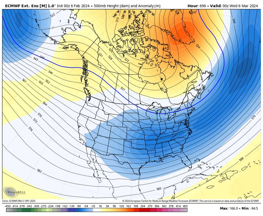
-
Weeklies look great. This is the 25th which is right around the corner. Sent from my SM-G998U using Tapatalk
-
2023-2024 Fall/Winter Mountain Thread
Met1985 replied to The Alchemist's topic in Southeastern States
Yeah honestly the hell with just posting shit to be opposite of cold and snow. -
You need to move to Aspen Colorado.
-
Yes sir Larry! Everything looks good from an overnight perspective of things. Looking at the big picture.
-
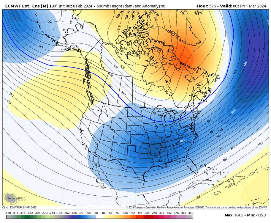
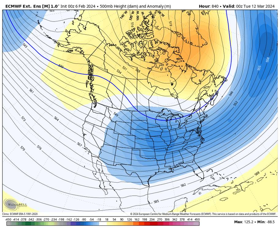
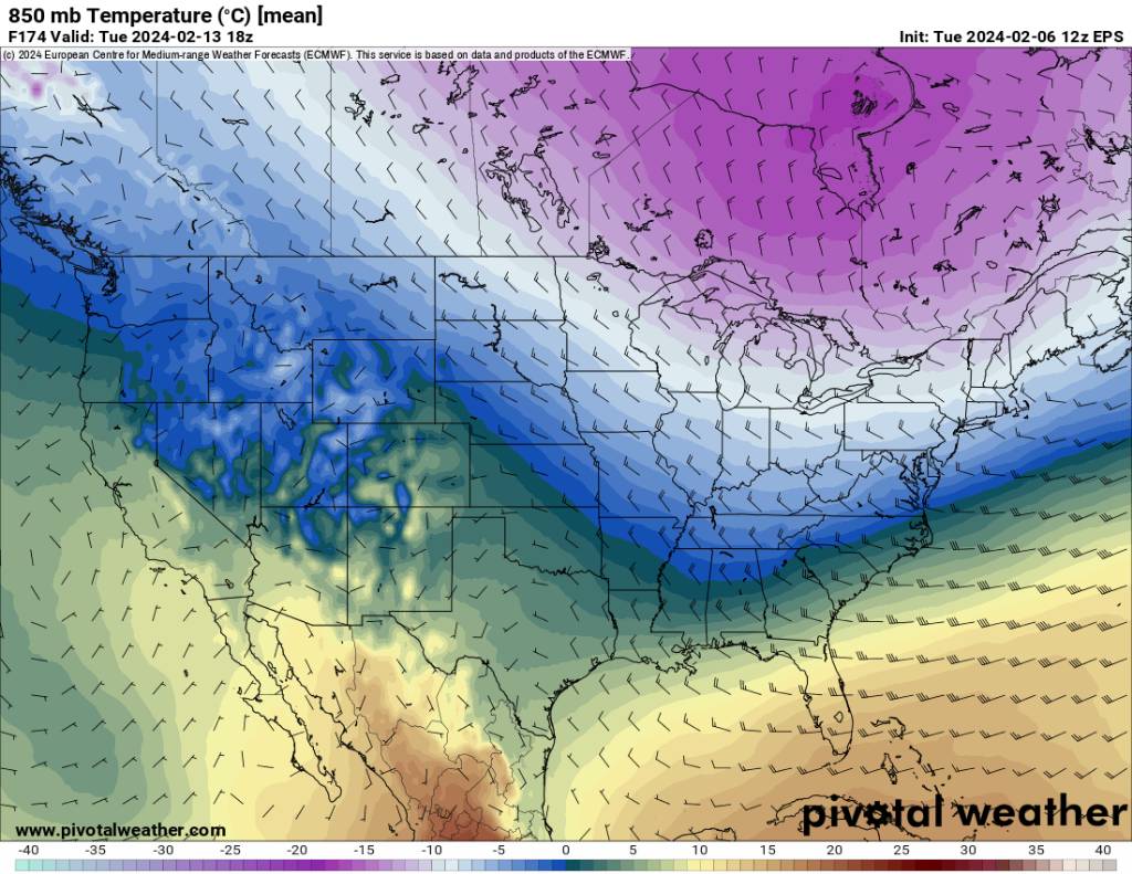
The EPS looks fine starting around the 13th. Classic west coast ridge east coast trough.
-
2023-2024 Fall/Winter Mountain Thread
Met1985 replied to The Alchemist's topic in Southeastern States
We will score again.
.jpg.b16e7aac0a62ff2c6cd11e4cc2fcec36.jpg)


.jpg.39b48eb421c66974165b1bfc5f59ff1c.jpg)
.jpg.52432beda3cce1c1aa8ffbf6922f1adc.jpg)
.jpg.2eabfcf45de4da9b36f00d2405f6706e.jpg)
.jpg.acdd9853f99b29068a663856b7cd68d9.jpg)
.jpg.ec05232da28c08225de6cc300ff43883.jpg)
.jpg.a07b9875afce0d77617c0511a294288a.jpg)
.jpg.393434a9f4ee5913a0244f8e65574459.jpg)
.jpg.b171b8678c589573820f544b8c570b86.jpg)

.jpg.23fcfe2570d2641aecbd8621279545e5.jpg)