

Met1985
-
Posts
16,909 -
Joined
-
Last visited
Content Type
Profiles
Blogs
Forums
American Weather
Media Demo
Store
Gallery
Everything posted by Met1985
-
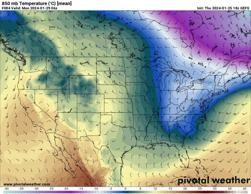
Then we have kind of a lagging trough in the NE to a much cooler pattern along the East Coast in general. Sent from my SM-G998U using Tapatalk
.thumb.jpg.82b39d8c92d910e414c63cce24365078.jpg)
.thumb.jpg.0acc59c25f66b838364c9eb1b061c6cf.jpg)
.thumb.jpg.3101bb89457e248136ae31f0e25eea92.jpg)
-
We then get another reinforced shot of cooler air behind the initial cool down. Sent from my SM-G998U using Tapatalk
.thumb.jpg.86a2f73aab0ac1ec17dbac1b8c4b1036.jpg)
.thumb.jpg.11be75d0b8f058069b19be4eb78c51c3.jpg)
-
We go from today to a nice cool down. Sent from my SM-G998U using Tapatalk
.thumb.jpg.b8ba8fa69097ff08da01dd52d054f737.jpg)
-
If you follow the ensembles they have cooled greatly just over the past few days.
-
The ensembles are catching onto this today as well. Doesn't look like an all out dumpster fire.
-

2023-2024 Fall/Winter Mountain Thread
Met1985 replied to The Alchemist's topic in Southeastern States
Yeah the torch has never materialized..We've been at or below normal essentially. I really don't think this so called torch will either. Glad I live in the mountains. I don't envy those that don't. -
Hey it does look like we will see a nice upslope even here the first of next week.
- 750 replies
-
- 2
-

-
- snow elk
- wooly worm
- (and 1 more)
-
2023-2024 Fall/Winter Mountain Thread
Met1985 replied to The Alchemist's topic in Southeastern States
More rain tonight. The river is way up but I don't see any flooding concerns. Maybe this weekend though. -
2023-2024 Fall/Winter Mountain Thread
Met1985 replied to The Alchemist's topic in Southeastern States
Hey I'm just trying to stay in my lane. Just living in reality lol. -
2023-2024 Fall/Winter Mountain Thread
Met1985 replied to The Alchemist's topic in Southeastern States
Still a signal but get your shorts on and tanning lotion out because it ain't going to snow ever again. Sent from my SM-G998U using Tapatalk.thumb.jpg.cdeda6cc76493538ce8a12b97e4aaf7d.jpg)
-
2023-2024 Fall/Winter Mountain Thread
Met1985 replied to The Alchemist's topic in Southeastern States
This is fake news guys. Sent from my SM-G998U using Tapatalk.thumb.jpg.783ad1f9f19c8573e10267b8932dea49.jpg)
-
2023-2024 Fall/Winter Mountain Thread
Met1985 replied to The Alchemist's topic in Southeastern States
This is what the rest of our winter is going to look like. Sent from my SM-G998U using Tapatalk
-
2023-2024 Fall/Winter Mountain Thread
Met1985 replied to The Alchemist's topic in Southeastern States
No winter is over guys. Get ready for spring and the beach. -
Carver say it ain't so. I was told winter is over now. Close the blinds, put out the grass seed, start getting ready for beach weather...
- 750 replies
-
- 2
-

-
-
- snow elk
- wooly worm
- (and 1 more)
-
No freaking kidding! Yeah it was anything but warm.
-
2023-2024 Fall/Winter Mountain Thread
Met1985 replied to The Alchemist's topic in Southeastern States
Still a great signal for a significant upslope event during this torch. Sent from my SM-G998U using Tapatalk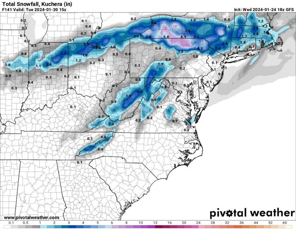
-
This would definitely line up with what the ensembles are show for sure.
-
Excellent post Larry and some of what I was alluding to but you put it in a much better context than me. Keep it up warm or cold.
-
Lol rough crowd guys, rough crowd. I do understand yall outside the mountains. Hopefully everyone can score.
-
I can understand that for sure. What I don't understand is people thinking this was not advertised in the mid range forecast. Larry has posted some great statistics for a possible snowy February. Tennessee has scored and hopefully the prevailing pattern to come will help us score as a state in whole. I'll state this again looking at op runs after op run will only get you more and more frustrated. We all know that the time period for a significant change back to a much better pattern is going to be around February 8th and then some. So maybe use this time to take a little break and enjoy the weather we have.
-
For yalls area I do understand your frustration. It is way harder to get snow down yalls way than up here in the mountains. But I still wouldn't completely take your area out of the probability to see some snow this year.
-
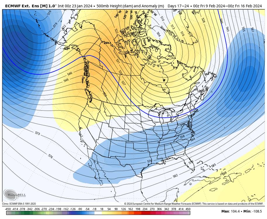
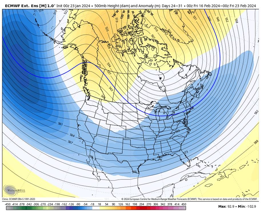
Euro Weeklies. Heading into much better territory. Sent from my SM-G998U using Tapatalk
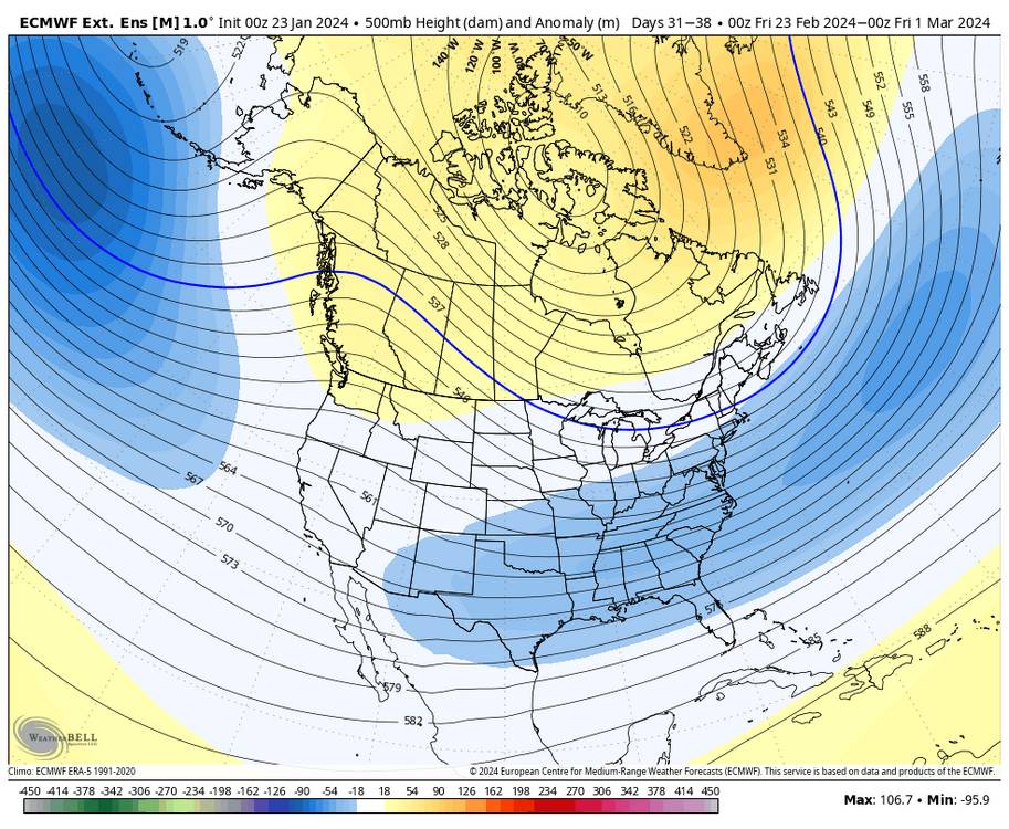
-
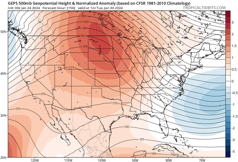
The GEPS also agrees on the solution from the 2nd to around the 7th. Again all the ensembles are heading in the right direction. Sent from my SM-G998U using Tapatalk

-
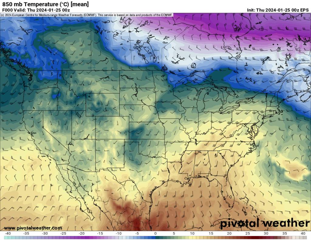
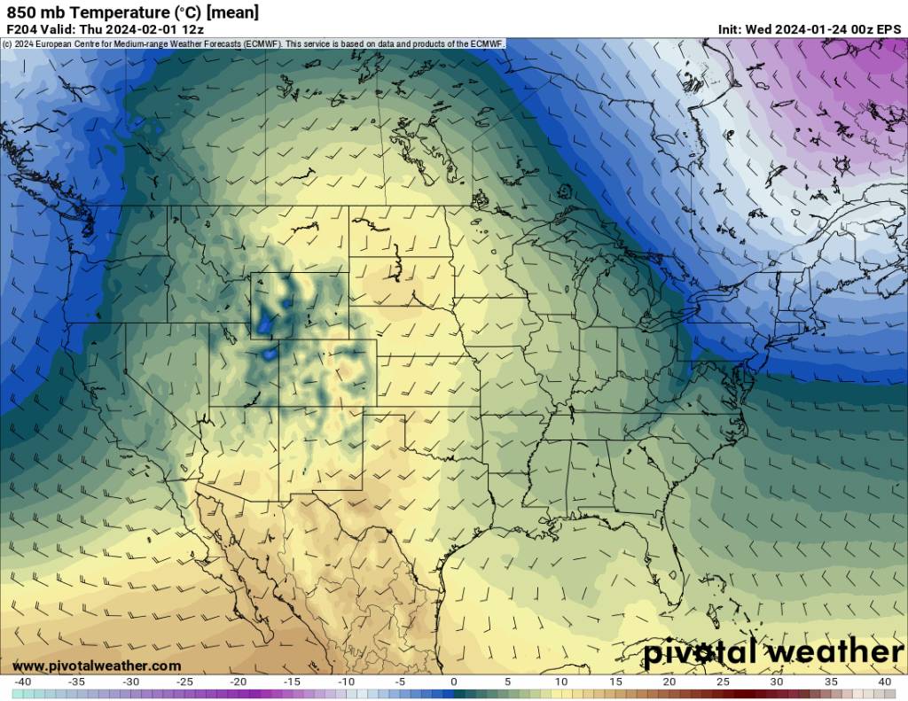
Also the GEFS agrees. Heading in the right direction. Sent from my SM-G998U using Tapatalk

.thumb.jpg.484de478aeb028aa74e3f6231aacab8f.jpg)
-
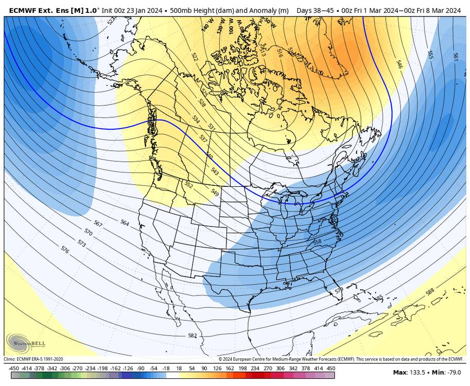
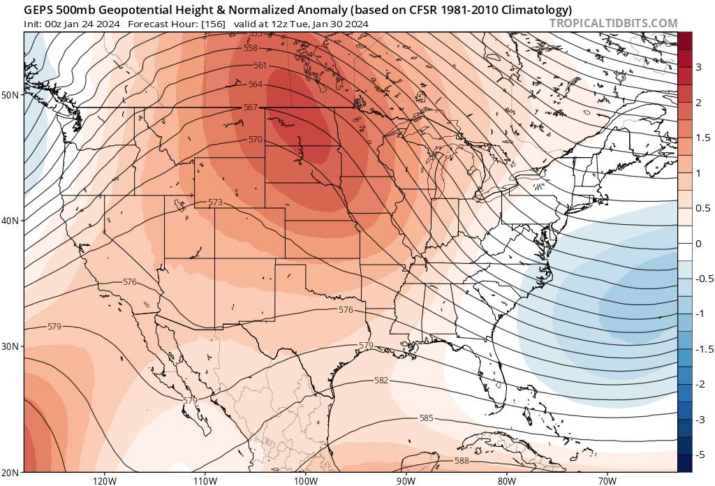
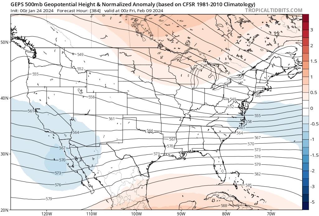
On the eps we go from torch on the 2nd to a much better look 5 days later heading in the right direction. Sent from my SM-G998U using Tapatalk

.thumb.jpg.8812048b665917befe9854500115ac26.jpg)
.jpg.1b1cd56f1f09e042a647d28f896b9dda.jpg)
.jpg.8d93ea01707ca8cd3e5f8759108328fe.jpg)
.jpg.3a3fcea380edb77faf8e3f427d1d30be.jpg)
.jpg.f46b643605bb1cdbc9c45e213bbe87ab.jpg)
.jpg.43a692150f3effde6d002267aabe6751.jpg)

.jpg.fdef3a916c1157410d391a50ad74e34b.jpg)

.jpg.edf232d180fa8f058474608ac32846d5.jpg)
.jpg.36c27a6d8ff9d904c3c52901503768b4.jpg)

.jpg.3c194aeb28e95313da843c05892ef84b.jpg)

.jpg.e89669d9973aebc7fa85c5c37dd6fe24.jpg)