Snowstorms
-
Posts
4,126 -
Joined
Content Type
Profiles
Blogs
Forums
American Weather
Media Demo
Store
Gallery
Everything posted by Snowstorms
-
That's a long drive if you do it regularly. I don't mind road trips, but they can be tiring sometimes. Bring your New England magic this way so Chicago-Detroit-Toronto can get a 12"+ storm.
-
His last thread was a win for my area . I have faith in him.
-
Some positive trends for our area. Northern vort is definitely further north and the west based -NAO should help to minimize any crazy northward trend with the main southern energy and help it to amplify. One of the main things that intrigues me is the availability of moisture should the southern energy have room to strengthen with some added STJ influence. Not completely sold out for our area yet as I would like to see some more positive trends. Should get a clearer picture by tomorrow 12Z runs.
-
Have yet to dip below 14F this season. We could tomorrow night which I believe would be the latest on record. Terrible. Even 2011-12 or 2001-02 dipped below 14F by this time.
-
Well-deserved for the Chicago crew considering the snow drought y'all are experiencing.
-
Yeah, I'll take the UKIE please.
-

Winter 2020-21 Medium/Long Range Discussion
Snowstorms replied to Hoosier's topic in Lakes/Ohio Valley
Not the winter I expected. Endless cloudy days with zero precip on top of this stay at home order. You add them together and it equals boredom and depression. If we go all of Jan without a single snowstorm, I'm all in for Spring. It's Jan 15 and YYZ has yet to go below -10C lol. Just ridiculous at how warm it’s been. -
Our avg high and low on March 31 is 45F and 28F, respectively. But I agree, it can be tough to get warm temperatures especially near the Lake when spring starts up. YYZ didn't even crack 60F last April which has never happened before since records began. To make it even worse we didn't even crack 70F till May 22 lol. Now that's rare but it goes to show you how hard it can be to get warmth to cross the escarpment in spring.
-
Unless we get a blizzard of 99 and/or Feb is historic, nothing and I mean nothing, can redeem this shitty month. About to be 2 weeks of literally nada in the heart of winter.
-
Mid Jan 2019 to early March 2019 was epic, at least locally. Nearly 50" in that 6-7 week stretch. How did your area fare?
-
Upstate/Eastern New York
Snowstorms replied to BuffaloWeather's topic in Upstate New York/Pennsylvania
I agree. Would be the best pattern for you especially given the trough orientation. Only 2% ice cover right now with the Lakes running exceptionally warm. I think a big lake effect outbreak could be on tap after next weekend. You deserve it after that shitty December. -
Upstate/Eastern New York
Snowstorms replied to BuffaloWeather's topic in Upstate New York/Pennsylvania
Just a bunch of strung out clippers lacking moisture with zero southern stream influence. Terrible pattern. It's too progressive. -
Winter 2020-21 Medium/Long Range Discussion
Snowstorms replied to Hoosier's topic in Lakes/Ohio Valley
Strong easterlies have dominated across the ENSO region primarily near the dateline and are expected to continue past mid-Jan which has driven the SOI to 2010-11 levels. So yes, for the moment it's expected to strengthen. Subsurface anomalies continue to remain cold. Wouldn't be surprised to see a second peak. Thus far, the La Nina hasn't fully coupled with the atmosphere but there's growing evidence the ridge building across the west will slowly retrograde towards the Aleutians come February, which is more typical of a Nina. Global AAM has finally gone negative so we’ll see if that holds over the next few weeks. February is certainly going to be a strong gradient month with the La Nina fighting to take control of the pattern and impressive polar blocking. Feeling optimistic about February, it could be our best month. -
Winter 2020-21 Medium/Long Range Discussion
Snowstorms replied to Hoosier's topic in Lakes/Ohio Valley
You're right. There have been many instances where you and I have cashed in where the rest of the sub didn't. The upcoming pattern doesn't look favorable for clippers with a relatively weak polar jet. Need more Nina influence on the pattern. It's mixed between Nino and Nina right now. But one thing is for sure, there's potential for phased storms in the upcoming pattern. Hopefully we get a redux of a classic great lakes winter storm. -
Wow, nice picture. You're lucky. The last time we had a sunny clear day like that was Dec 18 and before that Dec 6 lol. Terrible climo.
-
Upstate/Eastern New York
Snowstorms replied to BuffaloWeather's topic in Upstate New York/Pennsylvania
Was on top of Detroit 2 runs ago. Still though, potential is there for a partially phased storm but I’m not buying into anything yet. -
Winter 2020-21 Medium/Long Range Discussion
Snowstorms replied to Hoosier's topic in Lakes/Ohio Valley
If that PNA ridge in the west can stay off the coast rather than poking into AB, we can see storms across our region. Otherwise the pattern is more favorable for the east coast given the strong west based -NAO. Would be nice if we had typical Nina like ridging towards AK and the Aleutians. Most of Western Canada continues to torch and that's never good for winter storms or sustained cold. But until Jan 15, a pretty boring stretch inbound. -
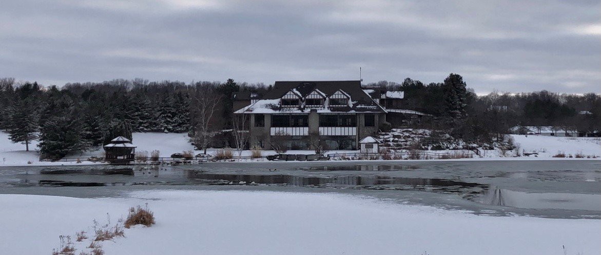
Went for a drive in the area and snapped this pic yesterday. Would've been nice if the small lake was frozen but without any sustained cold, that ain't happening.

-
My 2 day snow total is 3.8" with 2.5" coming last night. Not bad. We've had snow on the ground since Christmas eve. Our longest stretch so far lol.
-
Probably the only spread the wealth storm we've had in the last 25 years. Read an article that regarded the Blizzard of 99 as being one of Chicago's worst blizzards ever.
-
What an epic storm. We need a repeat. Over 20" locally and the first in a series of storms that plastered Toronto over the following 2 weeks with over 40" of snow. They had to call the army. I was a little kid so I don't remember but I do recall being home for a week from school lol.
-
That's sweet. I'm guessing you're more than half way to your seasonal average already? Glad somebody in this sub was able to score big with this event. Happy New Years!
-
YYZ finished with ~13.6" but there's some missing data at the beginning of the month so I suspect it's close to 14.6". We finished above average as well. YYZ is ~23" on the season. Snow wise, it was a great month with that Dec 1 storm and Christmas storm. Otherwise, it was mild and pretty boring overall I agree. Let's hope January is better. Happy New Years!
-
Winter 2020-21 Medium/Long Range Discussion
Snowstorms replied to Hoosier's topic in Lakes/Ohio Valley
I agree. If anything, it may help snow weenies out in the Mid-Atlantic with such an impressive west based -NAO. But for us, I don't foresee any 2014 or 2015 type of cold if the vortex remains parked up in AK. However, it should help in increasing snowfall probabilities as we'll have more cold air to work with than now. -
Just crazy. I wonder if it has to do with people gathering for Christmas pre lockdown. The positivity rate is 8% today too. Not impressed with our current vaccination program. I understand it's about being fair and ensuring all Canadian's have the right and access to the vaccine. However, most of Canada's cases have been confined to 4 provinces (AB, BC, ON and QC). More than 80% of our entire country lives in these 4 provinces and half that in ON alone. They should be prioritizing 75% of the vaccine to these provinces where cases are surging not the Yukon for example. Target the vulnerable, elderly, nurses, doctors, etc. in these 4 provinces and have them all vaccinated by mid-January before you distribute a portion to other provinces. But what can you do? It's all bureaucratic bs. You can’t expect society to adhere to lockdown protocols if politicians themselves refuse to do the same. You can’t expect changes in cases if you’re not implementing proper lockdown procedures and vaccination rollouts. Everything since this pandemic began has been a complete mess and now were at record levels and trapped in our homes. 10 months in and people are going crazy mentally sitting at home. That one-month Toronto and Peel lockdown was completely unnecessary unless they locked the entire province down. And these lockdowns are half-ass too. Cases are surging because factories, warehouses and these big stores like Walmart continue to operate as normal not because of our average small one stop clothing store. Sorry for the rant but this is ridiculous now.