Radtechwxman
-
Posts
2,481 -
Joined
-
Last visited
Content Type
Profiles
Blogs
Forums
American Weather
Media Demo
Store
Gallery
Everything posted by Radtechwxman
-
Imagine that. Something that favors northern IL. Lol. Now looks like that frontogenic band will bypass here and we only get a narrow west to east band a few hours. Sunday clipper may actually have better potential here
-
Globals really struggle with these clippers and underestimate what high ratios with minimal moisture can do. Hrrr/rap have been pretty consistent.
-
The Never Accurate Model strikes again. Issue with nam with amounts seems to be a much narrower snow band so much less duration.
-
Yea GFS seems lost. Barely shows anything till Mon. And seems to have toned down that as well. 12z RDPS looking pitiful like GFS. Hi res seems to overall be in good consensus for 2-4in
-
I would definitely start trusting those more over globals at this range. RAP was definitely stronger system. Deeper sfc low and further north.
-
03z rap a nice spread the wealth storm. Meanwhile GFS is like a dud. Also piddled out the Mon storm. Good thing it's goofus and probably just a whack run.
-
So are we going to merge threads like RC suggested with so many storms close together? It's hard posting in like 2 or 3 threads now. Ha.
-
Definitely been a very rough winter down this way. You may luck out later next week when storm track shifts more south with the cold air really sinking south.
-
One would think so but 2020-2021 winter be like rain you shall get. But this upcoming pattern has the most promise I seen all winter. Hopefully us central IL peeps can luck out
-
No more north trends please. Lol. Time for I80 south to cash in. Would be awesome to build a snowpack to really enhance this arctic outbreak. Bring on the ice age
-
Cue that happening because so far this winter everything has missed me north so only logical that next it would miss me south. Lol. Hoping I can squeeze a few nice fluffy snows out of this sustained cold pattern. Would be a waste to not put this quality cold air to work
-

Feb 3rd - 5th Potential strong stm threat
Radtechwxman replied to Brian D's topic in Lakes/Ohio Valley
Is ILX having issues today? Said AFD was out at 223pm but still showing last nights. I personally think IL River and points west should have WWA. Most models showing 1-2in and equally strong winds. Some models have a quicker changeover here. More excited for the next few waves after this one because they actually have potential south of I80! -
Feb 3rd - 5th Potential strong stm threat
Radtechwxman replied to Brian D's topic in Lakes/Ohio Valley
Trends today seem to be suppressed way south. Big change from previous days which were showing a massive storm and likely blizzard for the upper Midwest. Curious if it trends back towards that or if this system will end up way south like today's model runs show. Euro, gfs, and cmc had been remarkably consistent days prior with something tracking from the southern Plains into the Great Lakes -
January 30-February 1 Winter Storm Part 2
Radtechwxman replied to Hoosier's topic in Lakes/Ohio Valley
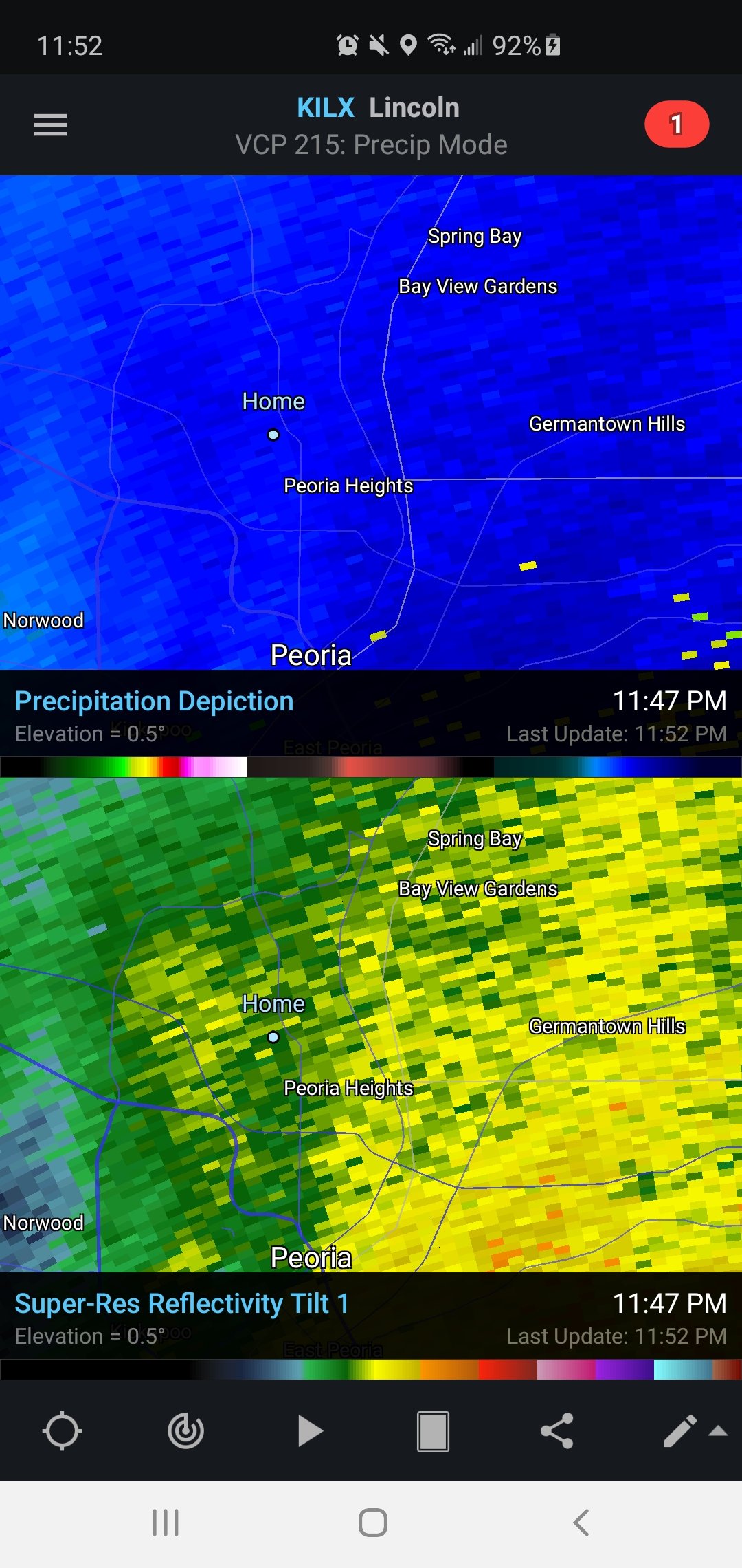
Gradient setting up very sharply near I74 like forecasted. Currently have a nice band stalled here for now.
-
January 30-February 1 Winter Storm Part 2
Radtechwxman replied to Hoosier's topic in Lakes/Ohio Valley
Mixing line finally pushed south with some decent bands pivoting over me as the 850mb low that janetjanet998 pointed out nears my area.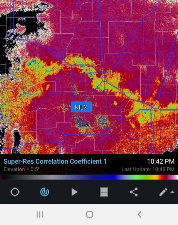
-
January 30-February 1 Winter Storm Part 2
Radtechwxman replied to Hoosier's topic in Lakes/Ohio Valley
Definitely think we will be on very low end of local forecasts. Local Mets saying 1-3in but will be shocked if we even get an inch. Congrats to Chicago folks. Winter of disappointment continues here. -
January 30-February 1 Winter Storm Part 2
Radtechwxman replied to Hoosier's topic in Lakes/Ohio Valley
Temps dropped several degrees in the initial light returns. Probably more so evaporative cooling with dews lower at that time. But I thought with the heavier precip they would hold steady but they keep bumping up. Beginning to wonder if we won't see any snow till the wrap around tomorrow. Dew right at 32. Hrrr showing snow transition would be soon but I'm very skeptical. -
January 30-February 1 Winter Storm Part 2
Radtechwxman replied to Hoosier's topic in Lakes/Ohio Valley
33 degrees and pouring rain. Just wonderful. Love it. Man if temps were colder to start this would have been a big ice storm. Models still seem to think a changeover here around 03z. -
January 30-February 1 Winter Storm Part 2
Radtechwxman replied to Hoosier's topic in Lakes/Ohio Valley
Man cutoff will definitely be insanely close to me along I74. Models are wavering on whether I cash in or not. Obviously impossible to nail exact location and timing of the rain snow line when it's highly dependent on dynamic cooling. Temps were 35-36 here but have now dropped to 33 with light rain. If it weren't for that warm nose aloft would probably get wet snow soon. But hoping maybe we're running cooler and can changeover quicker but not holding my breath. -
January 30-February 1 Winter Storm Part 2
Radtechwxman replied to Hoosier's topic in Lakes/Ohio Valley
Most everywhere will with marginal temps to start but you will changeover relatively quickly and will be ripping for hours. You're sitting pretty for this one. -
January 30-February 1 Winter Storm Part 2
Radtechwxman replied to Hoosier's topic in Lakes/Ohio Valley
Seeming more and more likely that this warm nose is going to be a major issue even further north and west. Hi res models before were at least showing a few hours of rippage here between 9pm and 12am but now looks like I may never changeover with initial band and may have to wait for any potential wrap around as the low pulls east. -
Sounds about par for the course. Holding hope dynamic cooling will help cool the column more for a heavy wet snow vs rain snow mix. I don't forsee much in the way with freezing rain with marginal temps. Maybe some sleet or graupel with convective nature of WAA precip.
-
Definitely an improvement but I still feel it's thermals may be too warm, esp on southern flank
-
I appreciate your input. Even hi resolution cams can struggle with timing of changeover due to dynamic cooling. Earlier timing could be detrimental here during warmer sfc temps. Going to be a very nowcasting situation.
-
I'm riding a fine line near I74. Models showing a later changeover now here. Hoping precip can arrive later. 3km nam was showing a better deformation band Sun.