

LongBeachSurfFreak
-
Posts
9,480 -
Joined
-
Last visited
Content Type
Profiles
Blogs
Forums
American Weather
Media Demo
Store
Gallery
Everything posted by LongBeachSurfFreak
-
Excellent response. I find volcanoes incredibly fascinating. It’s, in my opinion the only reliable chance we have at seeing a real NYC old winter in our lifetimes. (The others being truly awful, meteor/comet strike or nuclear winter). I don’t wish anything truly apocalyptic, like Yellowstone going off. Or any population center close super volcanos either. Let’s say a VIE 7 in an extremely remote location.
-
I might now be as on par with volcanos as yourself, I’m more of a wave/hurricane guy, so I have to ask what do you think the reoccurrence rate is of a Tambora event? My favorite is 542AD the mother of them all during civilization. Great docs on that one.
-
What we would give to experience another eruption of that caliber. Or even better Tambora, a winter on par with the little ice age would follow, despite the current background warming.
-
Yeah I was watching just as that crazy bright band was passing Albany. It was just puking cat paws, based on the low ratios it probably was only really 2/3” an hour not 3/4” but still, it was extremely impressive.
-
It’s been absolutely ripping on the Stratton cams for the last few hours. Some of the heaviest snow I have seen In many years of watching the cams. So this is going to be a surprise big one above 2k even down to SvT.
-
Definitely best winds in a while, granted im further from the water then where I grew up. But the trees have that sound in lynbrook. Meanwhile it’s snowing as hard as I have have ever seen it on the Stratton mt. Southern Vermont cams. Gotta be 3/4” hour rates above 2000’. Might not last long but this storms over preforming.
-

Central & Eastern Pacific Thread
LongBeachSurfFreak replied to Windspeed's topic in Tropical Headquarters
I nominate Ramon, for the worst use of a name of all time. -
Well we finally did it in the urban jungle. Fun day ahead removing all the dead annuals. I bet midtown may have stayed above freezing though. I’m sure there are some annuals still alive down there.
-
Pretty much a lock now. Adios to all the tropical plants on campus. They look silly still alive at this time of year anyway.
-
I might be a bigger snow lover than you: the reality is, ninos are back loaded. My livelihood relies on snow for major overtime, so if it were up to me we would repeat 95/96 every year. But based ok climatology ninos are backloaded winters. I’m not saying we repeat December 15, that almost put the ski industry out of business, but let’s be realistic.
-
Simple. I have tropical plants on campus on the uws that are still thriving. The urban heat island has been killing marginal events for years, and it’s only getting worse. If you took a campus tour right now and you had no idea what time of year it was I could convince you it was early October.
-
highly doubt it’s worth it. As of right now the only trail with snow on it is franks. I just don’t see how they can pull it off. Head to killington, worth the extra hour drive.
-
I’m fully in that camp, let the cold air build over the pole and send it down (hopefully on our side of the world after the new year) pretty typical nino forecast. I don’t think this winter will full on rat, but I do believe there will be lots of talk of it ratting after December.
-
We haven’t had much wind, certainly not a high wind event. Nothing on the horizon either. So leaves are coming down very gradually this fall.
-
30 for my low with lots of frost. JFK hit 32 but as expected the park and LGA not even close at 36 and 37.
-
JFK radiates the best out of the city sites so I could see the first 32 there. The park will probably be 34 and LGA the worst radiating site 35. Assuming it doesn’t happen tonight we may go pretty late in the season for the Park.
-
Yeah, my tropical plants on the uws are still going strong. I’m debating potting some that I over winter inside for the potential Sunday night.
-
Some of the best nor’easters and apps runner of all time were in November.
-
Extremely boring time to be weather enthusiast. Hopefully with the developing nino we have storms to track soon, regardless if it’s rain.
-
New England Met Autumn 2023 Banter
LongBeachSurfFreak replied to bristolri_wx's topic in New England
We will just have to differ without me divulging more information on higher end quantity prices on indoor quality (think white widow, it’s been around since the 80s) now, that kind of thc level can be found in mass grown plants. There are warehouses in Oklahoma with so much product it rots before getting to market. Those thc levels can be had for $800 a pound. In the 80s, sure there was cheap Mexican pack weed for similar prices, but something like white widow, was going for $3000. -
New England Met Autumn 2023 Banter
LongBeachSurfFreak replied to bristolri_wx's topic in New England
30 years ago it was worth 4 times what it’s worth now even with inflation. As the article posted clearly shows the market is saturated by illegal grows. Outdoor plants are generally worth considerably less, especially in a place like Maine which is far from mimicking their tropical originals even in summer. -
It’s an amazing station, I watch it a little too much. So if the wind is over 10mph it doesn’t radiate. Obviously if the winds calm it’s bombs away. Even the wantagh mesonet went below freezing and it just as coastal.
-
Not surprising given then nino. About as boring a pattern as we could possibly be in given the time of year. November has produced some of the best storms of all time. Especially apps runners.
-
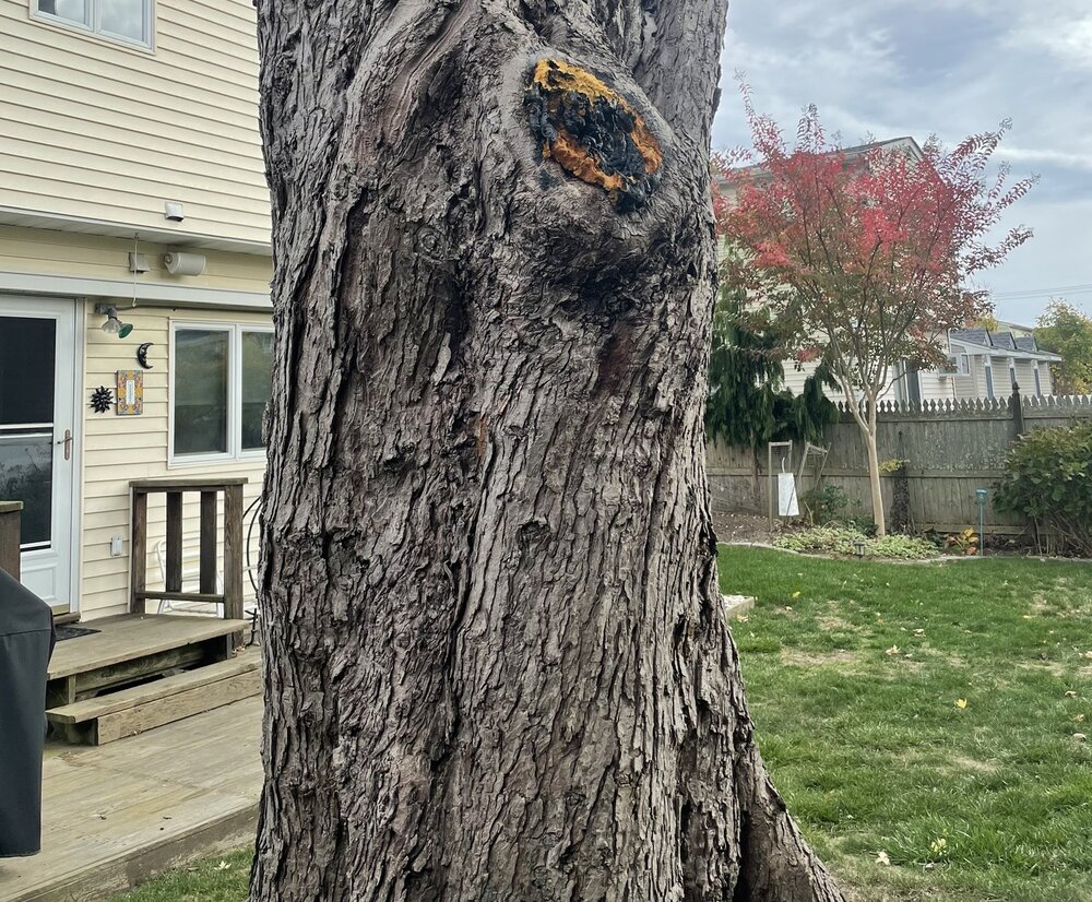
Here’s the tree, poor guy.
-
The obvious, I love storms and we are due. The last true high wind event for our area was in March 18. Localize it to the south shore of the island if you want. All the big trees either fell between 3/10 and sandy or were cut down. 75mph gusts are a real treat to weather enthusiasts and would due little practical damage. Even my dad cut down his 14’ circumference silver maple last year, despite me holding him off for years. Wound up being a good choice as the trunk was full of rot and its days were numbered.


