

donsutherland1
-
Posts
24,169 -
Joined
Content Type
Profiles
Blogs
Forums
American Weather
Media Demo
Store
Gallery
Everything posted by donsutherland1
-
Wave lengths begin to shorten around or after mid-month and the teleconnections begin to grow less important overall. That Philadelphia and Washington are also farther inland than NYC might allow them to avoid some of the marine influence that NYC experiences leading to slower transitions to rain.
-
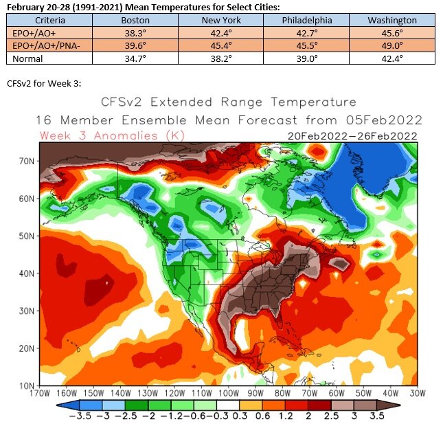
The long-range guidance remains in good consensus about the development of a sustained warmer pattern after mid-month. In some past cases, such a pattern change has been preceded by a snowfall. Currently, there is considerable disagreement among the model solutions with the GGEM being the northern/warmest outlier and UKMET being much farther south and east. There has been some clustering of EPS individual members with respect to measurable snow. At present, the National Blend of Models (NBM) also favors a 1"-3"/2"-4"-type snowfall from Washington, DC to New York City, but the divergence in models suggests that a lot of uncertainty exists. In terms of teleconnections, an AO+ is very likely during Sunday-Monday when the modeled storm could impact the region. Already, the AO is strongly positive (+1.945 preliminary value). There is considerable uncertainty concerning the PNA. Select data for the February 7-21, 1950-2021 period when the AO was positive: New York City: 21% of 4" or greater storms (n=28 storms); Biggest: 12.8" (PNA-) Philadelphia: 27% of 4" or greater storms (n=22 storms); Biggest: 11.5" (PNA-) Washington, DC: 35% of 4" or greater storms (n=17 storms); Biggest: 8.2" (PNA+) In sum, the historic data suggest that a moderate snowfall remains possible, even as the guidance currently favors a light snowfall. But the synoptic details, including the position of the trough and its orientation, would need to come together in just the right fashion to produce a moderate snowfall. Right now, the model divergence suggests that the details remain to be resolved. By Friday, the models should be converging on a solution.
-
Morning thoughts… After a cool start, it will be mostly sunny and mild. High temperatures will likely reach the lower and middle 40s in most of the region. Likely high temperatures around the region include: New York City (Central Park): 44° Newark: 45° Philadelphia: 51° Temperatures will remain above normal into the weekend.. Normals: New York City: 30-Year: 41.0°; 15-Year: 41.1° Newark: 30-Year: 41.7°; 15-Year: 41.9° Philadelphia: 30-Year: 43.0°; 15-Year: 43.0°
-
Morning thoughts… Clouds will give way to sunshine. It will be mild. High temperatures will likely reach the middle 40s in most of the region. Likely high temperatures around the region include: New York City (Central Park): 45° Newark: 44° Philadelphia: 45° Temperatures will remain above normal into the weekend.. Normals: New York City: 30-Year: 40..9°; 15-Year: 40.9° Newark: 30-Year: 41.6°; 15-Year: 41.7° Philadelphia: 30-Year: 42.8°; 15-Year: 42.7°
-
Milder air is poised to overspread the region. Much of the rest of this week will see above normal temperatures before the next cold front reaches the region during the weekend. That cold shot will likely be of a fairly short duration. There is growing consensus on the long range ensembles that the second half of February could experience a significant pattern change. Ridging could retrograde to the East with the persistent trough heading westward. That pattern change would lead to a return of sustained above normal readings after mid-month. Such a change could be preceded by a storm, as sometimes happens. There remains a degree of uncertainty about the timing and magnitude of the pattern change. However, the warmer pattern will likely be in place for the closing week of February. Some guidance suggests that readings could rise to well above normal levels during that time. The EPS continues to forecast the development of an EPO+/AO+/PNA- pattern around February 20th. Such a pattern favors above to much above normal temperatures in the Middle Atlantic and southern New England regions. The ENSO Region 1+2 anomaly was -1.0°C and the Region 3.4 anomaly was -0.6°C for the week centered around February 2. For the past six weeks, the ENSO Region 1+2 anomaly has averaged -0.80°C and the ENSO Region 3.4 anomaly has averaged -0.83°C. La Niña conditions will likely persist through meteorological winter. The SOI was +7.30 today. The preliminary Arctic Oscillation (AO) was +1.672. On February 5 the MJO was in Phase 3 at an amplitude of 0.837 (RMM). The February 4-adjusted amplitude was 0.769 (RMM). Based on sensitivity analysis applied to the latest guidance, there is an implied 68% probability that New York City will have a warmer than normal February (1991-2020 normal). February will likely finish with a mean temperature near 37.7° (1.8° above normal).
-
Light snow has dusted the ground in Larchmont and Mamaroneck.
-
Morning thoughts… Today will be mostly cloudy. Some light snow, light freezing rain, and later some showers are possible. High temperatures will likely reach the upper 30s in most of the region. Likely high temperatures around the region include: New York City (Central Park): 38° Newark: 38° Philadelphia: 40° Temperatures will moderate starting tomorrow. Normals: New York City: 30-Year: 40.7°; 15-Year: 40.8° Newark: 30-Year: 41.4°; 15-Year: 41.5° Philadelphia: 30-Year: 42.6°; 15-Year: 42.5°
-
Tomorrow will be variably cloudy. Some light snow, flurries and/or light freezing rain or showers are possible depending on location. Afterward, much of the week will see above normal temperatures before the next cold front reaches the region near or during the weekend. There is growing consensus on the long range ensembles that the second half of February could experience a significant pattern change. Ridging could retrograde to the East with the persistent trough heading westward. That pattern change would lead to a return of sustained above normal readings after mid-month. Such a change could be preceded by a storm, as sometimes happens. There remains a degree of uncertainty about the timing and magnitude of the pattern change. However, the warmer pattern will likely be in place for the closing week of February. Some guidance suggests that readings could rise to well above normal levels during that time. The EPS continues to forecast the development of an EPO+/AO+/PNA- pattern around February 20th. Such a pattern favors above to much above normal temperatures in the Middle Atlantic and southern New England regions. The ENSO Region 1+2 anomaly was -0.5°C and the Region 3.4 anomaly was -0.7°C for the week centered around January 26. For the past six weeks, the ENSO Region 1+2 anomaly has averaged -0.85°C and the ENSO Region 3.4 anomaly has averaged -0.92°C. La Niña conditions will likely persist through meteorological winter. The SOI was +14.41 today. The preliminary Arctic Oscillation (AO) was +1.360. On February 4 the MJO was in Phase 3 at an amplitude of 0.776 (RMM). The February 3-adjusted amplitude was 0.709 (RMM).
-
The EPS shows the development of an EPO+/AO+/PNA- pattern near February 20th. That pattern would favor warmth in the East. The CFSv2 is quite aggressive with the warmth. That’s still far enough out that it isn’t cast in stone. For now, a warm or perhaps very warm outcome is on the table, but is not yet locked in. A week from now, we’ll have a better idea of where things are going.
-
Morning thoughts… Today will be mostly sunny but still cold. High temperatures will likely reach the lower 30s in most of the region. Likely high temperatures around the region include: New York City (Central Park): 31° Newark: 30° Philadelphia: 37° Temperatures will moderate starting tomorrow. Normals: New York City: 30-Year: 40.6°; 15-Year: 40.6° Newark: 30-Year: 41.2°; 15-Year: 41.4° Philadelphia: 30-Year: 42.4°; 15-Year: 42.4°
-
Tomorrow will be another fair but cold day. Afterward, temperatures will turn milder before more cold air arrives near or during the following weekend. There is a small possibility of some light snow or flurries on Monday. Some areas could see rain showers, especially those south of New York City. Beyond next week, there is a slowly growing consensus on the long range ensembles that the second half of February could experience a significant pattern change. Ridging could retrograde to the East with the persistent trough heading westward. That pattern change would lead to a return of sustained above normal readings after mid-month. Such a change could be preceded by a storm. There remains uncertainty about the timing and magnitude of such a possible pattern change. However, the warmer pattern will likely be in place for the closing week of February. The ENSO Region 1+2 anomaly was -0.5°C and the Region 3.4 anomaly was -0.7°C for the week centered around January 26. For the past six weeks, the ENSO Region 1+2 anomaly has averaged -0.85°C and the ENSO Region 3.4 anomaly has averaged -0.92°C. La Niña conditions will likely persist through meteorological winter. The SOI was +13.35 today. The preliminary Arctic Oscillation (AO) was +1.385. On February 3 the MJO was in Phase 3 at an amplitude of 0.708 (RMM). The February 2-adjusted amplitude was 0.553 (RMM).
-
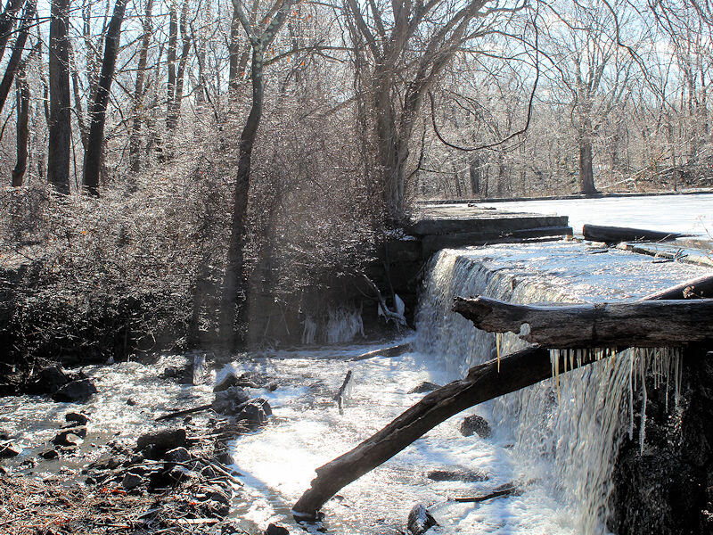
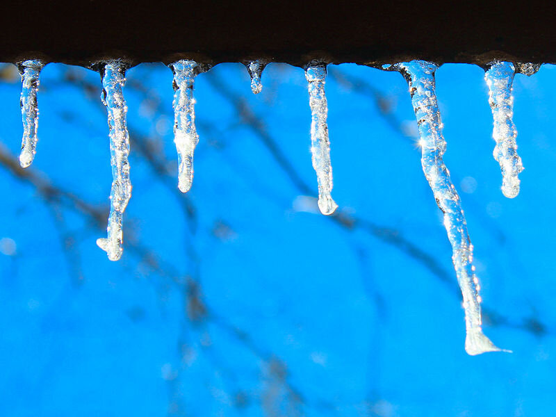
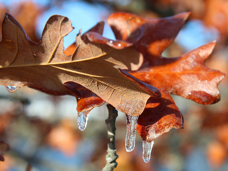
Some photos from the freezing rain:


-
Morning thoughts… Today will be mostly sunny but cold. High temperatures will likely reach the upper 20s and lower 30s in most of the region. Likely high temperatures around the region include: New York City (Central Park): 29° Newark: 29° Philadelphia: 33° After another cold day tomorrow, temperatures will moderate. Normals: New York City: 30-Year: 40.4°; 15-Year: 40.5° Newark: 30-Year: 41.0°; 15-Year: 41.3° Philadelphia: 30-Year: 42.3°; 15-Year: 42.3°
-
A cold but generally dry weekend lies ahead. Next week will see temperatures turn milder for a time before more cold air arrives. There is a small possibility of some light snow or flurries from late Sunday into Monday. Beyond next week, there remain hints on the long range guidance that the second half of February could experience a significant pattern change with both the GEFS and EPS beginning to move into better consensus. Ridging could retrograde to the East with the persistent trough heading westward. That pattern change would lead to a return of sustained above normal readings. There remains uncertainty about the timing and magnitude of such a possible pattern change. The ENSO Region 1+2 anomaly was -0.5°C and the Region 3.4 anomaly was -0.7°C for the week centered around January 26. For the past six weeks, the ENSO Region 1+2 anomaly has averaged -0.85°C and the ENSO Region 3.4 anomaly has averaged -0.92°C. La Niña conditions will likely persist through meteorological winter. The SOI was +15.23 today. The preliminary Arctic Oscillation (AO) was -1.443. On February 2 the MJO was in Phase 3 at an amplitude of 0.551 (RMM). The February 1-adjusted amplitude was 0.405 (RMM).
-
Winter 1962-63 was quite dry. For example, NYC picked up just 6.74" of precipitation during December-February.
-
Ice accretion is underway.


-
Congratulations on the coming grandchild.
-
No torch, just a warmup starting around the 17th-18th. The CFSv2 is very warm during week 4, but that's way out of its skillful range. There is uncertainty, as some guidance shows the Alaska Ridge pattern holding on until around the 20th before an Arctic Low pattern favoring ridging in the East develops.
-
It was also the largest hourly decline during winter. The old mark was 13 degrees.
-
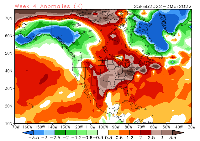
The CFSv2 also shows the pattern change with much above normal temperatures during the closing week of February.
-
JFK: 78 days (12/22/1962-3/9/1963 and 12/29/1968-3/16/1969) LGA: 78 days (12/29/1968-3/16/1969) NYC: 90 days (11/13/1880-2/10/1881)
-
Morning thoughts… Light rain will turn to freezing rain as the temperature plunges this morning. Temperatures will fall from the 50s and 40s into the lower 30s and then 20s in most of the region. Likely daytime high temperatures around the region include: New York City (Central Park): 49° Newark: 55° Philadelphia: 57° A cold weekend lies ahead. Normals: New York City: 30-Year: 40.3°; 15-Year: 40.4° Newark: 30-Year: 40.9°; 15-Year: 41.1° Philadelphia: 30-Year: 42.1°; 15-Year: 42.1°
-
With a temperature of 51 at 11 pm, New York City has reached 50 for the first time since January 2nd when the temperature topped out at 59.
-
On the first issue the guidance seems to be converging in the 17th or 18th, but that’s still 2 weeks away. Big pattern changes have sometimes been preceded by storms. Some individual ensemble members show a storm, but there’s very little agreement among them right now.
-
At 5 pm, it was snowing in Buffalo and Syracuse. Light freezing rain was falling in Binghamton. Rain was falling in Albany. Tonight into tomorrow, colder air will press southward, producing a changeover to freezing rain, sleet, and some snow north and west of New York City and later perhaps into Newark and New Jersey before ending. Northern New Jersey, southeastern New York, Connecticut, and Rhode Island are at the greatest risk of seeing significant icing. A cold but dry weekend will follow. Next week will see temperatures turn milder for a time before more cold air arrives. However, the recent back-and-forth between below and above normal temperatures suggests that a transition is perhaps getting underway. There remain hints on the long range guidance that the second half of February could experience a significant pattern change with both the GEFS and EPS beginning to move into better consensus. Ridging could retrograde to the East with the persistent trough heading westward. That pattern change would lead to a return of sustained above normal readings. There remains uncertainty about the timing and magnitude of such a possible pattern change. The ENSO Region 1+2 anomaly was -0.5°C and the Region 3.4 anomaly was -0.7°C for the week centered around January 26. For the past six weeks, the ENSO Region 1+2 anomaly has averaged -0.85°C and the ENSO Region 3.4 anomaly has averaged -0.92°C. La Niña conditions will likely persist through meteorological winter. The SOI was +16.14 today. The preliminary Arctic Oscillation (AO) was -1.700. On February 1 the MJO was in Phase 4 at an amplitude of 0.399 (RMM). The January 31-adjusted amplitude was 0.500 (RMM).


