donsutherland1
-
Posts
24,169 -
Joined
Content Type
Profiles
Blogs
Forums
American Weather
Media Demo
Store
Gallery
Everything posted by donsutherland1
-
Thanks, North and West.
-
Clouds will increase tomorrow as a bomb cyclone takes shape off the southeastern U.S. That storm will move northward and bring blizzard conditions to parts of Long Island and eastern New England. During the height of the storm, winds could gust past 60 mph in that region with temperatures falling into the teens. Visibilities will decrease to 1/8 mile or less. Moderate to heavy snow will reach Newark and New York City for at least a time, but the heaviest amounts will fall east of those areas. Snowfall estimates: Boston: 12"-24" Bridgeport: 6"-12" Islip: 8"-16" New York City: 4"-8" Newark: 4"-8" Philadelphia: 3"-6" Poughkeepsie: 2"-4" During the January 15-February 15, 1950-2021 period, 37% of Boston's 10" or greater snowstorms have occurred during an AO+/PNA+ pattern. In contrast, just 12% of New York City's and 10% of Philadelphia's 10" or greater snowstorms have occurred with such a pattern. Not surprisingly, for New York City and Newark to reach 10" or more, one will need the storm to phase somewhat farther to the west than is currently modeled. The ENSO Region 1+2 anomaly was -0.5°C and the Region 3.4 anomaly was -0.8°C for the week centered around January 19. For the past six weeks, the ENSO Region 1+2 anomaly has averaged -1.05°C and the ENSO Region 3.4 anomaly has averaged -0.98°C. La Niña conditions will likely persist through meteorological winter. The SOI was +13.67 today. The preliminary Arctic Oscillation (AO) was +1.704. On January 25 the MJO was in Phase 8 at an amplitude of 0.910 (RMM). The January 24-adjusted amplitude was 0.953 (RMM). Based on sensitivity analysis applied to the latest guidance, there is an implied near 100% probability that New York City will have a colder than normal January (1991-2020 normal). January will likely finish with a mean temperature near 30.3° (3.4° below normal).
-
This is correct. I will try to post the data later.
-
Morning thoughts... Today will mostly sunny but cold. Temperatures will likely reach the lower and middle 30s across much of the region. Likely high temperatures include: New York City (Central Park): 33° Newark: 33° Philadelphia: 35° Clouds will increase tomorrow and snow will arrive. Initial snowfall estimates: Boston: 12"-18" Bridgeport: 6"-12" Islip: 7"-14" New York City: 4"-8" Newark: 4"-8" Philadelphia: 3"-6" Poughkeepsie: 2"-4"
-
Better than 18z.
-
The cold will begin to slowly ease tomorrow. However, the risk of a potentially significant storm in parts of the East continues to increase. Already, Boston, Islip, and Providence appear likely to see 10" or more of snow, but the probability of such an outcome has decreased. Guidance has continued to push the event farther to the east throughout the day. Snowfall amounts for New York City and Newark are unusually uncertain, as phasing situations are complex and small details can make for large changes in outcomes. There still remains some potential for a 4"-8" snowfall in both cities. The PNA is positive and is likely to remain positive through at least January 30th. A positive PNA is associated with more frequent snowfalls in the Middle Atlantic region. However, big snowfalls typically occur when the AO is negative, especially in such cities as Washington and Philadelphia. Prospects of a negative AO have faded. During the January 15-February 15, 1950-2021 period, 37% of Boston's 10" or greater snowstorms have occurred during an AO+/PNA+ pattern. In contrast, just 12% of New York City's and 10% of Philadelphia's 10" or greater snowstorms have occurred with such a pattern. Hence, confidence in a 10" or more snowfall in Boston and eastern New England remains solid. Synoptic details, which remain fluid, will be crucial to the outcomes from Philadelphia to New York City. In the wake of the storm, a pattern change toward persistent milder conditions will likely begin to evolve. The ENSO Region 1+2 anomaly was -0.5°C and the Region 3.4 anomaly was -0.8°C for the week centered around January 19. For the past six weeks, the ENSO Region 1+2 anomaly has averaged -1.05°C and the ENSO Region 3.4 anomaly has averaged -0.98°C. La Niña conditions will likely persist through meteorological winter. The SOI was +16.73 today. The preliminary Arctic Oscillation (AO) was +2.422. On January 24 the MJO was in Phase 7 at an amplitude of 0.954 (RMM). The January 23-adjusted amplitude was 1.097 (RMM). Based on sensitivity analysis applied to the latest guidance, there is an implied near 100% probability that New York City will have a colder than normal January (1991-2020 normal). January will likely finish with a mean temperature near 30.4° (3.3° below normal).
-
The importance of blocking from NYC and southward cannot be overstated. An AO-/PNA+ was present for the following % of 10” or greater snowstorms during the January 15-February 15 period (1950-2021): Boston: 42% (n=19) New York City: 71% (n=17) Philadelphia: 90% (n=10) 2 or more of those cities: 81% (n=16) All 3 of those cities: 86% (n=7).
-
Morning thoughts... Today will mostly sunny but cold. Temperatures will likely reach the upper 20s and lower 30s across much of the region. Likely high temperatures include: New York City (Central Park): 28° Newark: 30° Philadelphia: 31° A significant storm could impact the region this weekend. At present, it seems that New York City and Newark are in line for a 4"-8" snowfall, while cities such as Boston, Islip, and Providence will likely see 10" or more. There remains considerable uncertainty, which could result in large changes in snowfall amounts.
-
Today's warmth will be short-lived. A strong cold shot will bring much colder weather for tomorrow. Afterward, the cold will likely begin ease, but the risk of a potentially significant storm in parts of the East continues to increase. Already, Boston, Islip, and Providence appear likely to see 10" or more of snow. A pattern change toward persistent milder conditions could begin to evolve during the first week of February. The PNA is positive and is likely to remain positive through at least January 30th. A positive PNA is associated with more frequent snowfalls in the Middle Atlantic region. However, big snowfalls typically occur when the AO is negative, especially in such cities as Washington and Philadelphia. Some individual ensemble members hint at the AO's going negative for a time in the closing days of the month. The ENSO Region 1+2 anomaly was -0.5°C and the Region 3.4 anomaly was -0.8°C for the week centered around January 19. For the past six weeks, the ENSO Region 1+2 anomaly has averaged -1.05°C and the ENSO Region 3.4 anomaly has averaged -0.98°C. La Niña conditions will likely persist through meteorological winter. The SOI was +16.92 today. The preliminary Arctic Oscillation (AO) was +1.843. On January 22 the MJO was in Phase 7 at an amplitude of 1.095 (RMM). The January 21-adjusted amplitude was 0.891 (RMM). Based on sensitivity analysis applied to the latest guidance, there is an implied near 100% probability that New York City will have a colder than normal January (1991-2020 normal). January will likely finish with a mean temperature near 30.4° (3.3° below normal).
-
It looks like the NAO will be around +0.500. During 1950-99, the January NAO was negative on 64.7% days when the AO was negative. Since 2000, that percentage has fallen to 53.0%.
-
Morning thoughts... Today will be variably cloudy and milder. Temperatures will likely reach the lower 40s across much of the region. Likely high temperatures include: New York City (Central Park): 41° Newark: 41° Philadelphia: 44° Tomorrow will be much colder. A significant storm could impact the region this weekend. Normals: New York City: 30-Year: 39.3°; 15-Year: 39.7° Newark: 30-Year: 39.8°; 15-Year: 40.4° Philadelphia: 30-Year: 41.1°; 15-Year: 41.5°
-
The NAO stays positive.
-
Tomorrow will be briefly milder. Many areas will see the thermometer rise into the lower 40s. However, the warmth will be short-lived. A strong cold shot will bring much colder weather for Wednesday. Parts of the Northeast have the potential to experience their coldest temperatures of the winter. Afterward, the cold will likely begin ease, but the risk of a potentially significant storm in parts of the East could increase. A pattern change toward persistent milder conditions could begin to evolve during the first week of February. The extended range of the EPS already shows the start of a warming trend in the closing days of January, so the timing remains somewhat uncertain. Such large-scale pattern changes have sometimes been preceded by or coincided with storms. The PNA is positive and is likely to remain positive through at least January 27th. A positive PNA is associated with more frequent snowfalls in the Middle Atlantic region. However, big snowfalls typically occur when the AO is negative, especially in such cities as Washington and Philadelphia. Some individual ensemble members hint at the AO's going negative for a time in the closing days of the month. The ENSO Region 1+2 anomaly was -0.5°C and the Region 3.4 anomaly was -0.8°C for the week centered around January 19. For the past six weeks, the ENSO Region 1+2 anomaly has averaged -1.05°C and the ENSO Region 3.4 anomaly has averaged -0.98°C. La Niña conditions will likely persist through meteorological winter. The SOI was +13.15 today. The preliminary Arctic Oscillation (AO) was +0.947. On January 21 the MJO was in Phase 7 at an amplitude of 0.888 (RMM). The January 20-adjusted amplitude was 0.757 (RMM). Based on sensitivity analysis applied to the latest guidance, there is an implied near 100% probability that New York City will have a colder than normal January (1991-2020 normal). January will likely finish with a mean temperature near 30.4° (3.3° below normal).
-
Morning thoughts… It will be partly sunny and cool today. High temperatures will likely reach the lower and middle 30s in most of the region. Likely high temperatures around the region include: New York City (Central Park): 33° Newark: 34° Philadelphia: 36° Normals: New York City: 30-Year: 39.2°; 15-Year: 39.7° Newark: 30-Year: 39.7°; 15-Year: 40.4° Philadelphia: 30-Year: 41.0°; 15-Year: 41.5° Tomorrow will be briefly milder before another very cold air mass overspreads the region.
-
It’s pretty much there, except statistically.
-
Not exactly the 2016 event, but still nice. https://youtu.be/Bq7UYqO939U
-
A generally cold but dry week lies ahead. A strong cold shot is likely around midweek. Parts of the Northeast have the potential to experience their coldest temperatures of the winter. Afterward, the cold will likely begin ease. A pattern change toward persistent milder conditions could begin to evolve during the first week of February. The extended range of the EPS already shows the start of a warming trend in the closing days of January, so the timing remains somewhat uncertain. Such large-scale pattern changes have sometimes been preceded by or coincided with storms. The PNA is positive and is likely to remain positive through at least January 27th. A positive PNA is associated with more frequent snowfalls in the Middle Atlantic region. However, big snowfalls typically occur when the AO is negative, especially in such cities as Washington and Philadelphia. The ENSO Region 1+2 anomaly was -0.4°C and the Region 3.4 anomaly was -0.8°C for the week centered around January 12. For the past six weeks, the ENSO Region 1+2 anomaly has averaged -1.20°C and the ENSO Region 3.4 anomaly has averaged -1.03°C. La Niña conditions will likely persist through meteorological winter. The SOI was +11.17 today. The preliminary Arctic Oscillation (AO) was +1.406. On January 21 the MJO was in Phase 7 at an amplitude of 0.734 (RMM). The January 20-adjusted amplitude was 0.664 (RMM). Based on sensitivity analysis applied to the latest guidance, there is an implied 99% probability that New York City will have a colder than normal January (1991-2020 normal). January will likely finish with a mean temperature near 30.4° (3.3° below normal).
-
Morning thoughts… It will be variably cloudy and somewhat milder today. High temperatures will likely reach the middle 30s in most of the region. Likely high temperatures around the region include: New York City (Central Park): 35° Newark: 36° Philadelphia: 37° Normals: New York City: 30-Year: 39.2°; 15-Year: 39.7° Newark: 30-Year: 39.7°; 15-Year: 40.4° Philadelphia: 30-Year: 41.0°; 15-Year: 41.5° A generally cold and dry week lies ahead. A strong cold shot is likely at midweek. Meanwhile, 30-year normal temperatures have now begun to increase at New York City, Newark, and Philadelphia.
-
A quiet weekend will conclude with another fair but cool day tomorrow. Next week will feature a continuation of the generally colder than normal temperatures. A strong cold shot is likely around midweek. Afterward, the cold will likely begin ease. A pattern change toward persistent milder conditions could begin to evolve during the first week of February. The extended range of the EPS already shows the start of a warming trend in the closing days of January, so the timing remains somewhat uncertain. Such large-scale pattern changes have sometimes been preceded by or coincided with storms. The PNA is positive and is likely to remain positive through at least January 27th. A positive PNA is associated with more frequent snowfalls in the Middle Atlantic region. However, big snowfalls typically occur when the AO is negative. The ENSO Region 1+2 anomaly was -0.4°C and the Region 3.4 anomaly was -0.8°C for the week centered around January 12. For the past six weeks, the ENSO Region 1+2 anomaly has averaged -1.20°C and the ENSO Region 3.4 anomaly has averaged -1.03°C. La Niña conditions will likely persist through meteorological winter. The SOI was +11.26 today. The preliminary Arctic Oscillation (AO) was +1.549. On January 20 the MJO was in Phase 6 at an amplitude of 0.665 (RMM). The January 19-adjusted amplitude was 0.402 (RMM). Based on sensitivity analysis applied to the latest guidance, there is an implied 99% probability that New York City will have a colder than normal January (1991-2020 normal). January will likely finish with a mean temperature near 30.4° (3.3° below normal).
-
A cold and dry weekend lies ahead. Overnight and tomorrow, a storm will move offshore well to the south and east of the region. No precipitation is likely. Next week will feature a continuation of generally colder than normal temperatures. A strong cold shot is likely around midweek. Afterward, the cold will likely ease. A pattern change toward persistent milder conditions could begin to evolve during the first week of February. The extended range of the EPS already shows the start of a warming trend in the closing days of January, so the timing remains somewhat uncertain. Moreover, the currently forecast drop in the AO, should it verify, provides additional uncertainty. The PNA is positive and is likely to remain positive through at least January 27th. A positive PNA is associated with more frequent snowfalls in the Middle Atlantic region. However, big snowfalls typically occur when the AO is negative. The ENSO Region 1+2 anomaly was -0.4°C and the Region 3.4 anomaly was -0.8°C for the week centered around January 12. For the past six weeks, the ENSO Region 1+2 anomaly has averaged -1.20°C and the ENSO Region 3.4 anomaly has averaged -1.03°C. La Niña conditions will likely persist through meteorological winter. The SOI was +6.46 today. The preliminary Arctic Oscillation (AO) was +1.135. On January 19 the MJO was in Phase 6 at an amplitude of 0.399 (RMM). The January 18-adjusted amplitude was 0.365 (RMM). Based on sensitivity analysis applied to the latest guidance, there is an implied 97% probability that New York City will have a colder than normal January (1991-2020 normal). January will likely finish with a mean temperature near 30.5° (3.2° below normal).
-
Morning thoughts… It will be variably cloudy and very cold today. High temperatures will likely reach the lower and middle 20s in most of the region. Likely high temperatures around the region include: New York City (Central Park): 22° Newark: 24° Philadelphia: 27° Normals: New York City: 30-Year: 39.1°; 15-Year: 39.7° Newark: 30-Year: 39.6°; 15-Year: 40.4° Philadelphia: 30-Year: 40.9°; 15-Year: 41.5° The weekend will be cold and dry.
-
In the wake of an Arctic cold front, much colder air is pouring into the region. This air mass will cover the region tomorrow through the weekend. The weekend will be mainly dry as a storm moves offshore well to the south and east of the region. A pattern change toward persistent milder conditions could begin to evolve during the first week of February. The extended range of the EPS already shows the start of a warming trend in the closing days of January, so the timing remains somewhat uncertain. The PNA is positive and is likely to remain positive through at least January 27th. A positive PNA is associated with more frequent snowfalls in the Middle Atlantic region. However, big snowfalls typically occur when the AO is negative. The ENSO Region 1+2 anomaly was -0.4°C and the Region 3.4 anomaly was -0.8°C for the week centered around January 12. For the past six weeks, the ENSO Region 1+2 anomaly has averaged -1.20°C and the ENSO Region 3.4 anomaly has averaged -1.03°C. La Niña conditions will likely persist through meteorological winter. The SOI was +7.92 today. The preliminary Arctic Oscillation (AO) was +0.486. On January 18 the MJO was in Phase 7 at an amplitude of 0.364 (RMM). The January 17-adjusted amplitude was 0.429 (RMM). Based on sensitivity analysis applied to the latest guidance, there is an implied 96% probability that New York City will have a colder than normal January (1991-2020 normal). January will likely finish with a mean temperature near 30.5° (3.2° below normal).
-
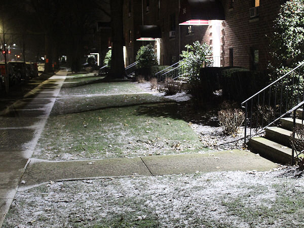
Snow is starting to mix with the rain in Larchmont, NY.
- 280 replies
-
- 2
-

-

-
- snow
- freezing rain
- (and 1 more)
-
Morning thoughts… Rain will end as a period of snow or flurries. 1” of snow is likely in Philadelphia, Newark, and New York City with local amounts as high as 3”. The temperature will fall throughout the day. High temperatures will likely reach the upper 30s and lower 40s in most of the region. Likely high temperatures around the region include: New York City (Central Park): 39° Newark: 37° Philadelphia: 40° Normals: New York City: 30-Year: 39.1°; 15-Year: 39.7° Newark: 30-Year: 39.6°; 15-Year: 40.4° Philadelphia: 30-Year: 40.9°; 15-Year: 41.5° Tomorrow through the weekend will be cold and dry.