

John1122
-
Posts
9,692 -
Joined
-
Last visited
Content Type
Profiles
Blogs
Forums
American Weather
Media Demo
Store
Gallery
Posts posted by John1122
-
-
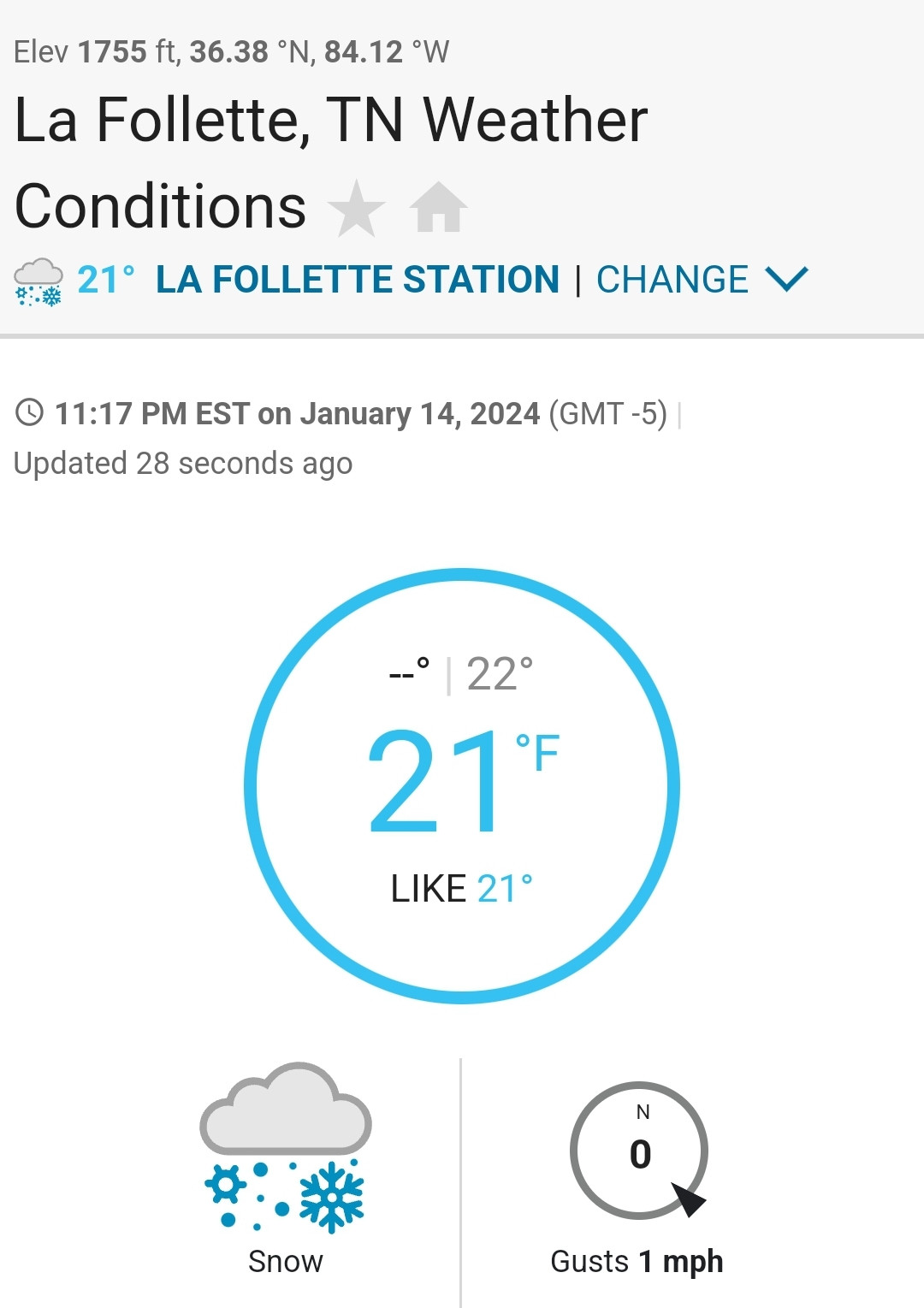
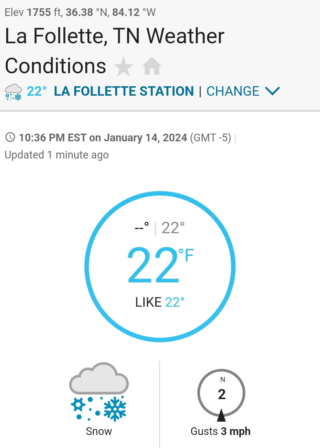
Crossing 4 inches as the air is filled with pixie dust. It actually warmed up to 23 degrees earlier but dropped back to 21 now.
-
 4
4
-
-
Under one of my best bands of the night right now. Solid quarter sized flakes and a lot of them. Definitely powdered sugar/pixie dust at 19 degrees.
-
I bought two 12 inch rulers the other day for snow measuring because I have a terrible time holding a measuring tape and taking a photo. They looked funny because they had a blank space before the mark start and after the 12. I measured them with the tape measure and they are 12.5 inches long and have instructions in small letters on starting at the mark instead of the end of the ruler. So here i am at 3:30 in the morning trimming my rulers to their actual measurement to measure snow.
I at least don't feel so odd after some of the otner revelations tonight. I am baffled that they couldn't just trim the extra off each end of the ruler or set the machine to run them at exactly 12 inches.
-
1
-
 2
2
-
-
16 minutes ago, bearman said:
It has almost completely stoped hear in Knoxville. We have about a half inch. Hopefully something changes or we are going to way underperform.
The HRRR and NAM at least, has the band lifting north of 40 until 8am or so then heavier returns start working back your way. This is basically "bonus" snow with the main part of it still to come.
-
I'm at about 2 inches now. Been sticking for about 6 hours. So I'm averaging about .3 inches per hour. Talk about slow and steady!
-
1
-
-
3 minutes ago, jaxjagman said:
kinda hit a lull recently but picking up again should be getting some decent snow here soon
There's a heck of a band through Nashville that hopefully heads your way.
-
Had a nice 20 minutes of high rates and then a lull. Looks like another shot of heavy returns are almost here. About 1.25-1.5 inches.
-
1
-
-
The Euro finally fattened its snow band and came north a ways. Would be pretty good for us all.
-
4
-
-
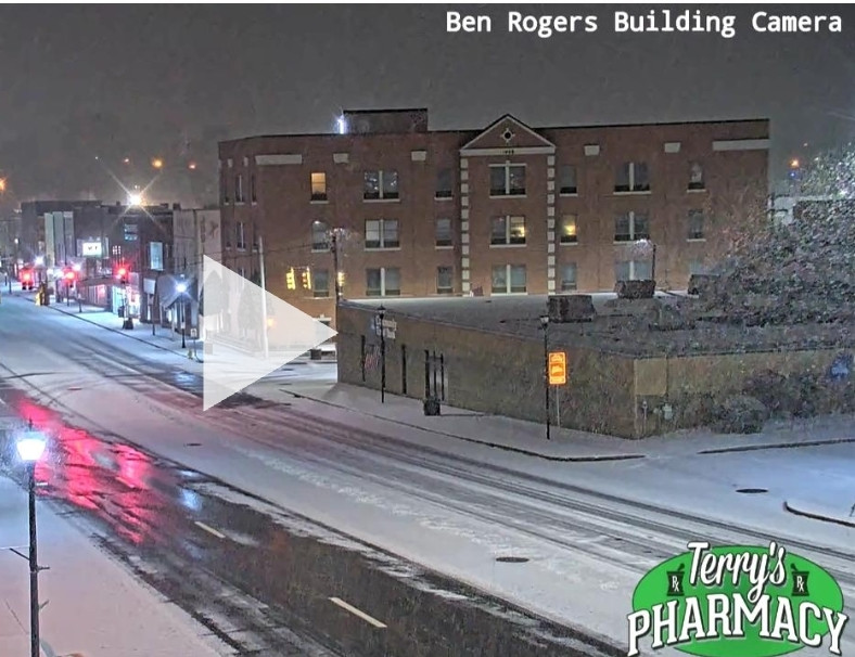
Can't get the cam to actually play but a screen shot from south of me in LaFollette.
-
4
-
-
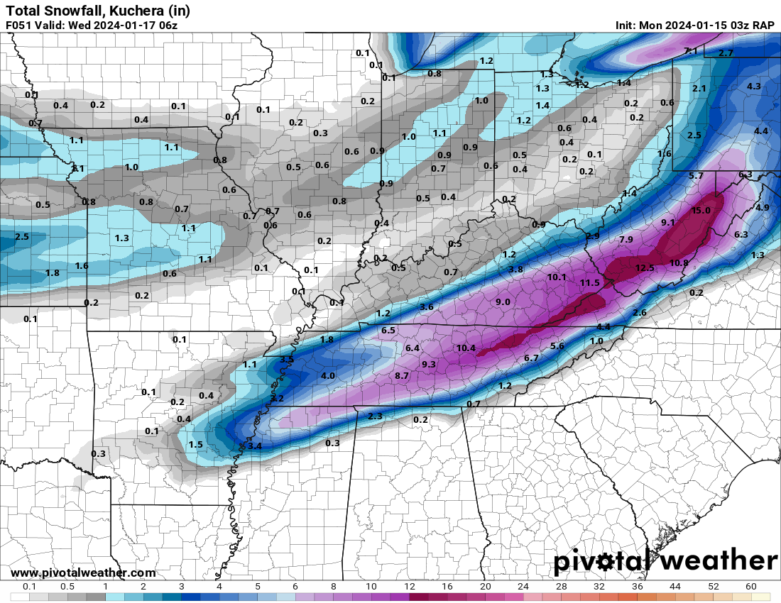
03z RAP
-
2
-
 1
1
-
-
2 minutes ago, Matthew70 said:
Though it’s supposed to be quite warm after this week correct? From the 21st till beginning of Feb.?
There's going to be a warm up for 5-6 days, but the MJO should be headed towards the favorable phases around the 28th and there looks to be a PNA ridge inbound. It should set the stage for favorable weather in the first half of February.
-
4
-
-
1 minute ago, Stovepipe said:

I'll be lucky if I get any sleep tonight.
I sleep about 7 hours a week when we have winter threats.
-
2
-
6
-
-
2 minutes ago, Shocker0 said:
Should it be snowing on the western Plateau all day tomorrow? WBIRs future radar showed it looking like it cleared out here at like 11am and then remained over Knoxville the rest of the day/evening
The NAM has heavy snow over all of Cumberland County at 7pm tomorrow. The RGEM has snow all the way to Nashville at 7pm.
There may be a break in it for a time in some areas but the models are actually trending away from the break.
-
4
-
1
-
-
25W north of LaFollette near where I turn off. The highway was clear about 10:25 when I came in.
-
4
-
2
-
-
1 minute ago, bearman said:
We need some more ump to our rates. We have had steady snow from around 8 oclock and here in West knox I am just aproching a half inch. I am at 28 and our roads are clear.
It's mostly going to be a slow and steady event tonight. I think I saw MRX or OHX mention 1/4th inch per hour rates overnight in one of their discos. Still, if we get 1/4th to 1/2 inch per hour for the next 8 hours, that adds up to several inches.
As noted, tomorrow we get some gulf connection and rates go up.
-
4
-
-
The GFS was a nice 1-3 with some 4+ areas for the Thursday/Friday event. The air behind it may be as cold or even colder than this.
The heart of winter here is January 15th to February 15th. It's the coldest and snowiest time of winter here. You can hardly beat having a favorable pattern in this window. It looks like we might have one for a good part of that window.
-
6
-
1
-
-
Getting close to an inch down now. Snowing about 1/2 inch an hour. The HRRR and 3k NAM had me getting 4 inches by 5am. I may get close.
-
6
-
-
I'm wondering when I'm gonna stop falling. MRX initially had my low at 18 but they actually raised it to 21. These are the 15-17:1 rates the globals were advertising here.
-
4
-
-
2 minutes ago, Greyhound said:
I don’t have a PWS (too many trees), but this one is closest to my house.
.One good burst of heavy rates and calm.traffic would do it I'd think. Once I turned on Hwy 25w North the road was white for me all the way home. No brine there though. Barely even pavement.
-
1
-
-
Just now, Greyhound said:
Two questions related to roads:
1). When should it start sticking to roads in Knox County? Just all wet at the moment.
2). At what temp does the brine become ineffective?
.What's the temp? It will take lower than 25 or a heavy burst to start on main roads that have salt/brine working. Brine is much less effective below 25 and almost completely ineffective at 15 or lower.
I drove home through Jacksboro/LaFollette an hour ago and bridges were covered on brined areas and patches on the roads. But the roads were mostly wet due to the brine. The temp was 27 there then.
-
2
-
-
13 minutes ago, jaxjagman said:
I love this camera. Whenever you post it the good times are usually rolling.
-
2
-
-
As the temp is getting down to the low 20s the flake size has gotten smaller but the visibility is the same. The thick fog look. Just crossing half an inch.
-
2
-
-
2 minutes ago, TellicoWx said:
If you would have asked me 3 hrs ago if I could get to 32 without wetbulbing, I would have said not a shot...yet here we are. T32...DP 26
The Arctic air is potent. I'd guess you'll get into the 20s soon.
-
1
-
-
Continuing to fall.
-
2
-
January 15th-17th 2024 Arctic Blast/Snow Event
in Tennessee Valley
Posted
You guys have been impressively cold for this one. I think that's one of the reasons Mid-state areas over performed, amazing ratios.