

John1122
-
Posts
9,688 -
Joined
-
Last visited
Content Type
Profiles
Blogs
Forums
American Weather
Media Demo
Store
Gallery
Posts posted by John1122
-
-
To me it looks like MJO forecasts are getting more favorable. Some still try to do the loop in 6, but others are pushing it to 7-8 faster. One of them stalls it in 7. A few days ago the Euro mean was looping it in 6, that's gone now and it pushes across 7 and 8.
-
 2
2
-
-
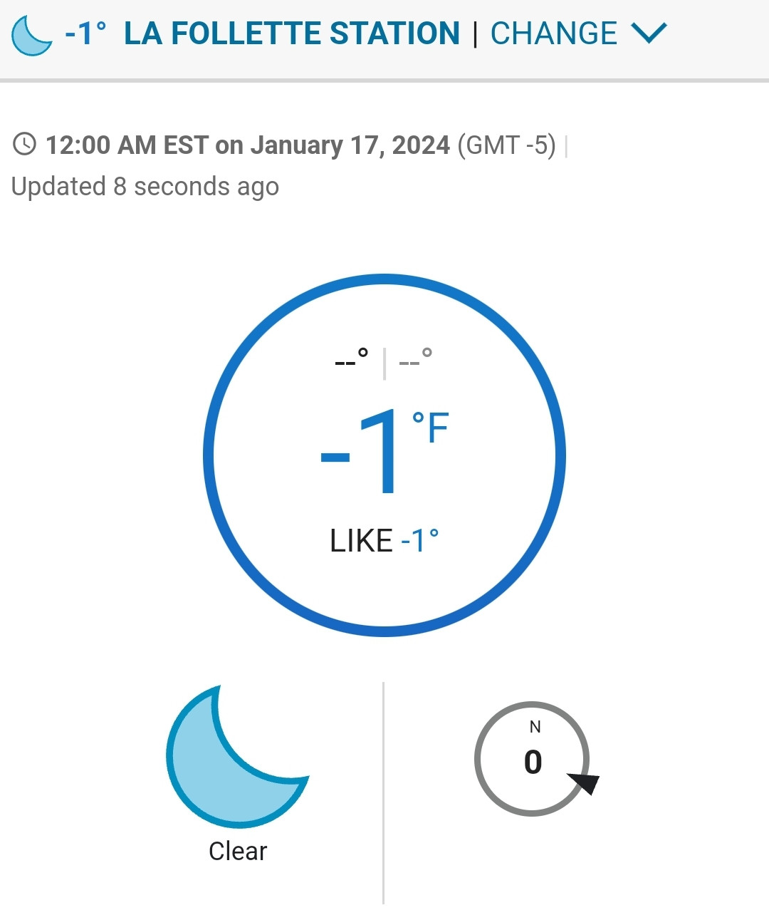
I got down to -8 this morning. Close to the -10 the GFS had for me. Way colder than the 1 the NAM had. Currently at 15 and will probably get to the 26-28 range today.
-
2
-
-
I've noticed most of the models are coming in weaker/less QPF. I'll be shocked if such a powerful Arctic front comes through without at least snow showers.
-
3
-
-
Those crazy looking GFS numbers weren't that far off apparently.
-
3
-
-
Down to -3. About to go to bed, as I've slept little the past 5 days. I'd be fine if it doesn't get any colder.
-
3
-
-
Pulled this off just before midnight. So will be subzero technically for 2 days this week.
-
2
-
-
Canadian maintained the 40 and North snow.
-
2
-
 1
1
-
-
The aforementioned GFS.

-
1
-
-
I'm already down to 8. These air masses in January, with snow cover, hit hard.
-
4
-
-
My brother in Hixson looks like he ended up with a few inches. He's not the weather enthusiast I am so he didn't actually measure. Just sent me a picture of his back deck.
-
2
-
-
2 minutes ago, Greyhound said:
I mean……he DID work at WVLT!!! LOL!!!
To be fair, I do like Aldrich and the enthusiasm he brings to his forecasts. But, I almost always come to these pages in regards to weather forecasts
.He's just over the top with the "Captain Accurate" stuff. He had the heaviest snow yesterday over the areas that mix/rained. Todd Howell is about it for local TV mets that seem to be aware of meteorology and the microclimates here.
-
9
-
-
15 minutes ago, Greyhound said:
Here’s the forecast from “Captain Accurate” (David Aldrich). Right or wrong…..no idea!!

.Man, he was awful with the storm we just finished. I hope he's off in a good way with this one.
-
2
-
-
4 minutes ago, Holston_River_Rambler said:
Looks like the band leeward of me is also producing flurries near the 40/75 split in west Knox county.
It's still flurrying here. I think the DGZ is around 2000ft this afternoon.
-
5
-
-
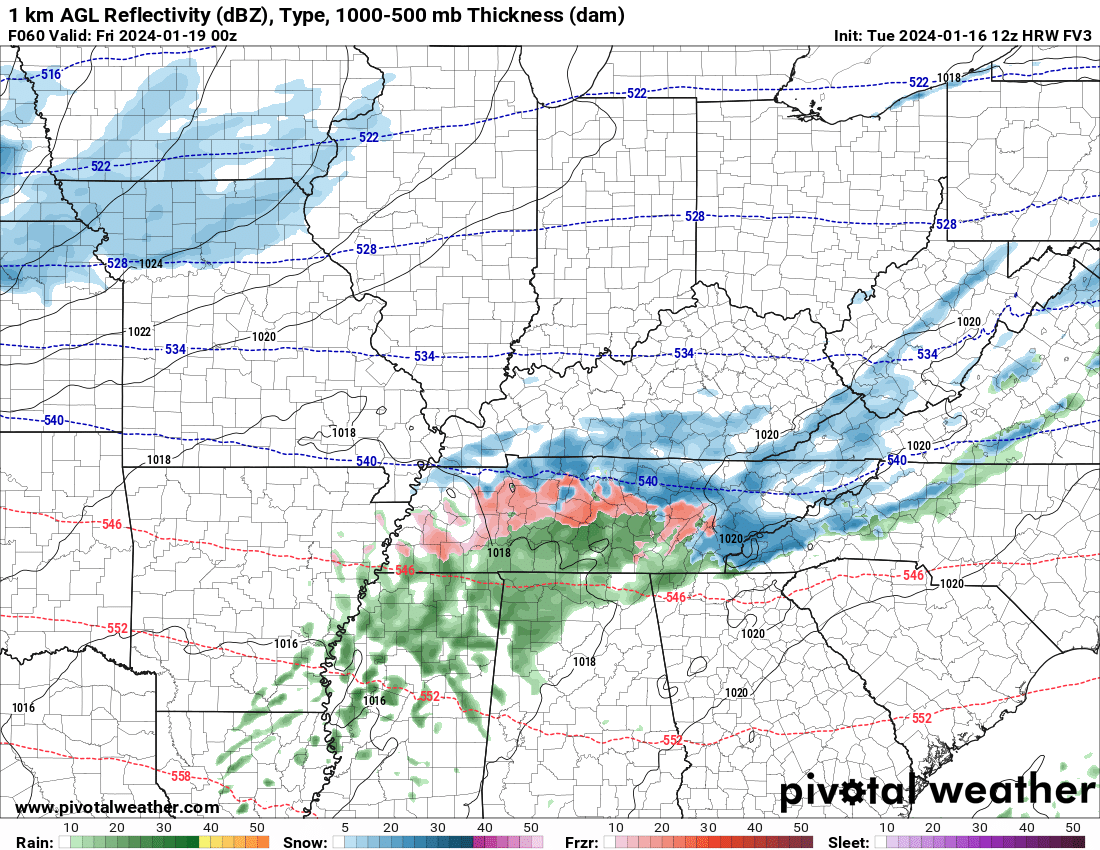
I expect the 18z GFS to back down or the other models to keep getting more frozen precip and less rain from here on. Kentucky looks pretty good for several inches of snow as do the mountains. More ice for everyone else per models but MRX is very confident in there not being much in the way of precip type other than rain/snow.
-
1
-
-
The RGEM was a bit south that time too, especially compared to 12z.
-
1
-
-
The ICON shifted from a mid-state cutter to an Apps low from 12z to 18z.
Always heard storms tended to ride below a snow pack but maybe that's an urban legend.
-
2
-
-
The NAMs came in more wintery than previous runs, especially the 3k. More ice than snow.
-
2
-
-
9 minutes ago, ShawnEastTN said:
Here is MRX accumulation map, just released.

It's not correct for my area but it rarely is.
-
2
-
-
The FV3 is more in the GFS camp.
-
7
-
-
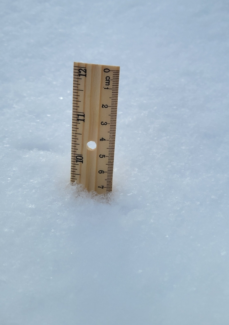
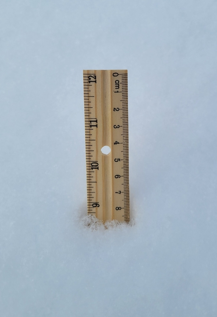
Average at a couple of different spots. There was some light snow early this morning that turned to flurries until about 20 minutes ago. Blue skies are about to get underway now.
-
10
-
-
1 hour ago, Holston_River_Rambler said:
I was actually just about to toss up some MJO pics so we can see how they verify down the road:


I'd love to see that continue into 7. Yesterday it was curling back into 6 on the Euro, it looks better at least, today.
-
3
-
-
The Euro did dip south by a bit. The NAM family is amped as usual at this range. I think the threat of frozen is very realistic.
-
5
-
-
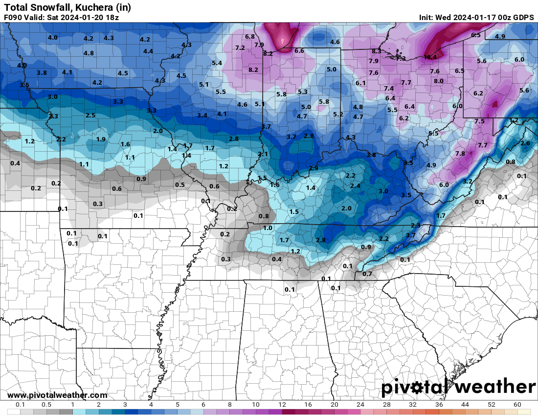
The 12z GFS sticks to it's guns and gives a nice snow event for all but the Ga/Alabama border counties basically from Nashville eastward.
-
5
-
-
MRX, in their disco mentioned that neither the GFS nor Euro really have much of a warm nose. The OHX disco above noted models were over warming highs considering the snowcover.
-
3
-
Winter 23-24' Wx Observations Thread
in Tennessee Valley
Posted
Our schools have closed until Monday already.