

John1122
-
Posts
9,688 -
Joined
-
Last visited
Content Type
Profiles
Blogs
Forums
American Weather
Media Demo
Store
Gallery
Posts posted by John1122
-
-
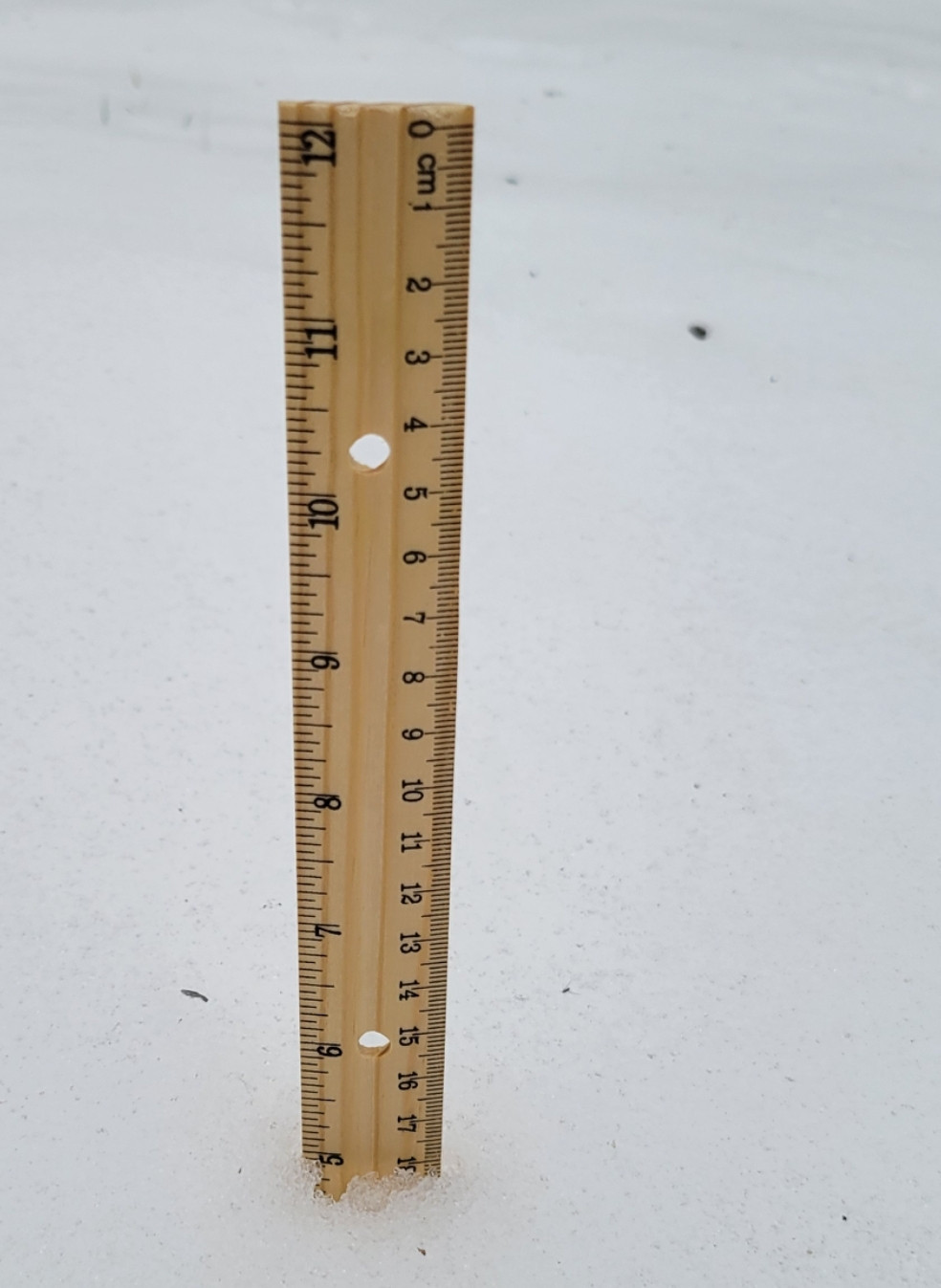
Went out and did several measurements. Still close to 5 inches on the ground. Made it to 42 today but I'm back in the 30s now.
-
 3
3
-
-
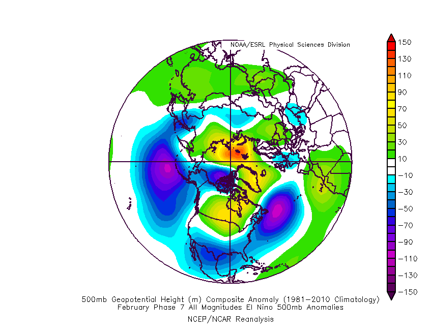
February El Nino MJO Phase 7.
-
4
-
 3
3
-
-
Phase 7 in Feb = BN heights from coast to coast over the southern half of the country and appears to feature a -NAO.
-
3
-
-
29 minutes ago, GaWx said:
I can’t take credit for the phase 7 snow analysis. I believe that was from Eric Webb and specifically was addressing NC, possibly only at Raleigh. Also, I can’t recall whether or not Eric was looking only at El Niño cases.
My big thing in recent years of MJO analyses for the SE has been to harp on the tendency for cold and wintry wx to favor weak MJO: just outside, near, or inside the circle. For example, off the top of my head I recall discovering that every major ATL ZR and IP (as far back as MJO charts go, which is mid 1970s) has been when the MJO was weak. I’m sure that streak will end at some point as the sample size isn’t large (I think it is only 8), but OTOH it makes sense that it would favor weak since weak tends to be colder than strong. Also, I wasn’t looking specifically at the TN Valley, which may be quite different.
Do you have a link for the MJO charts back to the mid-70s?
-
Went down to 26 this morning and clouded up. Finally made it to 40 for the first time in a loooong time. Snow pack is like wet cement under the cloudy skies. Roads are still extremely slick in areas where plows haven't reached and the sun doesn't shine.
-
2
-
-
2 hours ago, Daniel Boone said:
Problem is, Data is not trustworthy. Going back through records there's quite a bit of missing data, particularly snowfall. I'd bet my life there's been times of many more days than that. I know Knoxville doesn't get Snow as much as up here but, they've had much longer stretches. The late '70s are a good case. I kept Records for my area in Lee County then and there was a period of over a month and a half of 6 inches or more on the ground in 1977-78. Well over a foot in shaded, north facing areas.
Some of the issue is that they take snow depth at a fixed time every day and don't count snowfall that happens that day as snow depth. You can look back at records and see things like 6 inches of snowfall on January 15th but snow depth will be 0 or a trace etc according to what time the snow fell that day. Even in the chart Flash posed there it says 6.3 inches of snow fell on February 1st 1985 but snow depth is only one inch. I quickly found another day where it says snow depth was a trace on a day with 5 inches of snowfall recorded. Now I think snow depth is recorded as whatever the snowfall is that day, or close to it with compacting etc factored into the equation.
-
1
-
-
It got up to 38 today and it's 29 now. Neither feel cold after this last week.
-
4
-
-
On 1/16/2024 at 3:12 PM, Jed33 said:
I was looking at that earlier. Check out the GFS. It is way colder than the cmc or the rgem! Can’t believe it will actually be that cold -14 in Knoxville and -13 at Tri. Seems about 10 degrees too cold. I guess if winds go completely calm and the sky stays completely clear it could make a run at that with this kind of deep snowpack
I don't see how they didn't manage this in the 1970s.
-
3
-
-
Predicted low tonight was 14 but I'm down to 11.6 already.
-
1
-
-
A couple days ago the forecast high today was 33, then it was 31, looks like I'm gonna top out at 26, as the sun is setting here. After the high being 11 yesterday, and -4 this morning, technically our 4th day below zero, of this outbreak. This one will definitely go down in the memory banks for 95 percent of the forum. It stinks that the far southeast areas mostly missed out, but it just shows how hard it is to get a truly statewide event. The Arctic Invasion that allowed a forum wide winter storm in 1996 had highs near 0 and lows in the -20 range. This is like a mini version of it.
-
2
-
-
-4 here this morning. Currently 2. If this break we're getting wasn't going to be filled with flooding, I'd be happy to see it.
-
7
-
-
39 minutes ago, Shocker0 said:
Our high was 10 today but it currently says -4. Doesn't sound like it could be right but it has been steadily dropping since 4pm. I can't see us getting much lower than this here in Crossville though with the warmer air filtering in early tomorrow. The hot water in my bathroom is frozen currently so hopefully that will unthaw without busting.
EDIT: Right after I posted, it went to -5 :O

That's impressive! You may land around -10 or -15. I'm down to -1.
-
2
-
-
Only managed to get to 11 degrees today. Already down to 5. May make another run at -8 to -10.
-
4
-
-
Picked up about 1/4th inch more snow overnight. Finally clear skies outside. Up to 7 degrees.
-
3
-
-
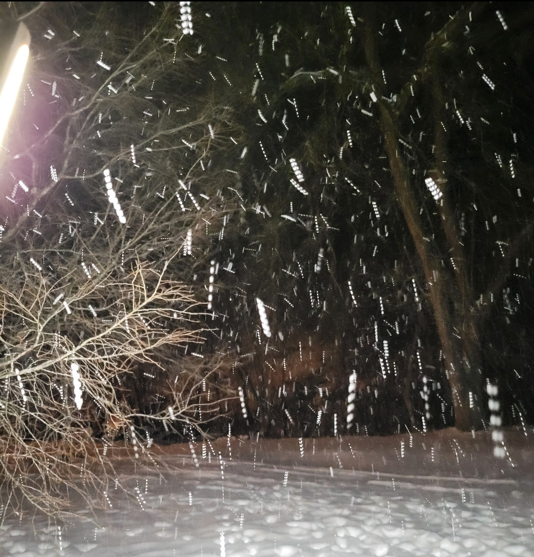
As always, my phone makes snow look like rotini noodles, but tons of flakes.
-
2
-
-
Thought it may be nearly over but back to about 1/2 or less mile vis with fluffy quarters filling the air.
-
1
-
-
Still snowing as of midnight. Just swept my steps off for the 4th time today. Will see how they look in the morning.
-
2
-
-
55 minutes ago, Daniel Boone said:
Yeah, a bit more moisture than usual got entrained in the flow.
There was a stout feed coming off Lake Michigan. This air mass helped too.
-
1
-
-
See that even Nooga is reporting snow from this. I know it's uncommon for it not to evaporate due to downsloping off the Southern Plateau.
-
2
-
-
It's still snowing here. Another over 24 hour period of snow falling or precip falling with sub-freezing temperatures.
-
1
-
-
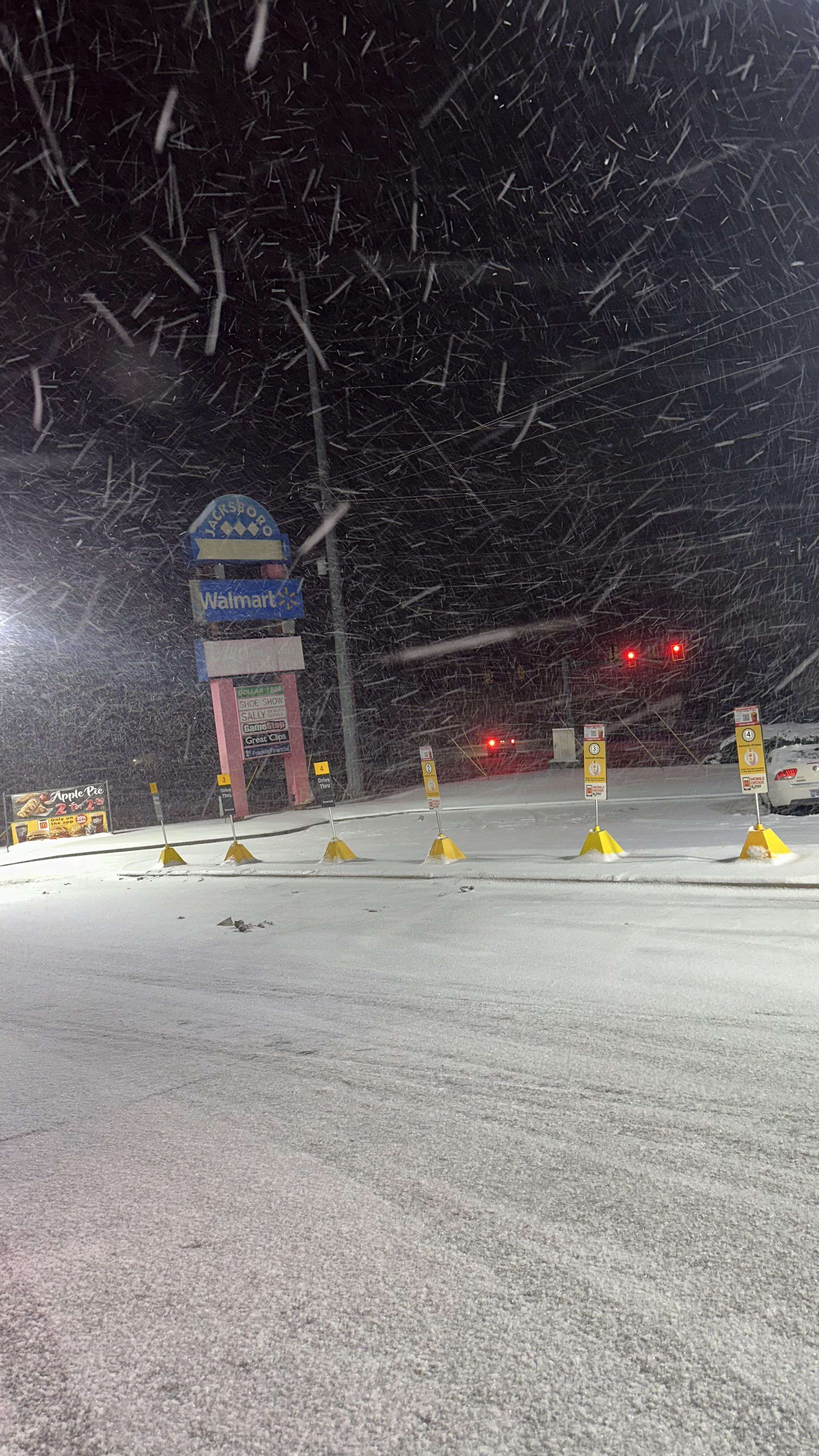
Jacksboro Walmart under a streamer.
-
2
-
-
3 minutes ago, Daniel Boone said:
Had a squall go through about 45 minutes ago that dropped an inch . Total for the day of 3" now.
The RGEM and GFS kept nudging a 3 inch line really close to me and I may get there myself. The energy for this is still going into central Kentucky. Every end time MRX has forecast today has passed with snow still falling. Originally they'd had a 20 percent chance of overnight snow showers but removed it with the evening forecast. They look like they have at least a little while to go.
-
2
-
-
https://www.resortcams.com/webcams/downtown-lafollette-tn/
They'd gotten everything cleared off in downtown LaFollette. It's going downhill fast.
-
2
-
-
I'm getting quarter + sized flakes and probably 1/2 or less mile visibility currently. It's 18 degrees.
-
2
-
Winter 23-24' Wx Observations Thread
in Tennessee Valley
Posted
There's been no sun here today at all. It was in the 20s this morning and froze up hard and clouded up over it. That kept the peak temp way down.