

John1122
-
Posts
9,692 -
Joined
-
Last visited
Content Type
Profiles
Blogs
Forums
American Weather
Media Demo
Store
Gallery
Posts posted by John1122
-
-
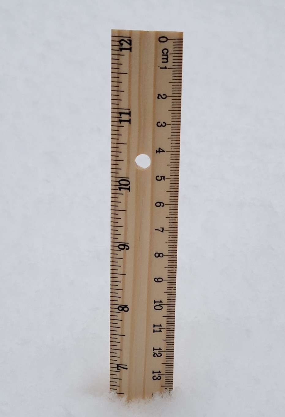
Its absolutely pouring down again out there. Nickel to quarter sized flakes and 17 degrees.
-
 4
4
-
 3
3
-
-
16 minutes ago, bearman said:
I am @ 9in in West Knox. Might get 1 more inch and get to double digits with the snow showers that will move through but I think that will be the limit unless I am missing something. It was a wild ride. The Snow is going to be around for a long time. It is a beautiful snow. I will try to upload my pics if I can get the file size down small enough.
I screen shot them on my phone and then upload that to freeimage.host and when it's uploaded i click "open image in new tab" and copy that link.
My home internet is so slow it takes forever to get the fill size file to upload and I've no storage here.
-
1
-
-
Looked like it was about to clear out here and then radar suddenly filled all the way back to Fentress County. Possibly the lee side low causing it.
-
3
-
-

Curious to see if this HRRR midnight sleeting occurs over me.
-
2
-
-
4 minutes ago, Daniel Boone said:
6" here. Suddenly stopped as broken area coming through. Some of those showers with the batch coming off eastern plateau are heavy and may put down a quick inch or two. I expect you to get 8-10 at least Carver.
I got the goose feathers and it stopped for about 10 minutes then picked back up.
-
3
-
-
This will be a deceptive storm on record books.
Tys has I believe 3 inches as the official measurement and Tri a trace. But that won't be reflective of this storm for climate purposes.
-
4
-
-
Just before dark, still snowing moderately.
-
5
-
-
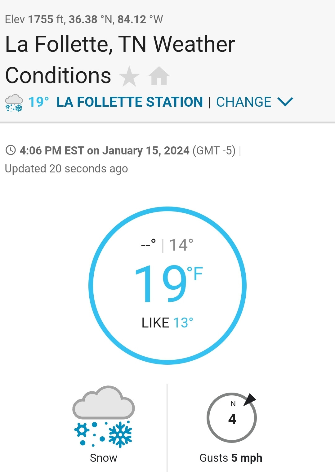
Much to my absolute surprise, now I'm getting huge goose feather flakes. Has to be something in the upper levels. I'm at 18.8 degrees.
-
5
-
 1
1
-
-
Oddly, MRX has no additional accumulation in my forecast and only an inch in Knox Co. The latest RAP has 6 inches in Knox from now til tomorrow morning.
-
2
-
-
The lee side low forms and pushes snow back into Scott County Tn and SE Kentucky according to the RAP. The Knoxville corridor just sits under it for 8-10 more hours and gets another 6 inches of snow if it's right.
-
1
-
-
Hardest snow of the whole event unfolding here right now. Probably 1/4th vis with nickels falling.
-
4
-
-
Continued cooling here helping rates. Making the most out of lower qpf.
-
4
-
-
I've probably not had a flake bigger than a nickel all day today. This reminds me of upslope. We had an event around Christmas in the 2010s where it was about 48 hours of it and I got 7 or 8 inches. Never snows hard, it just keeps snowing and snowing.
-
4
-
-
I have the temps but haven't had the rates those south of me had. Looks like the 40 corridor had the best of both world through Knox County.
-
-
Wind picked up from the nne and the temp is going down a bit.
-
6
-
-
The "blind" spot on the Plateau just filled in suddenly. I suspect thats some heavy stuff.
-
3
-
-
The GFS just had it's best run. The other models are determined to not be generous here.
-
3
-
-
I've been at 21 ever since the snow moved back in but the HRRR does show me getting sleet late this evening. Curious to see if that actually happens. I saw it happened down the Plateau to Knoxtron.
-
1
-
-
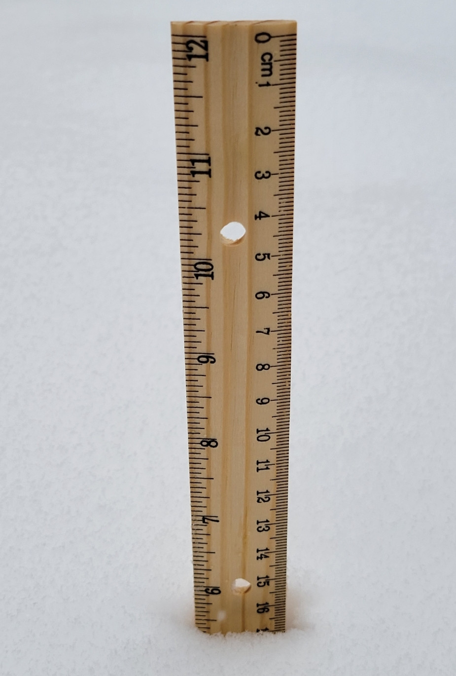
Just crossed 5 inches. If that area of snow around Nashville can maintain as it slides East I can probably manage 2-3 more before this is over. The Knox/Anderson area will probably reach double digits somewhere if mixing stays away.
-
4
-
-
Is anyone in the band north of Nashville? It's showing a 45dbz streak on the NWS radar.
-
1
-
-
2 minutes ago, PowellVolz said:
The moisture feed goes all the way back to Tx/La border. The bigger question is when does the whole feed start to shift SE. As long as @John1122 and our friend on the northern Plateau continues to see snow we are fine in the valley. Like John just said…. The radar doesn’t look great NW of Knoxville but the snow is there. It’s colder to the NW of Knoxville so the DGZ is lower and that area is in a radar dead zone. The radar is likely shooting over the top of the snow.
.The radar looked ragged/light but it's very small flakes/pixie dust and it snowed 1.5 inches in about an hour and 30 minutes from 10ish to 11:30. We had been in an extended break before then.
-
1
-
-
1 minute ago, Stovepipe said:
I've joined the 4 inch club. Maynardville Hwy is passable but the brine is losing the battle. I'm actually fairly proud of north Knox as I did not see anyone doing donuts in the road or parking lots yet. Although, for some reason quite a few people stop obeying traffic lights and stop signs in this mess. Yeah buddy, your diesel truck is cool, but you still need to stop at the red light. Anyway, very happy to get a pasting in this area. Might be a 20 year storm before it's over.
We've had 3 parking lot donuts and two main road donut incidents since 8 am per the scanner.
-
1
-
 2
2
-
 1
1
-
-
Radar always looks more impressive for snow the closer you get to the radar site. You can see this with every event where snow is coming at decent rates over a large area.
Right now you can see the bands that look very intense in a circle around Morristown, especially south and south east where the terrain isn't as ridge/mountainous. Meanwhile there's a strip of the Western Plateau were it appears nothing is happening. But suddenly returns keep appearing as if areas upstream from there are getting snow but you can't see it.
-
5
-
January 15th-17th 2024 Arctic Blast/Snow Event
in Tennessee Valley
Posted
I think this may be the convective showers that were showing up on models yesterday. The flakes are heavier/bigger and are actually making noise as they land on tne snow.
Trying to gif a video but who knows how long it'll take.