Tyler Penland
-
Posts
2,522 -
Joined
-
Last visited
Content Type
Profiles
Blogs
Forums
American Weather
Media Demo
Store
Gallery
Everything posted by Tyler Penland
-
 Crazy stuff.
-
Southeast Sanitarium - A Place to Vent
Tyler Penland replied to Jonathan's topic in Southeastern States
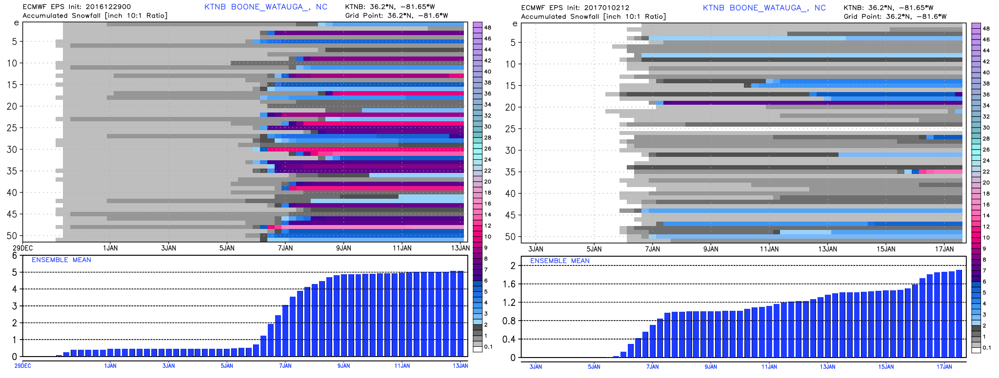
This has been a depressing collapse to watch up here. EPS from the 29th vs today.
-
Weather References and Newbie Information
Tyler Penland replied to burgertime's topic in Southeastern States
I use www.pivotalweather.com for point soundings from time to time. Geared more towards severe weather IMO, though. If you are dedicated and don't mind a small learning curve, BUFKIT is fantastic for viewing model sounds from the NAM/GFS. http://www.wdtb.noaa.gov/tools/BUFKIT/ Once you download the program the data distribution is here: http://www.meteo.psu.edu/bufkit/CONUS_NAM_00.html