-
Posts
2,528 -
Joined
-
Last visited
Content Type
Profiles
Blogs
Forums
American Weather
Media Demo
Store
Gallery
Everything posted by Jackstraw
-

Nov 28-30th Post Turkey Day Winter Storm
Jackstraw replied to Chicago Storm's topic in Lakes/Ohio Valley
This things gonna cut right over me. Will literally be 5 mile shift in track that we could get warning criteria snow or 3in of slush. KIND rather bullish on warning criteria just to my west with the question mark right on top here as usual lol. White knuckle weekend ahead, pun intended. Go big or go home, I'll call 6in here. lol -

Nov 28-30th Post Turkey Day Winter Storm
Jackstraw replied to Chicago Storm's topic in Lakes/Ohio Valley
Everyone who gets it enjoy! I'm half way to last years season total so I've got all winter to get 4 pathetic more inches lol. Seriously, this is a good start to Met Winter as long as it doesn't catch the lane right before the pins. I expect kitchen sink variety this time of year here. But this year is feeling like a doozie of a winter coming. This damn rubber band has to snap at some point Note: There, I jinxed myself -

Fall 2025 Medium/Long Range Discussion
Jackstraw replied to Chicago Storm's topic in Lakes/Ohio Valley
I know I am lol. Havent seen a fantasy run like that for my area in a loooong time for late Nov/early Dec -
My climo isn't exactly December friendly but lately winter isn't friendly period. That snow the first week of this month was half of my total last year. That ain't climo, that's just stupid lol
-
-
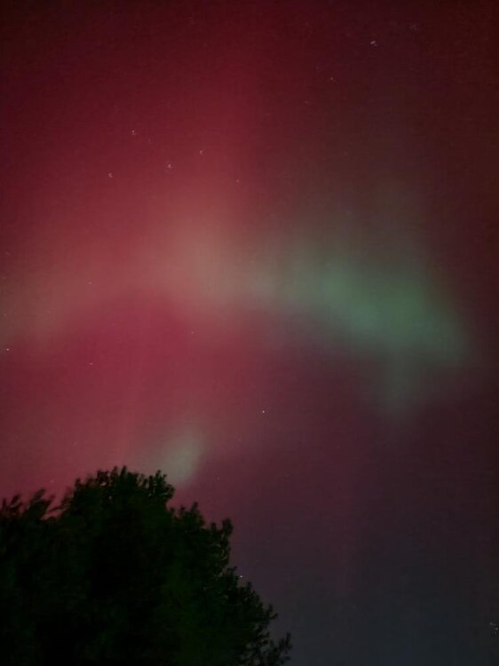
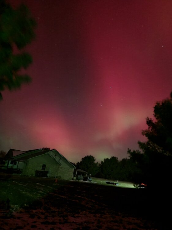
That was the best Aurora ever for me down here!
-

11/8-11/10 First Snow and Lake Effect Event
Jackstraw replied to Geoboy645's topic in Lakes/Ohio Valley
Leaves are covering the snow here. That's pretty funny. Snow plows and leaf blowers lol. Great Sat loop of the Great Lakes as the upper low recedes to the S revealing the extent of it's early season cover.... https://www.star.nesdis.noaa.gov/GOES/sector_band.php?sat=G19§or=cgl&band=GEOCOLOR&length=12 -

11/8-11/10 First Snow and Lake Effect Event
Jackstraw replied to Geoboy645's topic in Lakes/Ohio Valley
2in here and still moderate sugar falling. Last short cut of the grass paid off lol. Roads are covered so it got cold enough for sure. A bit surprised. Wasn't expecting this much this far S but hell, I'll take it. Have fun up there! -
Hopefully it's a trendsetter
-
Easter lol
-
I usually leave my grass 4-5 inches tall for winter. After last year I may cut it down to 1 inch for a better chance that I get full coverage this winter lol.
-
Yeah thats about what we got from this last system. Threaded the needle N and S big time. With no measurable precip until fantasy range on the models here's to hoping the precip rubber band bounces back with sub freezing temps and as snow! Buddah knows, after last winter, we are way overdue for a bomb storm this coming winter!
-
Well this slowly growing older man finally broke down and built a new PC. I do my PC's like my cars, I drive them until thewy smoke lol. Built a PC and bought a laptop in 2009 cost me 3500 bucks. I future proofed them best I could and well, its been nice but time to move on. They'll make good Linux machines. I was completely blown away by how damn confusing (and expensive) it was to build a new PC today. I was in IT for 30 years and I've never seen a market like this since the 90's. I think all of these companies paid billions on marketers and only spent 100's on engineers. I tested some real stupid components with some really flashy light thingy's and all kinds of wiz bangs that didn't amount to crap lol. There is so much marketing BS, especially graphics cards (what a freaking insane rip off!) I was in over my head instantly. All I got to say is if anyone else does it good luck. Researching through all the BS is a royal pain. It's worse than car salesman. If you don't do your research you can end up spending 3 or 4k bucks when you can build one that is 90% of one of those for less than a 1k bucks and will last 10 years. Took me 3 months just to research and test this marketing garbage lol. Got it done. Whew!
-
Well Fall is my favorite time of year. I could care less about the colors but its the feeling in the air when that first big front rolls through and triggers the seasonal change. There's just a feeling in the air as we move through October up to Thanksgiving. The sound of leaves blowing, crunching under the feet as you stroll through the woods. Out in the country (where I live) suddenly opens up as they harvest and you forget how far you could see after a few months of being surrounded by crops. The woods too suddenly open up. Its great just to get in the woods as or after the leaves fall as you can really see all the wildlife getting ready for winter. It's also a great time to canoe or kayak. Ill be heading to Turkey Run State park area to go canoeing. Canoeing or kayaking down rivers in the Fall is the best (so's the fishing). A lot of this comes from when I was young. My grandfather had a 5 acre garden that we harvested by hand for his veggie stand. The smell of my grandmother canning veggies in October. There are certain spices used more when cooking in the fall. Very distinct smell when your around someone that cooks from the land and not a store. Working out in the giant garden in the early morning with coats on then peeling off layers as the day progressed. There's a smell that plants release when your picking, can't describe it. Those insanely long times of daylight starting to decrease at an ever growing pace. I always notice that more in Fall than in Spring. It's another sign of what's coming. It's anticipation which is a great feeling. If you're locked up in a city yeah it sux. Get the hell out and go someplace where you can enjoy it. I also enjoy it because it's the first hint of what could come, my second favorite time of year winter. Anyway Fall is about a lot more than colors. It's in our genes. It's in our instincts. It's the beginning of a celebration as we get ready for another trip around that big ball of light. Yeah, a lot more than colors... to me anyway.
-
They've been hitting the corn hard while it still has some green around here. I'd imagine its farmers trying to get a good price as the number of industrial drying silo's around here have been going up like crazy, maybe 2 or 3 every 5 sq miles. The commodities market for grain is bit volatile right now.
-
Thats mostly harvest or crops close to it. Does it every year though rarely all at once as of late. One thing around here, farmers that got flooded out early summer and raced to re-plant are being re-warded with this weather. Its mostly soybeans that they did that as its harder to recover corn. But there are huge swaths of still green growing soybeans in fields and they are harvesting around them hoping for another 3 weeks before a frost shunts them/ It was a big gamble but many lost so many crops in that couple of weeks of intense flooding it was worth the risk.
-
Yeah you can't "see" drought from space. However the crops are crispy especially soybeans which have been a crispy brown for 3-4 weeks. I noted significant browning over the midwest from those geo-color sat pics a month ago. Some of it is crops, some of it is bare earth from early harvest. I will say its definitely a very very dry harvest/ If they running through soybean field in the evenings the dust lingers along the ground so thick you can only see a couple hundred feet when you drive through it, for maybe a half mile. Early afternoon you can see huge clouds of dust riding the thermals into the air from the combines. Its eerily got a scifi look to it from Dune lol.
-
Absolutely. And notorious IN November breakouts fit my chasing style, sit and wait because most of the time you ain't gonna catch them lol
-
Can't ask for better weather !!
-
To be fair any of the globals out that far could predict the Cubs winning the Super Bowl lol. However the NHC did mention using Google DeepMind's forecast in a few of it's discussions on Erin (in an experimental capacity). I will say this. I'm strongly suspect of some the discussions coming out of our local office. They have a very "machine" like feel to them at times, especially on weekends. I'm sure it's coming big time. It's inevitable
-
P&C has us 1 degree short of 3 nights in row in the 40's Mon-Wed. I don't think I ever remember 3 consecutive sub 50 evenings around here in August. Preface of things to come a few months down the road (as long as there's flakes involved of course ) ? A weenie can wish lol
-
Airing out a couple jackets today. Getting ready for the "freezing" blast of possible upper 40's next Monday night in August! Bring it! lol
-

2025 Short Range Severe Weather Discussion
Jackstraw replied to Chicago Storm's topic in Lakes/Ohio Valley
Flash Bang lightning out there. 3-5 strikes a minute. Watched from the porch for 90 min as these mini complex's moved SSE. Best light show of the year. They are just now weakening which could mean some left over outflows for initiation tomorrow morning similar to earlier today. Best light show of the year, until its on top of you lol. -
That's gotta be a monthly Anvil Rain record lol
-
Like clockwork the first week of August the crop dusters invade. They were extra heavy this year. I saw as many as 6 flying around from my back porch one morning. Same time every year, free airshow lol.


