

Jackstraw
-
Posts
2,592 -
Joined
-
Last visited
Content Type
Profiles
Blogs
Forums
American Weather
Media Demo
Store
Gallery
Everything posted by Jackstraw
-
18Z GFS blows chunks for me. Went from 4-6 to 0 lol
-
Started pouring at my house then switched straight over to quarter size flakes for about 15 min now stopped. Freakin' weird.
-

Winter 2024-25 Medium/Long Range Discussion
Jackstraw replied to michsnowfreak's topic in Lakes/Ohio Valley
Thats the problem with this pattern we're now in (as opposed to the pre- January arctic blast). I mean it's a decent setup for the entire sub with storm tracks but if one winds up it's gonna pump "hot 850's" right over the top of us and we get the gambit of everything but most of our moisture will drop as liquid (more frozen mud ) while those to the north cash in with a 12+ incher or if it's a fizzled piece-o-crap it slides south and spits some in KY that'll melt the next day or 2. I know the Chicago weenies are frothing at the mouth (when aren't they lol) and want 2 feet 25 miles north or south of Chitown lol but I'll take a a couple decent 6 or 7 back to back that spreads the wealth any day. I'm not totally buying into this track yet and think there's a decent chance, at least snow totals, could swing back south some 50 to 75 miles. But such is the Climo for our locations -
Yes and I hope I'm in it. As I posted before those of us that are north of I70 this setup is going to be feast or famine. Of course the last couple of runs have been wagons north so this thread will have 100 pages by tomorrow lol
-
Yeah we got about the same but the "Thunder Ice" was nuts. Had those storms training right over me for 3-4 hours with a lightning show better than I had all summer! Thunder was much louder than summer probably due to the colder denser air. My dogs were freaking out until about 3am. Pretty crazy stuff! Sad about the house burning.
-
Winter 2024-25 Medium/Long Range Discussion
Jackstraw replied to michsnowfreak's topic in Lakes/Ohio Valley
Well those of us in I70 Kitchen Sink Land will be nervously hopeful over the next 10 days. With this forecast setup of a sharp baroclinic zone from the SW to the NE US with the battle ground here centered somewhere between the Ohio River and I70 is like playing a casino snow slot machine for us. Hopefully after tonight we can stay in the cold conveyor. I'm already sick of the mud -
Well January for me was happy for the snow that fell. We got that initial 10 ten on the ground in a week with a couple nickel and dimers after which beat the entire winter totals of each of the last 2 years, before that arctic boot stepped in and suppressed everything to the south. January 2025 will be remembered by me as the glacier that wouldn't die. That brief bit of rain we received between the 2 arctic blasts just turned everything into 3-4 inches of solid ice. The shit was so hard out in my yard I tossed a 60's vintage lawn Jart out there and when it hit it "doinked" about as loud as that Commanders luckiest suckiest ever field goal in playoff history. The ice ruts in my 1/4 mile long dirt/gravel (its time) driveway finally melted away yesterday. I kinda liked them, I had a self driving driveway for most of January lol. Now its a gravel mud shake but I'm staying in the grooves for a re-freeze hardware upgrade to my "self driving" truck lol. Hope February can fill those ruts up with more snow!
-
Winter 2024-25 Medium/Long Range Discussion
Jackstraw replied to michsnowfreak's topic in Lakes/Ohio Valley
See my Sig line quote from Stebo many moons ago lmao -
Fall/Winter '24 Banter and Complaints Go Here
Jackstraw replied to IWXwx's topic in Lakes/Ohio Valley
Yeah its going to start going quick here tomorrow then its the start of Mud Mania 2025! lol -
That's why I I'm gonna appreciate this little half inch clean up snow we just got to ice our 3-4 inch glacier (one of the hardest deepest glacier packs in recent memory here). The pattern he speaks of usually brings us in kitchen sink row row just that, a crappy rain, sleet, snow menagerie lol. Definitely looks like better probs for the I-80 crowd to get some welcome relief. Meanwhile this stuff here is fixing to go away next week and we'll be in the dreaded mud/frozen mud 24 hour cycle for a bit. I hope we can swing through another decent snow before the February cold box settles in. I don't care what anyone says 10F feels like 30F when there's snow on the ground
-
Winter 2024-25 Medium/Long Range Discussion
Jackstraw replied to michsnowfreak's topic in Lakes/Ohio Valley
I have no memory left but... I do remember sometime back maybe 2015? not sure when a similar pattern as this set in sparked off by a very strong very late season (like December) west Pacific tropical system that was absorbed and enhanced an already strong low in the northern jet stream. When it hit the US it allowed a crazy near record (maybe record?) setting polar high in 1050's to come crashing into the plains behind it and that ridge set there for over a month suppressing the storm track well below the MD line. I think it was a record setting winter for much of the deep south. It was just bitter cold arctic tundra up here that winter and it sucked. Except for last week I feel like that's where we're headed for the next few weeks with polar ridges in the mid to high 1040's being advertised. Note: Once again, my memory is severely flawed these days -
Nice! I'm at 3.5 on a clean board, still falling. The Dendrite machine had to work it's ass off to get this. I barely saw a flake larger than a dime but the salt shaker in the sky was shakin' hard. The WWA around here was definitely warranted as roads went to (and still are) complete s@$t between 3 and 6. This is the kind of nickle dime pile ups I'm used to around here lol. 10 inches in a week? Where the hell am I
-
On a roll here and if the upper level system can help pump a couple more 10ths of moisture up here and high SLR's I'm going to call 5 here from 9am Fri to 9am Sat. Whatever we get tomorrow and tomorrow night it will make this the best winter here in 3 years. Have to admit, it doesn't take much
-
I was very surprised here with 6. I was expecting 3 at most. Hey ya got something lol. I have a friend in Cincy he was very happy he got to gloat for once lol.
-
It was brutal. Those little bumps of 5.8 and 6 right next to .2 is where I am. We ended up with 6 that I measured. I drove about 2 miles East and there was grass. We had a bit of a TROWAL or Defo set up over us for a couple of hours very early in the morning. We got 4 of the 6 in that 3 hour period from 2 to 5am. KIND was mentioning this possibility the day before. Great snow for our southern brethern that are so often just spectators. Ya'll got more coming!
-
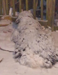
Got 2 here so far. Keep getting some bands drift through with +SN for 15 min then -SN prisms in between. Dry slot should stay south but then the only hope of reaching warning criteria is going to be some Defo coming through 3 - 9 hours from now me thinks. If I can get 3 more that'll give me 10 or so so far. That will equal my totals of each of the last 2 years. Seems I only have heart attacks when I get less than a foot of snow per winter so here's to another pitiful 3 inch storm after this one! lol. PS: Found my dog
-
Finally got a decent band overhead. Trying to find my dog lol
-
-
Yeah just started here. I went outside and spit about 20 minutes ago to raise the humidity. It worked! Lol
-
If I hadn't had 2 heart attacks in the last 2 years I could probably walk south a couple hours and go from a couple of inches to 10 lol. Famous North I70 sucker lane strikes again.
-
Spring 2023 Medium/Long Range Discussion
Jackstraw replied to Chicago Storm's topic in Lakes/Ohio Valley
Hell its 87-88 in KY and OH now. Thats pretty stout for the first week of April. Especially OH -
Yay my whole area is getting a tornado watch too. Was feeling left out
-
Nice 10 second 65mph sustained with that globular cluster that just went through. Not one lightning strike. Started having SE coastal living flashbacks lol
-
You dress up your dogs?
-
Hey, I'm in that box too. Too hell with Jupiters magno rings Quantum entanglement is forecasting a big dog here. My fishing reel looks like Phyllis Diller's hair and I'm sick of messing with it.


