
snowlover2
-
Posts
2,732 -
Joined
-
Last visited
Content Type
Profiles
Blogs
Forums
American Weather
Media Demo
Store
Gallery
Everything posted by snowlover2
-
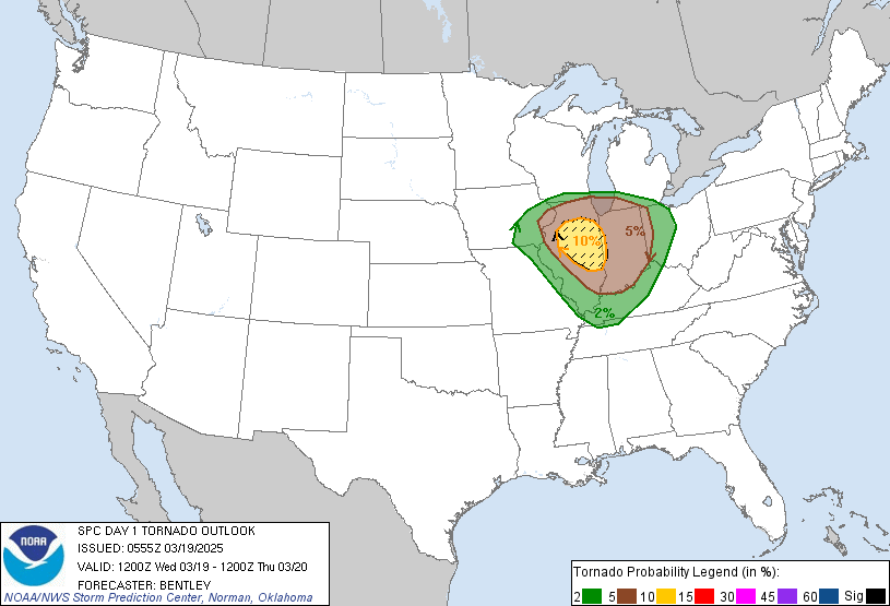
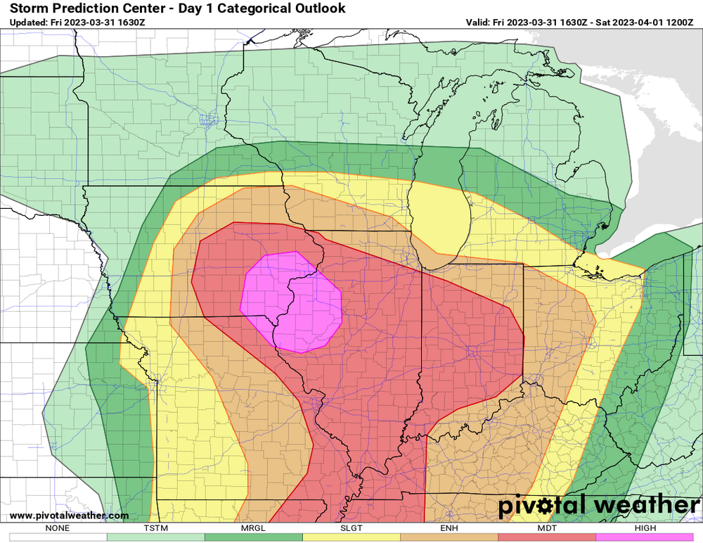
Expanded the slight south across much of IL/IN/OH because of this.
-

2025 Short Range Severe Weather Discussion
snowlover2 replied to Chicago Storm's topic in Lakes/Ohio Valley
Tornado warning for Springfield OH. -
My condolences to you and your family. I also have a message from a former mod from the Lakes/Ohio Valley forum. So sorry to hear the news of jburns' passing. He was a good poster, but seemingly an even better person. It was a pleasure being on the staff with him for a number of years. From beginning to end, he was never anything but kind to me in our public and private interactions. My thoughts and prayers are with the family during this difficult time. He will be missed by many people! Though he is gone, he will never be forgotten. May he rest in peace.
-
May 17th-20th severe weather discussion
snowlover2 replied to Chinook's topic in Central/Western States
Tornado Warning KSC097-190330- /O.NEW.KDDC.TO.W.0009.250519T0248Z-250519T0330Z/ BULLETIN - EAS ACTIVATION REQUESTED Tornado Warning National Weather Service Dodge City KS 948 PM CDT Sun May 18 2025 ...TORNADO EMERGENCY FOR GREENSBURG... The National Weather Service in Dodge City has issued a * Tornado Warning for... Northeastern Kiowa County in south central Kansas... * Until 1030 PM CDT. * At 947 PM CDT, a confirmed large and destructive tornado was observed near Greensburg, moving northeast at 30 mph. TORNADO EMERGENCY for GREENSBURG. This is a PARTICULARLY DANGEROUS SITUATION. TAKE COVER NOW! HAZARD...Deadly tornado. SOURCE...Weather spotters confirmed tornado. IMPACT...You are in a life-threatening situation. Flying debris may be deadly to those caught without shelter. Mobile homes will be destroyed. Considerable damage to homes, businesses, and vehicles is likely and complete destruction is possible. * The tornado will be near... Greensburg around 955 PM CDT. PRECAUTIONARY/PREPAREDNESS ACTIONS... To repeat, a large, extremely dangerous and potentially deadly tornado is ongoing. To protect your life, TAKE COVER NOW! Move to an interior room on the lowest floor of a sturdy building. Avoid windows. If in a mobile home, a vehicle or outdoors.. Move to the closest substantial shelter and protect yourself from flying debris. Tornadoes are extremely difficult to see and confirm at night. Do not wait to see or hear the tornado. TAKE COVER NOW! && LAT...LON 3751 9939 3773 9932 3767 9904 3749 9928 TIME...MOT...LOC 0247Z 221DEG 25KT 3753 9931 TORNADO...OBSERVED TORNADO DAMAGE THREAT...CATASTROPHIC MAX HAIL SIZE...2.00 IN -
4/2-4/3 Potential Major Severe WX Outbreak
snowlover2 replied to Geoboy645's topic in Lakes/Ohio Valley
PDS tornado warning SW of St. Louis. -
Confirmed now.
-
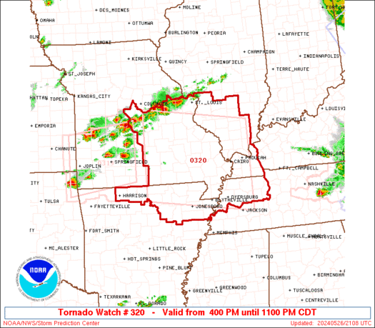
Peoria under a tornado warning. There was a confirmed SW of there.
-
2025 Short Range Severe Weather Discussion
snowlover2 replied to Chicago Storm's topic in Lakes/Ohio Valley
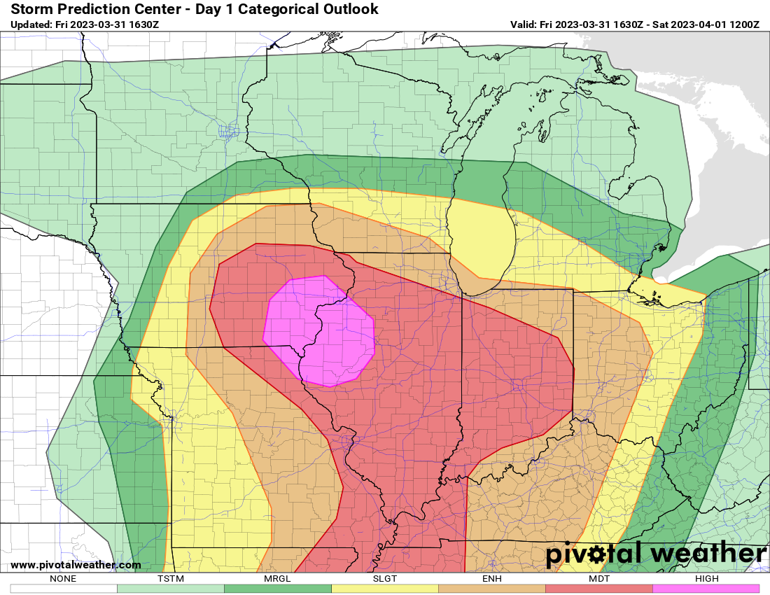
Small enhanced added for tornadoes and slight risk expanded.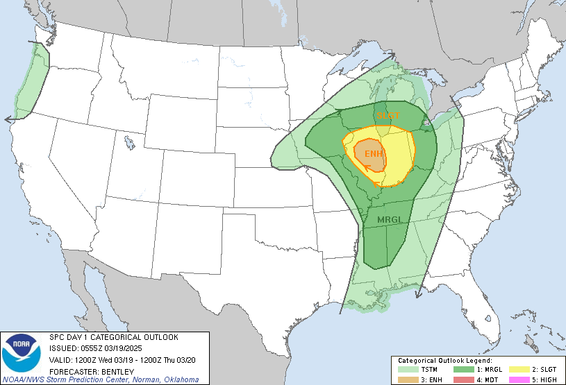
-
2024 Short/Medium Range Severe Weather Discussion
snowlover2 replied to Chicago Storm's topic in Lakes/Ohio Valley
HRRR is trash too. Not handling this current line well at all. -
2024 Short/Medium Range Severe Weather Discussion
snowlover2 replied to Chicago Storm's topic in Lakes/Ohio Valley
Janesville is PDS warned. -
-
22/14/6
-
-
December 22-23, 2004. Couldn't have been more perfect at least for my part of Ohio.
-
2022 Short/Medium Range Severe Weather Discussion
snowlover2 replied to Chicago Storm's topic in Lakes/Ohio Valley
Beat me to it. That's some pretty strong wording.
-
18-8-3
-
New day 2 mentions EF3+ tornado possible.
-
2022 Short/Medium Range Severe Weather Discussion
snowlover2 replied to Chicago Storm's topic in Lakes/Ohio Valley
It was radar confirmed which means there must have been debris showing up and it could have been brief leading to cancelation. -
2022 Short/Medium Range Severe Weather Discussion
snowlover2 replied to Chicago Storm's topic in Lakes/Ohio Valley
-
Could be something Wed night/Thursday that's been shifting north some and currently showing some snow along the Ohio River area.
-
Got a little more than 2" here in Dayton. That west outer band was a nice surprise.
-
Got around an inch here. This outer band is a nice surprise.
-
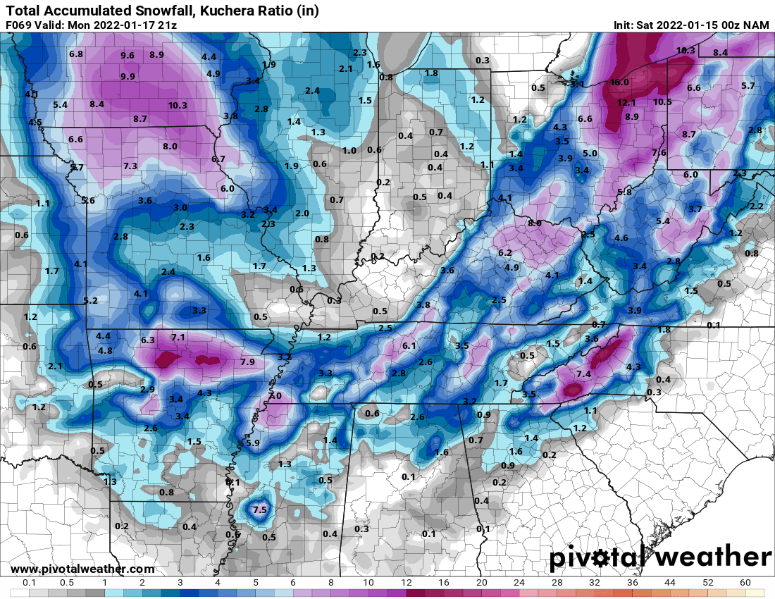
3k NAM still snowing in C/E Ohio. Northern energy snow showers in IN.

.thumb.png.fe96966d37f7b5a7e7eedf62cf946a20.png)
-
0z NAM continues the trend of the 18z Euro.


.png.9a95d00e972f68dbfb0919e409fac5a4.png)