snowlover2
-
Posts
2,733 -
Joined
-
Last visited
Content Type
Profiles
Blogs
Forums
American Weather
Media Demo
Store
Gallery
Everything posted by snowlover2
-
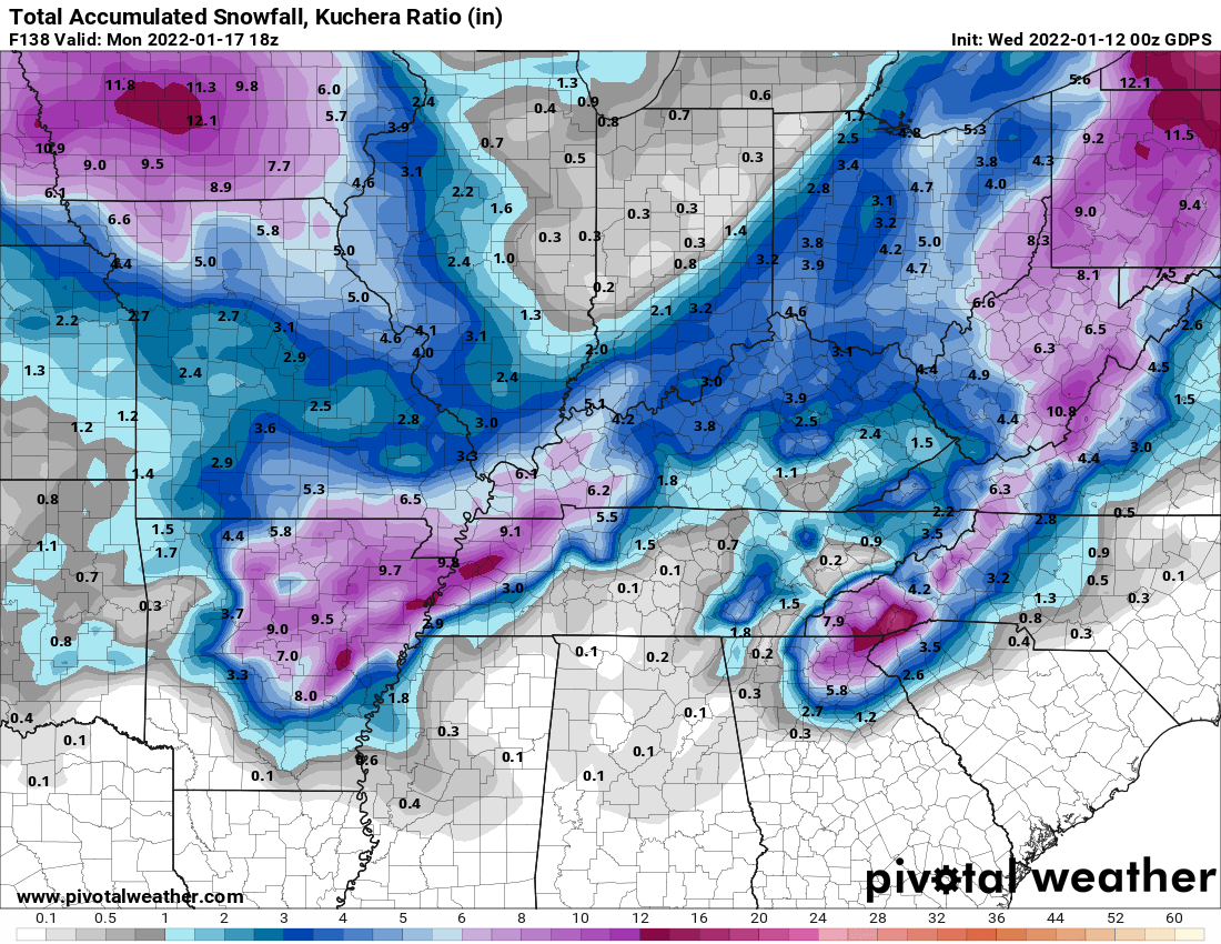
0z NAM continues the trend of the 18z Euro.
-
-
From ILN
-
12z GGEM finally loading and it looks very similar to the GFS.
-
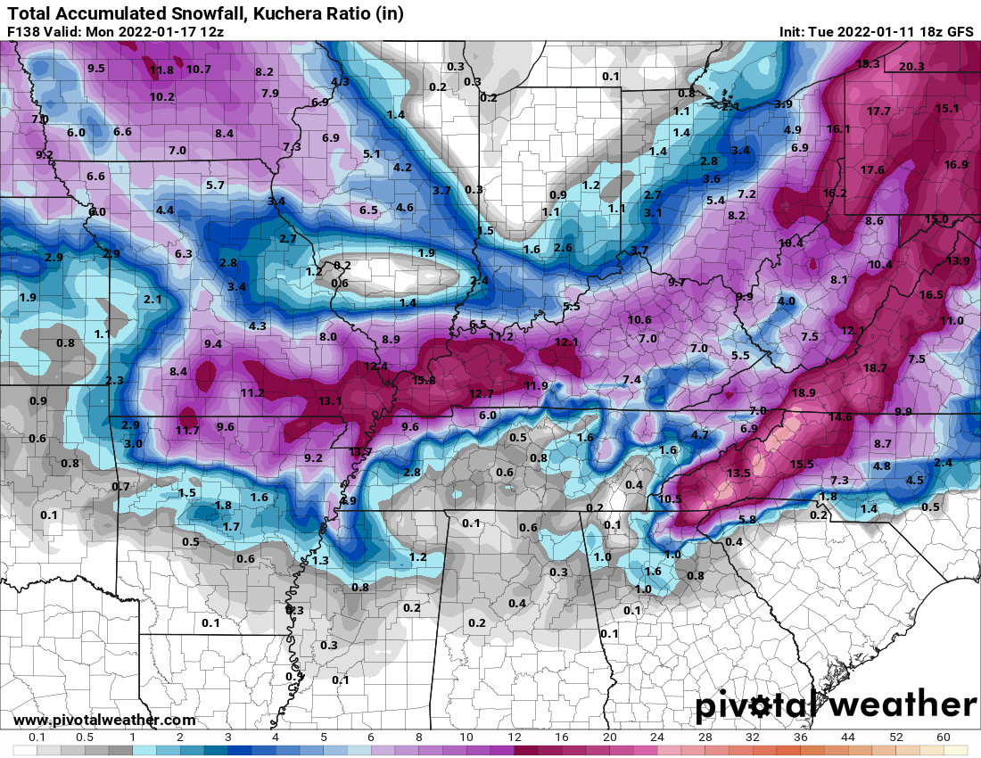
12z Ukie took a nice jump NW. Has snowfall east of I-71 where the 0z was in VA/Carolinas.
-

-
0z Ukie not buying any of this yet.
-

-
-
18z GFS is not terrible.

-
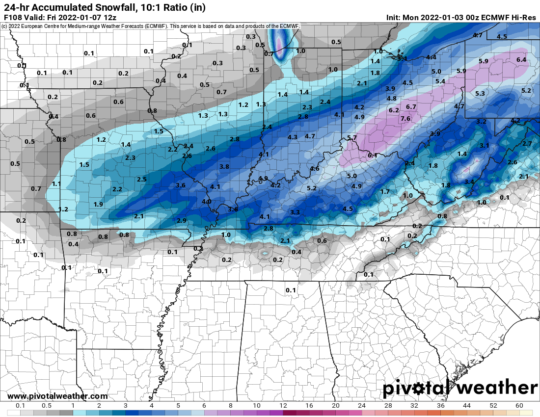
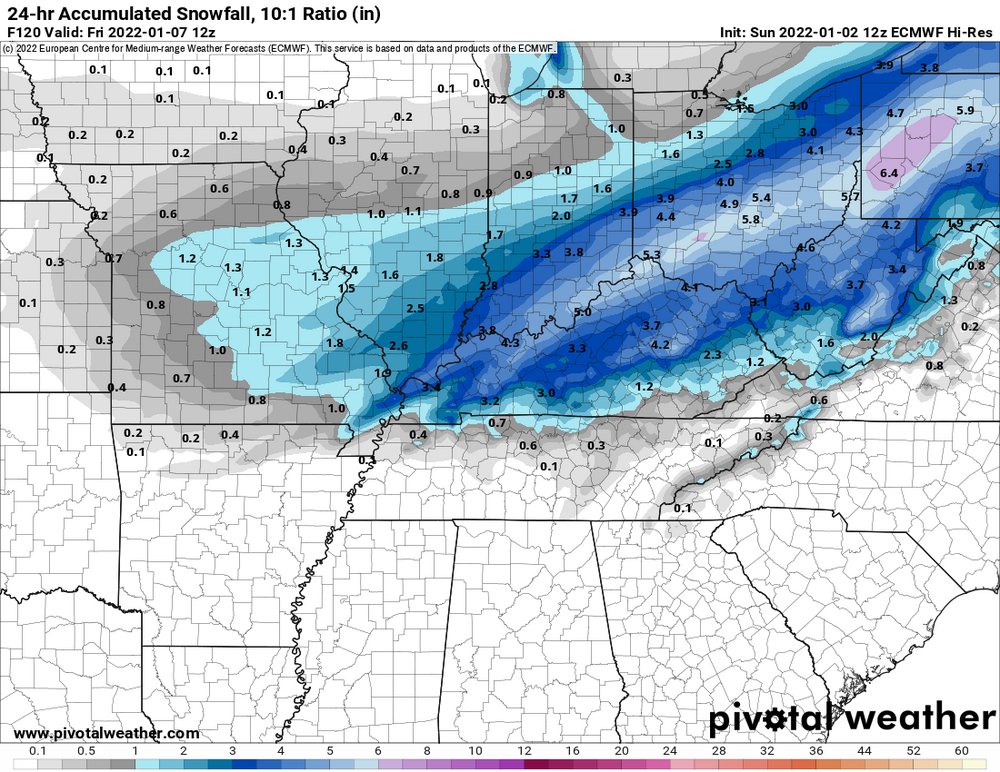
Euro joins in with the GFS trying to pull this sucker NW on the curve around.
-
12z GGEM also appears to have comeback NW some on the swing around.
-
Very lightly snowing here in Dayton.
-
0z GFS finally has a storm giving SE parts of Ohio a couple inches.
-
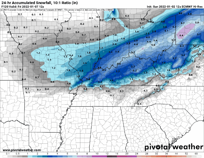
0z off to a good start. 0z NAM is much better.

-
18z NAM looked pretty crappy.
-
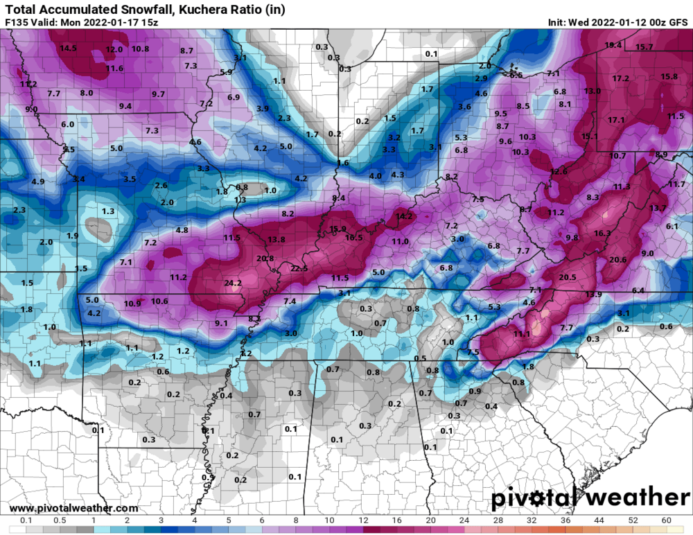
Got the NAM on board now too making GFS look like even more of an outlier.
-
For comparison to its 12z.
-
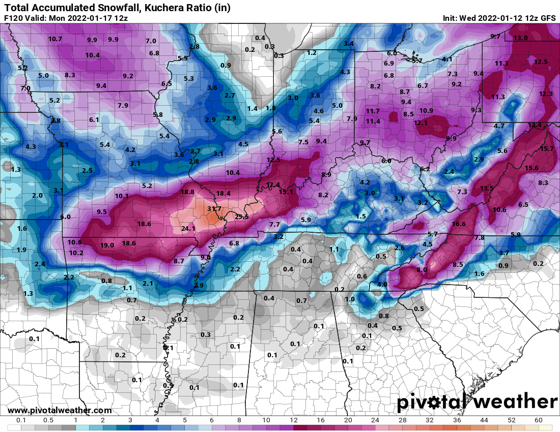
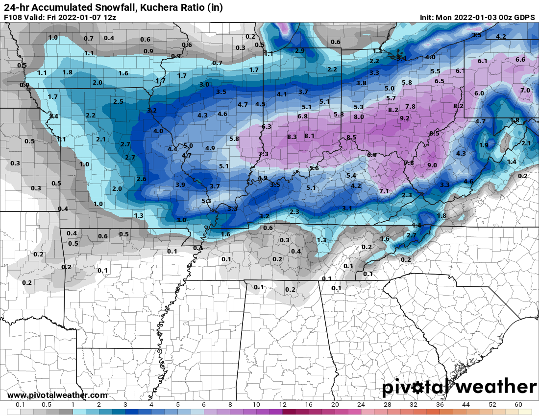
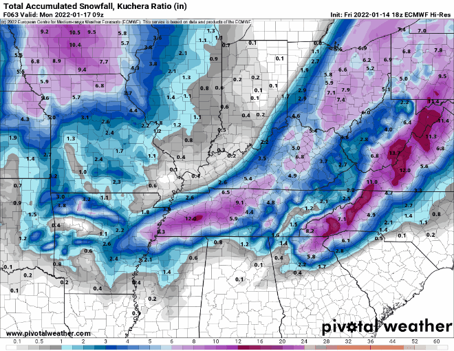
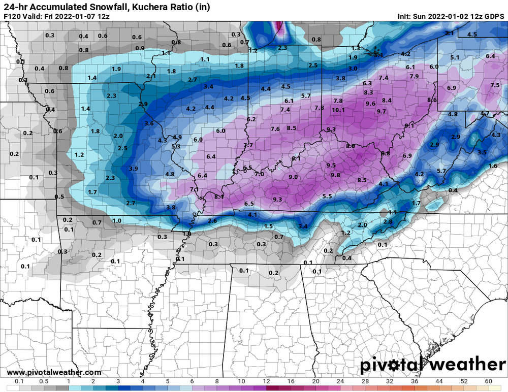
Actually west a bit. Kuchera maps probably would show some 8-12" totals.

-

-
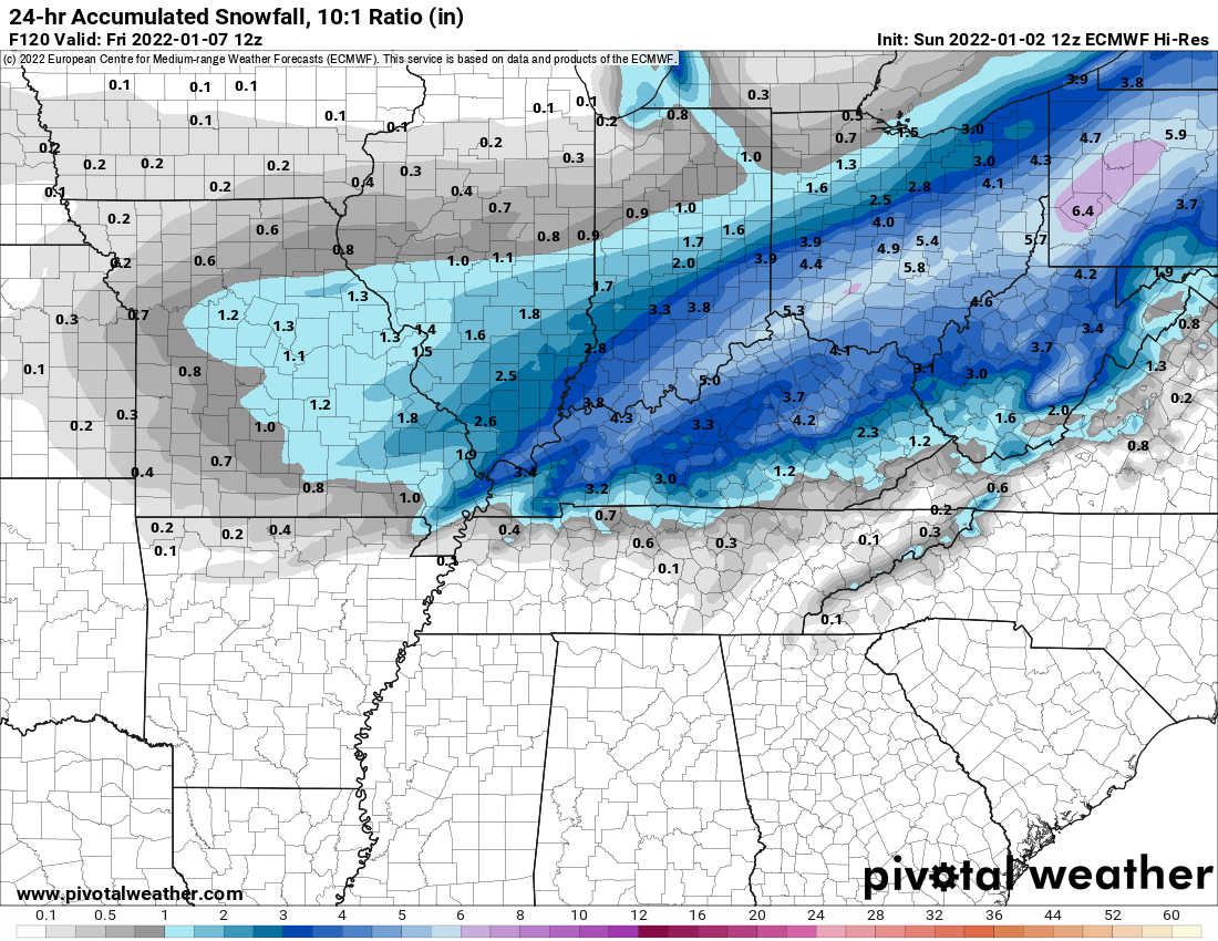
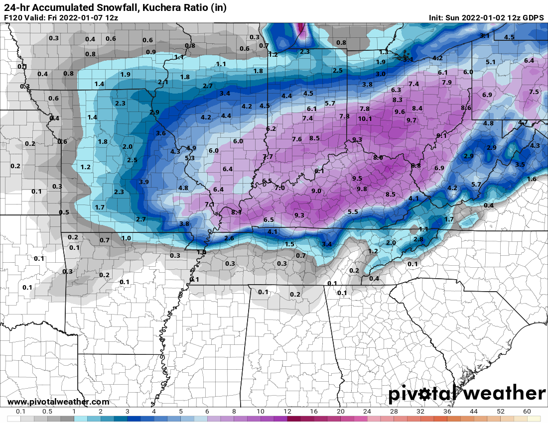
0z GFS still not playing ball but was a touch better.
-
Euro still good.
-
Ukie is weaker and suppressed.
-
GGEM still very much on board.
-
GFS still looking like hot garbage.