weatherwiz
-
Posts
81,345 -
Joined
-
Last visited
Content Type
Profiles
Blogs
Forums
American Weather
Media Demo
Store
Gallery
Everything posted by weatherwiz
-
 maybe because its a bit elevated but surprised no warning or at least a SPS on that cell heading towards Fairfield County/Danbury...decent wind signature on velocity
 -
Could be a nice line that organizes early tomorrow afternoon for E CT and points east
-
Same here. I feel like I didn't even really get to enjoy the summer. I regret not setting up shop outside and working like I did the past few summers. But I got myself one of those towers with 3 monitors hooked up and it would have just been a pain to bring that outside each day/inside and then the power strip. But its been work/summer classes so haven't been able to do much. I try and sit outside during the evenings but we get destroyed with mosquitos.
-
Already dealing with the later sunrises and the earlier sunsets are getting noticeable too, it blows.
-
Yeah the duration is certainly a question, but then again, duration of higher heat events is always trickly here just because of our geographical proximity to Canada and vulnerability of fronts moving through. I guess the question would be, do any fronts completely alter the pattern or would it just be a case of multiple days of average temps before we blow another warm front through and bring in another round of heat? Magnitude isa challenge too, but that is a very large plume of ~+25C 850 temps being modeled into the OV...doesn't take much to really break some of that off and send it our way, especially ahead of a front or even build the airmass in if ridging expands east.
-
Tip made a post on it yesterday, but you can see signals in that likelihood. Matches up kind of well too climatologically where we can get big (kind of final) big heat pushes in early August. The longevity of it though will certainly be a question given the continued theme for troughing to our northwest, but if anything that at least keeps the door open for cold fronts/convective potential
-
Higher heat and humidity will be building in through the first week of August.
-
HRRR was a solid line moving through
-
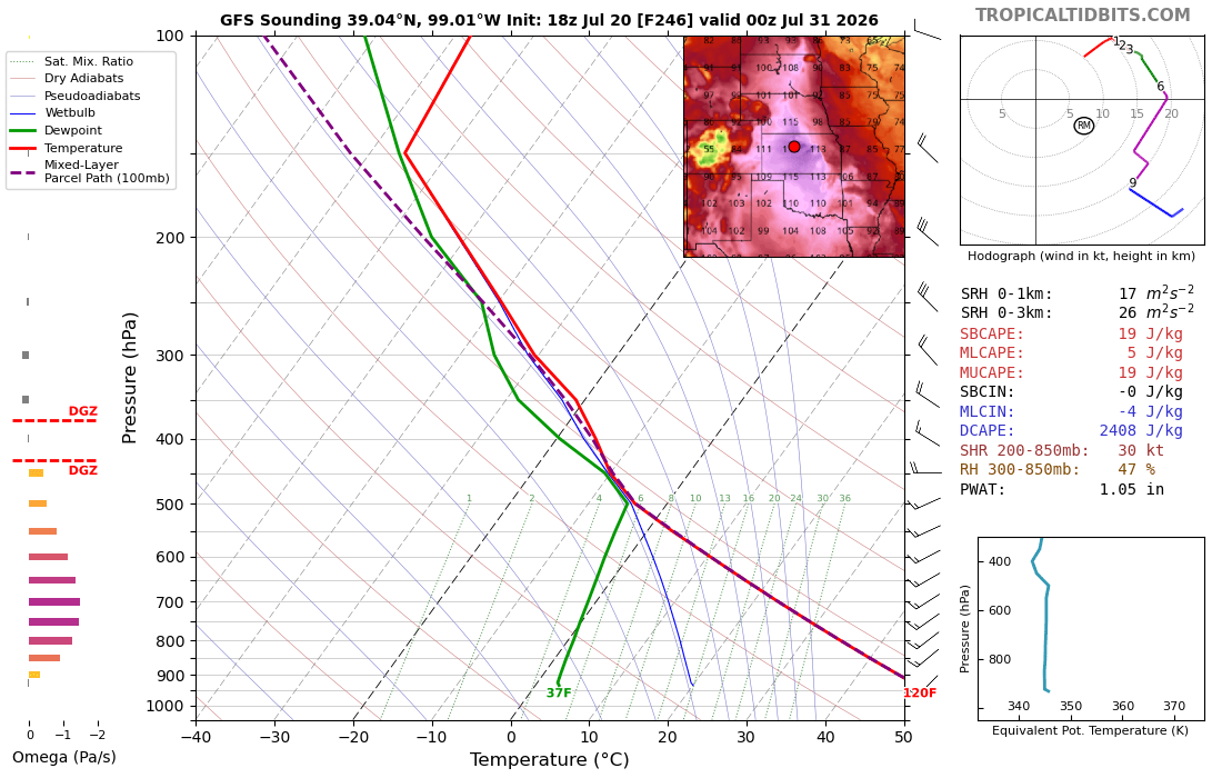
what a sounding

-
Another decent looking setup when you look at dynamics, however, doesn't look like there is going to be any room for cloud breaks tomorrow. Quite the soupy airmass, warm front nearby, and no capping. Going to be lots of clouds and pop up showers. Timing of the front/forcing not idea either...but...there may be a shot for some strong storms on Wednesday, especially east of the River.
-
It's certainly not a horrible look but its pretty far off from getting to the point of being like, "yeah this is a bit concerning" and something which may result in stronger storm impacts (something like increasing concern for power outages and surge/coastal flooding). There are a lot of "if this happens" involved here. Certainly worth watching, but if I had to lean towards a direction of what this becomes, it would be minimal impact...nothing more than what this area sees with daily thunderstorms which produce gusty winds and heavy downpours. maybe a bit more of a FF risk from torrential downpours and maybe some slightly stronger wind gusts.
-
Certainly can't disagree with that. As we've seen the past decade really is you can't trust a storm in the Gulf, especially with the OHC that builds going into the season.
-
Good stuff on TUTT's. It was essentially a TUTT that lead to this potential, but TUTTs are interesting in the sense that they can help with the initial phases but also can be very bad for TC genesis/strengthening in general. This system is certainly fighting stronger shear to the north and also ingesting some dry air. Despite the water temperatures, its really difficult seeing this take off or really becoming anything organized. I was pretty shocked to see TS watches fly but I guess I can sort of understand it because that allows certain protocols from local govt's to be activated. But this looks more like just some areas of heavy rain, scattered thunderstorms, and gusty winds...a.ka. a typical summer afternoon along the Gulf Coast. Seems like any greater storm impacts are going to be confined to the open waters.
-
This Gulf system is absolutely crap
-
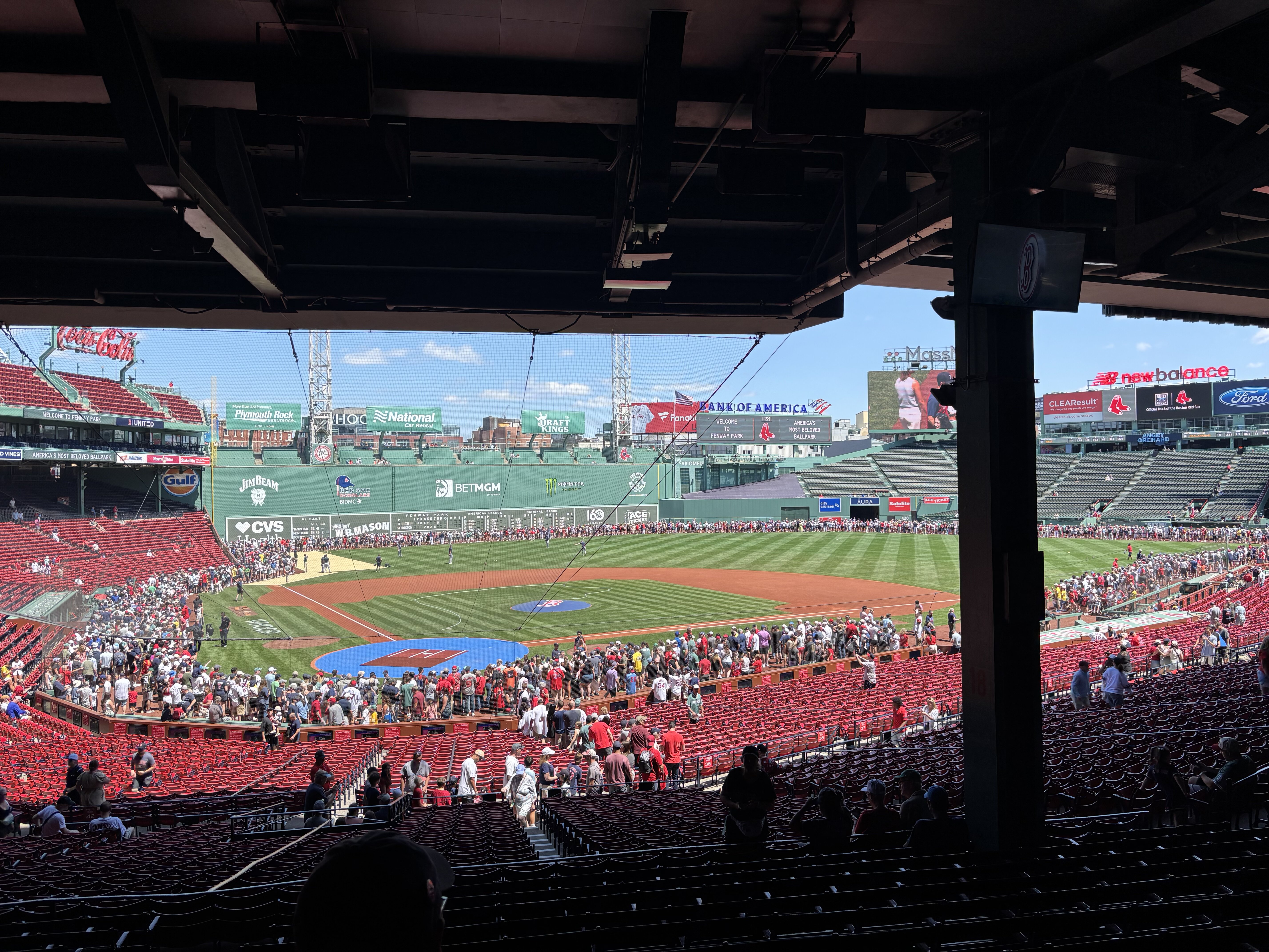
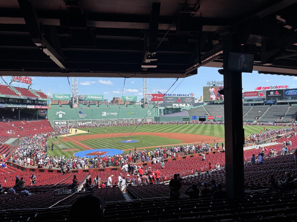
Beautiful day for some baseball, although a tad windy
-
Saturday, July 18, 2026 Thunderstorm/Severe Weather Potential
weatherwiz replied to weatherwiz's topic in New England
Yesterday didn’t really bust. The greatest threat for severe weather was off to the West, in which there were a quite a few reports, including at least one tornado. Threat was always lower here and worth watching. -
Saturday, July 18, 2026 Thunderstorm/Severe Weather Potential
weatherwiz replied to weatherwiz's topic in New England
yup multiple warnings. -
Saturday, July 18, 2026 Thunderstorm/Severe Weather Potential
weatherwiz replied to weatherwiz's topic in New England
yes MCD was issued which includes western CT mentioning uncertainty in whether downstream watch will be issued -
Saturday, July 18, 2026 Thunderstorm/Severe Weather Potential
weatherwiz replied to weatherwiz's topic in New England
Expectations should always be low in our setups really. At least for me, part of the fun in all this is the "unknown". 99.999999% of the time (or some number that's essentially 100% without being 100%) severe weather here is not going to be widespread or even concentrated, its just going to be some reports scattered about and localized. But back to the fun...its the tracking and monitoring to see even if one storm produces...and if that one storm does produce, there is someone out there who was directly impacted. These setups are just so intriguing in that regard because the kinematics support the potential and generally instability is usually just enough to warrant some concern, but ultimately low enough to where maybe only a few storms will ever become mature enough to utilize the environment. -
Saturday, July 18, 2026 Thunderstorm/Severe Weather Potential
weatherwiz replied to weatherwiz's topic in New England
Got the MCD for western areas...only an hour after I suspected maybe I meant 5:00 CT -
Saturday, July 18, 2026 Thunderstorm/Severe Weather Potential
weatherwiz replied to weatherwiz's topic in New England
I would wager by 5:00 we probably see an MCD for western areas. -
Saturday, July 18, 2026 Thunderstorm/Severe Weather Potential
weatherwiz replied to weatherwiz's topic in New England
That stuff west of BGM starting to look pretty good with cooling cloud tops. Looks like it just behind the warm front too. Probably up to the CT River probably still in game for svr potential given it looks like the warm front should get there. Want to see dews get to around 72-73...not sure how far northeast those will make it though -
Saturday, July 18, 2026 Thunderstorm/Severe Weather Potential
weatherwiz replied to weatherwiz's topic in New England
Hoping to go after that stuff moving past BGM now. Hopefully it will remain on a trajectory or pass close enough to BDL. -
Saturday, July 18, 2026 Thunderstorm/Severe Weather Potential
weatherwiz replied to weatherwiz's topic in New England
when I was outside with the dog this morning I was a bit shocked how it was outside...smoke was pretty evident. Thought at first it was maybe some fog but the smell of smoke was clear as day. -
Saturday, July 18, 2026 Thunderstorm/Severe Weather Potential
weatherwiz replied to weatherwiz's topic in New England
just edited...meant to say 3km is a bit off with how things are evolving. HRRR pretty good to get everyone with some amount of rain for rd 2. Severe potential remains complex. Might just have to watch where the instability gradient is. But even that will be tough to pinpoint because the warm front is moving.