weatherwiz
-
Posts
81,158 -
Joined
-
Last visited
Content Type
Profiles
Blogs
Forums
American Weather
Media Demo
Store
Gallery
Everything posted by weatherwiz
-
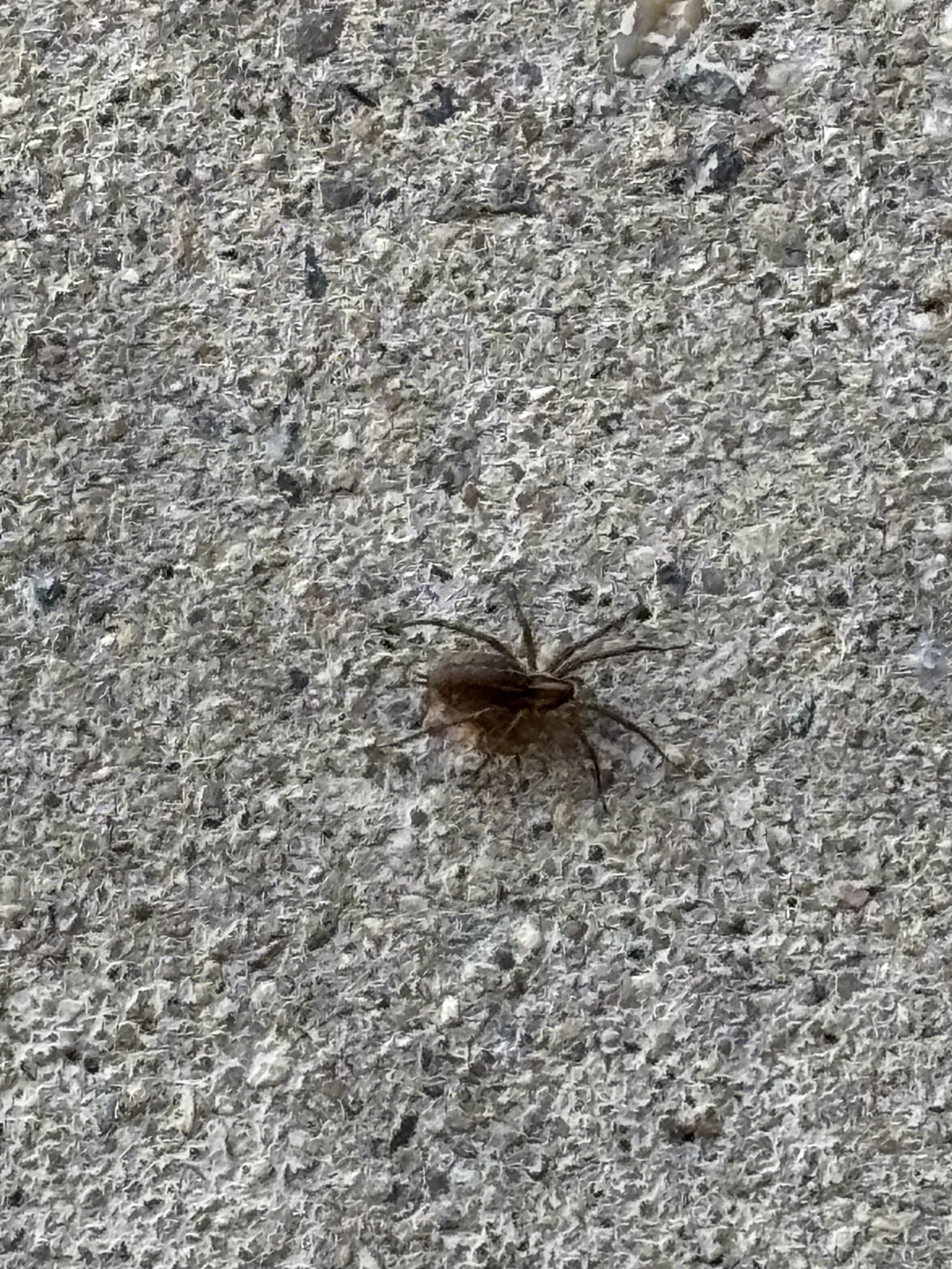
Finally the pest people are coming Thursday. This is getting outrageous with the spiders...they're running rampant everywhere. That massive wolf spider outside the other day, the one that was in my coffee filters, a few weeks back I had a spider crawl on my phone while I was watching stuff in bed, a few days after that one was running at me on the sheets, there were two in the office room the other day and I can't find them, and there is this tiny one on the ceiling and it looks like its humping the ceiling. Looks like one of those tiny jumping ones though I hope its not a baby wolf spider. They better spray every square inch of the house, both inside and outside. Don't care if we have to stay somewhere overnight.
-
May sit outside tonight and watch the Bruins game. Would get a little fire going but clearly not doing that in this state. Sucks the game is so late but at least it will be pretty nice out.
-
No, not required for the program there. At least I don't believe so. I had sent over all my materials and got the letter of acceptance and it didn't mention anything about it. But I should double check into this.
-
Been wanting to do this for several years but figured now is the time before I get any older and have kids but I'm going to start the masters program at Mississippi State University online in Fall of 2025 Just debating on whether I want to try and get it done in 2 years or draw it out longer. Anyways, pretty excited. The courses look super fun (just hopefully not crazy math intensive or heavily involving programming or I screwed )
-
I didn’t but my brothers girlfriend did
-
Was in New Britain today for my nephews soccer game. What a day. Those yellow jackets were vicious though
-
Friend of mine that lives outside of Boston said he just killed a black widow in his apartment
-
He needs to be away from the house. I have to call these pest people. I’m paying $50/month and they’re supposed to spray outside and inside to keep bugs out. They came once in July and haven’t seen them since. More bugs and spiders than ever. I want my money back. I just walked through a spider web in the basement, there was a spider in my coffee filters the other morning, and a spider in the bathroom.
-
Omg it’s a massive wolf spider. was sweeping some leaves to cut carpet and this idiot came out of the leaves

-
This is the 2nd or 3rd ever home opener I’ve missed. Their first season in Hartford, maybe 2015 or 2016, and then 2022.
-
Ughhhhhhh had to miss the Wolf Pack home opener. There was an accident on the highway and it took two hours to go from Springfield to Enfield. By the time I was able to get off the highway for backroads…projection into Hartford was like 8:30
-
Much better today, after a freezing morning, this is more like it. Going to be beautiful going into Hartford for the Wolf Pack's home opener later on. Won't be too bad coming out of the game either. Glad I don't have to wear my winter hat tonight.
-
Because it's a piece of junk
-
Maybe its because I have a light jacket, a heavy sweatshirt, and winter hat on but when I went outside with the dog I actually thought it would be colder out.
-
The snow makes the cold more tolerable so hopefully we have least have a snowy winter. But outside of snow there is just no use for this type of weather. If you're involved in physical activity it's not so bad but it takes so much longer for your body to get going. The cold makes me cramp so easily and it seems to get worse every year. I get cramps in my arms when I had them in folded position for a certain amount of time and then stretch them out. I'll even get like cramps in my throat which is odd.
-
I don't think this place is well insolated. If its above 60/70 outside it gets hot in the house and the house must retain alot of heat because at night, even if its in the 50's it can be very warm. Even last week when it got down into the 40's or 50's at night, we had the bedroom AC on. But once it turns cool its become downright freezing...says its only 63 in here .
-
The differentiator is the clouds. This becomes much more tolerable when there is Sun and winds are light. Like if it was 50 right now with bright Sun, it wouldn't be terrible. But these cloudy days, especially when we're dealing with the late sunrises and early sunsets, freaking brutal in the mood department.
-
It is FREEZING. This is absolutely miserable, brutal, and not fun. Want to put the heat on so badly but have to get the furnace serviced but I feel like I am in an ice box. Hands are frozen. 80's and 90's are so much more enjoyable. Literally have to wait another 8 months until we get consistently great weather....the North SUCKS
-
Had a decent little thunderstorm like 1:30-2:00
-
Despite the wind today was pretty nice, would have watched the Bruins game outside if not for the wind. But sat outside after the game, getting chilly now because I’m losing the sun in the backyard…this is when the wind really sucks
-
Looks like we had a light frost overnight ughhh not ready for this
-

-
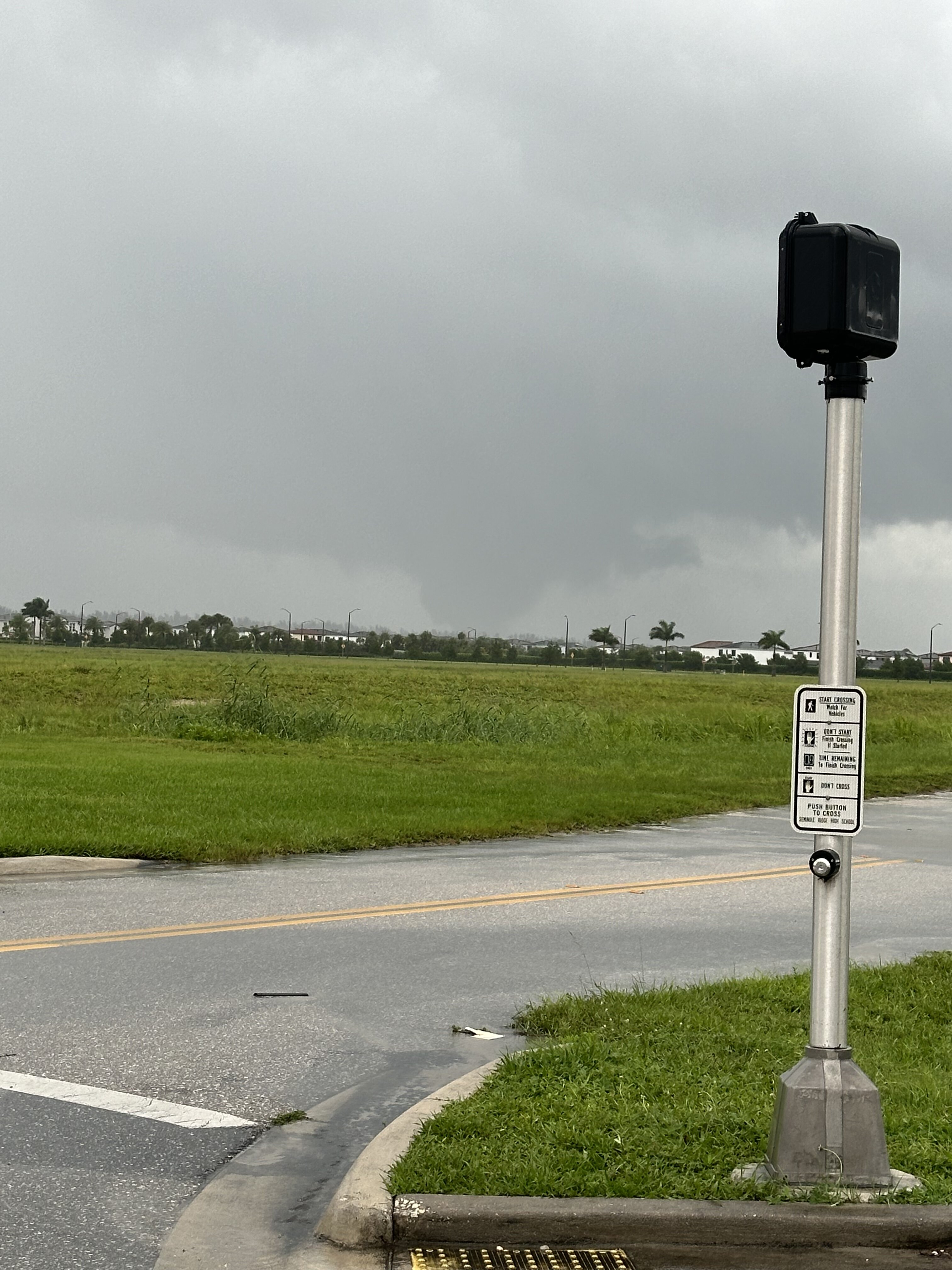
I am shocked Tropicana Field was used for staging when I heard that. I figured well if they are using it to stage the roof must be equip to handle winds up to a large magnitude but with those wind forecasts I was figuring that roof would blow off. Didn't hear anything of injuries (haven't checked though) but hopefully nobody was injured.
-
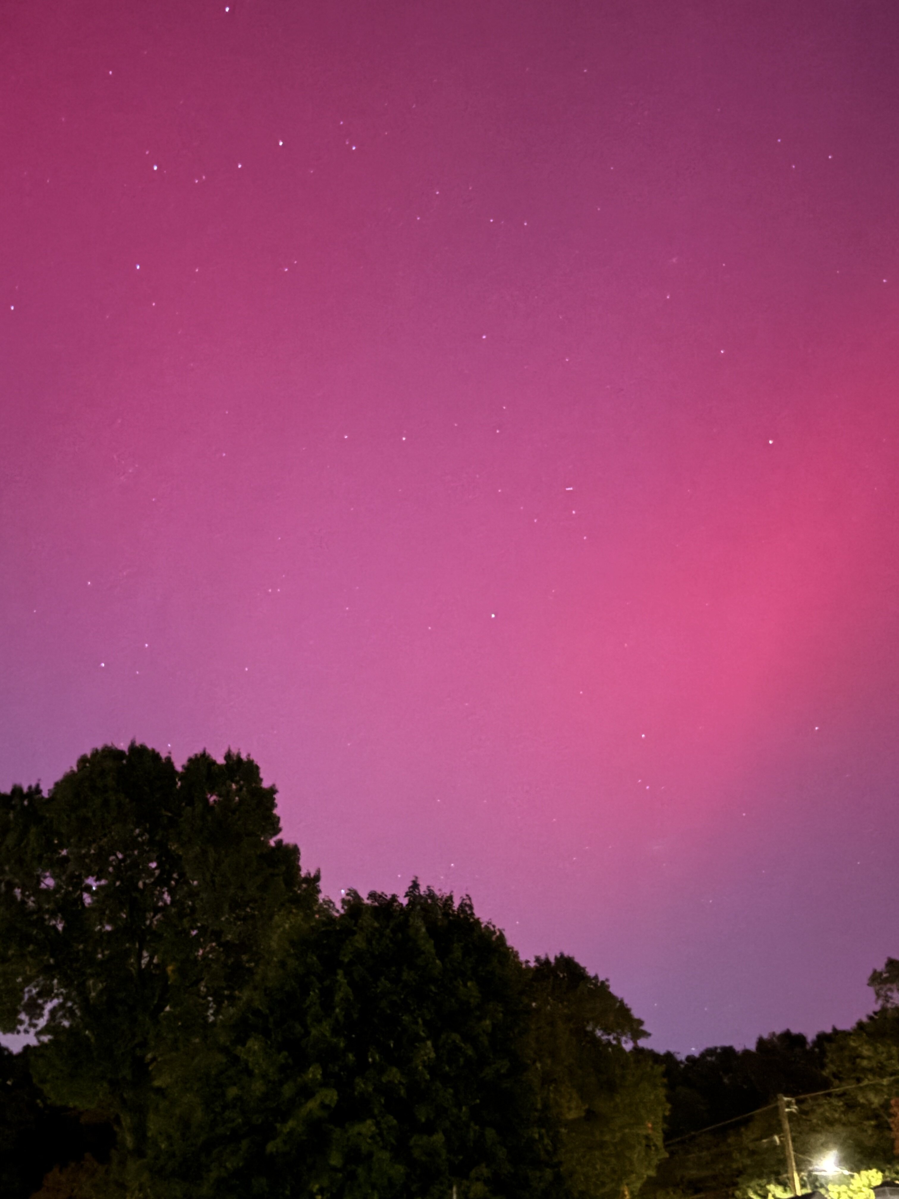
Was waiting for the flash flood emergency, looks like it came out
-
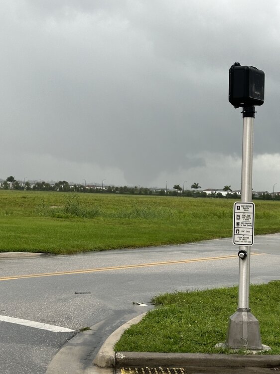
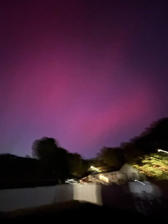
Another view of it from him