weatherwiz
-
Posts
79,820 -
Joined
-
Last visited
Content Type
Profiles
Blogs
Forums
American Weather
Media Demo
Store
Gallery
Everything posted by weatherwiz
-
It's getting its act together though. Seems on par on terms of development or organization, in fact may even be slightly ahead of forecasts.
-
I get what you're saying, makes sense. I guess with this, what we also need to throw out there is perspective and quantification. There are many different ways I guess we can quantify the season thus far. 1) The number of named storms has been a bit underwhelming comparted to history, especially during a period which was thought to be very favorable for the ATL (low shear, developing Nina). 2) Of the few storms, we had the absolute monster in Beryl - but how much does this skew things so far or is this a sign of what we could be looking at one/if activity ramps up? 3) You're point there in the bolded is something which I think all of us weather enthusiasts like to debate. We talk about this alot in the winter. What makes a winter memorable, is it one massive 2'+ blizzard or is it a bunch of 3-6'' events which add up?
-
Couldn't agree more.
-
I agree. Obviously we could get into September and all hell breaks loose, however, it just boggles my mind how so many people out there (professionals, amateurs) focus on one or two aspects and just go haywire with forecasts. You see it with every type of weather event and within seasonal forecasts. Severe - some will go absolutely wild because of hodographs winter - the 10:1/Kuchie maps...it's too early in the season to get me started on this crap. tropical - warm waters!!!!!!!!!!! winter seasonal - weak la nina...1995-1996 redux. But hype rules all I guess
-
Gonzalo as in this on is gonzo
-
It is definitely screwing with the model, however, in a negative way. Unless something wild were to happen, I can't see that vort being where the center develops or becoming the dominant feature. Those far western outliers should be removed really. Based on the trough progression, combined with where the ATL high is, this thing is going to re-curve sharply. However, there certainly is some room for maybe eastern Atlantic Canada to get some impact. Deviations in storm speed could increase or decrease the chance the trough capturing it and tugging it a bit back northwest.
-
Yup. One of these days those interesting members will be noteworthy but not with this one.
-
maybe we can blame the shitty Red Sox pitching on the solar max
-
I have no divulged too deep into the tropics but wasn't much of the forcing across the IO/WPAC? It's pretty wild that both the EPAC/ATL have both been super quiet. You would expect that to be more of the case in the EPAC with the developing Nina but to have BOTH basins quiet seems weird. Only recently didn't we get some forcing across the EPAC and we saw several systems brew up.
-
I know there have been and are some ensembles members looking "interesting" but this system never had a shot at sniffing the east coast. Just because a D11 model run shows a scenario of a storm moving up or into the coast does not mean it's a possible solution. The upper air pattern was never there for this. These troughs are a bit too progressive and the trough axis develop just a bit too far east.
-
Yup unfortunately the back is broken and we’re on the decline. Thankfully at least there is football, hockey, and basketball to look forward too.
-
It’s been super gusty here out ahead of it but about to roll here now. Guessing best winds probably out ahead of it
-
Only saw one warning so far
-
@Typhoon Tip’s Bahamas blues

-
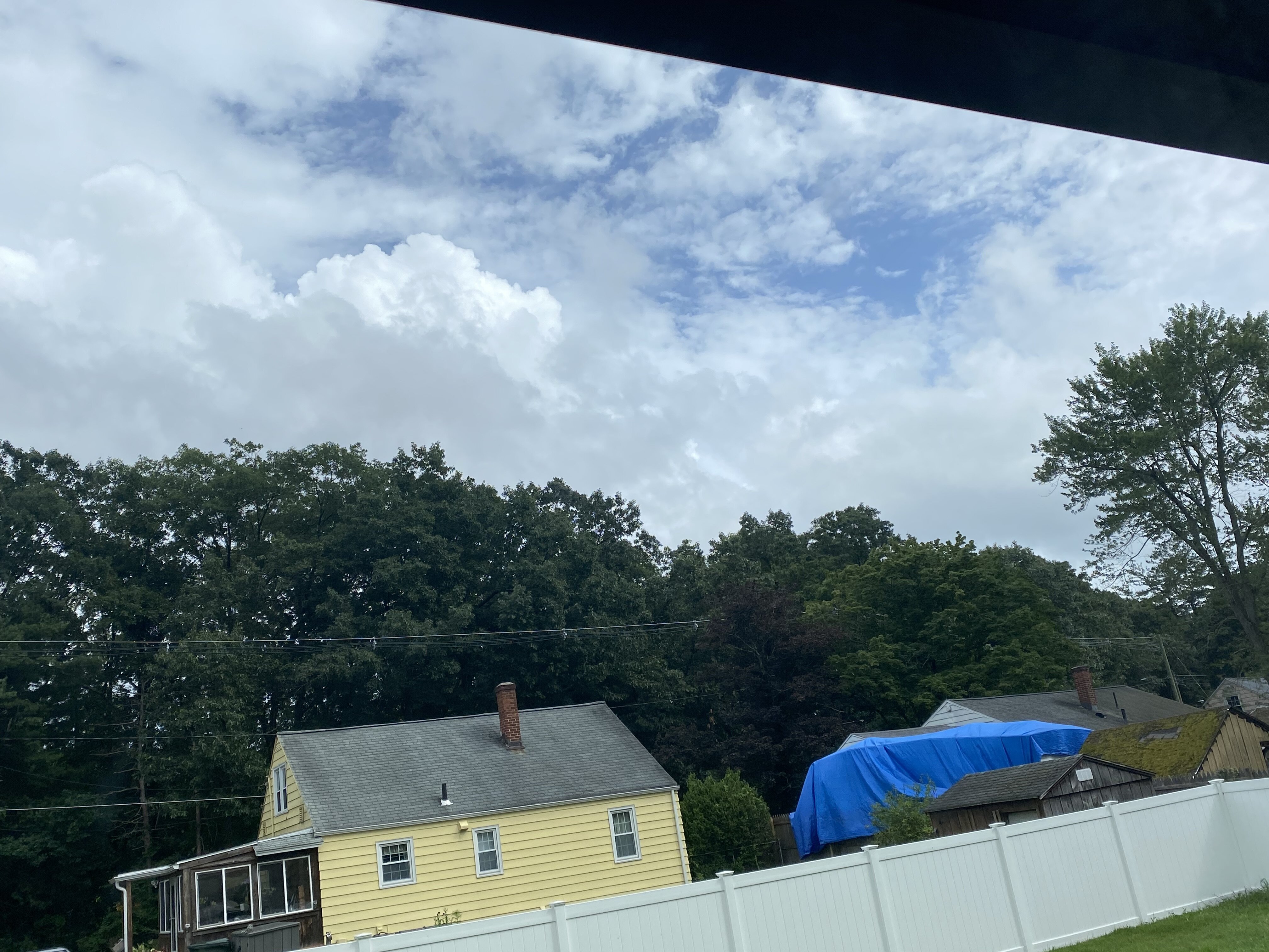
lightning strikes with the line in southeastern NY.
-
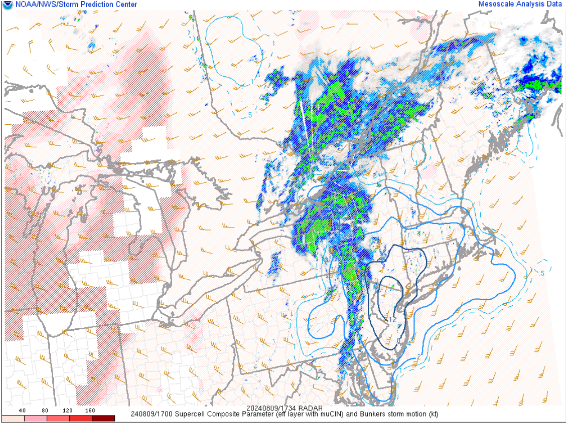
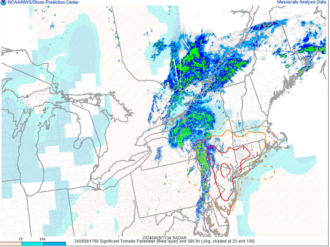
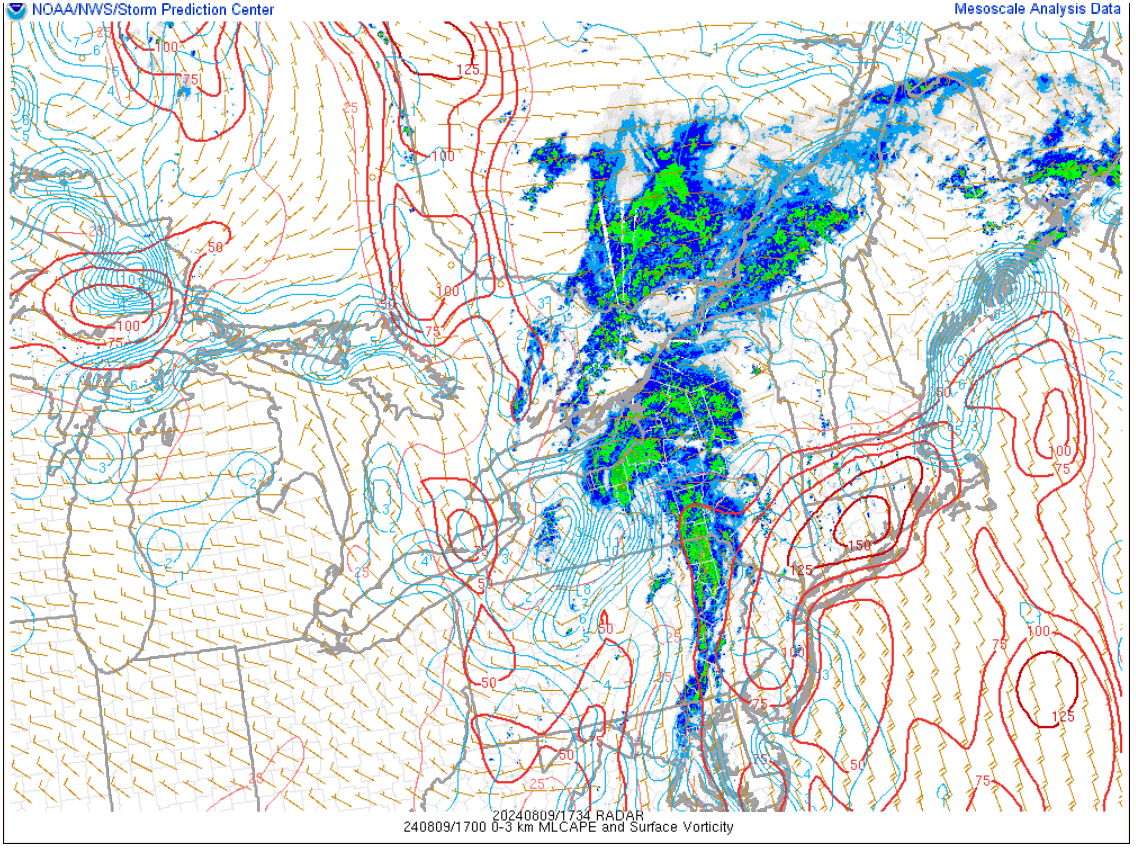
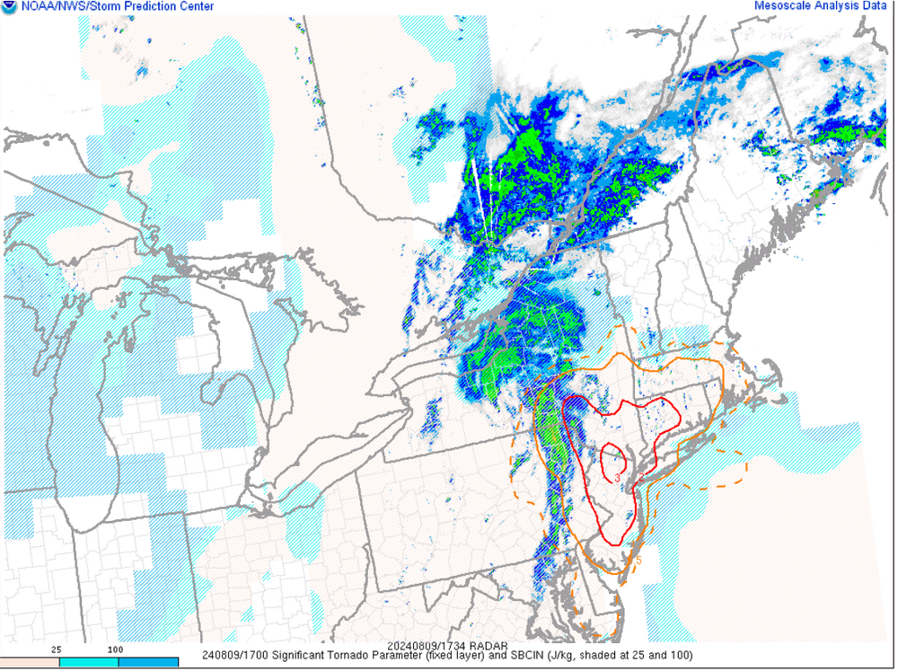
Don't see values like these too often here That's some beefy 3km CAPE. Again though, need a mature enough updraft to be able to utilize this

-
Everyone needs to clam down
-
ehhh can't really speculate as to what category at this juncture. Once you're starting to talk about the potential for a major hurricane there is the storm evolution processes which now get factored in and can play a significant influence on overall strength. I don't even feel comfortable saying "major hurricane" potential at this state, however, given what should be very favorable environmental conditions, it won't take much or long for this to really develop.
-
I could see this becoming a major hurricane. Might be something that gets its act going quickly once passing Puerto Rico and that area.
-
I can see some patches of Tips Bahama blues. And with some breaks of Sun it got very gusty all of a sudden
-
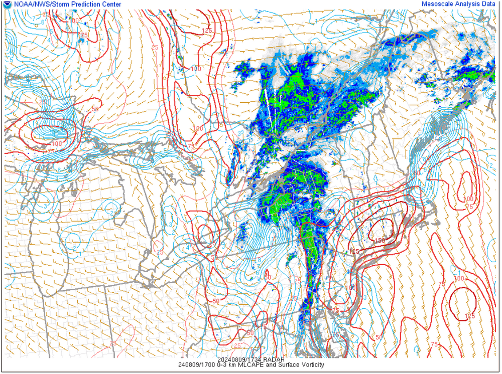
Would explain why mesos aren't very bullish in the open warm sector. Sometimes you see the HRRR go wild in these but for it not to be doing much may be telling.
-
meh not even worth worrying about potential track until a defined center actually forms and the models have something to go off besides a naked swirl with disorganized convection. While this has a decent shot of becoming a strong hurricane, where the center actually forms and how quickly it intensifies are going to influence latitude gains...check those boxes off then start worrying about track.
-
RAP mesoanalysis still indicating >100-125 J of 3km CAPE by early afternoon with 0-1km helicity >200 m2s2. Pretty noteworthy stuff. Just have to see if we can get any mature, sustained updrafts going.
-
-
They can pop up at about any time. Quick hitting, but torrential downpours.