weatherwiz
-
Posts
81,152 -
Joined
-
Last visited
Content Type
Profiles
Blogs
Forums
American Weather
Media Demo
Store
Gallery
Everything posted by weatherwiz
-
The communication definitely needs to involve and I think it just starts within the industry itself. The NWS relies heavily on local media and private sector to communication risks and to do so in a manner that is understandable to the public. For example, lets use the SPC Convective Outlook and probabilities...the public doesn't know what any of that means. So those on TV, in the media, private sector is going to communicate that information so the public can understand it. The second aspect of the communication is from the field to the public. One of my professors (who used to do TV as well) used to say something that really stuck with me. He really meant this more for TV (since that's what he did but I think it could apply all around). He would say when you're on TV you develop a following and an audience. People are watching you (the same people) day in and day out and are planning their days based on what you say. With that, the words you use...they start to develop meaning and people will start correlating those words. Certain words have strong meanings and if those words get overused, they start to lose their meaning and lose their impact. For example, if you say "oh wow it is going to be a beautiful day today". Beautiful is a strong word. But if you're using beautiful when its Sunny and say 50 and then again when its Sunny and 75 or Sunny and 85...that's a wide difference in how people would prepare. But if you save that word and use it for a specific say threshold...when you do use it...people will know right away what you mean. There is no guessing. Let's use a weather event. If you say, "we're looking at damaging winds of 50-60 mph today with downed trees, tree limbs, and power outages" that is a powerful statement, but what does that really mean? If that potential is something that is going to be more isolated or localized...that needs to be reinforced. But with these events that isn't being reinforced, so when the times come that we actually get something of that magnitude, people aren't going to be prepared because those words...that statement has lost meaning because every time that is said it's only localized impact. When communicating impactful weather events, whether its a more localized impact or widespread, that differences needs to be stressed.
-
Yup that was something which added into the coast for our neighbor. they were two huge pine trees and had to get some massive crane thing to cut the trees in segments from top down and then lift them onto a truck. They even had to close down a portion of the road to do it.
-
That type of wording is just not necessary. This is exactly why the public loses confidence in weather forecasting. Events that shouldn't be hyped up are being hyped up and events which should be "hyped" up aren't. We have had dozens upon dozens of these type of setups over the last several decades. Sure there will be some downed limbs here and there and some power outages but most people aren't seeing that. Save this type of wording for something that is extreme and dire. If you're using wording like that for the potential of 50-60 mph wind gusts what the hell is going to be used if we ever get a situation of widespread 80-90 mph wind gusts? Are we just going to end up evacuating the entire state? shutting everything down? Look at the past few winters, how many times 3-4 days out media is going bonkers with certain winter events and snow maps start flying and then as we get closer everyone is cutting back? Or last February...the winter storm watches to advisories only for more snow to fall than what was even being forecast. Or what about the August flooding? There have been countless weather events overplayed and then countless weather events which were underplayed and turned impactful. We just can't keep blaming models for that. How weather is communicated to the pubic needs to be worked on and there needs to be better training for those in public safety of how to respond and make decisions.
-
With the price nowadays to get trees cut...it's probably better to look for something without Our neighbor right now got two trees cut down I think it was last spring or the spring before...but he did it after that one ice event we got where a limb came down and damaged the fence. He said it was around $15,000-$18,000 to remove the two trees. Unfortunately though, we would be moving within the Valley. West Hartford is an area of discussion which I would love because I grew up there but the property taxes are disgusting.
-
My girlfriend and I are in the very beginning process of looking to buy a house. When she asked me what are some of the "musts" I am looking for in a house...my #1 response was "no trees around the perimeter of the house". There could be trees on the property but nothing that could fall onto the house.
-
I mean if there is a trend to start closing schools or dismiss school early for weather events, pretty soon nobody will be in school. If we're talking about the potential for a serious, life threatening event, then absolutely, close schools. I guess maybe it's hard to fully blame those making these decisions...they're making decisions based on what they're being presented and weather is flat out hyped. The other thing too with early dismissals is they're pointless. Just cancel the day. I remember in school when we were having an early dismissal, nobody was paying attention. Classes were shortened, teachers had to rush to get through material...nobody is winning in those situations. It's a disservice to the teachers and its a disservice to the students. I can't speak on the remote learning since I have zero experience with it (unless you want to count online classes ) but I feel like you have to be extremely disciplined to handle remote learning and how many middle/high school students fit that boat?
-
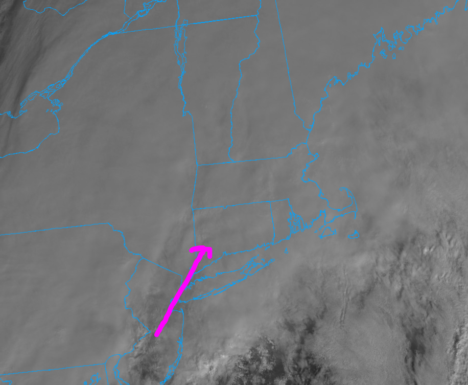
Kind of interesting but I wonder (at least across Connecticut) if there will be a 1-2 hour window upcoming where we get some breaks in the clouds...enough for some Sun to poke through and ramp up mixing. 925 winds about 40 knots but 50+ moving in.

-
Yeah I can't believe when I saw that. That is absolutely absurd. Who is coming up with these decisions? These people are becoming ridiculous and should not be holding the positions they do.
-
It's going to be interesting watching this unfold through the day. There are some interesting differences between the HRRR/NAMs (not even looking at clown maps). We may have just enough instability later on to have an increased likelihood for some widespread 45-50 mph gusts. Widespread 50+...that may be tough.
-
3km would be pretty wild today...even back to the CT River
-
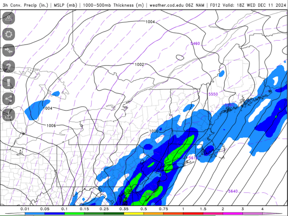
That should fill in over the next few hours as the dynamics increase. Now if we had a scenario of a dry slot when the LLJ was cranking...then we would be game for some big gusts. But I think it's going to be difficult to generate much in the way of bigger gusts today without the aid of convection. But we'll see the NAM does indicate a good deal of convective elements within the rain today so I suppose there will be some isolated higher gusts. Eastern areas though should watch for any line...mesos have a pretty solid looking line going which could produce some 50+ gusts out ahead of it as it moves east-northeast across far eastern Connecticut. Rhode Island, and eastern Mass later on.
-
Looks like the good gusts today will be Rhode Island and eastern Mass...maybe back into far eastern CT...shocker
-
wow...IIRC I think guidance had them in the mid 30's and rising this evening but what a bust.
-
Should be a good deal of convective precip tomorrow which should help in the gust department
-
Yeah you're right...just went and looked. I realized I never looked at 18z NAM. Even not much different than 12z run...just a little noise
-
Seems like quite the shift east with the main low on the NAM? Though not sure I want to say shift east...more so a more east develop of the low. Looks like it takes longer for the low to develop?
-

December 2024 - Best look to an early December pattern in many a year!
weatherwiz replied to FXWX's topic in New England
I just read the last 8 pages of this thread and have zero clue what I read. If someone were to test me on the last 8 pages and to write a few paragraphs detailing what I read, the only words I'd be able to muster are, "W.....T.....F" -
Going to be interesting around this window. HRRR generates just enough sfc based instability to warrant the potential for any convection to tap into these winds. I wouldn't be surprised if BDL got close to 50 knots tomorrow.
-
Definitely no argument with that. If we want to incorporate the CAA aspect that is certainly king
-
Ride the wind back home!
-
With sfc temps 60-62 and dews 58-59 there is going to be little issues with inversion.
-
Well just talking about *if* there is anything with a forced line. That would probably be OUR (not talking about eastern sections) BEST chance for maximum wind gust potential. I see tomorrow being windy due to sustained winds but we may struggle to get impressive gusts (above 40-45) because of how much rain there will be which stabilizes things. Just inland away from the immediate shoreline would do better.
-
Same thing with summer time squall lines...unless you have such an intense line that involves producing a microburst or macroburst or a derecho...the strongest winds are going to be either along the gust front or right at the onset of the heaviest rain. But because there is more instability to work with and stronger downward transfer of momentum you can fluctuate with some very strong gusts while as a setup like this you're more than likely to go calm quickly due to stability.
-
That's because even after all these years nobody can still seem to grasp the lines themselves don't produce big wind...it is always along the leading edge of the torrential rain. You get a massive gust of wind then a brief lull of quietness then it pours cats and buckets which quickly stabilizes the atmosphere.
-
Yeah...would probably have to go a bit inland...like interior southeast Mass? a bit away from the water. Looks like the 12z GFS did tick a few degrees warmer too...more in the 60-62F range versus 58-61F...subtle but could be a big difference maker. The other thing too with those eastern areas is they may be a bit more "unstable" with the heavier rain west. So they could get greater impact from that line as it moves east. Some decent signals the line could intensify as it progresses east.