weatherwiz
-
Posts
81,154 -
Joined
-
Last visited
Content Type
Profiles
Blogs
Forums
American Weather
Media Demo
Store
Gallery
Everything posted by weatherwiz
-
The uptick in school bus crashes seems alarming and yeah drivers are much worse. I have a friend who works for the DOT and is involved in research on the driving statistics and he said it's been alarming and scary since COVID, particularly with DUI's. People are much more aggressive trying to get around school buses or pass them and even blowing by them when they have the stop sign out. But bus drivers have some fault too, particularly on the highway. You can't have school busses on the highway going 40-50 mph, especially when they're changing lanes. There was a time when I would be driving down 91S and entering Hartford, if I caught it at a specific time, there would be two school busses merging onto the highway and getting over 3 lanes to catch the route 2 exit...it was scary because they're doing 30 and everyone else is doing 60-70.
-
yeah for sure. I know you and Will mentioned there would be some localized warning criteria reports but not enough to justify issuing a warning.
-
wow awesome! I always felt you were good for somewhere in the 3-6'' range but that is impressive.
-
The world would have to be ending for us to get school cancelled in West Hartford. We would mostly get late openings or early dismissals. Now if the Sun is too bright or its above 75 school closes for a week
-
wow are 3 hour delays somewhat new? I never remember a 3 hr delay, just 60 min, 90 min, and 2 hr.
-
nahh second most. the happiest are at Electric Blue
-
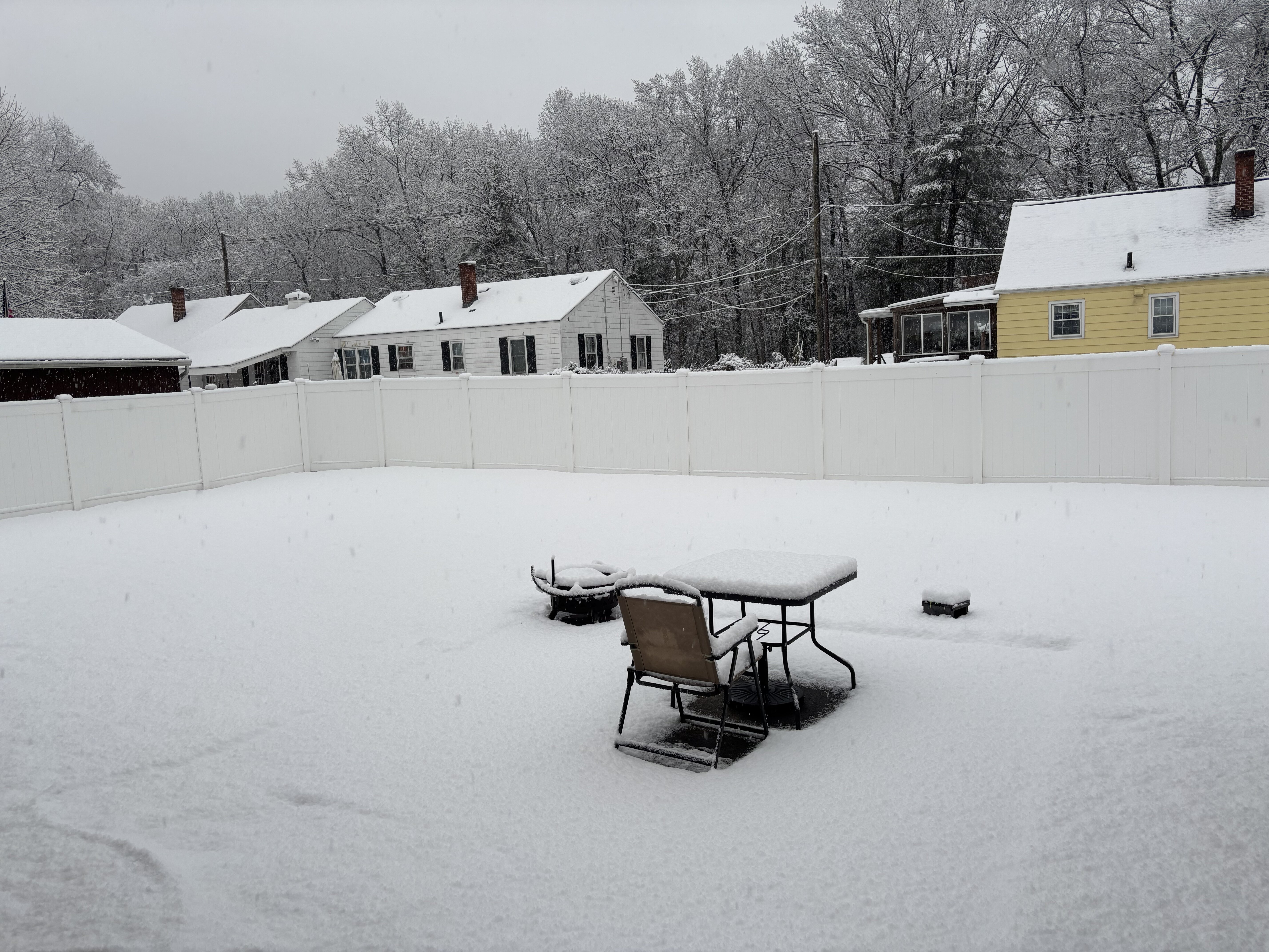
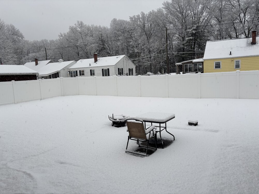
About 3.2-3.3” here!
-
Sweet!!!
-
Let’s try this https://imgur.com/a/Mo1WEQa
-
Downloading now. Going to take a video and try to post it. This better work
-
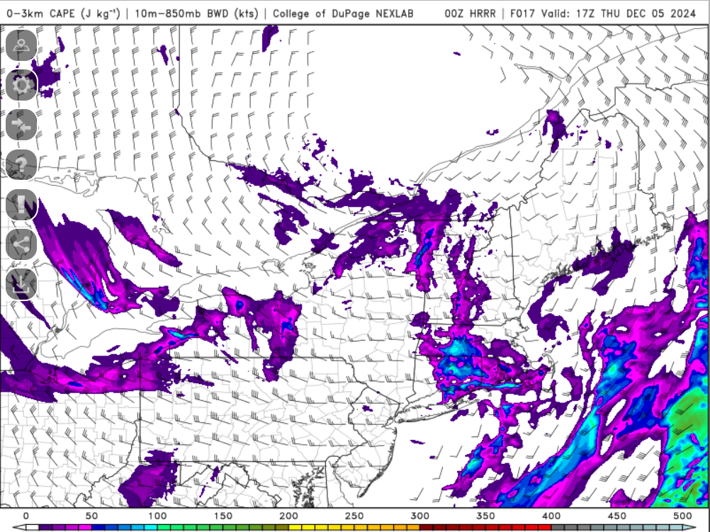
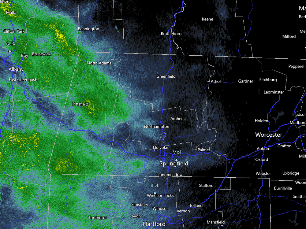
Must be all snow now...flake size is decent. Snowgrowth must be good now.
-
Too many reactions to click on...I am a little buzzed and can't control my mouse enough to click on the reaction I want...keeps moving off them and I have to hover back over the reactions to bring them up. Take me like 15 seconds to get on a reaction.
-
https://x.com/tollandkev/status/1864496301158683042?s=46
-
I've tried that and it didn't work. But I tried on mobile
-
I've tried what people had said and it didn't work for me.
-
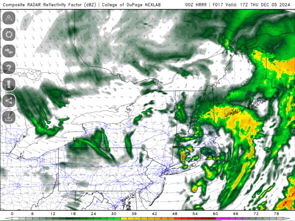
Just stepped outside...seems like it may be a rain/snow but probably like 90% snow if it is a rain/snow mix. Coming down decent...seems like the grassy surfaces may be starting to get some stickage but the pavement is just wet. See what happens over the next hour.
-
just looked out the window and coming down nicely here too. I'll go outside after the second period
-
Snow has started here...quite wet. Almost graupel like
-
If we get tornadoes with snow falling does that spin up Frosty the Snowman?

-
Time for an obs thread
-

December 2024 - Best look to an early December pattern in many a year!
weatherwiz replied to FXWX's topic in New England
Some pretty drastic differences between the GEFS and EPS for next week and what happens just after, especially with the degree and strength of the western ridge for the 120-156 hour window and some big differences after. While the pattern looks to become poop, you might be able to sneak some potential in...just have to time something right -
hmm odd indeed. I noticed my computer had updates available so I did an update/restart and it started working.
-
Should be getting into something soon
-
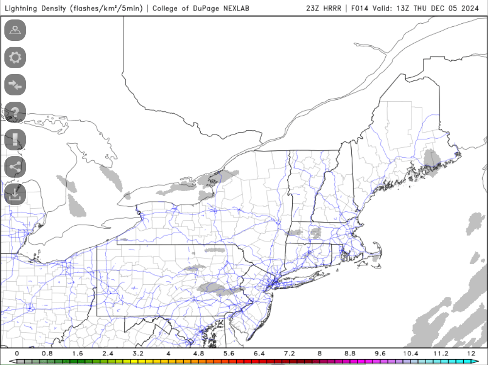
Maybe I can see a flash of lightning in the morning!

-
I wish mesoanalysis also plotted like 950mb or even 975mb.