weatherwiz
-
Posts
79,817 -
Joined
-
Last visited
Content Type
Profiles
Blogs
Forums
American Weather
Media Demo
Store
Gallery
Everything posted by weatherwiz
-
That's possible but I mean if the accuracy is because it had temperatures of 88-90 (which verified) versus 84-86 which other models had...I can't see that being a huge impact on the power grid. I would want to know more details though. For example, say google AI was showing a large area of high temperatures in the 105-110 range at D10 and the GFS was a bit more muted...100-105. What preparations would be made differently within the energy industry, for example? Now...if we're talking where this was showing widespread 100+ while other models were like 70-80 and this 100+ is verifying...now that is noteworthy and certainly something more groundbreaking.
-
Want to clarify...I was calling the claim garbage, not the model or the work into it. If a claim is going to be made that a weather event was nailed 10 days our or 15 days out...at least indicate the model held true to that solution for each run leading up to that day. If google AI had a category 3 hitting SNE at D15 and it ended up occurring...if between it showed solutions ranging from OTS or into the mid-Atlantic, or a weak storm...well you can't say it "nailed it". That's what I am calling garbage
-
So it has greater skill with 2m temperature, sea-level pressure, and wind? That isn't exactly mind blowing, IMO.
-
I do want to invest some time to find any published, peer-reviewed papers which provide highly detailed analysis but IMO, much of this stuff is hyped up. All you hear about is a success story and within these success stories they fail to tell you about the non-successes. For example, if 10 storms were tracked and analyzed and the model nailed 1 of the 10...the story will be ran on that 1 and you'll get a title like you see here, "AI Weather Model masters 15-day Forecast"...but there will be nothing on the other 9. AI will probably help drastically improve short-term forecasting during extreme weather events, such as the flooding event that occurred in Connecticut back in August but I don't buy it will ever become more accurate overall with increasing time stamps. Weather, physics, chemical processes are all way too complex and I'm sorry but AI is not going to ever figure that out because there is way more to this than just what happened historically. That atmosphere is extremely fluid and there are influences that we still don't know about or fully understand and a computer or algorithm isn't just going to magically figure that out. AI still struggles with generated images of people and objects...so we're to expect it will figure out the atmosphere?
-
I find this to be nothing but voodoo and actually its kind of gross because there are people being taken advantage of for this type of stuff, particularly if they're paying a great deal of money. There have been a few articles on the "success" of these AI models. For example, that one tropical system last year that went into NS and there was the article that said the google AI nailed that 10 days out.... Well what do they mean by nailing something 10 or 15 days out? That what the product showed for D10 and D15 verified? But how did it do on D14, 13, 12, 11, ..., 3,2,1? Was it extremely consistent or did it waver back-and-forth and have a million different solutions? If that is the case then GARBAGE. That's no different than what models currently do. The idea of being able to process data much more quickly is phenomenal but if I understand correctly, these AI models are not run with equations and physics...it just looks for pattern similarities. I mean pattern recognition is great but humans can do that too and while the weather pattern is important its how the pieces move and evolve which is more important and there is zero chance in hell AI will ever figure that out because this goes beyond "patterns".
-

December 2024 - Best look to an early December pattern in many a year!
weatherwiz replied to FXWX's topic in New England
Probably going to see some type of wintry mess for NNE Monday. Someone will end up getting smoked -
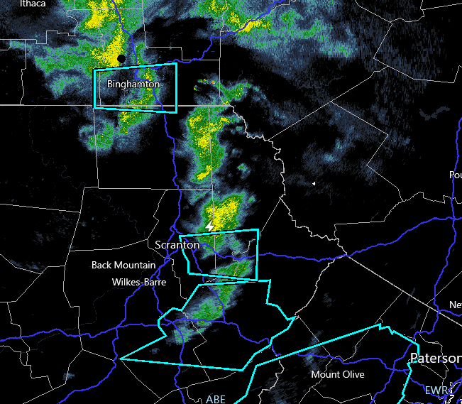
Still looks like we see some isolated snow squalls this afternoon...HRRR does get some decent 3km CAPE so certainly can't rule something out! Coverage though seems to be a big question.
-
December 2024 - Best look to an early December pattern in many a year!
weatherwiz replied to FXWX's topic in New England
was just coming to post that -
Sun coming out here...bye-bye sno. And holy crap did it melt off the trees quickly. I swear the trees were still caked like 20 minutes ago.
-
A lot of this stuff is below the radar beams. Probably best to use satellite and look at cloud tops.
-
Lightning!!! I knew there would be lightning today
-
The uptick in school bus crashes seems alarming and yeah drivers are much worse. I have a friend who works for the DOT and is involved in research on the driving statistics and he said it's been alarming and scary since COVID, particularly with DUI's. People are much more aggressive trying to get around school buses or pass them and even blowing by them when they have the stop sign out. But bus drivers have some fault too, particularly on the highway. You can't have school busses on the highway going 40-50 mph, especially when they're changing lanes. There was a time when I would be driving down 91S and entering Hartford, if I caught it at a specific time, there would be two school busses merging onto the highway and getting over 3 lanes to catch the route 2 exit...it was scary because they're doing 30 and everyone else is doing 60-70.
-
yeah for sure. I know you and Will mentioned there would be some localized warning criteria reports but not enough to justify issuing a warning.
-
wow awesome! I always felt you were good for somewhere in the 3-6'' range but that is impressive.
-
The world would have to be ending for us to get school cancelled in West Hartford. We would mostly get late openings or early dismissals. Now if the Sun is too bright or its above 75 school closes for a week
-
wow are 3 hour delays somewhat new? I never remember a 3 hr delay, just 60 min, 90 min, and 2 hr.
-
nahh second most. the happiest are at Electric Blue
-
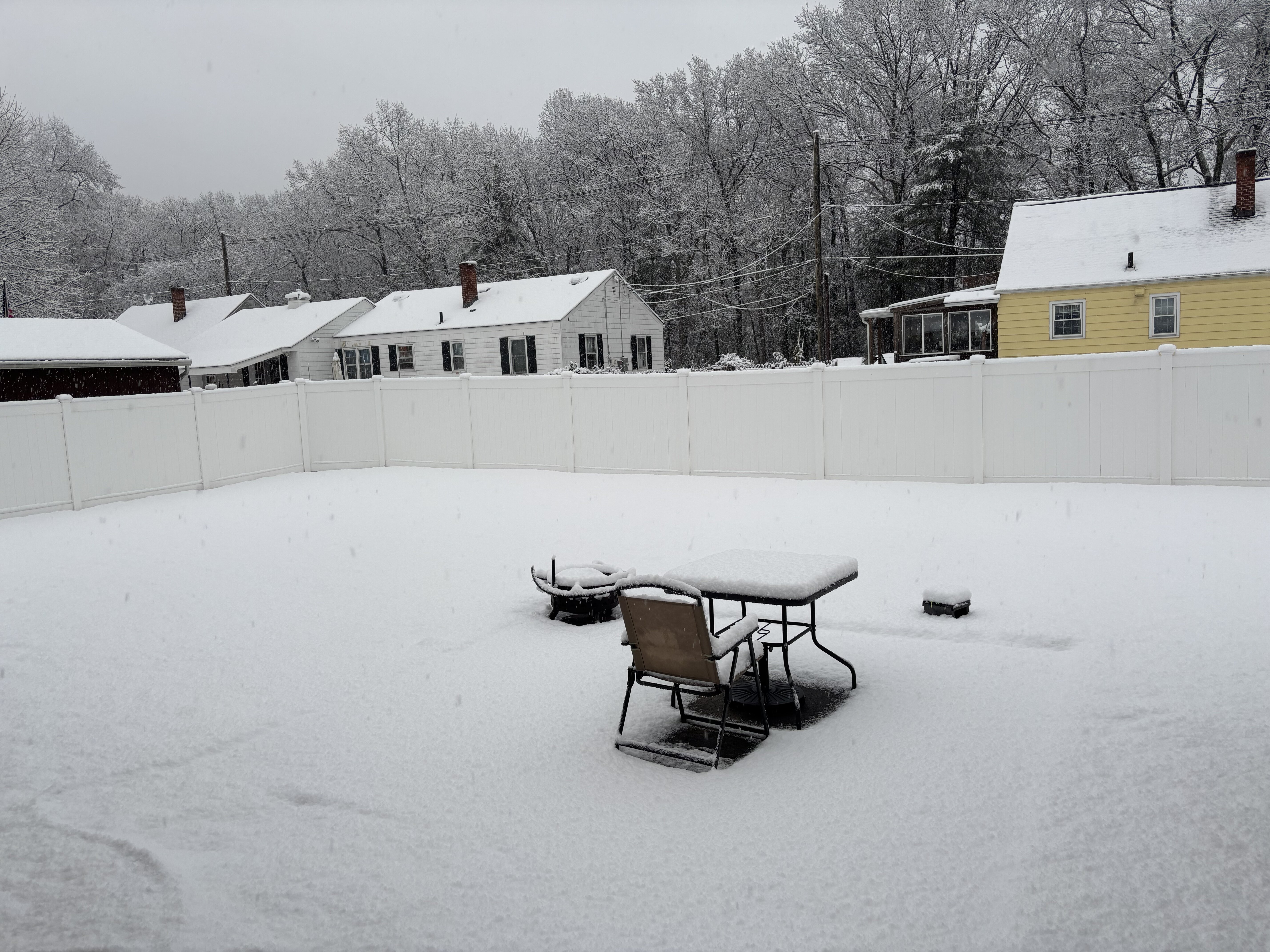
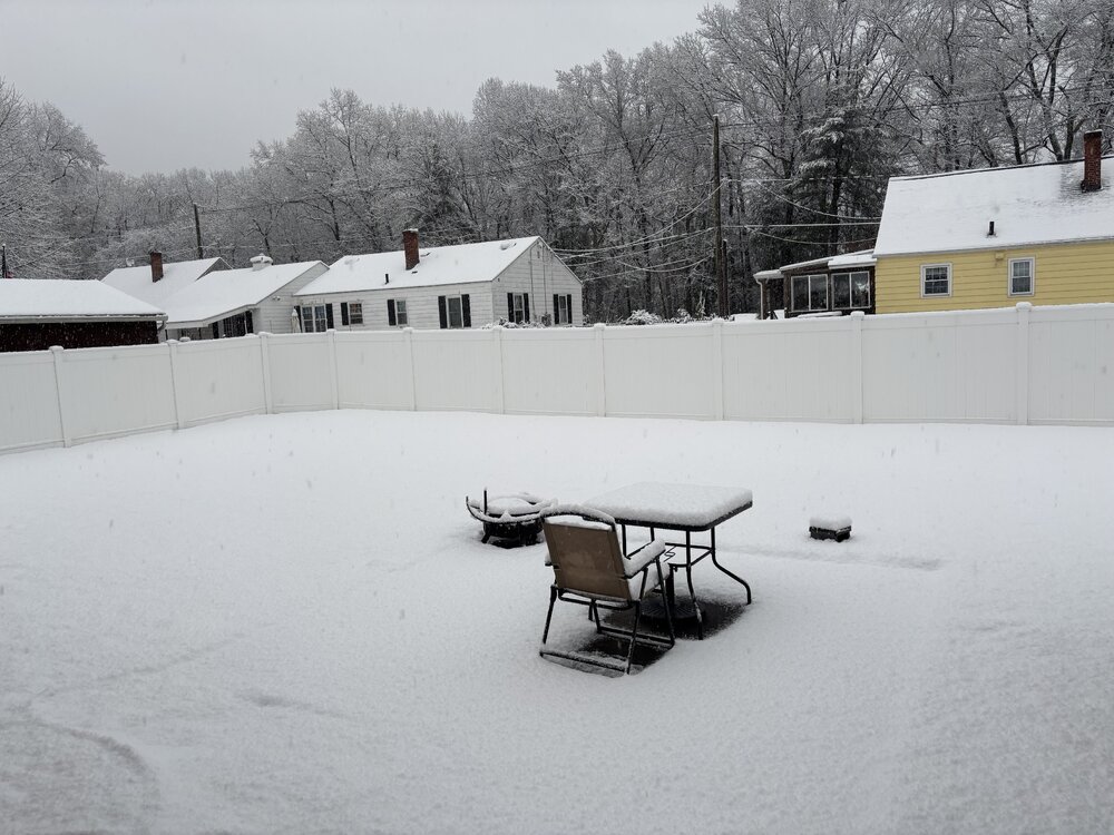
About 3.2-3.3” here!
-
Sweet!!!
-
Let’s try this https://imgur.com/a/Mo1WEQa
-
Downloading now. Going to take a video and try to post it. This better work
-
Must be all snow now...flake size is decent. Snowgrowth must be good now.
-
Too many reactions to click on...I am a little buzzed and can't control my mouse enough to click on the reaction I want...keeps moving off them and I have to hover back over the reactions to bring them up. Take me like 15 seconds to get on a reaction.
-
https://x.com/tollandkev/status/1864496301158683042?s=46
-
I've tried that and it didn't work. But I tried on mobile