weatherwiz
-
Posts
81,150 -
Joined
-
Last visited
Content Type
Profiles
Blogs
Forums
American Weather
Media Demo
Store
Gallery
Everything posted by weatherwiz
-
That may be a product of 1) As its moving away from the Albany radar the entire storm is being sampled better 2) It's in the process of strengthening but it doesn't look like the reds/greens are rotating around...look to be more divergent like. But it is moving into some better llvl shear so do have to watch
-
I think that is more straight line versus rotation
-
that's a pretty good divergent wind signal there
-
Yeah thunderstorms here definitely don't have the lighting production they do out in the Plains or even Southwest when they get them. That's certainly a product of warm mlvls.
-
we'll see what happens a bit East...storms went up in a weaker instability encirovnment
-
ahh...well must have felt good!
-
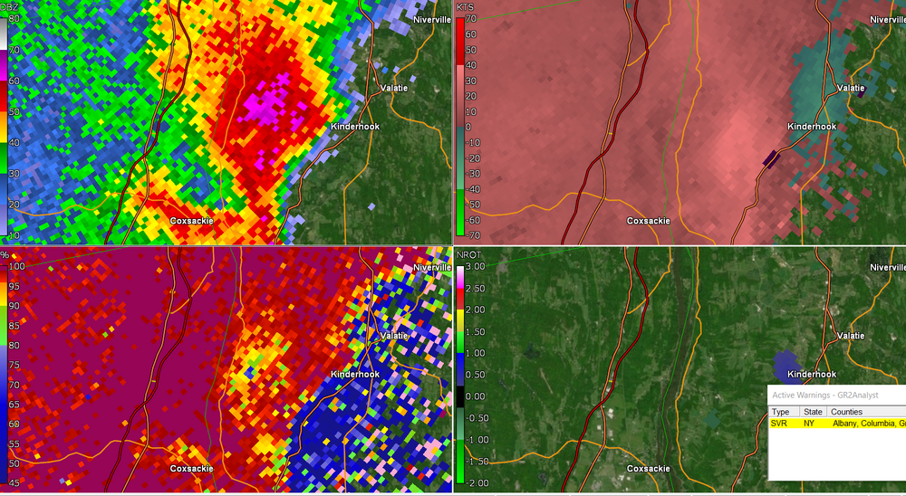
That low area of CC is moving along with that core and where there is weak rotation
-
You may have to just cover for someone on a day we have a risk so you can do it
-
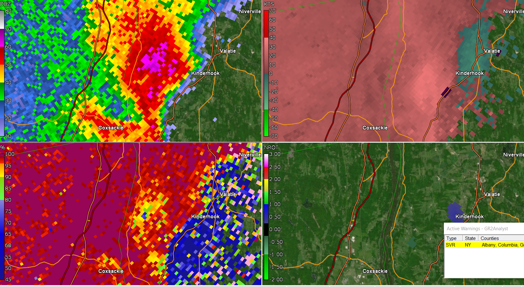
Nice hail core west of Kinderhook. 70dbz to over 10k on Albany radar...unfortunately storm probably not being sampled fully either. Actually is that a TDS too??
-
Just got the watch notification!!! This is why May 1st is called the start of severe weather season. So anyone who weenied that before take your weenie back
-
that little cluster headed for Pittsfield is going to be a good wind producer
-
The llvl flow is backed enough to where there could be a tornado is any cell remains discrete and can become mature enough. Dews are a bit low so LCL's are sky high so that will probably hinder this a bit but its something to watch for
-
They do in the desert
-
Should be, we're maximizing heating which is always critical when dealing with lower dews/marginal lapse rates. llvl lapse rates are quite steep from the heating and even 2-6km lapse rates getting at/above 7 C/KM...good indicator there should be some localized damaging wind gusts today.
-
have to start small
-
Been a decent start locally in the thunderstorm department. Had a nice one the other night around 3:00 AM and then there was one a few weeks back like 10-11 PM which had good thunder/lightning. Would like to see some branches come down with some hail today though
-
mlvl lapse rates look to "steepen" some through the day.
-
SEVERE THUNDERSTORM WATCH COMING!!!
-
GWDLT
-
Should be some decent storms though...won't have to go far today!
-
yeah that's probably about accurate...probably closer to the 5 window than the 7 though. Stuff probably starts firing 3-4 PM
-
also wish mlvl lapse rates were steeper but that's the theme for here
-
I will be staying up the rest of the night
-
Friend of mine said fishing spider
-
I was afraid of the T word. Oh God if those are running in the wild up here…