weatherwiz
-
Posts
81,150 -
Joined
-
Last visited
Content Type
Profiles
Blogs
Forums
American Weather
Media Demo
Store
Gallery
Everything posted by weatherwiz
-
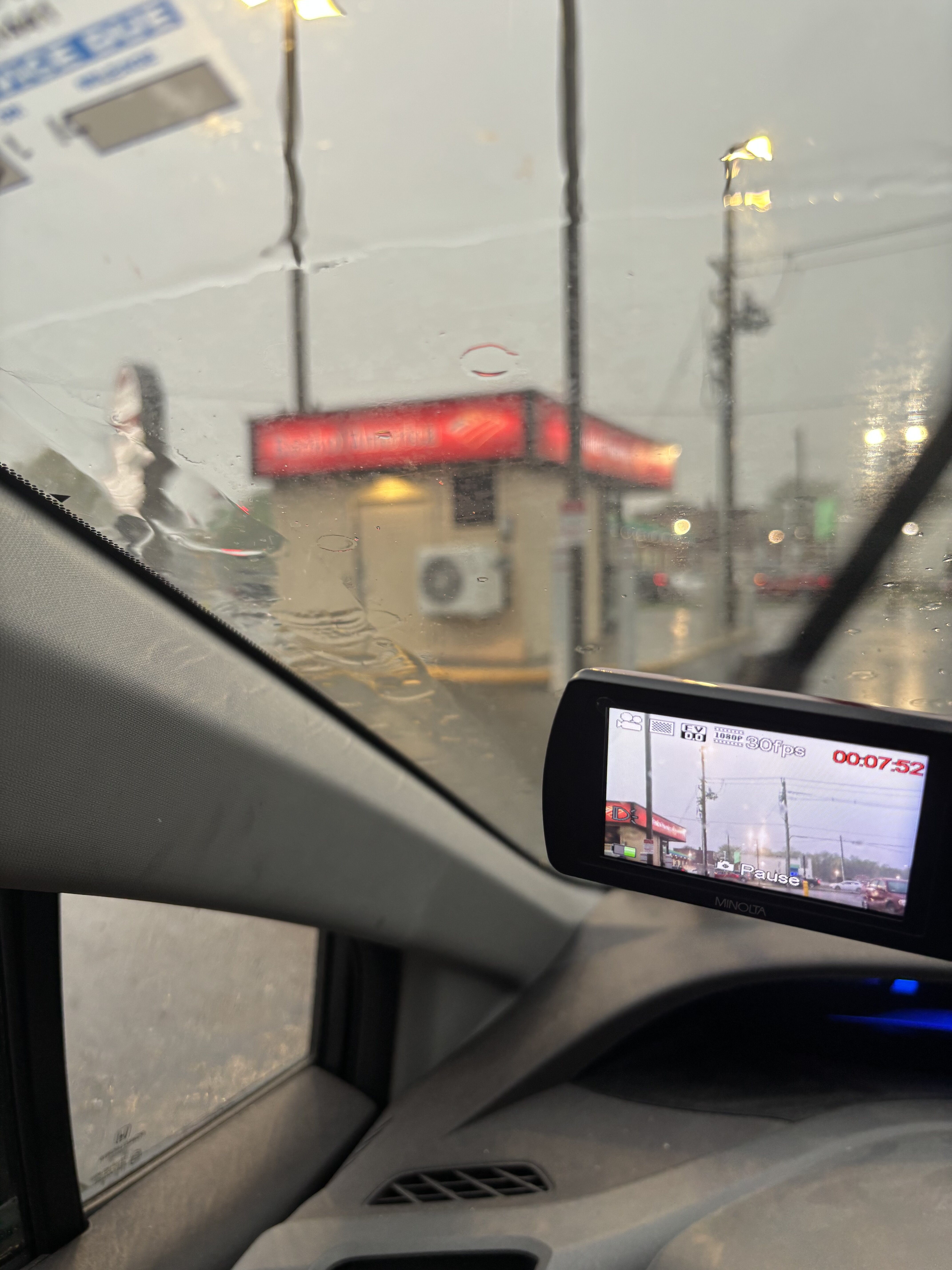
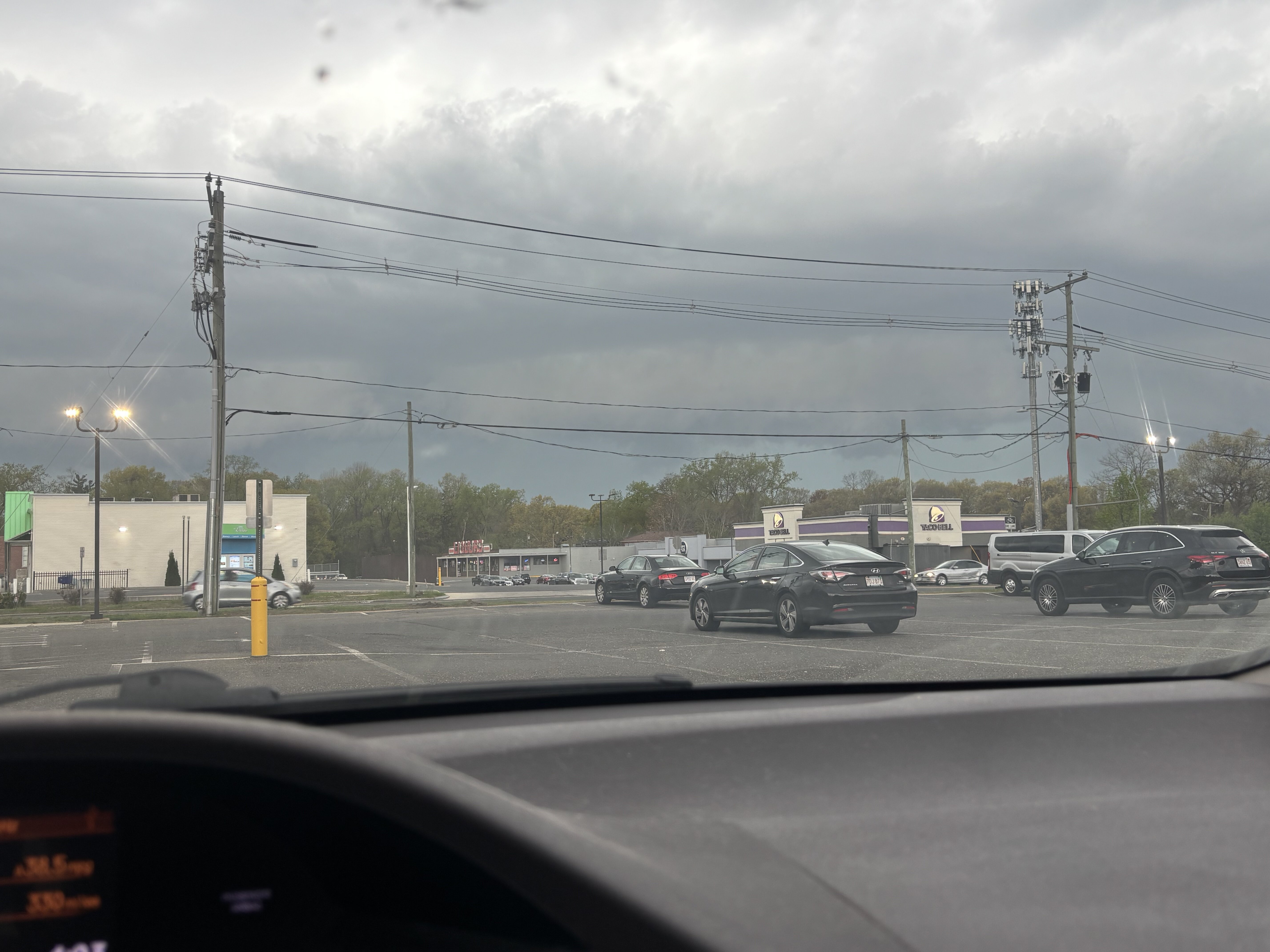
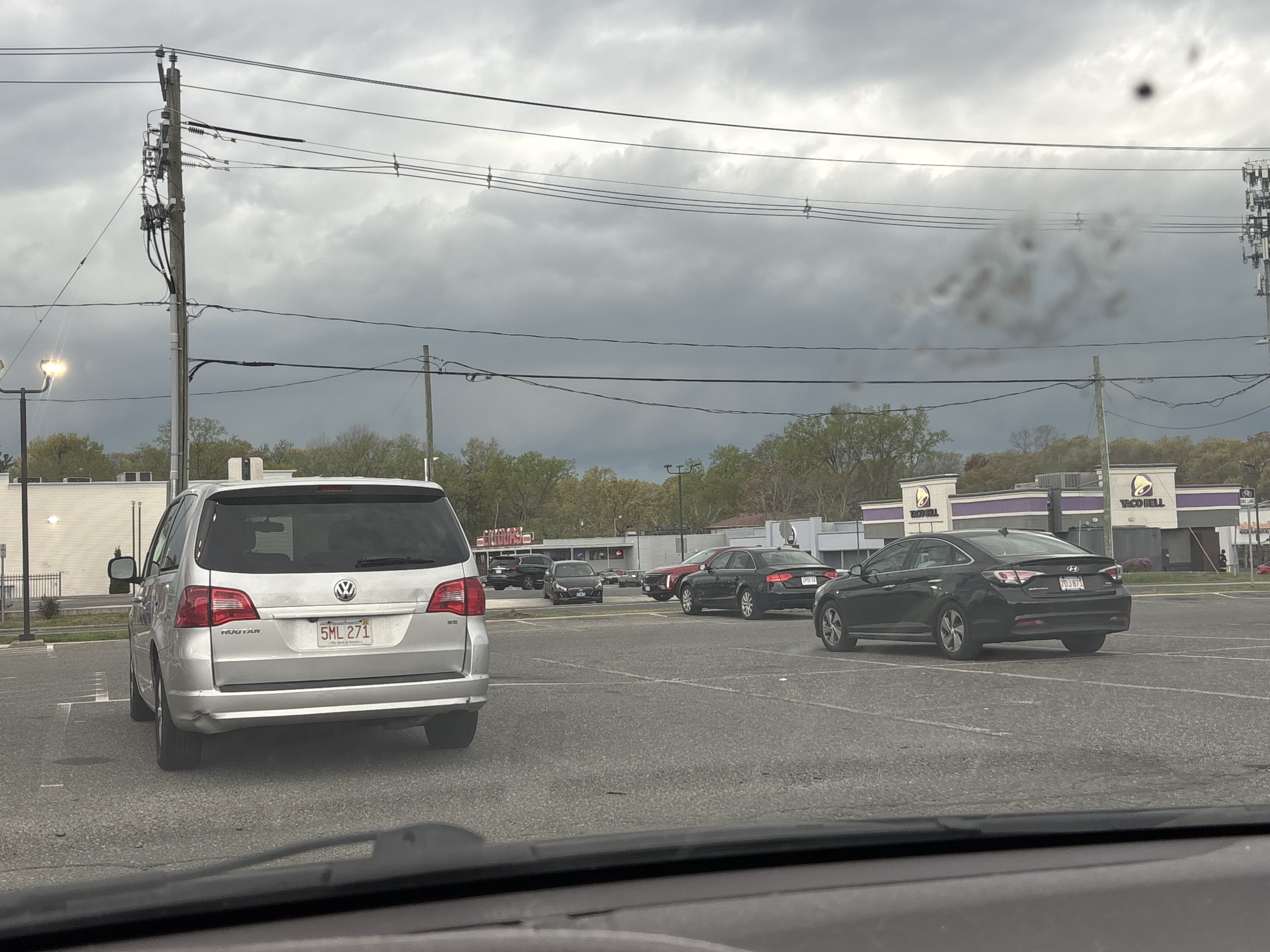
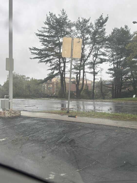
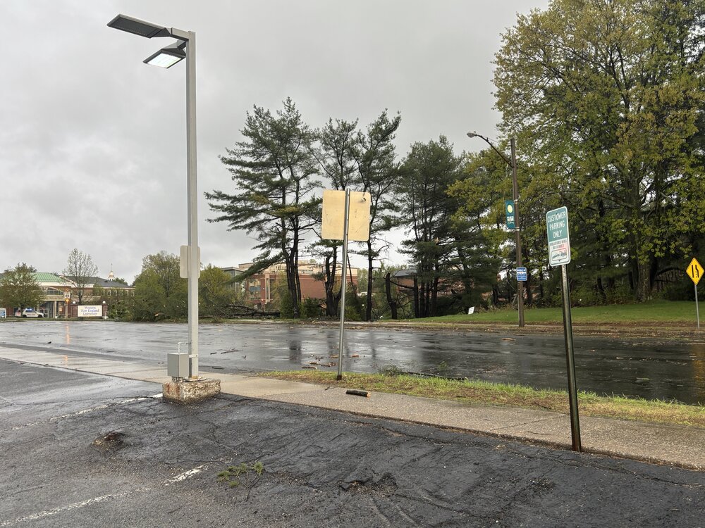
This is right next to me, just a bit behind me so I didn’t see it
-
Damage…and right next to me
-
EMS/police out now…wonder if something happened. Going to check around once rain stops
-
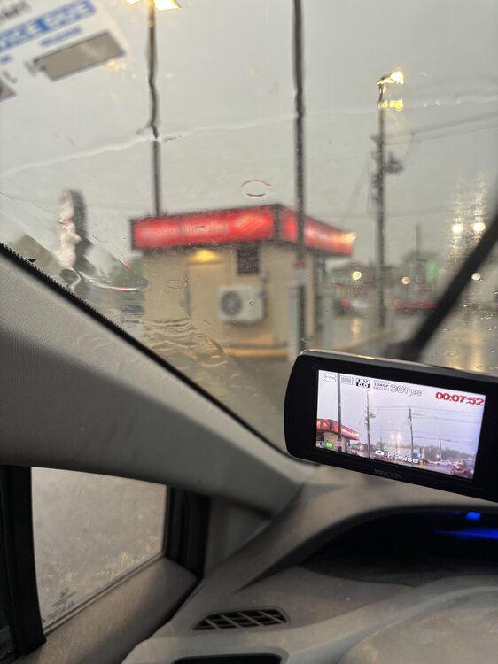
I’m shaking in excitement right now…I’ve never seen anything like that. I thought it was going to pass across my car. It came from behind the Bank of America. I look and there is this massive swirling brown and the lights were flickering and the wind went crazy. I thought the pine trees were going to snap.
-
I am pretty sure I got it on video. I will post when I get home. My heart is racing. It went right next to me.
-
Springfield. The lights were flickering and I’m looking in front of me and there was this rotating column coming across the street and it came with an insane busty of wind. Went dead quiet behind it. I think it was a gustnado
-
Holy shit that was insanee
-
I tornado just went across the parking lot…
-
Weak rotation over south Hadley
-
Come to papa
-
I can see a shelf arriving!!!!!!
-
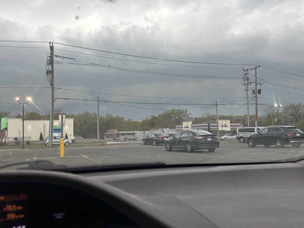
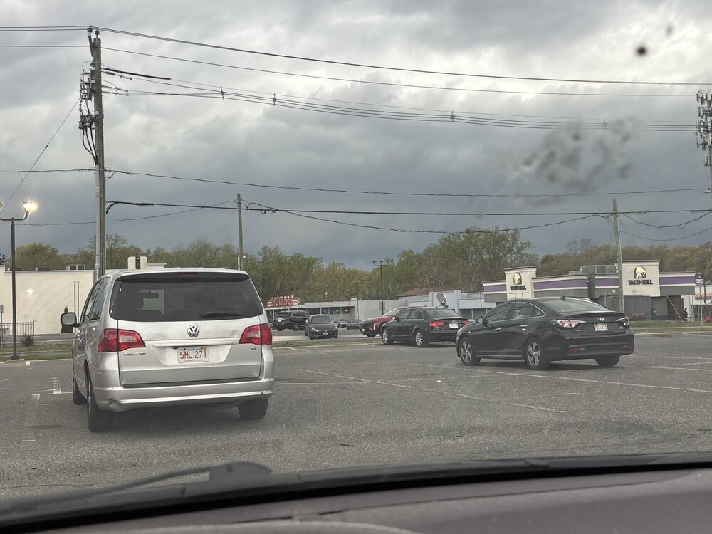
Got to the parking lot just up the road. Thankfully it’s only a 3 minute drive. Got here and realized I forgot my camcorder and had to go back home
-
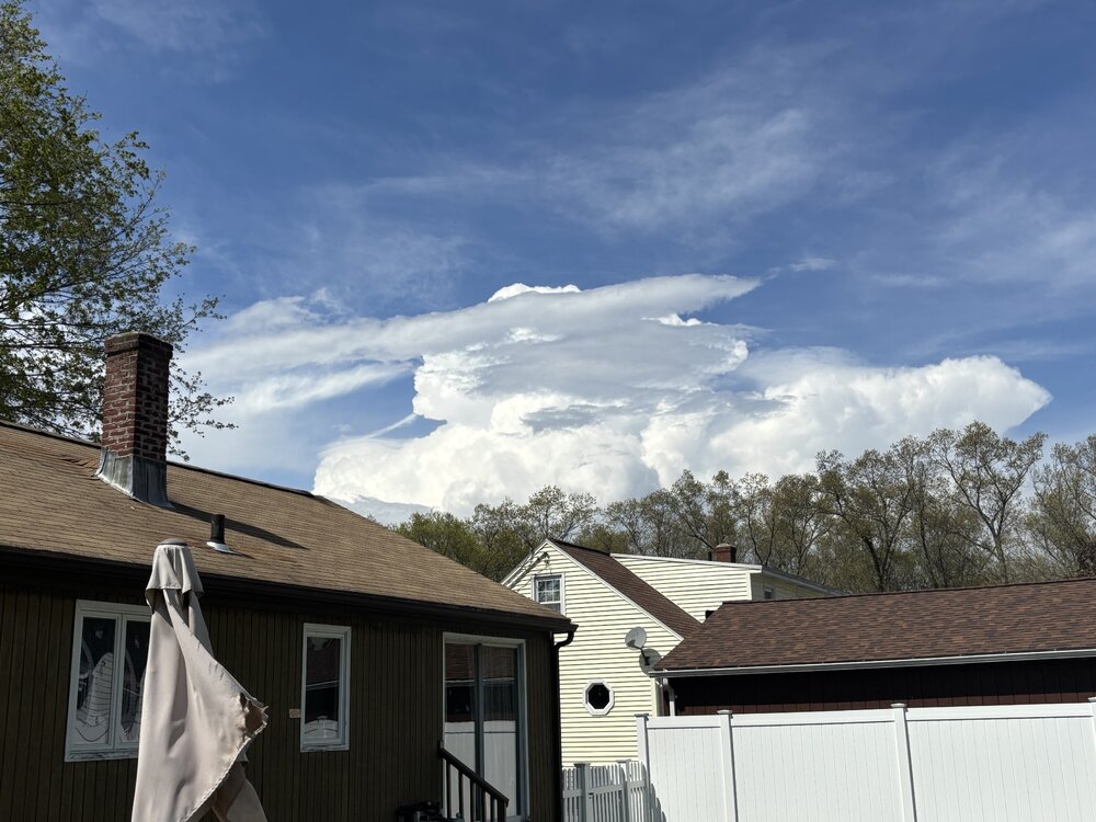
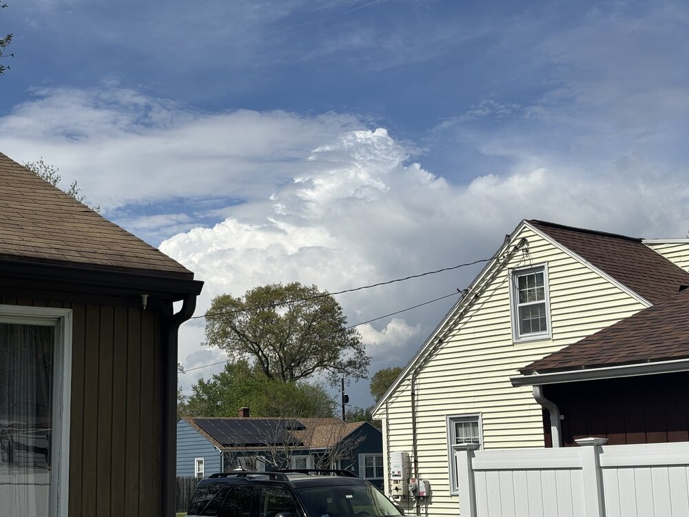
What a beautiful
-
oh man I forgot to look at the 3km this morning. Just looked now...usually that model is about as tame as tame as can be with convection (and is usually right lol). I wish I looked earlier...for it to show what they did would have netted confidence even more.
-
shear continuing to slightly increase too
-
Looking northwest
-
glad a good chunk so far is going to my northwest. skill basking in sun here. watching the southern edge of that stuff..that is going to swing through here later. I'm only going to have to go up the road to a parking lot.
-
56 mph wind gusts south of Pittsfield when that stuff came through
-
Cannan is solid for views...I think they are likely mostly farm land? It smells of poop
-
Probably Great Barrington...only issue is I don't think there are a ton of good viewing spots...I've gone there a few times before but they are a magnet for big storms
-
That has to be dropping close to quarters over Windsor
-
Nice hook on that cell now east of Pittsfield
-
I wish dews were even 4-5F higher in the Hartford-Springfield corridor. That cluster in southeast New York would be prime to take off. We are also increasing mlvl winds and ulvl divergence so that will compensate a bit.
-
probably also a ton of tree buds flying around. Trees going to look like winter again when all said and done
-
interesting...looks to be going in different directions too...was right to left across the camera then left to right...but could just be the storm rolling through with a Wind shift