weatherwiz
-
Posts
81,150 -
Joined
-
Last visited
Content Type
Profiles
Blogs
Forums
American Weather
Media Demo
Store
Gallery
Everything posted by weatherwiz
-
And that's a scary thought.
-
Not looking likely. Continues to look like the Arctic/PNA domains are going to play a heavy influence at least into the first week of June. Maybe not so much the NAO or AO but I would have think some of the daily PNA values have to be nearing top 5 for the upcoming period. Going to be tough to get a really hot summer here, if for any reason we don't even look to be building any sustained or early heat in the southwest. There's been fluxes of some big early season heat in the Southwest into Texas but not sustaining.
-
doesn't feel like it with thick overcast and a stiff breeze.
-
It’s so chilly out this blows
-
I wouldn’t be fretting about temperatures this far out. If we end up with more clouds/precip the most extreme of the cool anomalies will verify, if we end up with less precip and sneak in sun then we end up probably within a few degrees of average (solely talking daytime temps here)
-
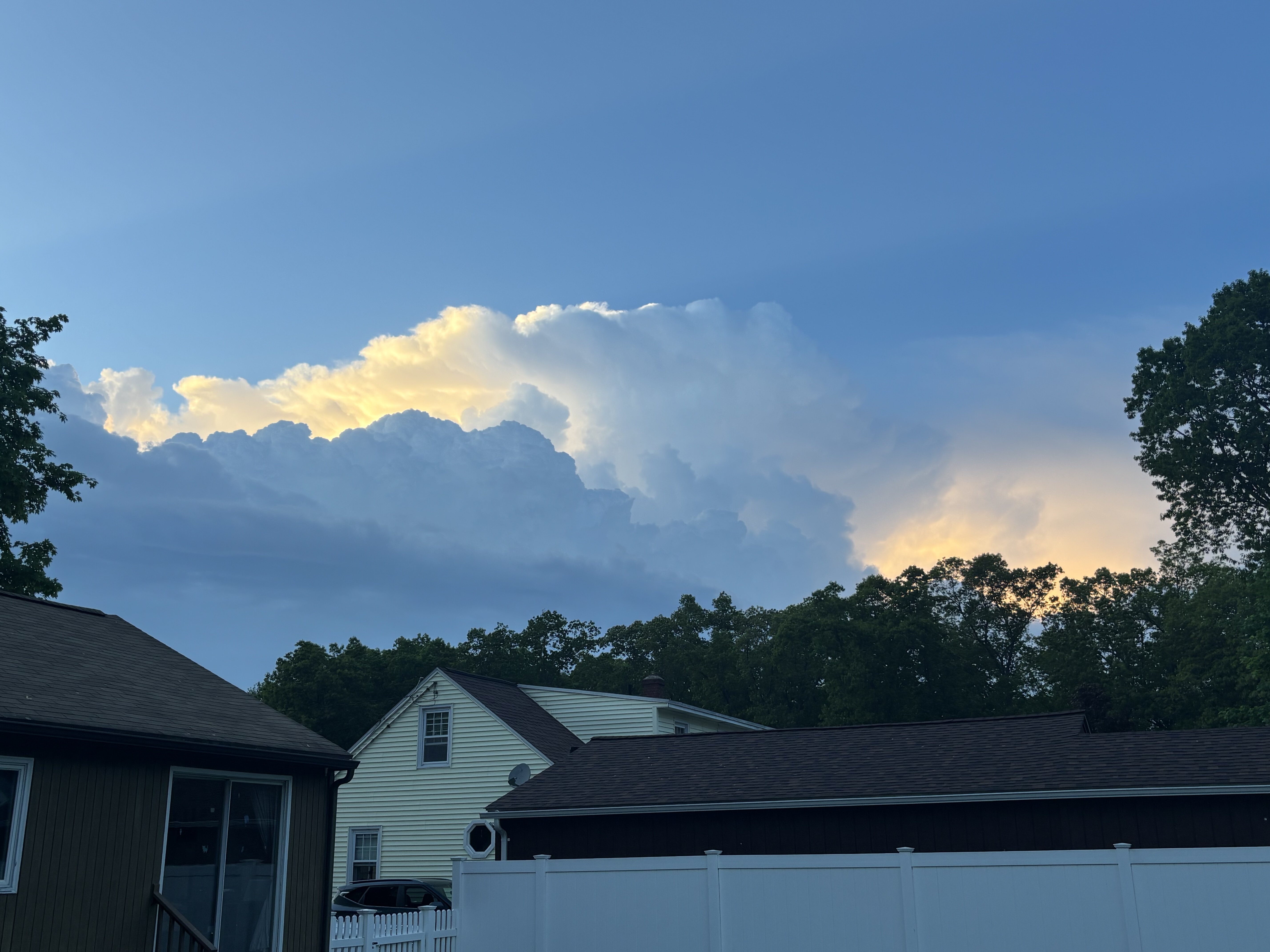
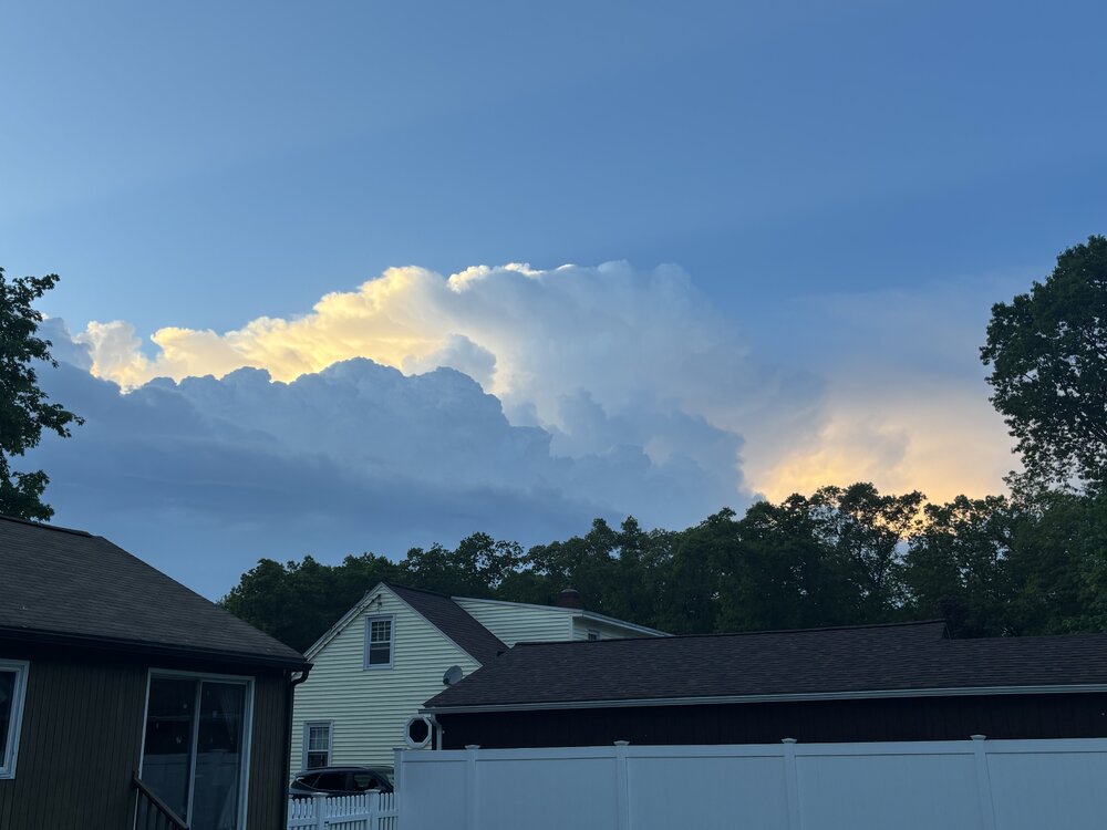
Nice view of the storms to the north
-
Are you going to the game in Dallas?
-
58 knots KDTO
-
Range folding going on. That’s a tough spot though for rotation from the radar sites
-
Eh I broke the rule of not animating…looks more like straight line wind signal
-
Have to watch that, some decent rotation
-
Yup that will probably be the best/only cell really this far east.
-
Nasty cell east of pittsfield
-
Nice looking hook near Schenectady
-
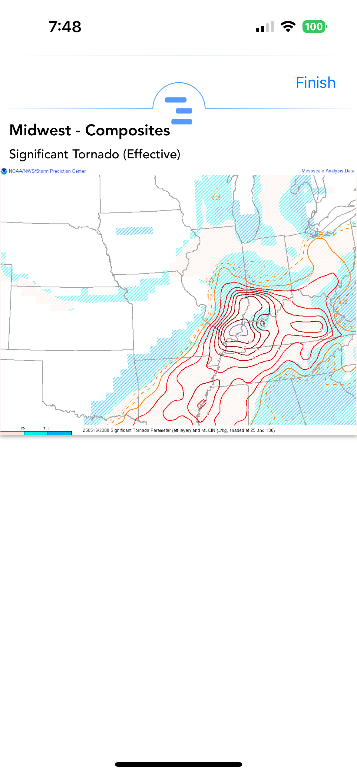
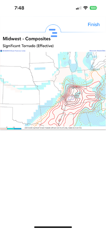
From the temperature profile (which this is also apparent by how poor the 700-500 lapse rates are) convection would really struggle in that environment. The llvl turning is nice but not a ton of speed shear there in the lowest 3km or really through the column...winds aren't really increasing with height. Could see some gusty winds in that environment with the dewpoint depression/inverted-v look
-
Yeah this is more central/northern New England today. Best forcing too late for southern areas. Those mlvl lapse rates hang on a few more hours today and there could be some nasty storms up north.
-
Correct, discrete cells is where you can get violent, long tracked tornadoes in these setups. Those cells are in a prime environment. Going to be an ugly few hours
-
This is insane
-
IND 65 knots!!!!
-
I couldn't imagine being in any of those buildings on the higher floors and seeing that. I think I would literally start jumping floors and not even running down the stairs
-
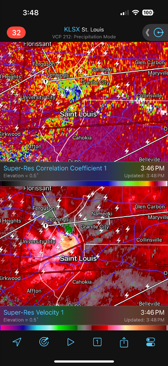
ummm I certainly hope that's a rain shaft unfortunately it isn't
-
Gotta be close to tornado emergency call there...if that gets any stronger that may happen
-
Nice KSTL 161938Z COR 22032G47KT 1/4SM R30R/2200VP6000FT +TSGRRA SQ FEW045 BKN070CB OVC090 23/18 A2964 RMK AO2 PK WND 24047/1936 RAB12GRB36 TSB16 PRESRR CONS LTGICCCCG ALQDS TS ALQDS MOV NE GR 1/2 P0006 T02330183
-
Oh shit
-
My niece is graduating from college and the ceremony is Thursday at Dunkin Park in Hartford...looks like crap