Floydbuster
-
Posts
3,132 -
Joined
-
Last visited
Content Type
Profiles
Blogs
Forums
American Weather
Media Demo
Store
Gallery
Everything posted by Floydbuster
-
I'll say 922 mb/140 kt.
-
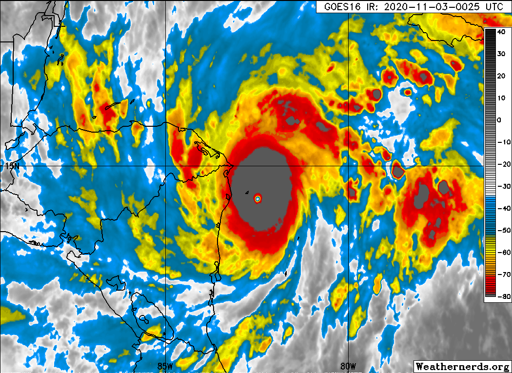
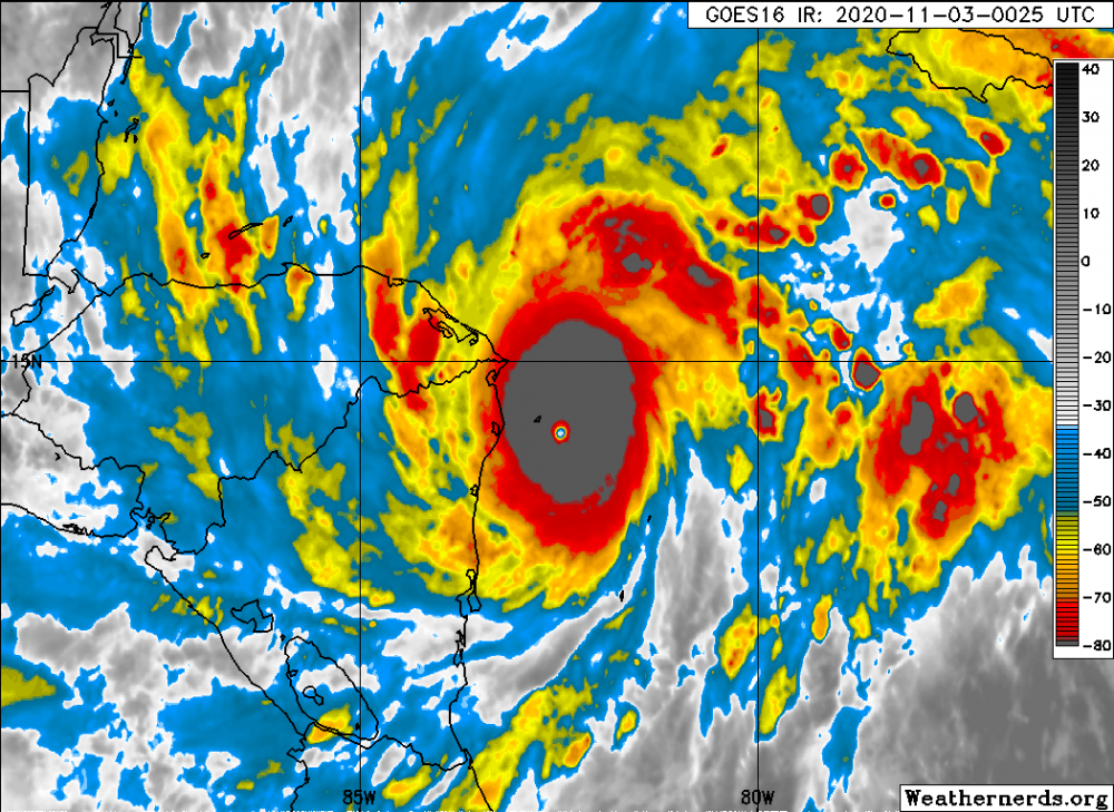
Watching the satellite, Eta's eye just got even BETTER defined, and those extreme cold cloudtops now make up the entire CDO. Similar to Wilma, to be honest.
-
Any status on the recon?
-
-
100 mph, Cat 2. This is definitely strengthening due to enhancement from the trough picking it up.
-
This is now Zeta. It seems like westward adjustments towards the Yucatan may be necessary.
-
I still think we could see a November hurricane. By that time, realistically we could be on Hurricane Eta.
-
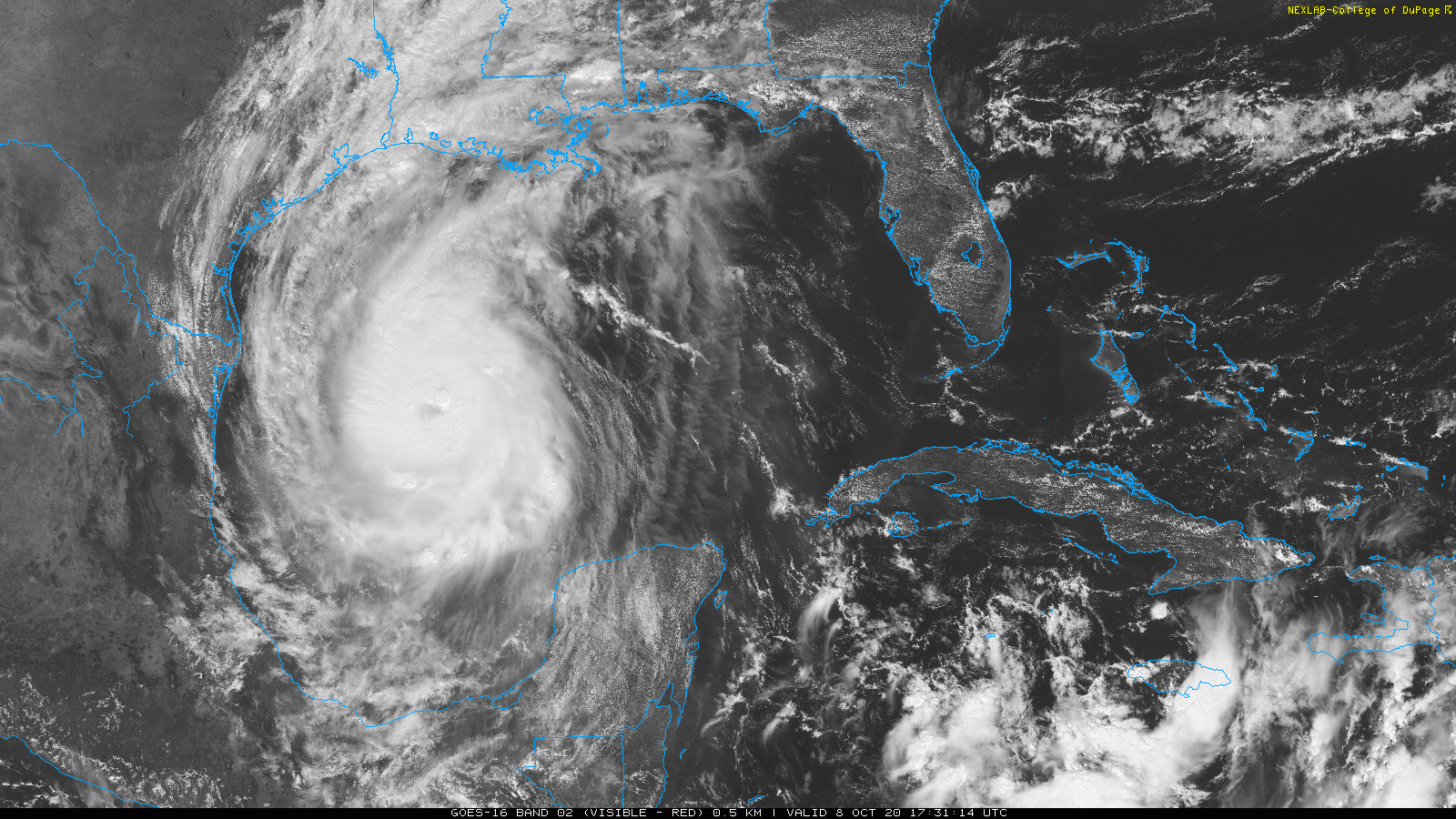
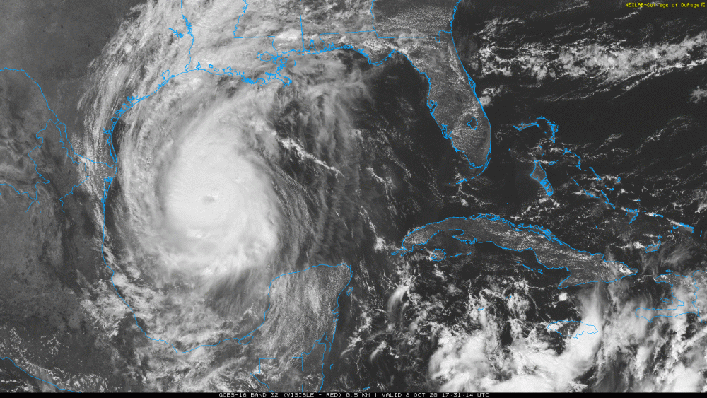
I think Delta is holding together quite well on radar. Not a Katrina, but certainly a bad lashing coming for Louisiana.
-
Delta clearly won't be as strong as Laura, and possibly not a major hurricane upon landfall. Nevertheless, quite a severe blow to the Gulf Coast of Louisiana, especially following the devastation of Laura in August.
-
-
I'm not seeing any shear over Delta right now at all. It's definitely taking advantage of whatever it can.
-
Quite a menacing look beginning to take shape.
-
Hurricane Delta is much better stacked than when in the Caribbean. Looks quite menacing, in my opinion.
-
Thanks alot. When you said female I thought of Delta Burke, and now have the "Designing Women" theme song in my head. Georgia on My Mind. Crazy how my mind made that connection in ten seconds. Hurricane Delta ---- Female Name Delta ---- Delta Burke ---- Designing Women theme song from when my mom watched it when I was laying on the couch at like 5 years old. Crazy. My mind is just one big conglomeration of hurricanes, 80s and 90s pop culture, and music.
-
Anyone else curious how we just had a Category 4 hurricane that the models barely caught in time?
-
Agree. The Yucatan and Belize should have high quality radars.
-
-
Surveillance data from the NOAA G-IV aircraft suggest that Delta's circulation does not extend as markedly into the upper troposphere as one would expect for a major hurricane. Very interesting.
-
Recon found 963 mb. Any word on winds?
-
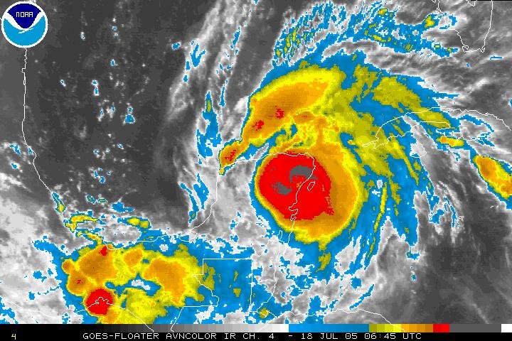
Emily 2005 looked similar and maintained 135 mph Cat 4 into landfall near Playa Del Carmen.
-
I think it's easterly shear.
-
Not looking good
-
Getting that shape.
-
This is clearly a 65-70 kt hurricane. Visible looks great.
-
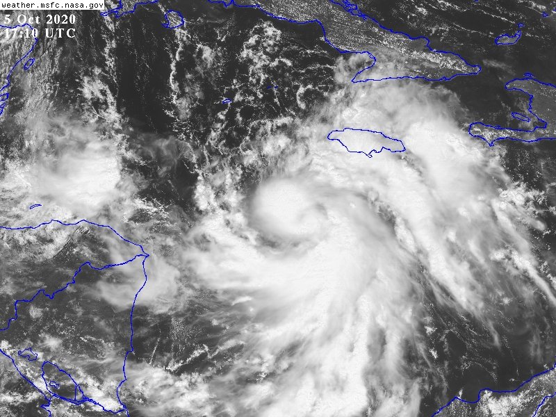
Impressive shape and outflow. Trying hard to become a hurricane before striking the Yucatan. Doubt it gets there.