mreaves
-
Posts
14,917 -
Joined
-
Last visited
Content Type
Profiles
Blogs
Forums
American Weather
Media Demo
Store
Gallery
Everything posted by mreaves
-
I was in Waterbury for the December 19th storm. I was sitting in a conference room at the State Office Complex and the wind was so strong it was pushing water into the room around the window seals. I would not call that "minimal damage" to the snow pack. Outside the mountains, it pretty much set us back to bare ground.
-
One more thing, in Vermont, you can request the trail be curfewed and have it posted for speed.
-
The first thing is that we always defer to the landowner. You can definitely ask the club to move it to a different location on your land. The would much prefer that than having to completely re-route around your property. Re-routes can be expensive and difficult but it happens all the time. Talk to the club and see if you can find something that works better for you. In the end, you have every right to not have the trail on your property but that doesn’t always make you friends locally.
-
I know there are some big craft beer fans here (not me). You might find this article interesting. Vermont’s Craft Brewers Brace for an Uncertain Future
-

January 2026 regional war/obs/disco thread
mreaves replied to Baroclinic Zone's topic in New England
2" here, about the same as yesterday and Saturday. -
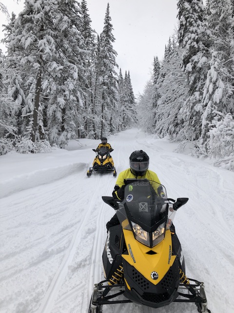
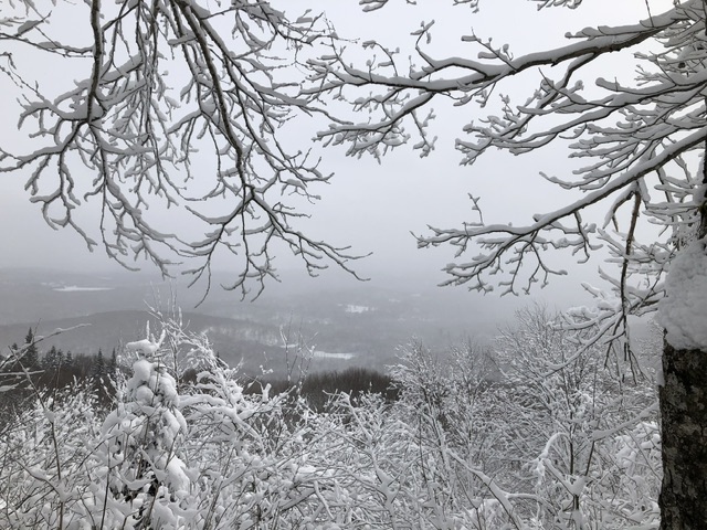
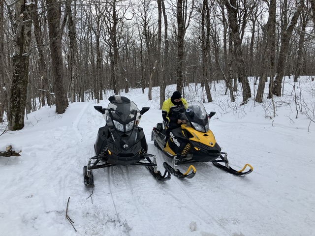
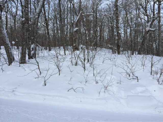
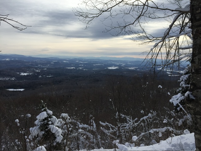
Walden is definitely a weenie spot. Great snowmobiling area. The pictures below are from the last couple of years.
-
Looks like about 2”
-
January 2026 regional war/obs/disco thread
mreaves replied to Baroclinic Zone's topic in New England
To what? This Or this
-
January 2026 regional war/obs/disco thread
mreaves replied to Baroclinic Zone's topic in New England
T*ts N’ A**? -
Alright my skiing friends, I’ve been going down a ski resort ranking video rabbit hole. Peak Rankings videos on YouTube. I’ve done Jay Peak, Stowe, Sugarbush and a couple of overall ones. I’ve never been a skier but I’ve always been fascinated by it. I keep thinking I should try some sort of beginner package but at 57 it may not be wise.
-
@dryslot @WinterWolfDo you guys remember any of these from the old days? I went to a vintage show today. 170 entries. My back hurts just looking at them!


-
It’s been snowing most of the day here. Did I miss that in the forecasts? I spent the morning over in Washington and was surprised at how persistent the snow has been. It’s been light to moderate at times and no real accumulation but I really didn’t expect it at all.
-
January 2026 regional war/obs/disco thread
mreaves replied to Baroclinic Zone's topic in New England
I saw the track in the pic and was wondering. -
January 2026 regional war/obs/disco thread
mreaves replied to Baroclinic Zone's topic in New England
Do you have a neighbor with a snowmobile? -
January 2026 regional war/obs/disco thread
mreaves replied to Baroclinic Zone's topic in New England
I don’t mind them but I wish they would compact them and use more of December. -
January 2026 regional war/obs/disco thread
mreaves replied to Baroclinic Zone's topic in New England
And the championship game should be today. The season is way too long. -
New Years Day 2026 - 1st snows of the new year possible
mreaves replied to Baroclinic Zone's topic in New England
No way. He’s usually up and running his 5 miles before 6:00 -
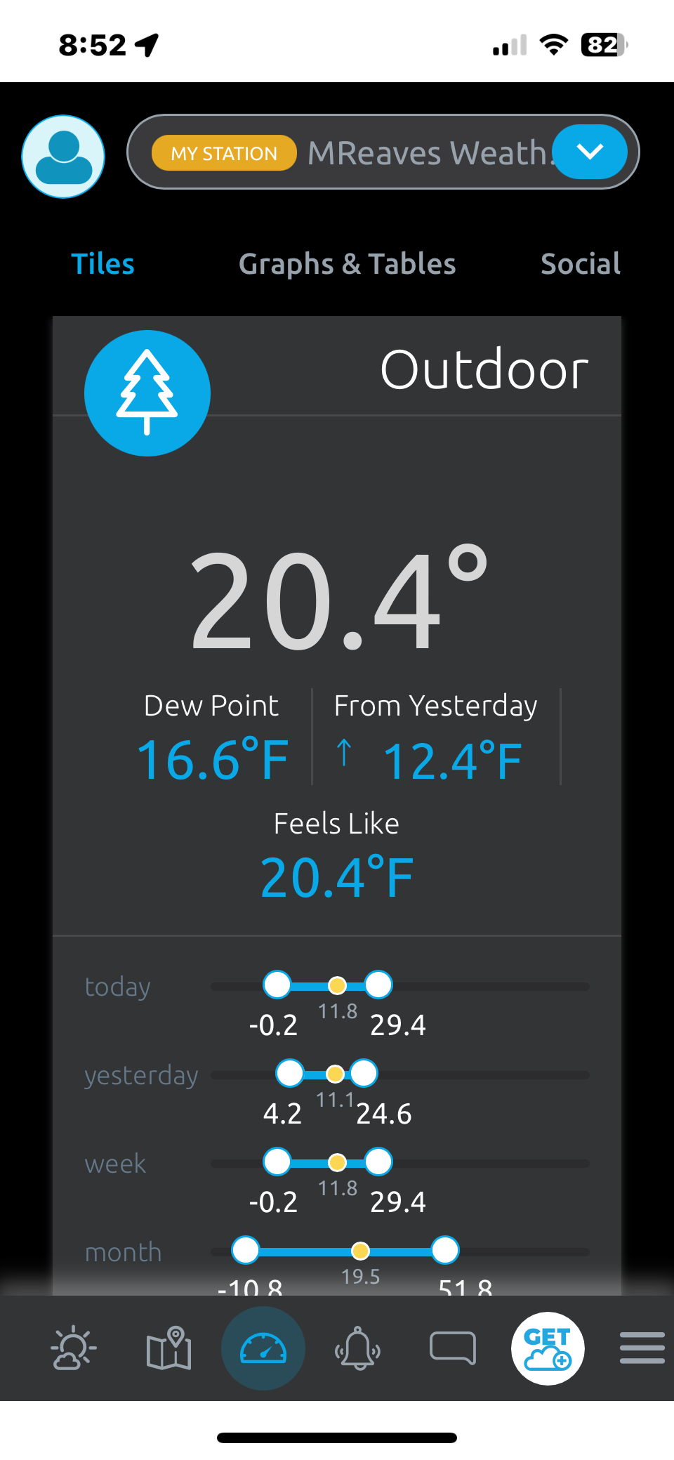
One of my favorite winters. We need to have a few bigger snowfalls thrown in away from the mountains to have it truly match up. In other news, looks like MPV is on pace for a -5° December. Even though I would like a deeper snow pack, the ground has been pretty much covered since mid November. We melted out during the torch a couple of Friday's ago but it was covered back up later that even with a light dusting.
-
Ice Ice Baby December 28-29 Storm Discussion
mreaves replied to Baroclinic Zone's topic in New England
Down to 25.5° off a high of 35.5°. Pretty icy. With a little skiff of snow to make the ice even slipperier. -
Interesting article in the Morrisville paper about snowpack on Mt. Mansfield. Putting it here because I don't want want to start a climate change argument. Mt. Mansfield study looks at effects of shorter winters
-
Ice Ice Baby December 28-29 Storm Discussion
mreaves replied to Baroclinic Zone's topic in New England
I've dropped a degree in the last hour or so from 33.8° down to 32.9°. I don't think my driveway is going to melt out enough to avoid a complete skating rink when it gets colder again. -
Ice Ice Baby December 28-29 Storm Discussion
mreaves replied to Baroclinic Zone's topic in New England
-
A relatively balmy 1.5° here off a low of -6.5°
-
26th-27th event, coming at us like a wounded duck.
mreaves replied to Go Kart Mozart's topic in New England
I just thought it was funny picking random numbers. -
26th-27th event, coming at us like a wounded duck.
mreaves replied to Go Kart Mozart's topic in New England
I need 6” to hit 36” which would leave me with needing 164” to hit 200