Tatamy
-
Posts
2,573 -
Joined
-
Last visited
Content Type
Profiles
Blogs
Forums
American Weather
Media Demo
Store
Gallery
Everything posted by Tatamy
-

OBS and nowcast Thursday morning 2/18 - 11PM Friday 2/19/21
Tatamy replied to wdrag's topic in New York City Metro
Light snow getting underway here 25F -
Feb 18-19 long duration manageable snow and ice event
Tatamy replied to wdrag's topic in New York City Metro
21z RAP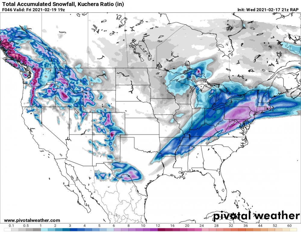
-
Feb 18-19 long duration manageable snow and ice event
Tatamy replied to wdrag's topic in New York City Metro
12z Euro -
Feb 18-19 long duration manageable snow and ice event
Tatamy replied to wdrag's topic in New York City Metro
12z Euro -
Feb 18-19 long duration manageable snow and ice event
Tatamy replied to wdrag's topic in New York City Metro
18z GEFS -
Ok. If you have MPING on your phone look and see what is actually being reported as coming down there.
-
Do you really believe that what it shows down in Virginia today is all sleet?
-
If you want to see snow for this week you can still find it on the 12z Ukie. This is a poster child for a bad algo.
-
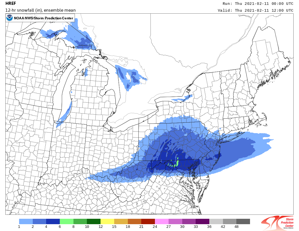
12z HREF
-
Steady light snow - 1 mile visibility - 28F
-
0z HREF through 12z tomorrow

-
2-7-21 Sunday 8-12 hour nor'easter snowstorm roughly 5A-5P
Tatamy replied to wdrag's topic in New York City Metro
Moderate snow - 1/2 mile visibility - 28F -
2-7-21 Sunday 8-12 hour nor'easter snowstorm roughly 5A-5P
Tatamy replied to wdrag's topic in New York City Metro
Light snow 29F -
January 2021 General Discussions & Observations Thread
Tatamy replied to Stormlover74's topic in New York City Metro
12z NAEFS at 180 hours -
Obs and nowcast Sun 9A Jan 3 - 6A Mon Jan 4 2021
Tatamy replied to wdrag's topic in New York City Metro
Light rain mixed with sleet. 33F -
Obs and nowcast Sun 9A Jan 3 - 6A Mon Jan 4 2021
Tatamy replied to wdrag's topic in New York City Metro
Very light drizzle 33F -
Obs and nowcast Sun 9A Jan 3 - 6A Mon Jan 4 2021
Tatamy replied to wdrag's topic in New York City Metro
Same here. -
Yes it is progged to fill in later. Question will be precip types. Most models are keeping precip type rain for most with snow north of I-80 /I-95 in NY as the afternoon progresses. New HRRR is colder and would have more snow south of I-80 in NJ/PA. Another piece of this is the inverted trough that is expected to be set up particularly across eastern PA. This will effect rates and thus precip types.
-
12z NAM has totally missed this initial burst of snow. According to it the Lehigh Valley (I am in Bethlehem Twp.) gets no snow today. It's only 9 AM and a lot of models have already busted on the day. I am at 1" myself and it is still coming down. The 12z HRRR has trended colder for the area near I-78 in eastern PA and NJ.
-
Obs and nowcast Friday afternoon-night 18z NY Day 2021- 12z/2
Tatamy replied to wdrag's topic in New York City Metro
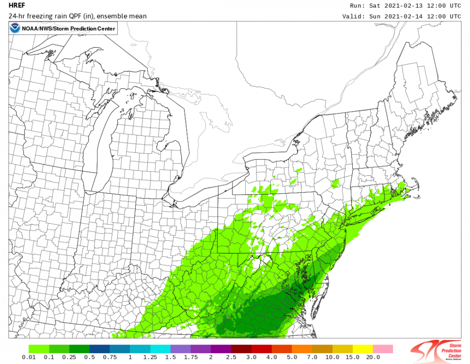
Moderate Freezing rain. 31.6. Trees and shrubs starting to accumulate ice.- 58 replies
-
- 1
-

-
- freezing rain
- sleet
- (and 2 more)
-
January 2021 General Discussions & Observations Thread
Tatamy replied to Stormlover74's topic in New York City Metro
18z GEFS - No support on the ensembles for next Friday that I can see here. With the current pattern in place focusing on an event on the OP at 168 hours is fantasy.