

Tatamy
-
Posts
2,585 -
Joined
-
Last visited
Content Type
Profiles
Blogs
Forums
American Weather
Media Demo
Store
Gallery
Everything posted by Tatamy
-
-
 18z GEFS increases the chance of 4” or more for the Saturday storm in NW NJ from 15% to 65%. It’s interesting how the ensemble mean moved east while the OP moved back to the NW with this run.
 -
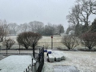
There is a second round on its way. We have flipped over to heavy snow here.
-
This is all about rates. Elevation doesn’t hurt either. Look at mPING to see the variation in precip type across the region.
-
I was just looking at a traffic cam where the Sagtikos meets the NSP and the grass is completely covered out there.
-
With water temps only in the low 40s you folks in Suffolk Cty especially north of the LIE could get a few inches out of this one if the dynamics work out. I have 36 with light rain/drizzle out here.
-
A check of the webcams across southern and SE PA indicates that most precip is currently falling as very light rain/drizzle or white rain. The exception is under the heavier echos currently located to the south and west of Lancaster and Harrisburg. In that area there is heavier snow falling particularly in the York area. This looks to be the beginning of the set up of the FG band that the models have been showing. The snow is actually coating the ground in that area.
-
Mt. Holly is going for 1/2” to 1” under where the FG band is progged to set up in their CWA. Even at 5:1 there is a good chance this busts higher (2-3”). The 0z RAP has 4-5” at 5:1 in a part of Bucks Cty. Tomorrow morning looks to be quite interesting if this FG does set up.
-
Mt. Holly reporting that an observer reported a wind gust to 66 mph in a nearby town to me. If you are in western/central NJ you need to pay attention to this squall line.
-
Had a wind gust to 42 mph with the passage of this squall line along with lightning and thunder.
-
Have just recorded a wind gust to 42 mph with this squall line. The temperature dropped 13 degrees in a few minutes. It is currently producing thunder and lightning as well. Temperature down to 56.
-
Winds have gone calm here with the passage of the showers. We gusted to over 30 mph earlier. Down to 60 from a high of 72 earlier.
-
Places just to the north and west and southwest with a little elevation can definitely see a few inches especially where banding sets up. In the city I would agree with the white rain idea however the outer boroughs could see accumulations. With ocean temperatures in the low 40’s I would strongly agree that LI could see accumulations as well. As Walt said there will likely be minimal accumulation on paved surfaces.
-
I put two bags of ice melt on my 1/2” of sleet with ice on the driveway. The precip is done, the temperature is up to 37, and my sleet and ice is all melted.
-
0.5” sleet and 0.25” ice. Like most other places very icy here. 30/29
-
For those going with the mesos look at the progression of the anticipated gradient on the RGEM during today's runs. Look at 6z, 12z and 18z. Interesting stuff.
-
It's all about the depth of that warm nose that is progged to set up between 700mb to 800mb.
-
Depending on your choice of model there is going to be a fairly significant gradient in snowfall amounts going from south to north. That gradient could set up anywhere on an west to east axis between I80 and I84.
-
18z Euro with Kuchera
-
18z Euro
-
Do you what ratios they are using to calculate these amounts? These amounts seem high.
-
I have found a report of 89 mph at a station on Block Island at about 5:40pm with the passage of the squall line. Other stations in the area peaked at about that time as well though none reached close to that level.
-
Not sure if any one is paying attention however with the passage of the arctic front there are some very strong winds occurring along the barrier beaches. I am finding multiple reports of wind gusts between 50 and 60 mph both on WU and the Davis network along Fire Island and Gilgo Beach currently.
-
I am posting the 18z GFS clown map results from the two different sites that we use. I think that this could lead to a useful discussion about why one of these might be better to use to use vs the other. I am not being critical in any way of either site, both are useful however one of them seems to do a better job in relating temps in the mid-levels to actual precip types and amounts. The major differences shown here are the snow amounts in the DC - Baltimore area. TT Pivotal
-
Winding down here. This event did live up to its advance billing. 0.6” new with a maximum wind gust to 36 mph.


