

Tatamy
-
Posts
2,585 -
Joined
-
Last visited
Content Type
Profiles
Blogs
Forums
American Weather
Media Demo
Store
Gallery
Everything posted by Tatamy
-
Radar is lighting up with snow across much of SE PA and western and NW NJ right now. Light snow here currently. Looks like a burst of snow here for a time this morning before we transition to a wintry mix/rain. Just a light coating so far. 29*
-
Very light snow falling out here. 25*
-
 Getting some fluffy snow flakes out here also as the event winds down.
 -
Don’t under estimate how fast conditions can change. Your temperature may be in the mid 30s however that will fall later. My back deck went from wet to a sheet of ice in 20 minutes. It is not often that you will see a flash freeze however I just did. Hopefully for your sake the precip is out of your area before the temperature drops.
-
We are getting a flash freeze right now. I am seeing a mix of sleet and wet snow flakes with this final batch of precip. My deck is turning into a sheet of ice as I write this. I can actually hear the crackling of the ice as it freezes over. Temperature down to 30.
-
30.5 with light rain and some sleet pellets out here in eastern PA. No ice accretion at this time (I just walked the dog and the streets are just wet).
-
Ice arrives very early Thursday morning on the 0z NAM to the N and W before going over to rain. Looks colder initially in the BL.
-
Big changes in the 06z Icon and GEFS as well. Waiting on the 06z Euro run.
-
Have a look at the 06z GFS…
-
It was a weenie run especially for those to the N and W of I 78 and I 287.
-
January 28/29 Blizzard Observations/Discussion/Nowcasting
Tatamy replied to Northof78's topic in New York City Metro
3” out here in eastern PA. Half of that was with the overrunning on Friday morning with high ratios. The other half was Friday night and Saturday morning with occasional light snow during the period. -
How about a thread for February?
-
January 28/29 Blizzard Observations/Discussion/Nowcasting
Tatamy replied to Northof78's topic in New York City Metro
Not sure if anyone is following the wind reports along the south shore at this time however there was a gust down at Fire Island Pines measured at 66 mph just before 9am. Two stations that I follow on Block Island are gusting to 57 mph. -
January 28/29 Blizzard Observations/Discussion/Nowcasting
Tatamy replied to Northof78's topic in New York City Metro
The back edge of the snow has been nearly steady across eastern PA and eastern MD for the last two hours at least so you will definitely be in this for a number of hours to come. -
January 28/29 Blizzard Observations/Discussion/Nowcasting
Tatamy replied to Northof78's topic in New York City Metro
It looks like an IVT has set up along the Delaware River going NW from Trenton towards my area. This storm does not lack for surprises. My visibility has dropped from 5 miles back down to 1. -
January 28/29 Blizzard Observations/Discussion/Nowcasting
Tatamy replied to Northof78's topic in New York City Metro
1 1/2” new today. -
The recon data that is gathered later will go into the 0z runs tonight. Interesting how the GFS jumped last night at 0z after the data from yesterday’s flights were ingested.
-
I have 1” new this morning and was forecast to get 1/2” for the entire day. Big time fluff factor here.
-
January 28/29 Blizzard Observations/Discussion/Nowcasting
Tatamy replied to Northof78's topic in New York City Metro
Steady light snow continues. 27* with 1 mile visibility. 1” new OTG. Big time fluff factor with this snow. -
Mesos showed me getting an inch or so today. Already 1/2” OTG.
-
January 28/29 Blizzard Observations/Discussion/Nowcasting
Tatamy replied to Northof78's topic in New York City Metro
Steady light snow- 1 mile visibility. -
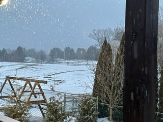
I am in the screw zone and expect to be on the west side of the gradient. In any case this is what it looks like out here at the current time.
-
Snowing here with 1 mile visibility.
-
Snow is rapidly breaking out across south central PA with the overrunning. Are we going to get an Obs thread set up for this?


