Tatamy
-
Posts
2,585 -
Joined
-
Last visited
Content Type
Profiles
Blogs
Forums
American Weather
Media Demo
Store
Gallery
Everything posted by Tatamy
-
I was at 40 before it started…
-
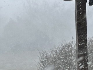
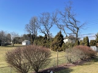
Snow just getting started here.
-
Skies getting ready to open up here.
-
Whiteouts along I78 to the west of Allentown with this feature.
-
Approaching snow squall
-
This is my current sky condition with the snow squall warning. This will change soon.
-
Mt Holly has just issued snow squall warnings for my area so now all the phones are going off… lol
-
You can go to 511pa.com and go to the webcams in the Scranton area. Select I81 for the cameras. A lot of white outs on these cameras right now out there.
-
It looks like you will end up with more snow from this morning’s activity vs this afternoon. The much advertised snow squall is continuing to the east and is moving across the I81 corridor in PA. The history of this feature is that it drops 0.2 to 0.4” in short order as shown on the HRRR. I just watched it pass one of the webcams along I80 just NW of Hazleton. Visibility drops quickly from 1/2 mile to about 1/16 mile and then back to 1/2 mile within just a few minutes. This is a quick hitter!
-
WRT today’s snow showers/squalls there is only some light snow showers reaching the ground along I84 in northeastern PA with the first round. The activity seen on radar in the first band in central PA is mostly not reaching the ground in places to the south and west of the Scranton/Wilkes Barre area at this time.
-
Consensus of the models so far is that this event would be primarily a sleet/ice event going over to rain for most in the metro. Better chances of accumulating snow would be north of I287. Of course a lot can and will change. As always be very careful with clown maps with this type of setup as they will overstate snow amounts.
-
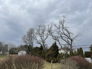
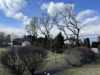
Not just on LI. There are many communities in northern NJ where between storms and other circumstances there has been a tremendous reduction in foliage trees. As a case in point I will note the community of Wood Ridge, NJ. This borough is situated right off of Route 17 south of I80. Before 2010 this was a heavily wooded community with many large old growth trees. I traveled there a year ago and was shocked by how it had changed. I would estimate that 90% of those old growth trees are gone. I was amazed. And this is just one community in that area. Even out by me there has been a large amount of old growth trees removed just in the past two years.
-
Quick burst of rain with the squall line but no unusual wind gusts as compared with what has been going on here overnight.
-
The squall line preceding the front is on my doorstep literally. Highest measured wind gust overnight was 50 mph. Up to 64 degrees now.
-
Up to 62 here with a recent wind gust to 33mph. Winds are starting to crank out here.
-
Take a close look at the actual precip types associated with these events…
-

2/13 Light/Moderate Snowfall Nowcasting & Observations
Tatamy replied to Northof78's topic in New York City Metro
At about 11 pm last night this guy at NY NJ PA weather tweeted that he was not buying the HRRR solution due to a lack of observational support. He further stated that the NAM solution was more likely. Seems like he changed his mind. -
2/13 Light/Moderate Snowfall Nowcasting & Observations
Tatamy replied to Northof78's topic in New York City Metro
5” new this morning here in Bethlehem Twp. The other poster in Macungie measured about the same a little earlier. The first three hours of the event was the most intense with the banding resulting in 4” during that period. -
2/13 Light/Moderate Snowfall Nowcasting & Observations
Tatamy replied to Northof78's topic in New York City Metro
Props to the HRRR/RAP/HREF on this one WRT to better placement of the most intense FGEN. NAM/GFS look to have been out to lunch on this one. -
2/13 Light/Moderate Snowfall Nowcasting & Observations
Tatamy replied to Northof78's topic in New York City Metro
He is probably asleep… -
2/13 Light/Moderate Snowfall Nowcasting & Observations
Tatamy replied to Northof78's topic in New York City Metro
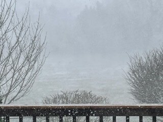
This is what a bust to the upside looks like. Been snowing here for about 3 hours. 4” new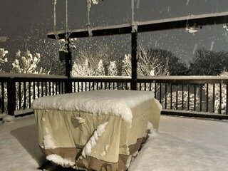
-
2/13 Light/Moderate Snowfall Nowcasting & Observations
Tatamy replied to Northof78's topic in New York City Metro
Boom says it well out here too. Snow started about 40 minutes ago here. Already an inch on the ground. Big time fluff factor with this one. -
2/13 Light/Moderate Snowfall Nowcasting & Observations
Tatamy replied to Northof78's topic in New York City Metro
Snow is moderate to heavy here with visibility about 3/8 mile. Looks just like a snow squall with large fluffy flakes. -
2/13 Light/Moderate Snowfall Nowcasting & Observations
Tatamy replied to Northof78's topic in New York City Metro
Snow has begun out here. It actually coming down quite hard in places around the Allentown area. It is literally like a snow squall in terms of how it gets underway. 35 degrees here.