Tatamy
-
Posts
2,581 -
Joined
-
Last visited
Content Type
Profiles
Blogs
Forums
American Weather
Media Demo
Store
Gallery
Everything posted by Tatamy
-
I agree with your commentary regarding hazardous conditions and drivers making bad decisions upon encountering. As I alluded to in my earlier post my primary issue was with the explanation provided for the lack of a snow squall warning as noted in the posted article. A few weeks ago in a similar situation Mt. Holly was very proactive in issuing a snow squall warning for eastern PA and it verified. I even posted pictures of the before and during on this board. As a point of reference the air temperature recorded here just before it hit was 40 so the road impacts were negated even though visibility’s were low. My issue with this situation is the fact that air temperatures prior to the Monday event were only in the low to mid 20s. That is a big deal. Furthermore the location where the accident took place has an elevation of 1600 ft. so that results in lower air temperatures as compared to surrounding areas. In addition I 81 is a major trucking corridor in that part of PA. In fact there are massive distribution centers operated by Walmart, Lowes, Wegmans, and Prologis within walking distance of the accident scene. It is easy to think that this accident took place in the sticks somewhere and is not in a built up area that would be more impacted by this type of event. I hope that the decision processes that took place as alluded to in the article are reviewed by the folks up in State College.
-
Tornado warning has now expired.
-
Tornado warning in northern Bucks Cty, PA. Storm has a debris signature on radar. Storm is getting ready to move into Hunterdon Cty., NJ .
-
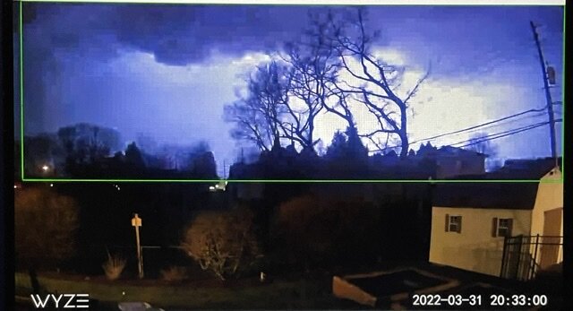
We have experienced a very impressive squall line out here tonight. This feature would match up very well with one we could experience in the warm season. We have had continuous lightning and thunder for over an hour now. Rain total is up to 1.07”. My Tempest has recorded 754 lightning strikes in the past three hours within 30 miles. This is really impressive stuff for March!
-
Lightning with the approaching squall line.
-
Back to tonight’s threat the squall line is a few minutes away now and there is plenty of lightning associated with it. I have a severe thunderstorm warning in effect at my location as it trucks on to the east.
-
The argument made by the Met from State College strikes me as being lame. Six people dead and millions of dollars of property damage. But the snow squall was short lived so no warning was necessary - really? Many tornadoes are short lived however warnings are issued once rotation is detected in the atmosphere. How many of those warnings verify? I don’t disagree with the issuance of tornado warnings under these circumstances BTW. In any case there is definitely a problem with how this threat was addressed (or not) by all parties involved.
-
There was no snow squall warning in effect for Schuylkill Cty at the time of the terrible multiple vehicle crash on I81 on Monday morning. Due to the distance between the radar stations situated in this region weather radars cannot see below 9000 feet in that location. The squall was low topped so it was underneath the radar beam. A similar scenario played out in February in that area of PA. I was out in the Scranton region on that day (I drove south on I81 and then onto I476 to the south of there. Elevations range up 2000 ft in that vicinity. The roads had been brined or were dry. Temperatures ranged from 21 to 25 depending on altitude. Penndot had signage posted on the electronic equipment about the potential snow squall hazard. I encountered snow flurries and showers on my drive. This squall that caused the accident was apparently in a narrow streamer that reached SE down to the Philadelphia area. This has been a recurring problem in east central PA and I hope they decide to increase radar coverage in that area.
-
There is a snow squall about 30 miles west of Allentown currently. Visibility of about 1/2 mile associated with this feature as it moves east. There is also a nasty snow squall along I84 to the east of Scranton. If you are up in NW NJ or Orange Cty keep an eye out for this one. Visibility of less than 1/4 mile associated with it.
-
Mt. Holly issues a Severe Thunderstorm Warning for parts of eastern and NE PA for the incoming squall line. If you are in western or NW NJ or adjacent NY keep an eye on this one.
-
 This feature is weakening as it moves east. There are a few brief bursts of moderate snow however much of it is just flurries. It is accompanied by strong winds.
 -
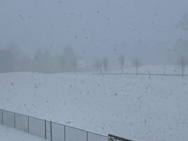
Light snow with 1 mile visibility. Temperature at 25. Strong winds are whipping up ground blizzard conditions here.
-
There are some very potent snow squalls in the Harrisburg area right now. There are some very low visibility’s associated with these. On radar at least this activity is slowly translating to the east. If anyone reading this is going to be traveling west into PA and west of Allentown I 78 is closed due to accidents at Hamburg.
-
There are actually some good bursts of snow in the Harrisburg area right now. The latest run of the HRRR is not too bullish on that area of snow translating to the east with much potency.
-
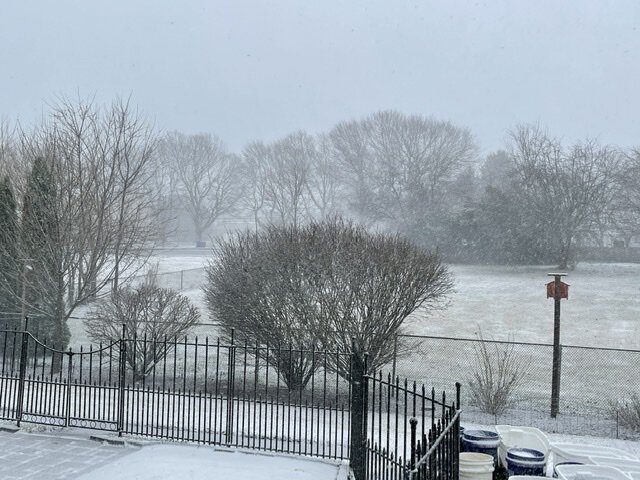
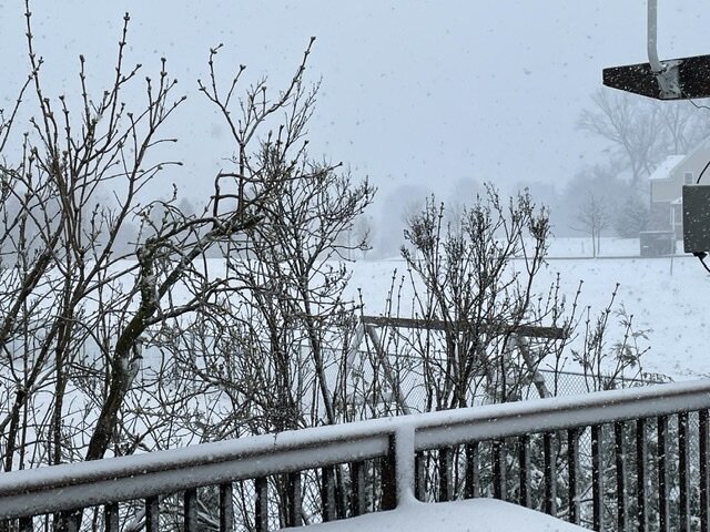
3 1/2” OTG. Moderate snow continues. 27*
-
Heavy snow with 1/8 mile visibility 29*
-
Heavy snow 1/8 mile visibility.
-
It really has been booking off to the east as of late. Conversely the back edge of the snow is moving to the NE across VA at about 60 mph. This storm is a fast mover.
-
No weenies today- what happened??
-
Strongly agree that the Euro lead the way with the more easterly track during the week.
-
I am seeing that here now with heavy snow 30*
-
There’s rain and snow mixed where 78 and 287 meet however you need to go west of there to find accumulating snow.
-
Big difference in conditions from where you are at elevation as compared to those on I80 to your south.
-
Heavy snow 1/4 mile visibility.