Tatamy
-
Posts
2,581 -
Joined
-
Last visited
Content Type
Profiles
Blogs
Forums
American Weather
Media Demo
Store
Gallery
Everything posted by Tatamy
-
4-8” for northern NJ on the 18z NAM.
- 1,529 replies
-
- 2
-

-
- hurricane
- tropical storm
- (and 1 more)
-
After having moved north of me this morning the front has just dropped back south again. I am getting into some light rain while I await the arrival of some convection now over southern PA.
-
12Z Euro

- 1,529 replies
-
- 3
-
-
- hurricane
- tropical storm
- (and 1 more)
-
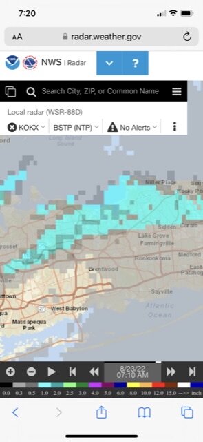
Radar is starting to get active in my area now. This activity will form up and move towards NW NJ.
-
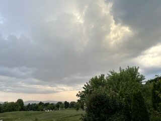
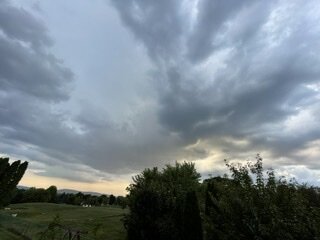
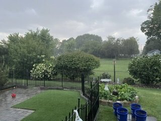
The pictures posted below are one example of how an outflow boundary or frontal zone produces convection. This took place by me yesterday evening over a 30 minute period. I picked up 0.25” from this feature.
- 1,529 replies
-
- 4
-
-

-
- hurricane
- tropical storm
- (and 1 more)
-
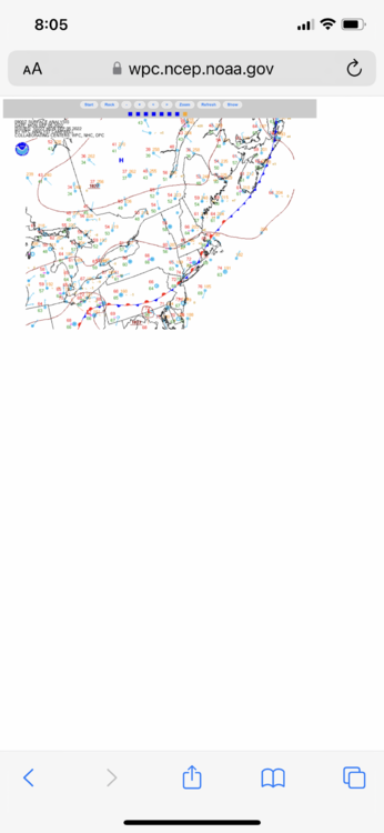
If you look at this run and the position of the stationary front it appears that the Euro is focusing on both the position of the front itself along with terrain influences in this region.
- 1,529 replies
-
- 1
-
-
- hurricane
- tropical storm
- (and 1 more)
-
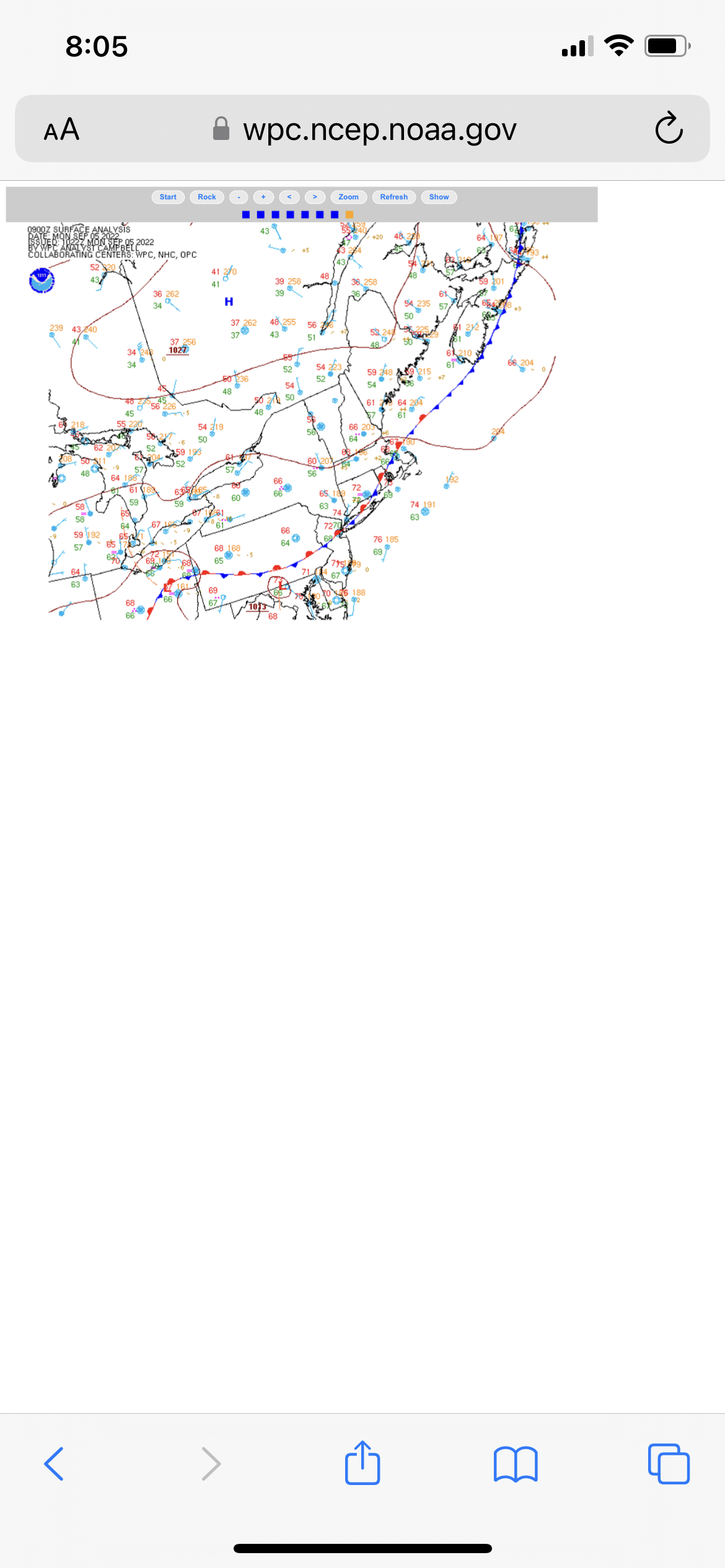
06z Euro

-
The position of this stationary front as we go through the day is going to be a major player in terms of where the convective activity sets up.
- 1,529 replies
-
- 5
-
-
- hurricane
- tropical storm
- (and 1 more)
-
The activity over eastern PA relates to an outflow boundary in the area. I have received 0.15” from it so far. Right now the area to be for heavy rain in looks to be in the southern area of SI and adjacent central NJ.
-
The outflow boundary from earlier is starting to pop some activity along the I78 area. There is a cell near Easton, PA and others near Piscataway, NJ. A sea breeze front is also approaching that area from the SE and could act to invigorate the central NJ cells further.
-
Outflow boundary dropping south as seen on radar across northern NJ between I80 and I 78. Could help to pop some storms in that area. 18z NAM 3K seems to be buying into this setup.
-
Managed 0.09” here.
-
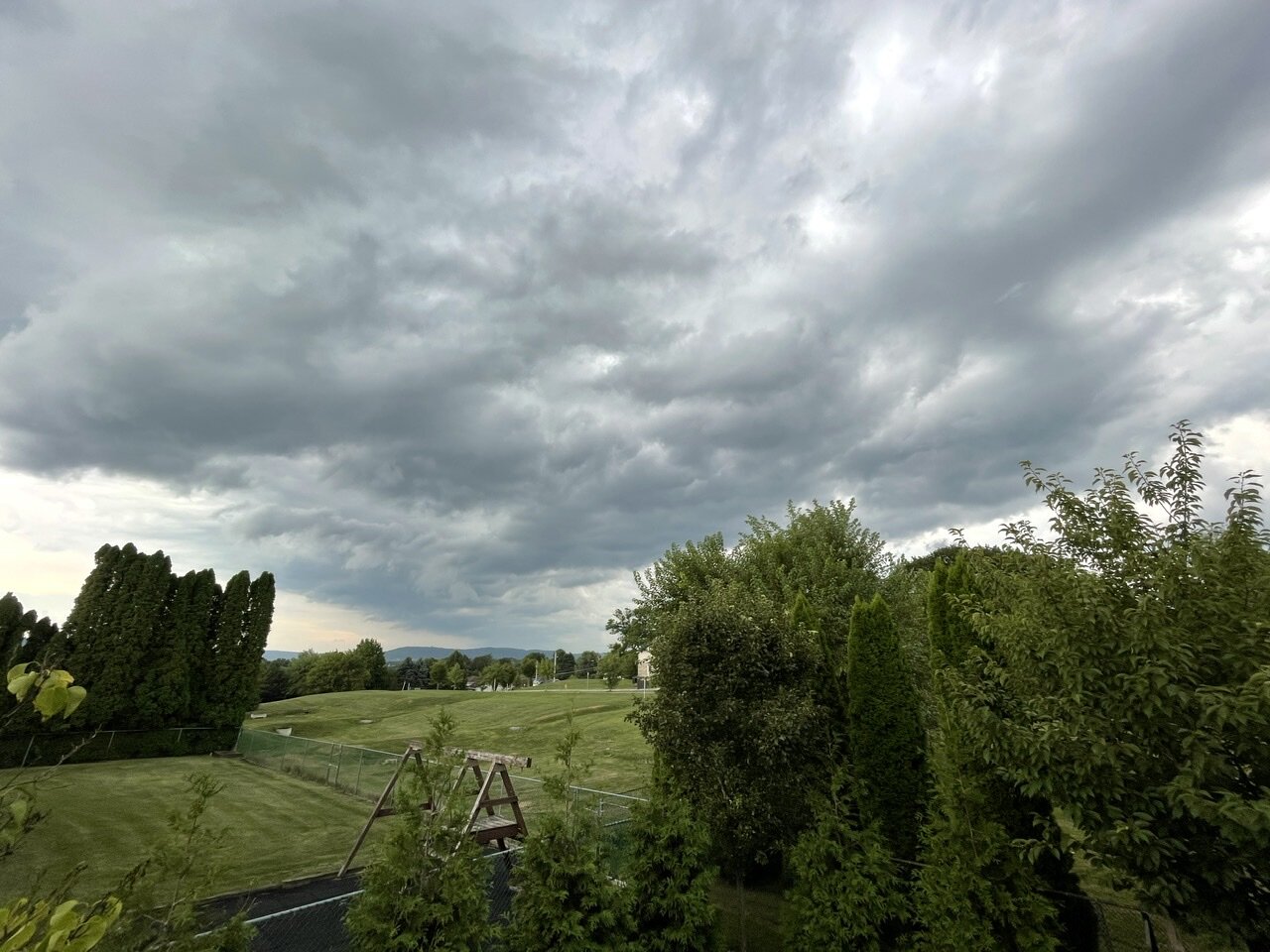
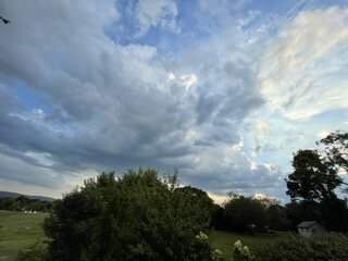
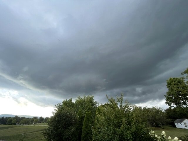
This is the shelf cloud associated with this “squall line.” Not detecting any lightning with it.

-
Sorry to tell you this however the short term models have this feature running out of gas as it crosses the Delaware River. I am not even certain it gets as far east as my location.
-

possible first significant rain in months for some 8/21-23
Tatamy replied to forkyfork's topic in New York City Metro
Looks like a convergence zone is set up right along the immediate north shore. There was a similar set up yesterday along I78 in NJ and eastern PA. We alternated between clouds and sun and downpours. What was strange was how when the sun was out there were scattered CU moving from SW to NE like on any typical summer day however the surface wind was light from the east. This was the result. Like in your area there were crazy gradients in rainfall totals.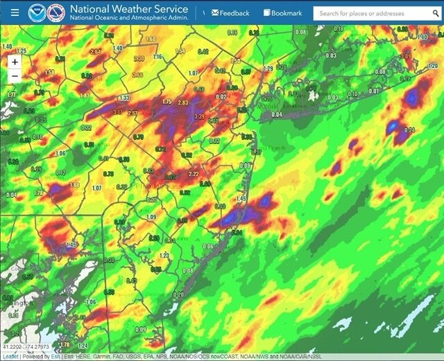
-
A lot of places along the north shore of Suffolk from about Huntington Twp. and east received close to and even over 1” with that storm.
-
possible first significant rain in months for some 8/21-23
Tatamy replied to forkyfork's topic in New York City Metro
It was. It was a right turner as shown on radar. -
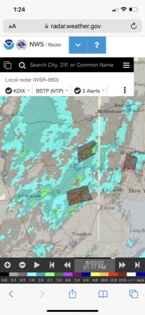
Rain total up to 3.30” for the day. The last storm that I just had was a right turner as shown on radar. Crazy look on the radar loop.
-
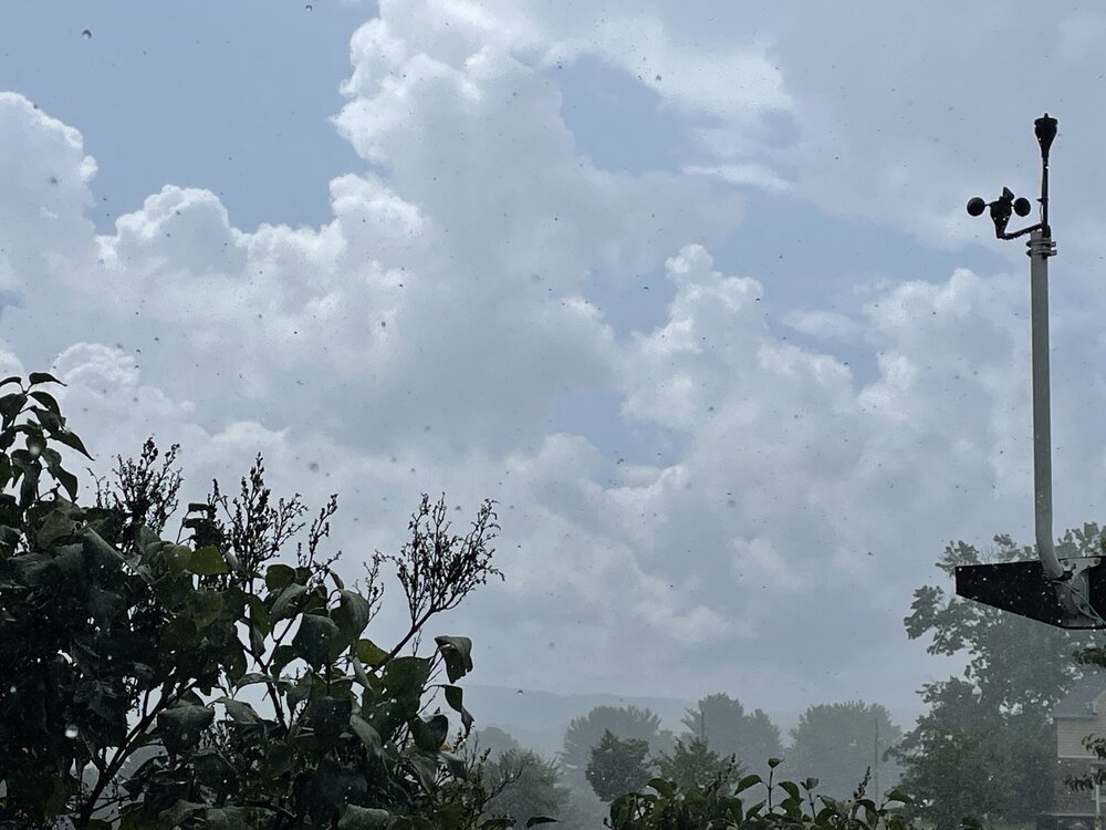
Just had a spectacular severe thunderstorm here. Wind gusts to 30 mph. 3/4” hail. Quite a day for weather out here.

-
I am sitting right under what looks like one of those mother ship type Cu clouds. Just received a Severe Thunderstorm Warning.
-
A couple of places right on the north shore did well today with nearly 1” in Centre Island and almost 2” in Lloyd Harbor (Davis network).
-
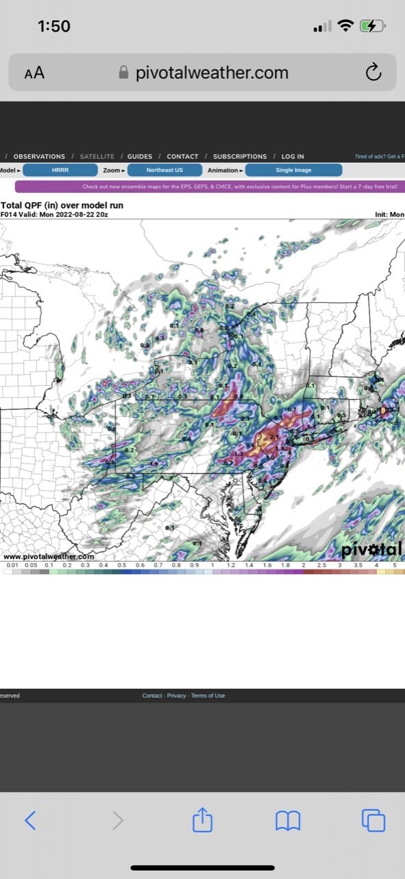
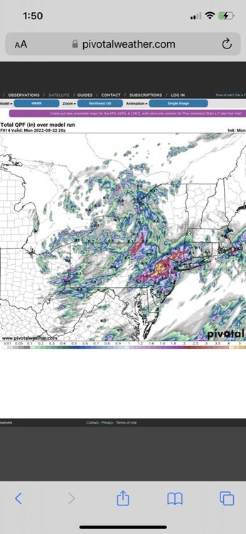
The models were not all wrong. This is from this morning’s 06z run of the HRRR. It’s not totally correct however it did pick up on the rainfall maxes in parts of central NJ and eastern PA.
-
Precip totals so far for the current event
-
Interesting mesoscale setup in place roughly along I78 today. The prevailing flow is lifting moisture up and over the boundary that is in place in this area resulting in numerous showers and storms forming along it. I just passed 2” on the day.
-
Looks like the area in Branchburg and Readington Twp is hitting the JP with this event. Several reports of rainfall reports in the 2-3” range so far in addition to yours. Short range models have shown that potential in your area on some of the runs in the past 24 hours. I have 1.22” with intermittent downpours out here.