

RobertSul
-
Posts
730 -
Joined
-
Last visited
Content Type
Profiles
Blogs
Forums
American Weather
Media Demo
Store
Gallery
Everything posted by RobertSul
-
Wow, that's insane. Be careful out there man!!
-
Huh, I haven’t seen anything about hurricane force winds...
-
Hurricane force winds?? When?
-
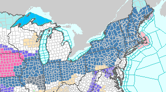
Winter Storm Watches for west and central lower Michigan. Was surprised by the issuance of the watch itself, but then especially by the condition of "Up to 3"" of snow, which would usually warrant a winter weather advisory if any headline at all. The very strong winds/near whiteout conditions are probably the deciding factors here. ...WINTER STORM WATCH IN EFFECT FROM SUNDAY MORNING THROUGH LATE SUNDAY NIGHT... * WHAT...High winds are forecasted to combine with occasional snow and falling temperatures to potentially lead to widespread impacts for the area. Westerly winds could gust over 60 mph. Blowing snow could potentially lead to near whiteout conditions. Accumulations of up to 3 inches are possible. * WHERE...Portions of central, south central, southwest and west central Michigan. * WHEN...From Sunday morning through late Sunday night. * ADDITIONAL DETAILS...An increased risk for tree damage and widespread power outages exists with this storm. Plan on difficult travel due to poor visibilities...slick roads and high winds.
-
DTX issued a Winter Storm Watch for all its counties.
-
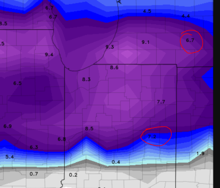
4 - 8 inches sounds like a pretty good consensus to me?
-
Winter Storm Watches extending from Missouri to Maine, but nothing yet issued in the DTX area.
-
Winter 2018-19 Medium/Long Range Discussion
RobertSul replied to snowlover2's topic in Lakes/Ohio Valley
24"+ for both storms combined or just for the 2nd big dog? -
All other things being equal, would a W-E trajectory be more beneficial for our area?
-
I like the look of it! I don't think I've seen a model output with inconsistency between its hard numbers and the corresponding gradient shading - any particular reason for the examples above?
-
Those several 1-1.5" snow events favored areas to the east and north of my backyard, I distinctly remember seeing that on radar. There was one event where we got an inch, sure, but fussing over a half inch just really hits home how bad this winter has been locally, lol. EDIT: Meant for my original post to say much more than half an inch.
-
Don't shame me too hard for posting this, but found this little gem off Weather.com for my locale. Have yet to see anything over a half inch this season. If it completely covers the grass, I'll be a satisfied man! (Real low standards this year)
-
Man, I so hope you're right.
-
Winter 2018-19 Medium/Long Range Discussion
RobertSul replied to snowlover2's topic in Lakes/Ohio Valley
Yes but every other word would be misspelled. -
Winter 2018-19 Medium/Long Range Discussion
RobertSul replied to snowlover2's topic in Lakes/Ohio Valley
I hope so! I haven't seen anything over an inch so far this year, and even then it's melted by mid-afternoon. Starting to feel like Missouri in these parts (no offense to that part of the sub-forum). -
I think the best weather place for you might be a hotel in Colorado.
-
How often is it that every state in the CONUS, except one, has had at least a trace of snow before December?
-
Nov. 25th-26th Midwest Snowstorm Potential
RobertSul replied to Malacka11's topic in Lakes/Ohio Valley
My deepest condolences. -
Well if Detroit had 8 million people crammed into it, with an early snow storm occurring in mid-October by climatological comparisons, receiving 6+ inches when they were supposed to get 1 or 2, with the heaviest snow falling during the evening commute that catches /millions/ off guard, then I think there might be similar issues.
-
It’s interesting that from 1972 - 1980, it was almost an every other year occurrence to have 5”+ in November.
-
I imagine this would be better for lake effect, especially if the warmer southern half of the spit flow were to warm them into November.
-
We had unexpected tornado warnings in and around Detroit around midnight last night.
-
Flash Flood Watch posted for overnight for a lot of SE Mi. Mentioned 3-5” in most persistent bands!
-
FYP. Just kidding, bud. Looks like you're gonna get slammed - good luck!
-
Forecast/storm discussions and part II Manitoba Mauler
RobertSul replied to Damage In Tolland's topic in New England
Ah, my hometown! Best of luck to you and take pictures (I know my folks won't be :| ). Southborough typically does well, jackpotted in the '97 blizzard.


