wxsniss
-
Posts
5,812 -
Joined
-
Last visited
Content Type
Profiles
Blogs
Forums
American Weather
Media Demo
Store
Gallery
Everything posted by wxsniss
-
That sucks Yeah figured your area, south shore, down to Cape getting pummeled now under those echoes rotating in while peak 850 winds 2-5am
-
Scituate 87mph 227am No doubt biggest winds of event along coast underway now Eversource EMA outages more than doubled in past hour to 63,396, 5% customers Coming in intermittent bursts with calm in between, so I continue to suspect mixing has been relatively limited, at least in Boston area
-
Biggest winds so far in Boston metro, as expected KBOS 51.8 mph gust at 1:30am Eversource EMA up to 27K outages, 2.2% of customers Still think mixing down has been relatively less than expected so far:
-
Same area was in 70s 2 hrs ago:
-
https://www.windy.com/?namConus,41.326,-70.116,7 Kinda cool, based off 12z NAM, can also appreciate some of the mesolows earlier Tuesday... This is 1am tonight, speeds are mph... obviously wind gusts will be significantly underestimated with plenty of mixing:
-
New 24/7 streaming channels in the works for weather lovers: https://www.theatlantic.com/culture/archive/2021/07/fox-news-weather-channel/619408/
-
Yeah nowhere close to the hail and wind damage we had almost exactly a year ago June 28 2020 Though left a nice rainbow over the city on exit
-
Outflow just went through Brookline
-
In case not posted earlier… Nice NWS summary of June 1 tornado: https://storymaps.arcgis.com/stories/272ead74dfe348a4a0f10b3b619c9003
-
Cool tornado chase story: https://www.washingtonpost.com/weather/2021/04/24/texas-tornadoes-hail-storm-chase/
-
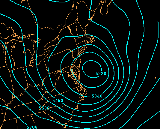
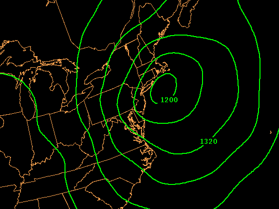
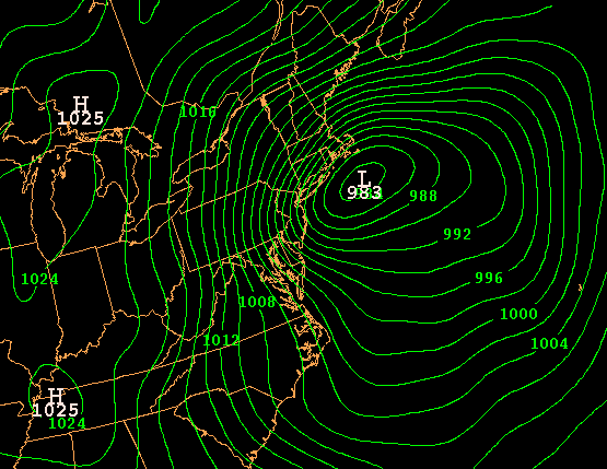
She's occluded and pressures steady ~992 all day... imagine if this were still rapidly deepening:
-
Fun event... NAM was excessive but had the right idea most of the way and before most other guidance HRRR / RAP yesterday were spot on for 495 belt... Almost to Plymouth Bay in her little loop...
-
What am I talking about... I meant already more accumulation than Jan 31 (not Dec 5) storm when we were robbed 10" by 1-2F BL temps Impressive look for mid April! Route 128 getting nailed with this band at moment Boston metro probably has seen the best of it as surface low jogs up and loops around PYM
-
There were doubts about inside 495... mesos nailed this Intense band sitting over Boston metro area now
-
Changed to moderate-heavy, already more accumulation than Dec 5 Jan 31storm Cars, grass white, and now pavement whitening (Coolidge Corner)
-
For those inside 495 grasping for straws... HRRR and RAP continue to support at least snow in the air for a few hours Friday morning. 0z GFS made a solid tick east with where the SLP loops around the canal.
-
-
Wow 6z NAM captures a tick even further east eSNE crushed with a CCB Friday afternoon Would be widespread warning to coast
-
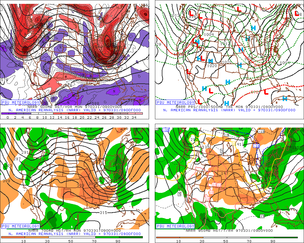
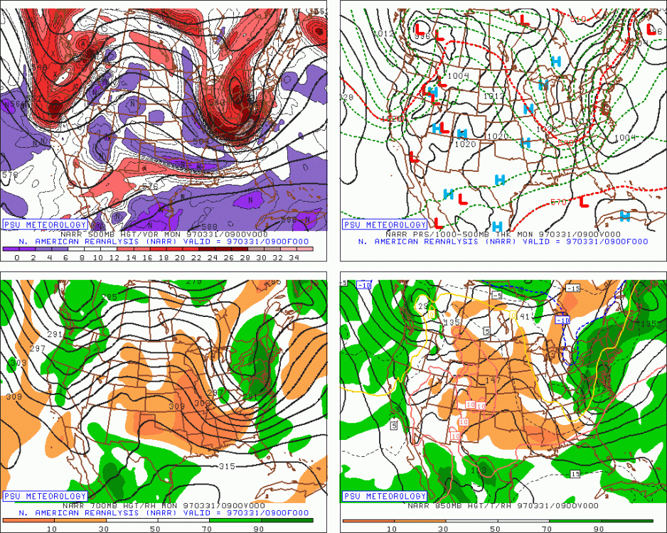
Was gonna say, don't even go there...! That there is hallowed ground haha Definite resemblance with some features, but 1997 had significantly sharper digging trough, surface deepening, longer duration... 3/31 9z: 4/1: H5: H8: Sfc:
-
Holy cow just looked at 0z 12k/3k's... like Gronk coming out of season retirement for one more spike. That would even at least whiten Boston metro area. NAM has been pretty consistent with digging that shortwave decently southeast of others
-
Thoughts on the NFT craze? TKAT and now HOFV and DLPN took off... don't know much about it, not sure if this is just another meme fad or a future in cyrptovaluation of digital art and other items. NYTimes had a feature on it this week.
-
With a last gasp effort, winter 20-21 refuses to give up the ghost
wxsniss replied to moneypitmike's topic in New England
Tip nailed this. What we had is weak cyclonic mechanics devolving even more into an anafrontal deal. Yesterday and before, guidance maintained better cyclonic mechanics as the system departed 6z-12z Friday. Now it’s almost a frontal passage. Not an issue of too warm or track too south. Remains solid C winter for Boston metro. Would’ve been worse (Jan 31 robbed 10”+ by 1-2F BL temps), but: - October snow is always magic - Dec 17 1-2am one of the most intense WAA snows we’ve seen in a long time - Brady Super Bowl snow -
With a last gasp effort, winter 20-21 refuses to give up the ghost
wxsniss replied to moneypitmike's topic in New England
Thanks that's what I figured, just checking if I was missing something. Looking at 850 wind barbs, how cyclonic vs. just parallel to the frontal boundary. And relatedly, how bent back vs. flat are the temp contours. At least on 0z Euro and 12z NAM, the cyclonic character looks best at 6z-9z and then starts to squash out by 12z. -
With a last gasp effort, winter 20-21 refuses to give up the ghost
wxsniss replied to moneypitmike's topic in New England
Tip or anyone... I know there's a continuum... at what levels do you assess degree of cyclonic mechanics within an anafrontal setup? This particular system seems like a good case to appreciate this. -
With a last gasp effort, winter 20-21 refuses to give up the ghost
wxsniss replied to moneypitmike's topic in New England
Wow 0z NAM coming in even more amped than 18z A tick further north Verbatim widespread warning SNE into southern VT/NH