Jump to content

wxsniss

Members
  • Posts

    5,528
  • Joined

  • Last visited

Everything posted by wxsniss

  1. Firehose... 2F colder BL temps and this would have been a widespread 15-20"+ event for eastern SNE Still hoping we catch up some over next 3-4 hours, soundings look decent
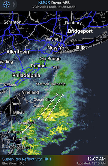
  2. Watching Taunton's band, best rates of event underway... mesos have that ticking north to us by 9-10pm... check out 3z soundings off 0z HRRR:
  3. Awesome video. That was Boston area Dec 17, 1-2am... may have been the most intense WAA snow I've ever seen.
  4. Getting 7:59pm readings in Boston of <32!!! Logan 32F Seaport 31F Boston Fire Dept Dist 1 29F 23z HRRR puts down another 6+ in Boston north... let's salvage this event!
  5. Your obs are encouraging... didn't you flip to rain earlier and then changed back to snow?
  6. If (and it's looking likely at this point) mesos like NAM/HRRR/HREF bust in eastern SNE, it's because of terrible accumulation, not because of snowfall depicted. You look out the window and it looks spectacular for hours. Then you look at the ground and there's little to show for it. It's been snowing intensely in the Boston metro area for hours. 2F colder and I'm pretty sure we'd see widespread 8-12.
  7. Closer than I had expected Invaded a little further than 93 southeast of us... poster in Randolph said it was raining
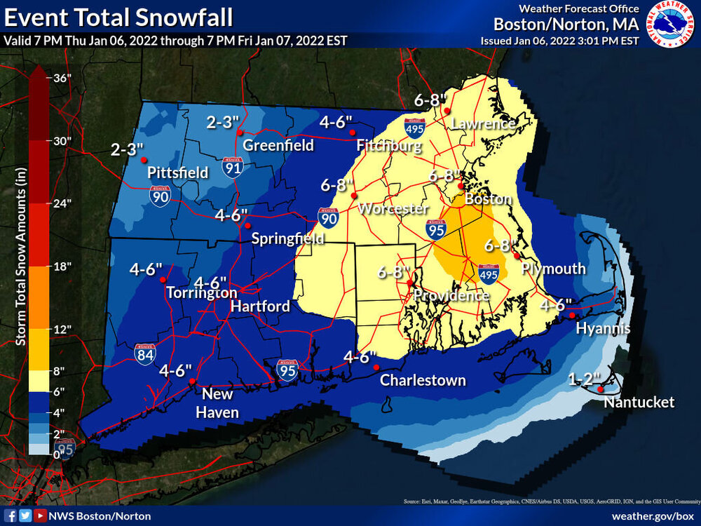
  8. To state the obvious, important to note... that's additional accumulation beginning after 7pm Many areas of CT already exceeded that map
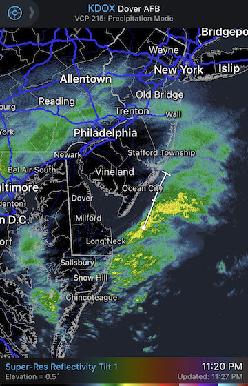
  9. You should do great. Snowgrowth and rates look fantastic next 5-6 hours. We started sticking in Coolidge Corner around 3:45pm
  10. Same... remember how quickly Dec 17 stacked up. We would have had 1-2 inches already. Finally whitening the ground and cars here in Brookline after hours of moderate snow. Per HRRR soundings, next 5-6 hours will not disappoint
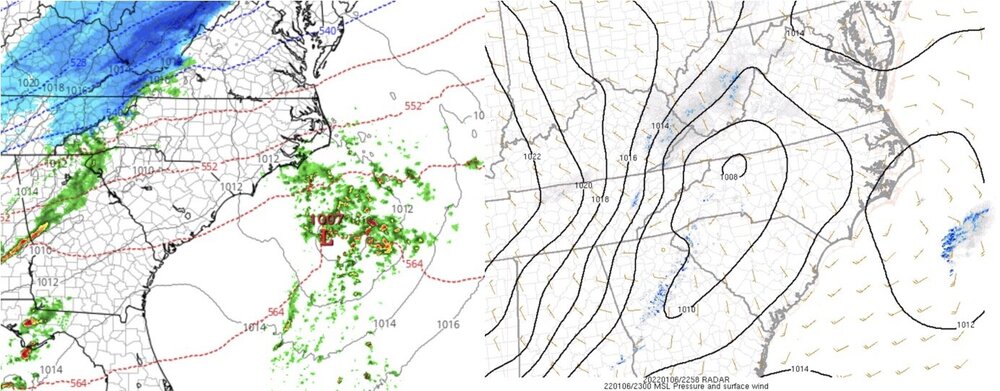
  11. Keep the obs coming! I saw your temp 33-34F... sticking ok? HRRR soundings have Boston metro rocking 5-10pm, ground and cars finally starting to whiten
  12. Boston metro wide swath of 33/34F... we'd probably have close to an inch accumulated on the ground already if it wasn't so warm Much better snowgrowth and rates now as we enter our first meaty band, let's see what we can do.
  13. Agree, HRRR soundings for Boston metro were always garbage before 4-5pm... then look excellent through at least 10pm I expect snowgrowth and rates to improve significantly within the next 90 minutes
  14. 34F on this side of the CF... gotta hope rates will be enough to wet bulb. So far barely even accumulating on cars. Expectation was always 4-5pm and later in Boston metro for better snowgrowth and rates
  15. CF looks to be right here at Brookline, 34F moderate rates but trouble sticking so far I think we'll have no problem sticking once the heavy rates enter after 4pm
  16. Doing the exact same, Tip. Watching Philly obs like a hawk. This zero-sum dynamic is reflected in guidance too. The less gets dumped there, the more mechanics are preserved northeast.
  17. Let's hope the forcing can maintain... those bands in LI sound remind me of 12/17 I called for 8-12" BOS city proper, 10-14" in northwest burbs, not including anything Tuesday evening... if the forcing we see down south maintains (and does not attenuate as on some guidance), and the CF sets up southeast of the city, I'll bust too low. I know it's not directly related to our forum, but really high stakes in Philly area... models still in 2 very different camps down there, and it seems the less is unloaded down there, the better the mechanics up here.
  18. Thanks for this Tip. See discussion ~ 2am last night... we were raising the similar points, without the same expert understanding. I wish I could remember the blizzard from ?2013 when guidance had a similar struggle for similar reasons... no single dominant shortwave within a great trough setup, and therefore a discombobulated solution on guidance... I remember only that I referred to the multiple spawned SLPs as mogwais popping up (reference to the movie Gremlins), but guidance eventually coalesced around a dominant shortwave with a blizzard. I also remember a quick leadtime of guidance "transitioning" towards that eventual outcome. Before I get jumped on, I'm not at all saying that a blizzard will verify tomorrow... just pointing out the evolution similarities in what we are seeing. I do also think that guidance may not "see" the possibility in relatively shorter lead time because of so much in flux today. Fun times! 10 days ago seems like a different season.
  19. Agree... when it's CMC / RGEM / HRPDS leading the way, you gotta remain skeptical. But I do think it's reasonable to expect that none of this will be sorted out on guidance until later Monday, even if the lead time is < 36 hours. Too much in flux with Monday's system underway. Also as someone suggested earlier, this could be just a transition on guidance towards a more continuous event.
  20. Yeah it's a really complex evolution... between a baroclinic zone that shifts further southeast courtesy of Monday's system, and leftover chunks of vorticity rotating around the broad trough... the end result is these cascading SLPs.... you get the sense a much bigger potential that Tip described is there, but it's just too discombobulated to materialize.
  21. Spawns a new low, but it's too far offshore... impacts northeastern ME
  22. All this energy spawning disparate lows reminds me of a storm a few years ago... sorry I can't remember the date... On guidance a large trough with multiple pieces of vorticity spawning different SLPs as they hit the coast, and we compared it to mogwais... guidance struggled and eventually coalesced into a single dominant SLP... reality was a SNE blizzard RGEM did the same thing as CMC and HRPDS, and Euro hints at it too... glad to see a potential popping up before it's off Maine
  23. 0z RGEM really goes to town with that leftover vorticity Wed Euro hints at it too
  24. But still delivers to eastern SNE... in fact a tick colder in interior southeast MA
×
×
  • Create New...