wxsniss
-
Posts
5,812 -
Joined
-
Last visited
Content Type
Profiles
Blogs
Forums
American Weather
Media Demo
Store
Gallery
Everything posted by wxsniss
-
Went through my household like a wrecking ball last week, despite 2 years of scrupulous caution. Was scary initially, but all recovering now. Perhaps an extremely contagious yet milder variant is a blessing in the long run. Hope your wife feels better quickly.
-
Nah, the worries were sincere. I can understand why people are shook by recent phantom storms, but this is a different setup and I don't think we've had as good a signal as this at this leadtime so far this season. I actually prefer the grazer look at this point. In any case, great to have something to track.
-
Agree And I only brought out the microscope to counter some premature (season-scarred?) worries last night. We have a ways to go for both subtle shifts in large scale features and how the shortwaves interact, favorable or not.
-
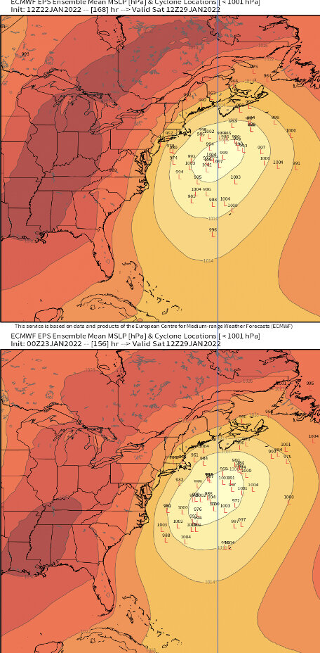
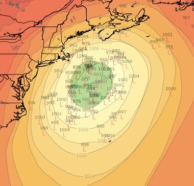
For the detail-oriented... (and I don't think this kind of scrutiny this early is informative... so much will change in the next few days): 12z (green) vs. 0z EPS:
-
What's not to like? Game is still on
-
Someone earlier this season alluded to the Idaho peak of the ridge axis as a great setup for EC hit A lot of irrational panics about this last night. 6 days away. And I weigh Euro op maybe just a little more than just another ensemble member this far out. We're in a good spot.
-
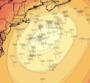
Definitely makes no difference at this point, but 0z is not east of 12z: Mean is nearly identical: And more members west of the drawn line at 0z:
-
Very much alive at 6-7 days out... and more west members than 12z
-
Agree, but we've seen trends like this reverse dramatically in shorter lead time. A touch more phase, axis of ridging out west... all very much in flux on guidance and days before we get better clarity.
-
0z Euro trough digs too little too late, results in a scraper As much weight as another ensemble member this far out, especially given track record this season
-
Ray and others alluded to this... there are definite resemblances... (this is not a forecast, tons of lead time, but this definitely has this level of potential):
-
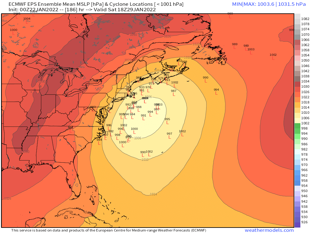
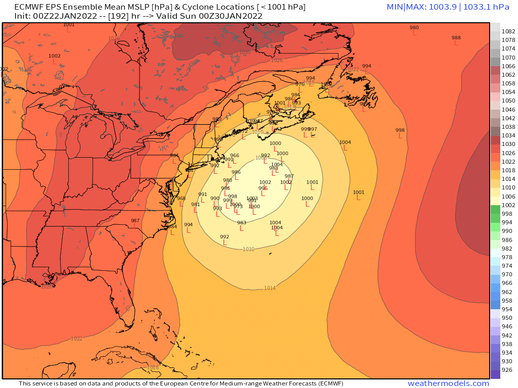
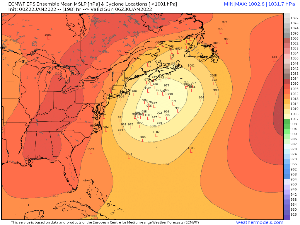
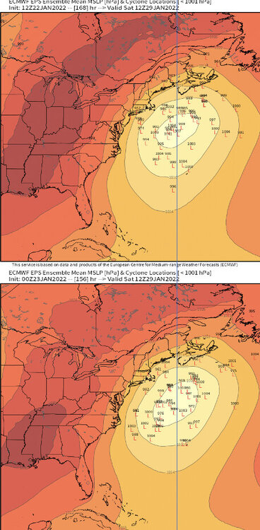
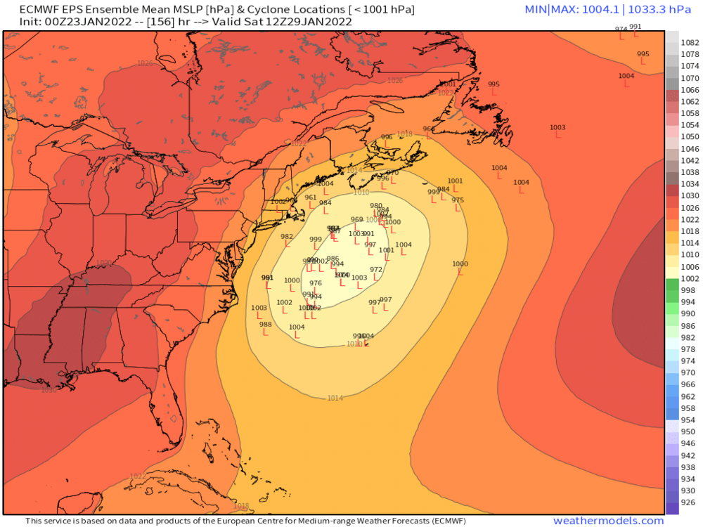
The rest of the EPS series... this is a really good look this far out...


-
Yeah Obviously tons of details tbd, especially thermals, but strong support for a big system. And not seeing the degree of wave spacing cluster look that has bungled other systems this season
-
Not a bad look
-
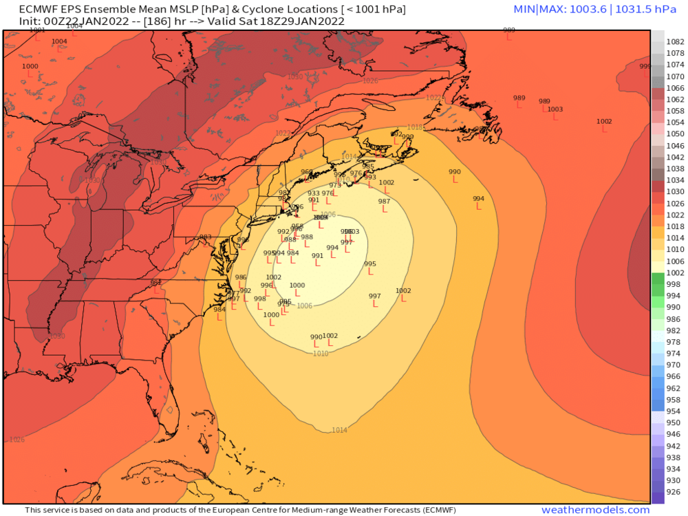
Euro is struggling with this... not that it is within range, but still a sizable jump at 0z (vs. 12z), at least at surface towards GFS What a season that GFS appears more steady (and trusted?) than EC Good consensus with GEFS and EPS for a big system
-
Great show Not quite the masterpiece that was Breaking Bad / Better Call Saul, but still extremely good. Give Succession a try... get past the insufferable Manhattan finance culture for an episode and you quickly get hooked. The character development and drama is fantastic and just won some Golden Globes.
-
Great to hear! Might be hard for people who have never raised a dog to understand... I had the joy of growing up with a dog for 18 years... was a member of the family.
-
Arctic cold and new threat emerges for the 26th. Patience Grasshoppers.
wxsniss replied to Ginx snewx's topic in New England
Euro looking good I like this potential -
In like a wall, great flakes Ground white in 3 min
-
Euro OP is 0/2 EPS say 2/2 not off the table Best signal yet for Fri: Mon:
-
Yeah I’m watching that, looks healthy and should arrive ~3 May re-whiten with 0.5”+
-
Definitely better than the op run for us. Seems more promising than the Thurs system from this far but obviously can change.
-

-
Call Roger
-
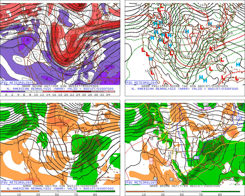
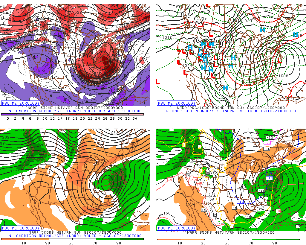
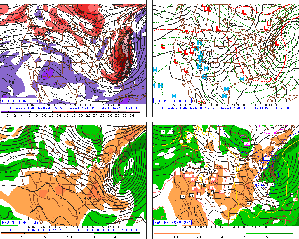
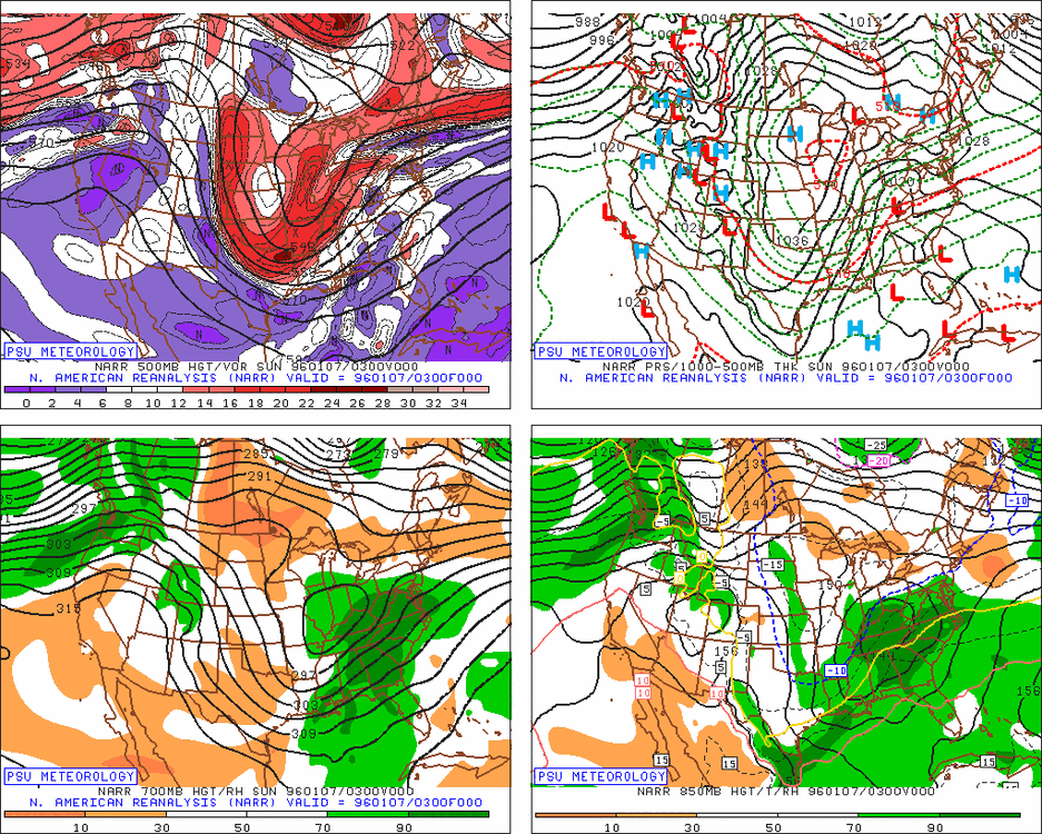
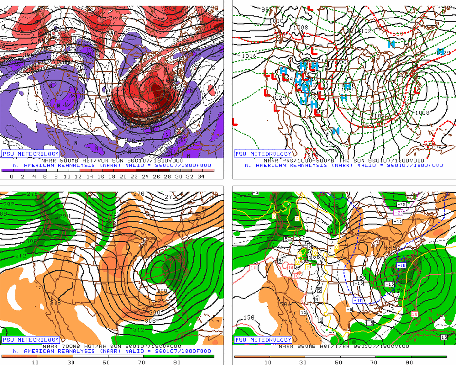
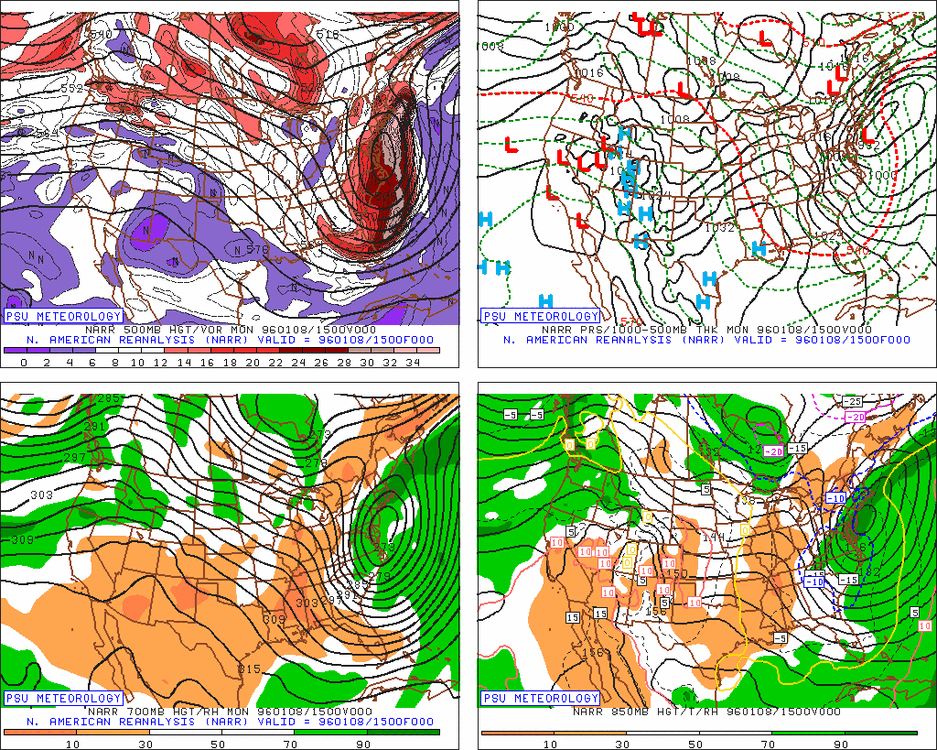
Hey Tip where do you get historic storm maps like this? I’ve looked all around the NCEI site and can’t find it. TIA