

wxsniss
-
Posts
5,812 -
Joined
-
Last visited
Content Type
Profiles
Blogs
Forums
American Weather
Media Demo
Store
Gallery
Everything posted by wxsniss
-
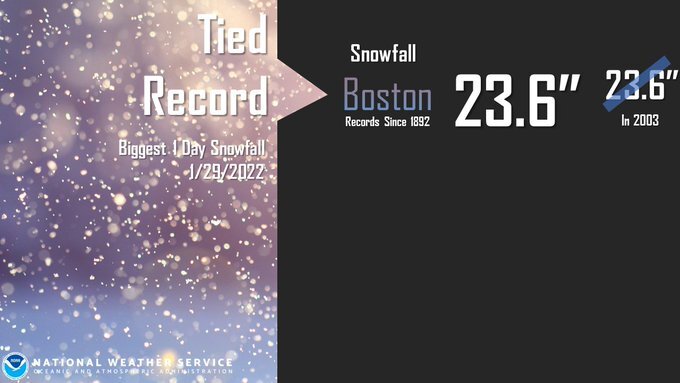
KBOS final 23.8 (0.2 fell Friday)
-
That Worcester now 495 band is fascinating... keeps regenerating while pivoting east, and can also see additional pulses entering from northeast... deformation? pieces of CCB? some low-level convergence? the smaller band behind it further west is reinvigorating too
-
RAP better than HRRR Also I forgot: in shortterm HREF was decent
-
Awesome storm The Memento tattoos (add any thoughts, correct if wrong): trust nothing more than Euro and within-24hr-NAM. RGEM was terrible. I thought winds were somewhat underwhelming, peak seemed around 18z... perhaps reflecting the extreme tilt of the system with the surface low so far east. And that peak deepening was in morning hours. Nowhere close to Jan 2005 for Boston area which was virtually a white hurricane, dynamics unmatched since imo.
-
With that Worcester band decaying as it moves east, pretty confident KBOS cracks 2 feet
-
Near Brookline Village I tried to measure, really inaccurate and guesstimating 20-24" around 4pm
-
That's a good measurement. I went out 4pm, guesstimate 20-24 inches
-
Still easily 1-2" / hr in Brookline Went for a walk, no way to measure, feet in some areas, inches in others. If 14.5 at 1pm, Logan is certainly over 20" by now. Will post pics in a bit, phone always dies in the cold
-
18z-22z was always progged to be peak for eastern MA and it's not disappointing
-
Yep, might be back to heaviest of event as that band expands west and pivots Logan farther east must be close to 20 at this point
-
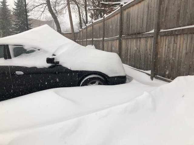
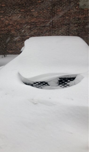
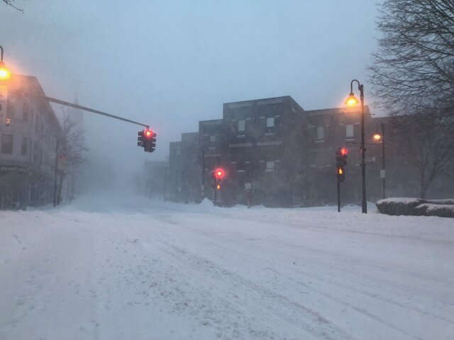
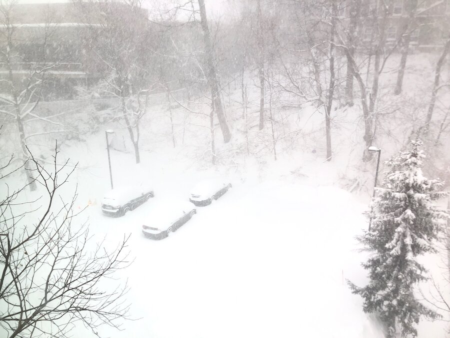
Keep em coming @DotRat_Wx! Wish I could post more Boston metro southeast getting crushed from this 700 fronto band since this morning. No doubt 30" will be reach somewhere southeast MA TWC reported 17.6" Logan at 2pm, didn't see on PNS Before/1pm photos from Brookline Village just outside of Boston during some of the heaviest of the event so far:
-
Was hanging out in here... I see it now, time to transfer over Get sleep man... I think the most critical nowcast is early Saturday AM
-
Yep Should be a fun Saturday afternoon
-
Agree Guidance just yanks it east chasing that further low. 9z-15z this morning is when that further low makes it presence... will be a good nowcast
-
Euro/RAP have settled around 1.5" for us... let's hope that stabilizes. With banding and 13-15:1 ratios, that would still give us a shot at 20+
-
No worries! Was anticipating the 12z-18z improvement would continue, but not to be. Still a tug of war of lows and not sure we've stabilized. This run tugs the low almost northwest as it gets captured, but that occurs later.
-
Tracks somewhere between 12z and 18z, ie not as good as 18z
-
One critical nowcast period looks to be 9z-15z Saturday (4-10am) when that convection driven runaway low farther northeast really stretches out from our main low. If we can mitigate that stretch, we crush.
-
CCB is slightly better for southeast MA
-
NAM unquestionably west thru hr15 12z was a burp cycle
-
I don't think this is done trending back west on guidance... NAM should tic west with a more consolidated low thru 12hr I posted earlier: relative to 12z guidance stretched out by that overweighted vorticity far east, we will watch this LBSW where SW = SNE If I didn't have very dependent dependents keeping me away from the computer, I'd be nowcasting the heck out of this... someone should! https://www.spc.noaa.gov/exper/mesoanalysis/new/viewsector.php?sector=16#
-
Lol thanks that's what I assumed but didn't know if I had missed something
-
I didn't realize that... is that just observation or their actual protocol?
-
HREF 12z fwiw (sorry if posted earlier), looks almost identical to NWS map Like a trail print of a dumbbelling low
-
What's clear is this is still in flux We watch for a LBSW, where SW = SNE... as is, very close to consolidating around the western low faster, more consistent with what we're seeing at mid/upper levels, and we're back to the 0z solutions

