

CaryWx
-
Posts
2,667 -
Joined
-
Last visited
Content Type
Profiles
Blogs
Forums
American Weather
Media Demo
Store
Gallery
Posts posted by CaryWx
-
-
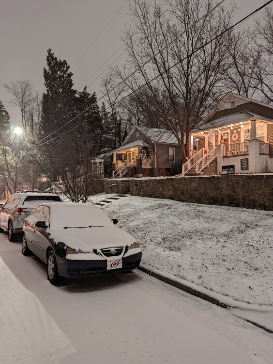
This is about as board wide a hit as we're gonna get.
Kudos to those of you putting up with us RDU & extended area folks. We can be insufferable.
")
-
 8
8
-
 4
4
-
-
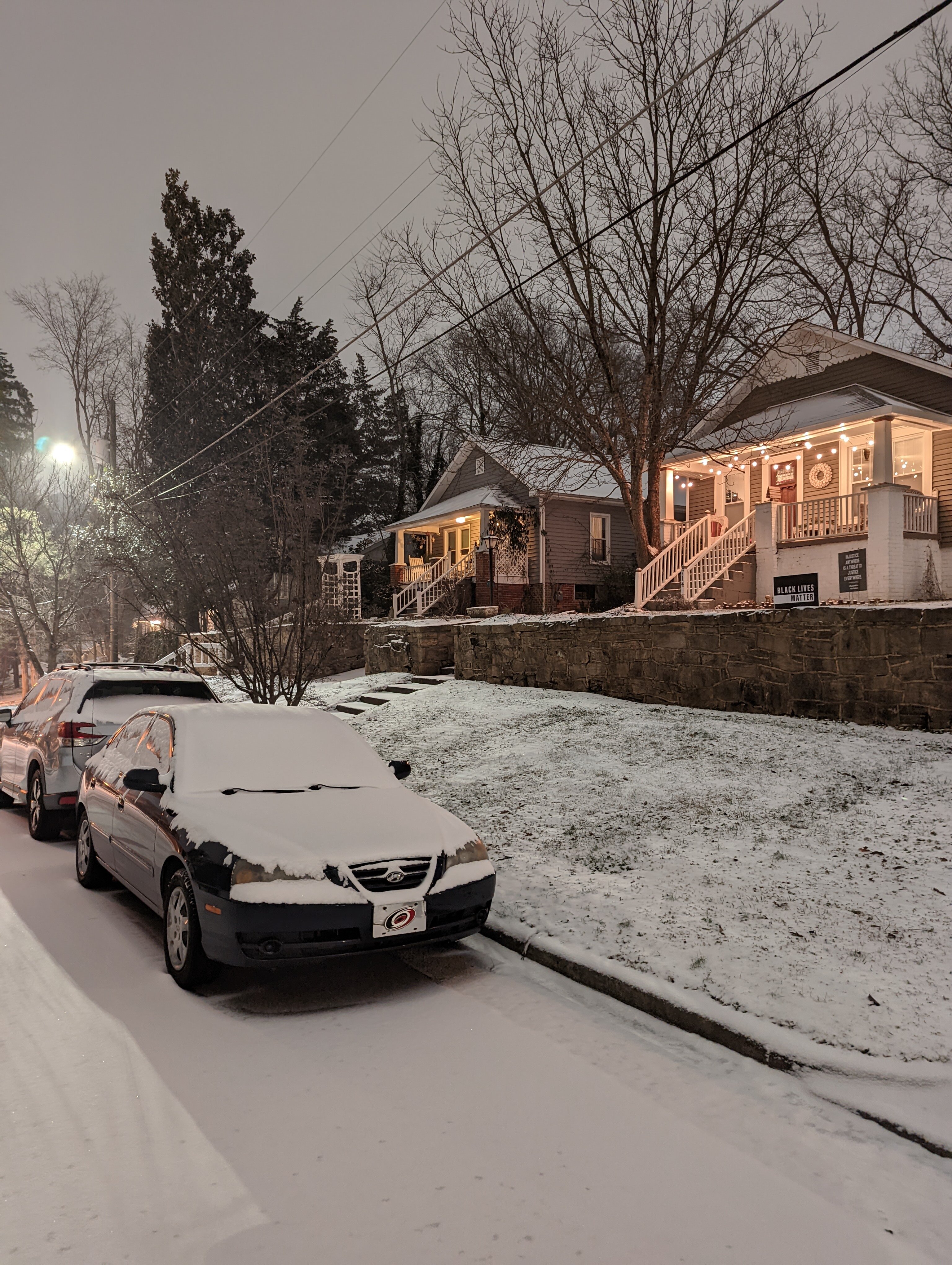
It's ripping some heavy powder in Cary right now
-
Just now, Stormpc said:
It's been good but it's just about to get really good! I measured 3 inches at 9:30.
You're going to get rocked
-
I've only have tiny grit like snow coming down.
But there's nothing minor at all about this event and a solid 24 F. Temps is going nowhere but down.
edit: Powder is almost blinding too and will only increase
-
1
-
-
1 minute ago, cbmclean said:
Can you say that again?
I meant twitterverse
-
Any mets on social media chiming in about lower rates in the Triangle or honking be patient.
-
3 minutes ago, eyewall said:
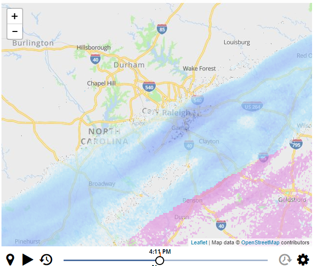
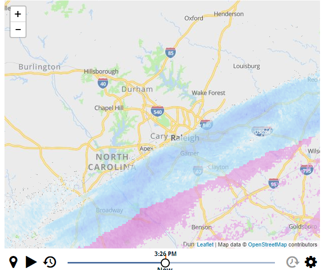
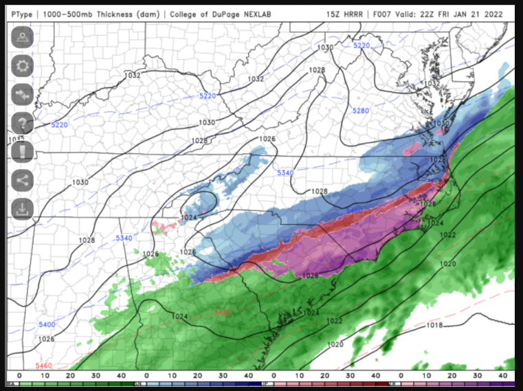
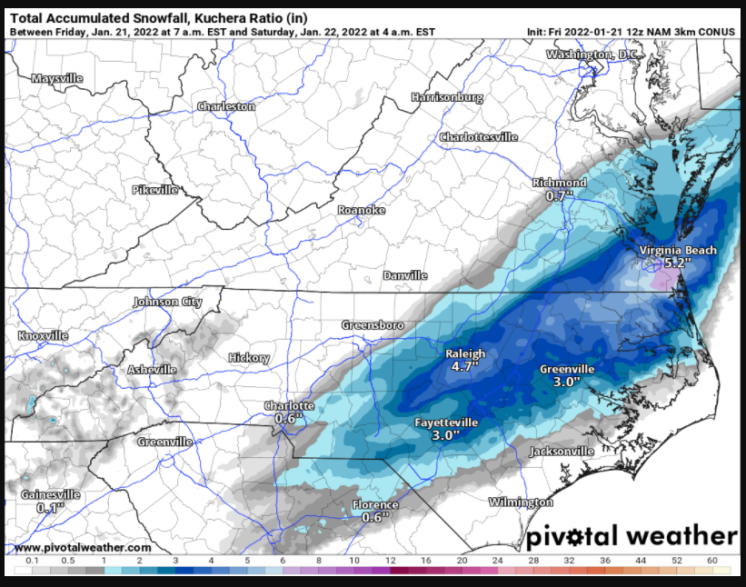
At this rate it is going to be tough making the low end of the forecast amounts. We will build an inch evey 5 hours or so with the current growth.
Thing is will these heavier rates nw of Columbia hit or miss the Triangle to the east.
-
1 minute ago, CntrTim85 said:
Looking forward to my "SPC Mesoscale Analysis" in a couple of hours!
What's your location?
-
3 minutes ago, NorthHillsWx said:
If you’re complaining about anything in the Raleigh area, you need a new hobby. This is our best storm in years. Absolutely awesome out right now. Loving every second of it
This. Plus the heavy stuff is progged for 10pm-2am
-
3 minutes ago, Justicebork said:
Everything we’re getting right now is gravy. This has been a midnight through 6:00 AM main event since that run where the NAM lost the storm.
.I think it's projected to end in the Triangle by 3am. Still that's a good 7hrs of moderate+ snows
-
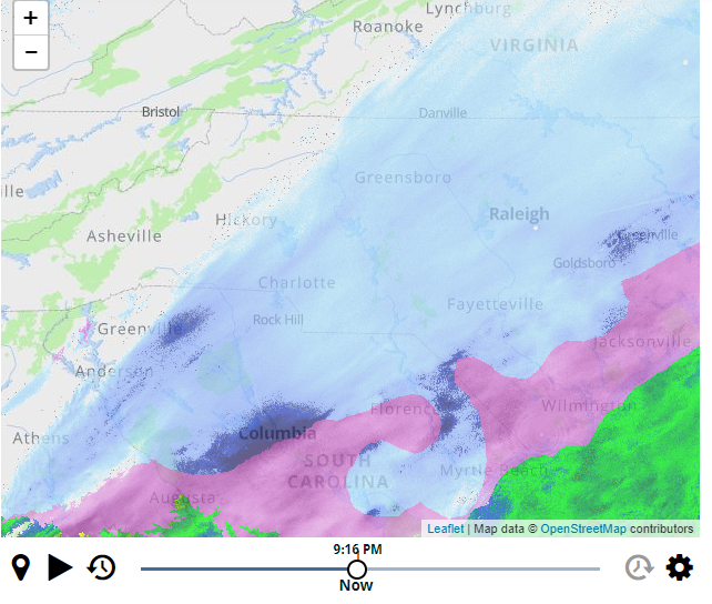
I would have to say returns look heavier for those in Garner attm
-
Another snapshot of icontrol radar for Raleigh area. Curtesy WRAL
-
Very light flurries here in southeast Cary 4:05pm. 5mins behind schedule.
-
I know WRAL's icontrol is not all that but this is why I am not seeing flurries yet nor some others in Raleigh.
-
Just now, BigWeather said:
Very light snow in south Cary.
Ok, I will check again and squint hard...
-
Still nothing in Cary. 27.1 F on my home station
-
Sounds like RAH set a new threshold--again. Probably last one though. I am just about square on that line between Wadesboro to Roanoke Rapides. Uncanny.
-
2
-
-
2 minutes ago, msuwx said:
A westward expansion of the WSW is imminent.
See folks, it pays to be on a first name basis with the NWS offices. j/k
Thanks for the heads up Matt.
-
4
-
-
9 minutes ago, GunBlade said:
This does not actually close off to an ULL. That map is also lower level pressure
Thanks Gun. Yep, sure missed that. Not down at 850mb. I need to pay attention more.
-
1
-
-
Is that the ULL southwest of Ashville?
-
3 minutes ago, eyewall said:
I think the GFS wants to develop a bit of banding, especially against the transition zone to IP/ZR. That wouldn't be unusual. To the north it is better ratios getting the job done.
I saw that too on the gfs. Question is where exactly will that set up and how large and long of duration will it be.. Progged just northwest of the airport attm. Could be further northwest or further southeast. Going to have to wait until nowcast time I'm afraid
-
I know RAH uses the objective criteria for guidance on issuing county notices but wonder since Canes Hockey is a 'Go' this evening would they take subjective criteria into consideration as well. In other words, better to have Wake under a WSW just so they can cya with that event full of traffic. Sort of a---well folks, we had issued a WSW prior to the game
-
1
-
-
4 counties in SC have WSWs now.
-
2
-
-
I'd like to see this happen and not be overdone, but we'll know in about 18hrs or so.
-
3
-
Mid to Long Range Discussion ~ 2022
in Southeastern States
Posted
In the bullseye this far out? I dunno