

CaryWx
-
Posts
2,667 -
Joined
-
Last visited
Content Type
Profiles
Blogs
Forums
American Weather
Media Demo
Store
Gallery
Posts posted by CaryWx
-
-
Just now, packbacker said:
Last January the NAM and the HRRR were great for showing the rain/snow cutoff. The HRRR wouldn’t budge and it was right.
So what's the HRRR telling us (Cary-Apex) now pack for this storm?
-
Can anyone post RDU sounding for tomorrow afternoon from SREF? We should be in a reliable range right?
-
What a dry bob! Pretty big shift. Need to see the next run.
-
1 minute ago, WarmNose said:
Wintry mix being reported in Spartanburg..foreshadowing for an over performer this weekend? Hmm
It's 47 in Spartanburg man--what's mixing in with it exactly?
-
13 minutes ago, FallsLake said:
From RAH:
.LONG TERM /FRIDAY THROUGH WEDNESDAY/...
As of 305 PM Wednesday...
...Increasing chance of snow across portions of Central NC between
midnight and 7 AM Saturday, with some accumulation on elevated and
grassy surfaces possible...
Friday and Friday Night: Central NC will be under the influence of
deep southwesterly flow aloft as a strong upper level trough to the
west swings eastward toward the region. Disturbances in the flow
aloft will move over the area, resulting in periods of heavier
precipitation. At the surface, Central NC will be sandwiched between
the stalled front off the Mid-Atlantic coast and high pressure
ridging eastward from the west. With the high in an unfavorable
location, the best push of cold air will likely get hung up along
the mountains. Expect much of the precipitation to fall as rain,
especially early on. Despite the delayed CAA, strong lift in a
saturated dendritic growth zone will likely result in precipitation
rates strong enough for snow to occur where temperatures are in the
32-36 degree range. This will be an event where the cold air is
chasing the precipitation, thus expect most of the precipitation to
fall as liquid. Liquid equivalent precipitation totals will range
from less than a quarter of an inch in the northwest to nearly 1.75
inches in the southeast. Given the warm ground and boundary layer,
snow will have a difficult time accumulating except for on elevated
and grassy surfaces and under high precipitation rates. Generally
less than an inch of snow is expected at this time, primarily
between midnight and 7 AM Saturday. Best chances for accumulating
snow along a line from Lexington to Burlington to Roanoke Rapids,
generally be along and west of US-1. Highs on Friday in the low to
mid 40s with overnight lows in the upper 20s NW to mid 30s SE. Temps
are not expected to fall below freezing in the Triad until after
midnight.
Saturday through Wednesday: As the strong upper disturbance swings
through the region Saturday morning, the main precipitation axis will
shift east of the area. At the surface, in the wake of the
disturbance aloft, west-northwest flow will advect strong cold air
into Central NC ahead of a secondary strong vort max aloft diving
southward over the area. Saturday and Sunday will be the coldest
days Central NC has had in a while, with highs in the low to mid 40s
and overnight lows in the low to mid 20s (possibly dipping below 20
in outlying areas Sunday night). Generally dry weather expected for
the remainder of the period although a few sprinkles/flurries early
next week cannot be ruled out. Temperatures will moderate a bit
Monday and Tuesday before another cold front moves through the area.
&&
Doing a double take on the Hwy 1 corridor with the cities mentioned because they don't square....unless RAH NWS means the space in between Hwy 1 and a virtual line drawn connecting those cities
-
Is that the mean Cheez?
-
4 minutes ago, Buddy1987 said:
Yes I am.
The only reason I asked is because Salem and Apex are wicked far from each other in terms of winter climo
When is not a good spot for Salem,Va in SE winter snow forecasting? July??
")
-
4 minutes ago, Buddy1987 said:
I consider you and I, along with the western folks to be in a good spot right now.
Buddy, are you in Salem VA??
-
The eastern edge already looks to have a hard cut to it. Just because of climo and time of year alone I expect that to shift back about 30-50miles
-
 1
1
-
-
2 minutes ago, packbacker said:
At 48-60 hours? This should be in its wheelhouse now. I would be surprised if the EPS is much further west and would expect spread to decrease. I also think the snow axis will shift west as the precip will be further west I bet and eastern side wide will be warmer.
So pack, you're saying there's a chance still huh?
Honestly sounding like 'dripping snow' at best for our area---If we're lucky
Be interesting to see the ensemble mean on this one
-
Thanks 91
Yowzers! Accounting for the overage maybe I still get a heavy wet 3" of the white stuff. Bullseye at 96hrs out! What could possibly go wrong?
-
3
-
-
8 minutes ago, wncsnow said:
Yea, EURO still doesnt look like UKMET or CMC... Its a little bit of a compromise between those 2 and GFS
Snowmap shows Coldrain jackpot over 6 inches lol
Hard for me to tell if that map has "Cary" in the heavy wet snow jackpot or not. Can anyone post it with counties shown?
-
Just now, Cold Rain said:
I can't tell if that's good, bad, or funny!
Me neither. Looks like we are progressively losing moisture here
-
Just now, Bango said:
For where?
Central NC
-
1
-
-
If we do get anything wouldn't think we get 10:1 ratios. Something lower
-
1
-
-
6 hours ago, YetAnotherRDUGuy said:
Besides the French, German, Canadian, UK, & Japanese models is there any other ones we can drag out?
If there's an Australian 00z model showing jackpot for RDU, I wanna know about it.
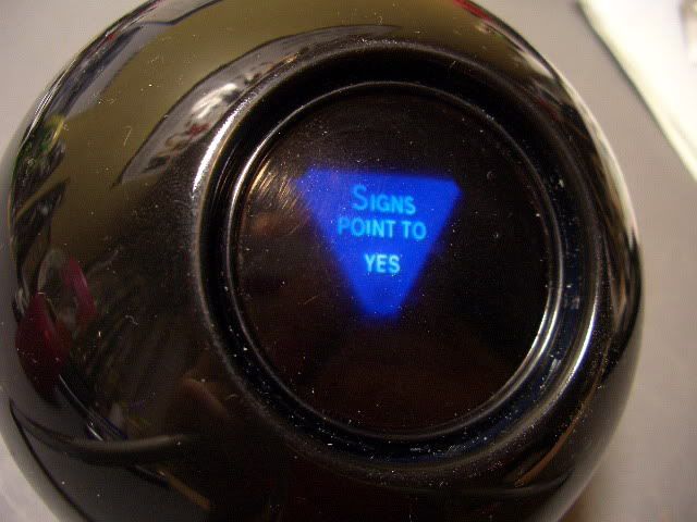
There's this one but it is from the 1950s. Believe it is in agreement with the major models at this point though.
-
33 minutes ago, Solak said:
Deja vu... Monday night/Tuesday
 Convection over the Gulf Coast and Southeast States could
impact the total qpf, something tough to discern this far out.
Oh hell not this again?

Something tells me there will not be enough moisture to have that happen this go 'round
The December to Remember 7th-8th blue turd winter threat thread.
in Southeastern States
Posted
Call it a gut feel but suspect Winston might not do too badly here. Relative to non-Mtns that is.