michsnowfreak
-
Posts
18,067 -
Joined
-
Last visited
Content Type
Profiles
Blogs
Forums
American Weather
Media Demo
Store
Gallery
Everything posted by michsnowfreak
-

2025-2026 ENSO
michsnowfreak replied to 40/70 Benchmark's topic in Weather Forecasting and Discussion
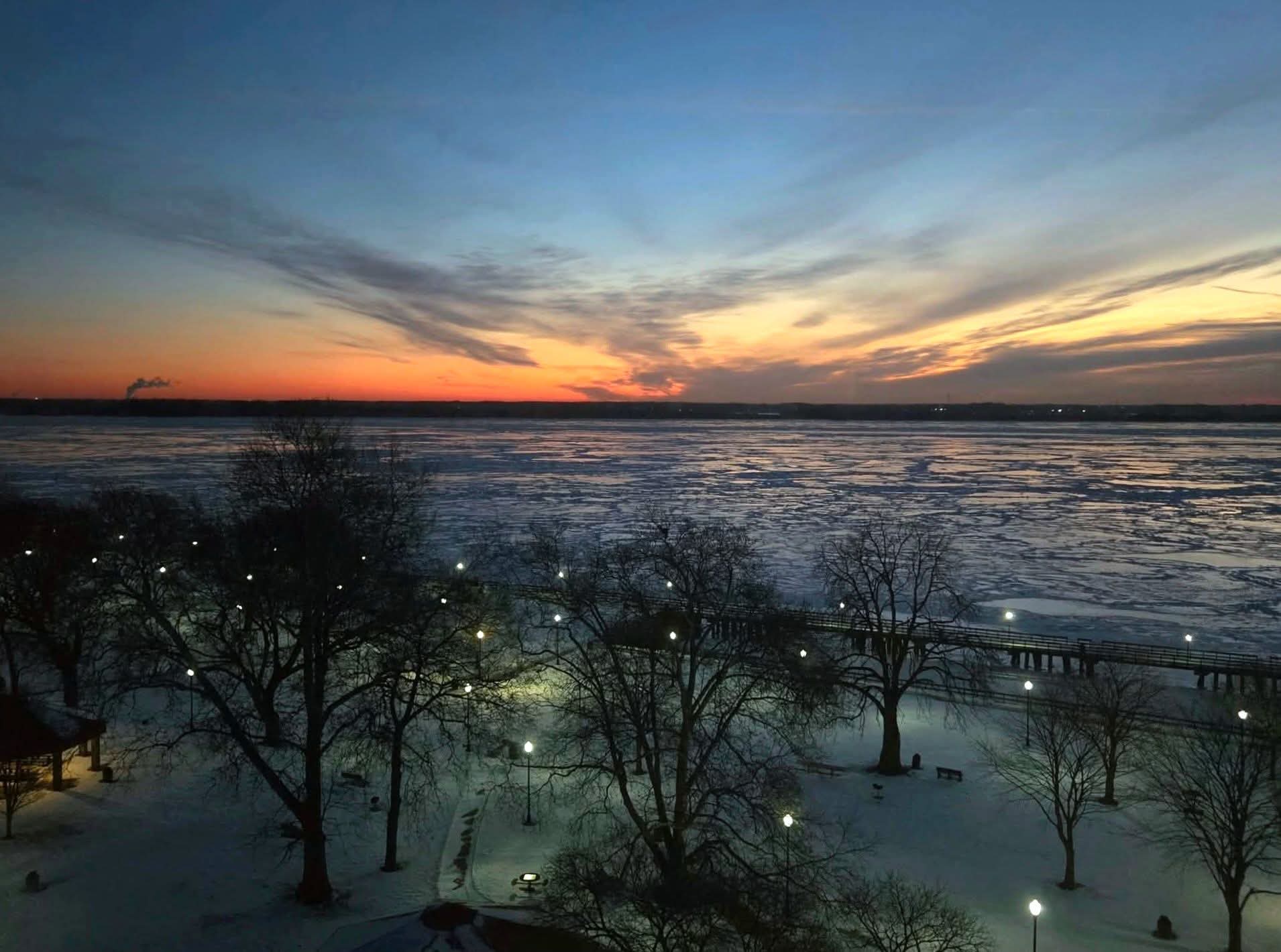
-10° at Detroit is the coldest since 2019. Ann Arbor, the usual cold spot with its bowl effect, hit -21°! Flint hit a record -24°. This is not my pic but its an incredible shot of sunrise at -10° over the Detroit River in Wyandotte.
-
-10° here this morning. I think DTW low also -10 but unsure yet. Cold spot Ann Arbor hit -21°! This is not my photo, but an incredible shot of a -10° sunrise over the Detroit River in Wyandotte.
-
2025-2026 ENSO
michsnowfreak replied to 40/70 Benchmark's topic in Weather Forecasting and Discussion
Cold anamolies will continue to grow. Its like the tundra outside.
-
1/24-1/25 Major Winter Storm - S. IL, IN, and OH
michsnowfreak replied to A-L-E-K's topic in Lakes/Ohio Valley
Theres 2+ solid months left of winter storm potential. We know how quickly things can and do change. And I have no doubt in the meantime there will be plenty more nickels and dimes. Give us a cold pattern in MI and it snows. -
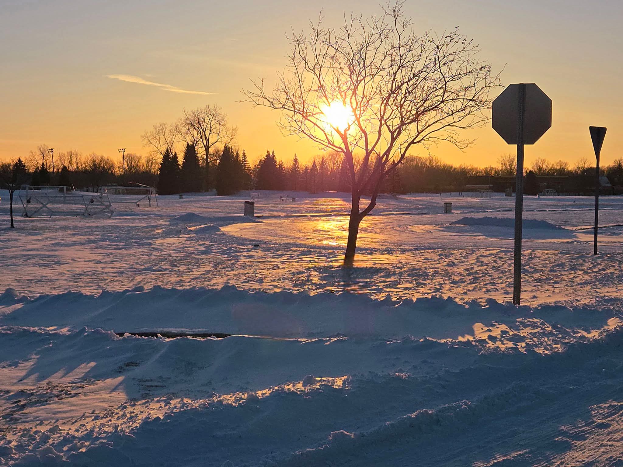
With all the blowing and drifting the past week i got to thinking. The drifts look cool but Im not a drift person overall. It compacts the snow too much. Exposes some grass blades in open areas. My avg depth is like 5" now. Packed powder. Perfect for cross country skiing and winter hiking but if there wasnt so much wind it'd be fluffier and deeper. Tundra sunset
-
1/24-1/25 Major Winter Storm - S. IL, IN, and OH
michsnowfreak replied to A-L-E-K's topic in Lakes/Ohio Valley
I have this weird feeling that Chicago is gonna get a huge march snowstorm or snow blitz that causes a very bookended season and makes for a solid snowier than avg winter despite a lot of zzz for you guys during actual winter. -
1/24-1/25 Major Winter Storm - S. IL, IN, and OH
michsnowfreak replied to A-L-E-K's topic in Lakes/Ohio Valley
No prob, and yes the 2000s were December-heavy. -
1/24-1/25 Major Winter Storm - S. IL, IN, and OH
michsnowfreak replied to A-L-E-K's topic in Lakes/Ohio Valley
Nov- 2 Dec- 12 Jan- 10 Feb- 13 Mar- 4 Apr- 1 -
1/24-1/25 Major Winter Storm - S. IL, IN, and OH
michsnowfreak replied to A-L-E-K's topic in Lakes/Ohio Valley
Hopefully the bleeding has stopped. Still a difference between American and foreign models. Temps will be in the low teens during the snowfall 12z qpf for DTW ICON- 0.15 GFS- 0.18 NAM- 0.24 GEM- 0.31 EUR- 0.31 RGEM- 0.36 -
1/24-1/25 Major Winter Storm - S. IL, IN, and OH
michsnowfreak replied to A-L-E-K's topic in Lakes/Ohio Valley
Enjoy! The cross country skiing should be phenomenal. With multiple layers of snow and plenty of compacting/settling/drifting, its that perfect "packed powder" -
1/24-1/25 Major Winter Storm - S. IL, IN, and OH
michsnowfreak replied to A-L-E-K's topic in Lakes/Ohio Valley
Agree. February has been our pot of gold frequently in recent years. I believe either Sunday or Monday is the exact halfway mark of the snow season average-wise. Breakdown of 6”+ snowstorms at Detroit by month (Nov 1880 – Jan 2026) Nov- 8 Dec- 37 Jan- 45 Feb- 46 Mar- 31 Apr- 4 -
1/24-1/25 Major Winter Storm - S. IL, IN, and OH
michsnowfreak replied to A-L-E-K's topic in Lakes/Ohio Valley
Weve had lot of advisories, no warnings, though arguably Jan 15th couldve been a warning (it went from a 50% chance of snow to an advisory halfway through lol). -
1/24-1/25 Major Winter Storm - S. IL, IN, and OH
michsnowfreak replied to A-L-E-K's topic in Lakes/Ohio Valley
Yeah. Not happy about the totals being cut. But again. The Detroit area has 4-7" of packed powder base, so add several inches and more powdery snowbanks...deep deep winter. And before the storm hounds freak, a week ago this was going no further north than KY. we've always been on the northern flank with the question, how north will it go? -
1/24-1/25 Major Winter Storm - S. IL, IN, and OH
michsnowfreak replied to A-L-E-K's topic in Lakes/Ohio Valley
I guess I cant even fathom a comparison, because I know that under no circumstances would I EVER live in TX...but what a slap in the face how prone to ice they are in deep winter cold shots. Its like, you finally get DEEP winter cold with surface temps that scream powder but you get stuck with freezing rain and sleet. -
1/24-1/25 Major Winter Storm - S. IL, IN, and OH
michsnowfreak replied to A-L-E-K's topic in Lakes/Ohio Valley
Sit inside and watch the shit show unfold. Gonna be pretty frozen there for a few days for people who can NOT handle it. -
1/24-1/25 Major Winter Storm - S. IL, IN, and OH
michsnowfreak replied to A-L-E-K's topic in Lakes/Ohio Valley
Today and tomorrow is dangerous stay inside cold. But the rest of the week i will be in my glory. Deep powder and frigid winter air. Will absolutely be bundling up and taking some scenic walks. -
1/24-1/25 Major Winter Storm - S. IL, IN, and OH
michsnowfreak replied to A-L-E-K's topic in Lakes/Ohio Valley
Trust me theres nothing dirty about the state of the snowpack right now. Its fresh drifty arctic looking powder. -
1/24-1/25 Major Winter Storm - S. IL, IN, and OH
michsnowfreak replied to A-L-E-K's topic in Lakes/Ohio Valley
I mean, you guys are sitting in warm climates from afar, youre not even here. Yeah it sucks that were missing the brunt of a massive storm. But some of the whining about the east coast lol. Theyve literally been in a decade long record snow drought, let em get a climo storm for once. It was bound to happen. -
1/24-1/25 Major Winter Storm - S. IL, IN, and OH
michsnowfreak replied to A-L-E-K's topic in Lakes/Ohio Valley
Theres plenty of snow already on the ground ahead of the storm. Fly in sunday morning and you won't know the difference. -
2025-2026 ENSO
michsnowfreak replied to 40/70 Benchmark's topic in Weather Forecasting and Discussion
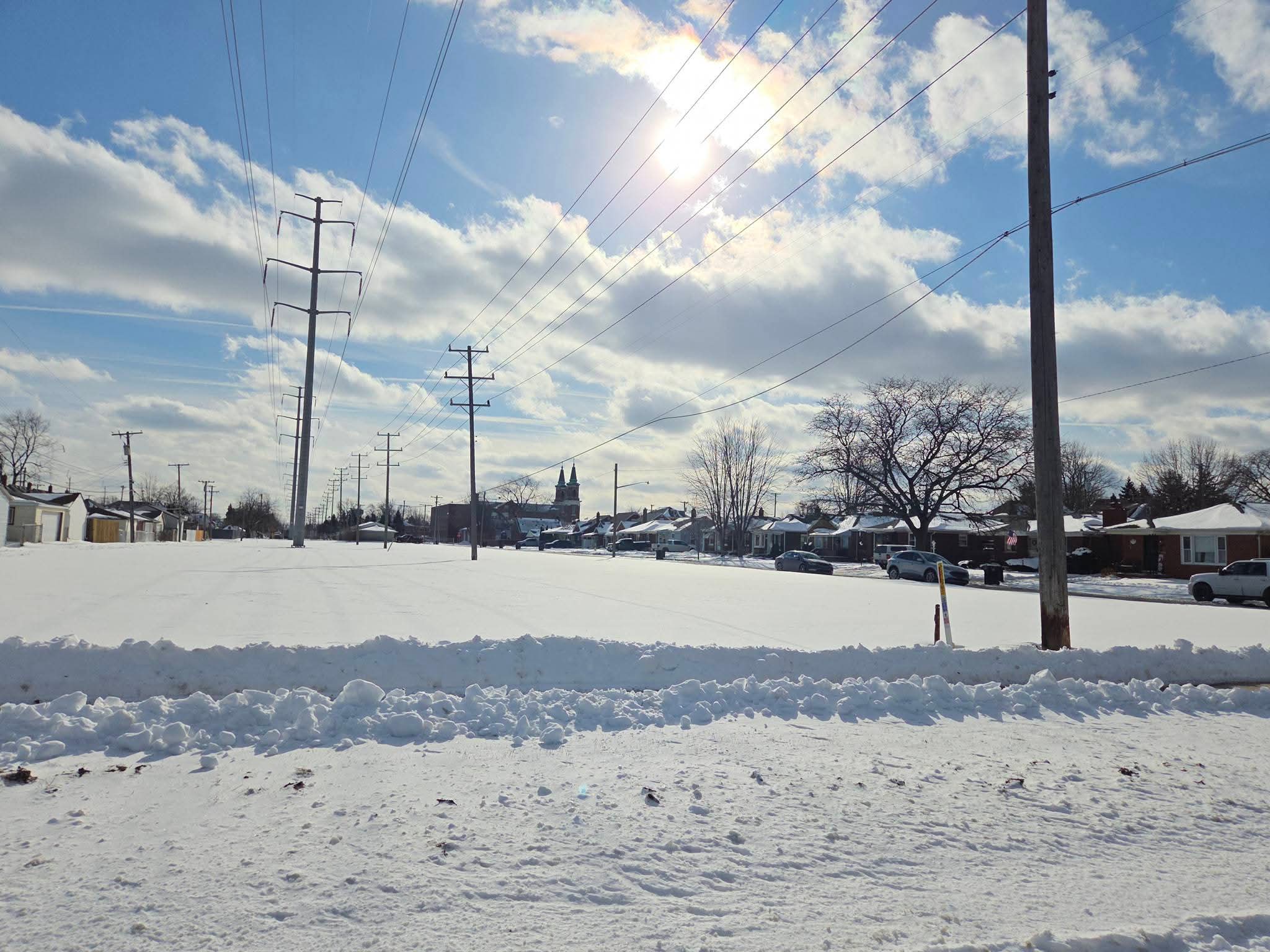
Wind chills hovering just above zero in the sun today for the last time for several days. Even the sun looks cold.
-
Sun came out today but the wind was biting and the slow decent of temps has been ongoing with falling continuing all day tmrw.
-
Winter 2025-26 Short Range Discussion
michsnowfreak replied to SchaumburgStormer's topic in Lakes/Ohio Valley
@beavis1729 I thought of you. This is deep deep winter. A thick drifty blanket of snow outside and I had to postpone a sledding promise to the nephews Saturday because its going to be TOO COLD to play in the snow! -
2025-2026 ENSO
michsnowfreak replied to 40/70 Benchmark's topic in Weather Forecasting and Discussion
Been a very solid winter here in southeast Michigan. And as we now hit the dead of winter, the cold is actually getting dangerous. Postponed plans to take nephews sledding Saturday because -35° windchills made even worse flying down a hill can literally be instant frostbite. Its been snowing near daily and we should even get in on the big storm to our south. Deep, deep winter. With many areas in the midwest/east (where 95% of this forum lives) facing a 2nd consecutive winter of below avg temps, it definitely is a buzzkill to a handful of posters in this thread. You can only talk about warm anomalies on other parts of the planet or snowless western mountains so much before its just time to hibernate until a torch comes. -
Winter 2025-26 Short Range Discussion
michsnowfreak replied to SchaumburgStormer's topic in Lakes/Ohio Valley
I know right? Another dusting this morning lol. I will say though...there's definitely a sizable contingent who do like winter. I mean obviously still the minority, but a lot more than just us weather weenies. -
1/24-1/25 Major Winter Storm - S. IL, IN, and OH
michsnowfreak replied to A-L-E-K's topic in Lakes/Ohio Valley
I dont like to jump on ratios too much. Sometimes when its bitterly cold you get sandy sugar snow instead of fluff. Either way, good trends.