michsnowfreak
-
Posts
18,458 -
Joined
-
Last visited
Content Type
Profiles
Blogs
Forums
American Weather
Media Demo
Store
Gallery
Everything posted by michsnowfreak
-

2026-2027 Super El Nino
michsnowfreak replied to Stormchaserchuck1's topic in Weather Forecasting and Discussion
People always focus on a total anamoly too much as well, warm or cold. Do you know how long a winter season is and how many fronts, systems, etc will be occurring during the season? Even if someone nailed a forecast seasonal anamoly, theres no way to tell whats going to happen with the actual weather. -
2026-2027 Super El Nino
michsnowfreak replied to Stormchaserchuck1's topic in Weather Forecasting and Discussion
1951-80 stable? By stable you mean coldest because it had the abnormally cold 1960s and especially 1970s? The 1950s were way warmer than the 1970s, so i dont see how that's "stable". How about we just use 1931-60 normals. -
2026-2027 Super El Nino
michsnowfreak replied to Stormchaserchuck1's topic in Weather Forecasting and Discussion
You know the drill lol. The summer of 1987 through July 31st was hotter at Detroit than the summer of 2026. Since winter all we hear about is the conus avg. Forget regional weather patterns or local weather. Its wild that weather, on a weather board, is now constantly overshadowed by a singular average temp for the United States. -
2026-2027 Super El Nino
michsnowfreak replied to Stormchaserchuck1's topic in Weather Forecasting and Discussion
Some assume theres some linear connection with the strength of nino and how warm it will be and simply ignore everything else. -
2026-2027 Super El Nino
michsnowfreak replied to Stormchaserchuck1's topic in Weather Forecasting and Discussion
97-98 wasnt the disaster here that it was on the east coast, but it was one of the last strong Ninos Id pick, only '82-83 was worse. Interesting about '97-98 is that it was front-loaded and Feb was a shutout. mid Nov to mid Dec was actually decent. So was the 2nd half of Jan. Everything else sucked. Shittiest strong Ninos locally: 1982-83, 1997-98, 2023-24 Best strong Ninos locally: 1877-78, 1972-73, 2015-16 At Detroit, the least snowy strong Nino is 1982-83 with 20.0" and the snowiest 45.0" in 1972-73. -
2026-2027 Super El Nino
michsnowfreak replied to Stormchaserchuck1's topic in Weather Forecasting and Discussion
My sister was born July 18, 1991. I was 8 years old and I remember how brutally hot and humid it was. My mom always talks about how it was so hot when she was born. -
I got 0.37". Honestly more than I expected.
-
Wow we really dodged this heat. 88 at DTW today should be hottest of the week.
-
2026-2027 Super El Nino
michsnowfreak replied to Stormchaserchuck1's topic in Weather Forecasting and Discussion
Those are neat snow maps. Any idea how far back they go? I tried populating 1972-73 and it wouldnt load. -
2026-2027 Super El Nino
michsnowfreak replied to Stormchaserchuck1's topic in Weather Forecasting and Discussion
Yeah thats a good point. Ive heard the average that 1" of sleet is about 3" of snow. Every location has its nuances. Up here, you get so many mood flakes that dont show in any aspect of the weather stats. In any given snow season, there will be approximately 35-45 days with a Trace of snow in addition to all the measurable snowfall. Its what happens in a Great Lakes climate. So "how many times did it snow last winter" is never a valid question here for determining winter severity. In the south, a disproportionate amount of wintry precip is ice vs snow, which is unfortunate for snow lovers because I imagine the mindset is "hey, its finally cold enough to snow, why is it raining?". -
2026-2027 Super El Nino
michsnowfreak replied to Stormchaserchuck1's topic in Weather Forecasting and Discussion
Just a suggestion if you guys make future snow maps closer to winter. It usually helps if you give a rough % of average to go in line with your thinking. I knew what raindance was getting at with the snow map (admittedly just a preliminary joke map rough idea) but it always looks funny when you see something like "snowy" in Atlanta and "not snowy" in Marquette. -
Let's not forget....I LOVE Fall. So as much as I love winter, not yearning yet. However, July 5th starts my annual "bring on Fall" attitude.
-
So nice to let fresh air in the house! Beautiful day. Very low humidity, 50s to start rising to the mid 70s.
-
2026-2027 Super El Nino
michsnowfreak replied to Stormchaserchuck1's topic in Weather Forecasting and Discussion
See my above post- almost EXACTLY what I was trying to say! I have lots of trees in my yard, drive a fuel efficient vehicle, work from home, recycle...I do my part. And I frankly could not care less about a warming planet. I have 4 distinct seasons regardless of ENSO or anything else. This year I have had wind chills to -40F and heat index to 105F, air temp from -10F to 98F. Most years have a similar range. Much like the east coast with its noreasters, its fascinating to see how often and how many ways the Great Lakes influence weather. If ALL of that is overshadowed by "but we are warming 0.5F per decade"....well, tell me youre not a weather enthusiast without telling me. -
2026-2027 Super El Nino
michsnowfreak replied to Stormchaserchuck1's topic in Weather Forecasting and Discussion
I agree with that, especially forecasting-wise. But I was more referring to it in past tense. Everytime anyone brings up this past winter's cold, like clockwork, the post gets dissected by the same few discussing warmth in the west/CONUS/globe etc. It really seems that a few of the warmistas have that chip on their shoulder. You should be able to use the words cold/snow WITHOUT prefacing "yes i know the worlds getting warmer" every single time. I was a weather observer before I had the internet, and I knew my local climate data history before I know how to read a single model map. Ive always thought it was cool to look into trends of local weather, and living in a place with extreme seasons, it's neat to see subtle trends that dominated decades past and how theyve changed for the better or the worse. I dont care if last winter was an inferno in the entire world, I will remember what happened here, and here it was a cold, white winter. Glittery snow for months straight gets an A+ for scenery/feels, but there is zero doubt in mind that the cold pattern that dominated the region was PROHIBITIVE to heavier snowfall here. So yes, Im saying if I wanted more snow in last years pattern, I actually needed it warmer. And of course the same rings true for the opposite. If its a colder CONUS winter, it wont mean a damn to me if I get a mild winter. -
2026-2027 Super El Nino
michsnowfreak replied to Stormchaserchuck1's topic in Weather Forecasting and Discussion
Good post. 99% of weather enthusiasts dont care what the temp ranking was in the Conus or the world...they care what happened in their area. The combination of a cold winter in the east and a record warm winter in the west in '25-26 brought some posters to ignore their own weather and concentrate on places elsewhere to a level I've never seen in 24 years on weather forums. -
2026-2027 Super El Nino
michsnowfreak replied to Stormchaserchuck1's topic in Weather Forecasting and Discussion
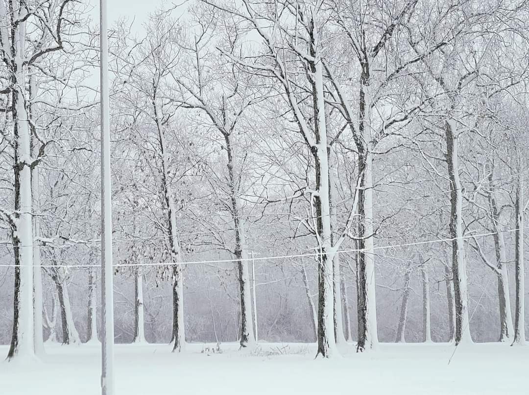
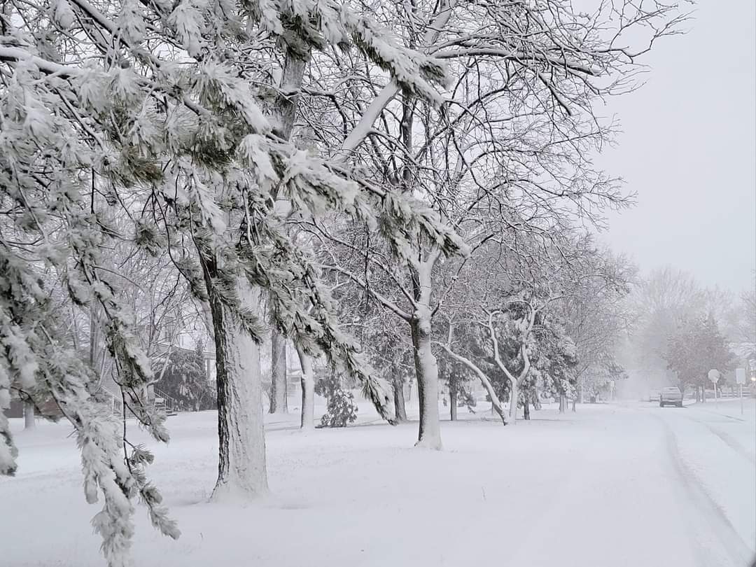
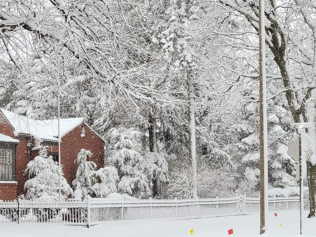
Its absolutely gorgeous. The past 2 winters here were nearly all powder. Here's the thing...powder is my absolute favorite. Its beautiful and last winter seemingly every night the snow glistened like diamonds. But I realized that even though I was getting my favorite powder, I missed a good wet snow. The winter of 2022-23 was the last time we had lots of paste snow. Below are 3 different 2023 snowstorms.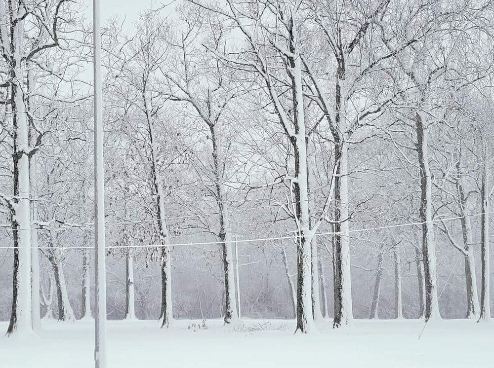


-
2026-2027 Super El Nino
michsnowfreak replied to Stormchaserchuck1's topic in Weather Forecasting and Discussion
There was lots of snow left in the mountains when I went to Alaska last month! The last flakes of the season at Detroit were May 2nd. So if we can squeeze out early flakes in October, there will only be 3 calendar months in 2026 I don't see snow of some kind. -
2026-2027 Super El Nino
michsnowfreak replied to Stormchaserchuck1's topic in Weather Forecasting and Discussion
Interesting to see a map of 1877-78. I knew the core of warmth was in the upper midwest, because while it was certainly a mild winter at Detroit, it wasnt nearly as extreme as in Minneapolis. Ive mentioned it before, but the 1875-1882 period had a very odd "every other year" pattern locally of very cold winter followed by very mild winter. 1875-76, 1877-78, 1879-80 & 1881-82 were all warm winters overall. I have no idea how ENSO played into it outside of 1877-78. 1877-78 at Detroit (using present-day departures): Nov: 39.2F (-2.0F)....Snow 1.0" (-0.9") Dec: 38.1F (+6.8F)....Snow 1.9" (-7.0") Jan: 27.3F (+1.5F)….Snow 23.1” (+9.1”) Feb: 29.2F (+1.2F)….Snow 17.4” (+4.9”) Mar: 41.3F (+4.1F)…Snow M (est 1-2")) Apr: 53.4F (+4.5F)…Snow 0 (-1.5”) Huge storm Jan 31st (14.8"). The winter followed a somewhat similar path as other strong Ninos in that there were some very good winter blasts but the warmth won out. And realistically, thats the best formula to run a strong Nino in the north. You want that roller coaster up and down, helps with some good storms and assures you get some arctic blasts with the warm spells. Way better than mundane, stagnant 40s every day. -
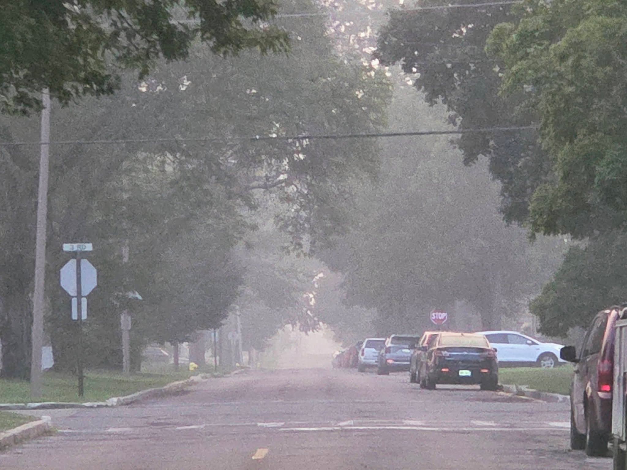
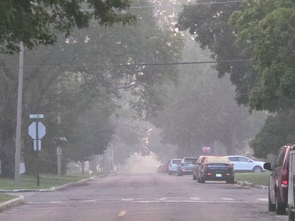
I literally did not step foot outside today because I know it would give me a headache.
-
Air absolutely choked with smoke. The smell is shockingly intense.
-
Kind of funny that the record warm low for July 14 is warmer at Marquette (76) than it is for Detroit (74)
-
Much like the last heatwave, temp somewhat underperformed here. DTW hit 94, the NWS forecast was 99.
-
Is that your first time hitting 100? I haven't seen 100 since 2012. How warm did it get in your house?
-
Not sure of its legitimacy, but I saw 105F in Big Bay. The next highest yoop numbers were a few 102s as you mentioned.